Category:Maps of the Schuylkill River
Media in category "Maps of the Schuylkill River"
The following 19 files are in this category, out of 19 total.
-
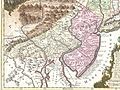 1756 Lotter Map of Eastern Pennsylvania, & New Jersey cropped from Geographicus-1756.jpg 3,600 × 2,700; 4.38 MB
-
 1986-cropped2.jpg 5,083 × 11,431; 17.62 MB
-
 A Plan of the City and Environs of Philadelphia, 1777 WDL9563.png 1,024 × 1,387; 2.64 MB
-

-

-

-

-
 Interpretive wayside for Pottstown Landing.jpg 2,876 × 4,074; 2 MB
-
 Schuylkill river (boat house and water works map).jpeg 206 × 172; 18 KB
-
 Schuylkill river.jpeg 1,107 × 681; 209 KB
-

-
 Schuylkillmap.jpg 434 × 479; 194 KB
-
 Schuylkillmap.png 600 × 603; 163 KB
-
 SchuylkillRiverTrailMap.svg 900 × 900; 2.64 MB
-
 Susquehanna River to Schuylkill River, Chesapeake Bay to Delaware Bay. NYPL484199.tiff 4,991 × 4,117; 58.79 MB
-
 The Schuylkill River National & State Heritage Area LOC 2010588180 (cropped).jpg 3,686 × 3,184; 978 KB
-
 The Schuylkill River National & State Heritage Area LOC 2010588180.jpg 10,232 × 4,783; 5.97 MB
-
 The Schuylkill River National & State Heritage Area LOC 2010588180.tif 10,232 × 4,783; 140.02 MB
-
 Wayside at Pottstown Landing.jpg 3,120 × 4,160; 1.4 MB


.png)

.jpeg)


.jpg)

