Category:Maps of the South District (Israel)
Subcategories
This category has the following 4 subcategories, out of 4 total.
A
B
Media in category "Maps of the South District (Israel)"
The following 21 files are in this category, out of 21 total.
-
 Ashkelon subdistrict in Israel.svg 361 × 1,000; 2.33 MB
-
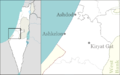 Israel outline ashkelon.png 692 × 430; 77 KB
-
 Israel outline southern-Ashkelon.png 692 × 430; 39 KB
-
 Beersheba subdistrict in Israel.svg 361 × 1,000; 2.33 MB
-
 South district.png 700 × 1,343; 176 KB
-
 South district divisions blank.png 821 × 1,867; 208 KB
-
 South district divisions unlabeled.png 821 × 1,867; 220 KB
-
 מחוז הדרום.JPG 440 × 1,028; 40 KB
-
 Israel black hebrews main cities.jpg 267 × 740; 25 KB
-
 Israel south dist.png 267 × 740; 44 KB
-
 Israel-Southern.png 100 × 301; 3 KB
-
 Septem-Israel location South.svg 200 × 510; 81 KB
-
 Southern District in Israel (semi-Israel areas hatched).svg 614 × 1,141; 337 KB
-
 Southern District in Israel.svg 614 × 1,141; 280 KB
-
 Tzomet hanegev.svg 70 × 70; 28 KB
-
 Israel outline southern negev north.png 1,471 × 715; 50 KB
-
 Israel south dist.svg 540 × 990; 76 KB
-
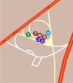 Qastina stops.png 395 × 451; 36 KB
-
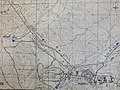
 Qastina.png 1,433 × 1,637; 139 KB
-
 Southern district in Israel.svg 361 × 1,000; 2.33 MB
-
 מפת הר צבוע.jpg 4,032 × 3,024; 3.94 MB


.svg)


