Category:Maps of the Wellington Region
Regions of New Zealand: Auckland · Bay of Plenty · Canterbury · Hawke's Bay · Marlborough · Nelson · Otago · Southland · Tasman · Waikato · Wellington · West Coast
Outlying islands, territories and dependencies: Auckland Islands · Chatham Islands · Kermadec Islands · Tokelau – Territory with specific status: Ross Dependency
Associated countries: Cook Islands · Niue
Outlying islands, territories and dependencies: Auckland Islands · Chatham Islands · Kermadec Islands · Tokelau – Territory with specific status: Ross Dependency
Associated countries: Cook Islands · Niue
Wikimedia category | |||||
| Upload media | |||||
| Instance of | |||||
|---|---|---|---|---|---|
| Category combines topics | |||||
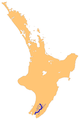
| Wellington Region | |||||
region at the southern end of New Zealand's North Island   | |||||
| Instance of |
| ||||
| Location | New Zealand | ||||
| Capital | |||||
| Inception |
| ||||
| Population |
| ||||
| Area |
| ||||
 | |||||
Subcategories
This category has the following 5 subcategories, out of 5 total.
E
L
M
P
W
Media in category "Maps of the Wellington Region"
The following 18 files are in this category, out of 18 total.
-
 Commuters-wellington.ashx.jpeg 558 × 637; 35 KB
-
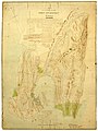
 Early Map of Wellington - Wellington County District (23530307892).jpg 4,231 × 5,499; 12.83 MB
-
 EmbassiesInWellington-Region.png 629 × 524; 46 KB
-
 Emerald Hours in New Zealand (1906) · Lowth · 009.jpg 1,540 × 2,117; 487 KB
-

-
 Kapiti Coast District within Wellington Region.png 1,214 × 827; 20 KB
-
 Kuranui College map.png 687 × 548; 86 KB
-
 Lage der Stadt Wellington in Neuseeland.png 390 × 579; 884 KB
-
 New Zealand Company plan of Port Nicholson, 1840 (15991853901).jpg 6,731 × 8,950; 12.69 MB
-
 NZ-Carterton.png 405 × 590; 11 KB
-
 NZ-Ruamahanga R.png 1,003 × 1,457; 230 KB
-
 South Wairarapa District within Wellington Region.png 1,214 × 827; 21 KB
-
 Street map of Wellington city New Zealand Level 12.svg 1,749 × 1,491; 4.22 MB
-
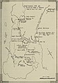 Transactions of the Royal Society of New Zealand (1920) (14761831051).jpg 2,208 × 3,144; 474 KB
-
 TransmissionGully.png 414 × 516; 34 KB
-
 Upper Hutt City within Wellington Region.png 1,214 × 827; 20 KB
-
 Wellington Urban Area.png 1,003 × 897; 129 KB
-
 Wellington, New Zealand map.svg 487 × 476; 123 KB

.jpg)

_%C2%B7_Lowth_%C2%B7_009.jpg)
_(14778999611).jpg)


.jpg)


_(14761831051).jpg)