Category:Maps of the history of Burgundy
Administrative regions and territorial collectivity of Metropolitan France (‡ since start of 2016):
Auvergne-Rhône-Alpes‡ · Bourgogne-Franche-Comté‡ · Brittany · Centre-Val de Loire · Corsica · Grand Est‡ · Hauts-de-France‡ · Île-de-France · Normandy‡ · Occitania‡ · Provence-Alpes-Côte d'Azur
Former administrative regions of Metropolitan France (until end of 2015):
Alsace · Auvergne · Burgundy · Franche-Comté · Lorraine · Lower Normandy · Upper Normandy · Picardy · Rhône-Alpes
Overseas departments and regions: Guadeloupe · Réunion
Use the appropriate category for maps showing all or a large part of Burgundy. See subcategories for smaller areas:
| If the map shows | Category to use |
|---|---|
| Burgundy on a recently created map | Category:Maps of Bourgogne or its subcategories |
| Burgundy on a map created more than 70 years ago | Category:Old maps of Bourgogne or its subcategories |
| the history of Burgundy on a recently created map | Category:Maps of the history of Bourgogne or its subcategories |
| the history of Burgundy on a map created more than 70 years ago | Category:Old maps of the history of Bourgogne or its subcategories |

Media in category "Maps of the history of Burgundy"
The following 70 files are in this category, out of 70 total.
-
 AD 0412 Four-step Theory of Burgundian Migration - EN.svg 1,142 × 760; 671 KB
-
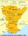
 Carte Etat bourguignon (Philippe le Hardi).svg 1,195 × 1,786; 434 KB
-
 Carte Etat bourguignons 1-es.svg 1,195 × 1,786; 1.54 MB
-
 Etat bourguignons.png 1,210 × 1,851; 618 KB
-
 Karte Haus Burgund 1.png 2,500 × 3,724; 859 KB
-
 Karte-Haus-Burgund-FR.png 2,500 × 3,724; 831 KB
-
 Burgundian State 1364-1404.svg 5,805 × 7,573; 1,004 KB
-
 Karte Haus Burgund 2-es.svg 5,442 × 7,100; 1.85 MB
-
 Karte Haus Burgund 2.png 1,200 × 1,787; 250 KB
-
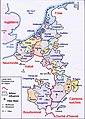
 Etat bourguignon Philippe le Bon Fr.png 1,213 × 1,802; 837 KB
-
 Etat bourguignon Philippe le Bon-es.svg 5,442 × 7,100; 2.15 MB
-
 AD 0412 Four-step Theory of Burgundian Migration - DA.svg 1,142 × 760; 671 KB
-
 AltaYBajaBorgoñaSiglosIXX.svg 1,002 × 1,014; 1.17 MB
-
 Borgogna.jpg 703 × 1,068; 171 KB
-
 BorgoñaSiglosXIIXIII.svg 1,068 × 1,081; 1.3 MB
-
 Bourgogne - Burgundy.jpg 1,757 × 2,066; 2.12 MB
-
 Bourgogne carte.png 894 × 899; 30 KB
-
 Bourgogne in France (1789).svg 2,000 × 1,922; 1.05 MB
-
 Bourgogne in XI-XII century.png 931 × 647; 294 KB
-
 Burgundian lands in 1467.jpg 526 × 440; 52 KB
-
 Burgundian northern France 1465–1477.png 416 × 399; 92 KB
-
 Burgundy (PSF).jpg 594 × 345; 114 KB
-
 Carte de la Bourgogne.svg 2,130 × 2,508; 1.13 MB
-
 Carte-Royaume-dArles.png 1,500 × 1,529; 412 KB
-
 Champagne, Île-de-France, Picardie, Artois, Flandre 1789 et 2022.png 800 × 800; 370 KB
-
 Comté auxonne et Terres Outre Saône.png 492 × 599; 107 KB
-
 Domaine d'Eudes de Bourgogne.png 293 × 391; 36 KB
-
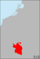 Duchy of Burgundy (918-1477).gif 617 × 907; 68 KB
-
 Duchy of Burgundy (918-1477, Red-Version).gif 617 × 907; 96 KB
-
 Duché et Comté de Bourgogne au XIVe siecle-es.svg 829 × 639; 63 KB
-
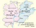 Duché et Comté de Bourgogne au XIVe siecle.svg 829 × 639; 53 KB
-
 Frankenreich unter den Merowingern.jpg 3,287 × 2,874; 2 MB
-
 Karte Haus Burgund 3-es.svg 5,442 × 7,100; 1.74 MB
-
 Karte Haus Burgund 3.png 1,200 × 1,787; 281 KB
-
 Karte Haus Burgund 4 EN.png 2,500 × 3,521; 1.33 MB
-
 Karte Haus Burgund 4 ZH.png 1,200 × 1,690; 840 KB
-
 Karte Haus Burgund 4.png 2,500 × 3,521; 1.36 MB
-
 Karte Haus Burgund 5.png 1,200 × 1,787; 449 KB
-
 Karte Haus Burgund Verwaltu.png 1,200 × 1,787; 227 KB
-
 Karte Hoch Niederburgund-FR.png 2,000 × 2,126; 549 KB
-
 Karte Hoch und Niederburgund EN.png 2,000 × 2,126; 538 KB
-
 Karte Hoch und Niederburgund-el.png 1,310 × 1,338; 200 KB
-
 Karte Hoch- und Niederburgund.png 2,000 × 2,126; 549 KB
-
 Karte Königreich Arelat DE.png 1,500 × 1,529; 414 KB
-
 Karte-Haus-Burgund 4-es.svg 5,442 × 7,100; 2.36 MB
-
 Karte-Haus-Burgund 4-FR.png 2,500 × 3,521; 1.34 MB
-
 Karte-Haus-Burgund 5-es.svg 5,442 × 7,100; 2.12 MB
-
 Kingdom of Burgundy.png 220 × 224; 70 KB
-
 La Bourgogne aux XI e XIIe siecles ru.svg 1,050 × 1,450; 304 KB
-
 La Bourgogne aux XI e XIIe siecles-uk.svg 1,050 × 1,450; 304 KB
-
 La Bourgogne aux XI et XIIe siècles-es.svg 1,050 × 1,450; 515 KB
-
 La Bourgogne aux XI et XIIe siècles.svg 1,050 × 1,450; 302 KB
-
 Le royaume Burgonde au Ve siècle la.svg 339 × 440; 122 KB
-
 Le royaume Burgonde au Ve siècle-es.svg 339 × 440; 126 KB
-
 Le royaume Burgonde au Ve siècle.png 339 × 440; 92 KB
-
 Le royaume Burgonde au Ve siècle.svg 339 × 440; 121 KB
-
 Les pagis bourguignons au 9esiecle ru.svg 636 × 595; 342 KB
-
 Les pagis bourguignons au 9esiècle-es.svg 664 × 690; 1.03 MB
-
 Les pagis bourguignons au 9esiècle-uk.svg 664 × 690; 567 KB
-
 Les pagis bourguignons au 9esiècle.svg 664 × 690; 503 KB
-
 Lower Burgundy 1200.png 524 × 577; 99 KB
-
 Map Kingdom Arelat AR.png 1,454 × 1,485; 856 KB
-
 Map Kingdom Arelat EN.png 1,310 × 1,338; 209 KB
-
 Map Kingdom Arelat-el.png 1,310 × 1,338; 227 KB
-
 Reino Burgúndio no século V.svg 339 × 440; 127 KB
-
 Royaume Burgonde en 499.png 640 × 831; 177 KB
-
 Royaumeburgonde501.png 640 × 831; 178 KB
-
 Étots d'Bourgonne-15e-sièke.jpg 2,268 × 3,183; 1.52 MB
-
 Évolution du royaume burgonde.png 839 × 824; 197 KB
-
 Évolution royaume burgonde 443-485.png 838 × 824; 200 KB

.svg)


.svg)


.jpg)


.gif)
.gif)


