Category:Maps of the history of Oklahoma
States of the United States: Alabama · Alaska · Arizona · Arkansas · California · Colorado · Connecticut · Delaware · Florida · Georgia · Hawaii · Idaho · Illinois · Indiana · Iowa · Kansas · Kentucky · Louisiana · Maine · Maryland · Massachusetts · Michigan · Minnesota · Mississippi · Missouri · Montana · Nebraska · Nevada · New Hampshire · New Jersey · New Mexico · New York · North Carolina · North Dakota · Ohio · Oklahoma · Oregon · Pennsylvania · Rhode Island · South Carolina · South Dakota · Tennessee · Texas · Utah · Vermont · Virginia · Washington · West Virginia · Wisconsin · Wyoming – Washington, D.C.
Puerto Rico
Puerto Rico
Subcategories
This category has the following 2 subcategories, out of 2 total.
M
Media in category "Maps of the history of Oklahoma"
The following 12 files are in this category, out of 12 total.
-
 Arkansasterritory.PNG 453 × 206; 14 KB
-
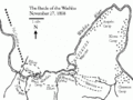 Battle of Washita map.gif 640 × 480; 33 KB
-
 Boundaries of the Five Tribes in 1866.svg 800 × 395; 2.46 MB
-
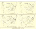 EB9 United States - historical maps (bottom).jpg 2,501 × 2,000; 942 KB
-
 Former Indian Reservations in Oklahoma.jpg 1,240 × 726; 99 KB
-
 Map of Chisholm Trail Picture 096.jpg 2,592 × 1,944; 978 KB
-
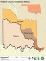 Map of Pickens County Chickasaw Nation.pdf 5,400 × 7,200; 4.05 MB
-
 Map of the Battle of Washita.jpg 756 × 633; 192 KB
-

-
 The essential facts of Oklahoma history and civics (1914) (14773774595).jpg 2,992 × 1,996; 820 KB
-
 Trails of Tears en.png 2,025 × 1,547; 3.04 MB
-
 Trajet-ponca.png 800 × 1,051; 109 KB


.jpg)


_(14773774595).jpg)

