Category:Maps of the history of Tennessee
States of the United States: Alabama · Alaska · Arizona · Arkansas · California · Colorado · Connecticut · Delaware · Florida · Georgia · Hawaii · Idaho · Illinois · Indiana · Iowa · Kansas · Kentucky · Louisiana · Maine · Maryland · Massachusetts · Michigan · Minnesota · Mississippi · Missouri · Montana · Nebraska · Nevada · New Hampshire · New Jersey · New Mexico · New York · North Carolina · North Dakota · Ohio · Oklahoma · Oregon · Pennsylvania · Rhode Island · South Carolina · South Dakota · Tennessee · Texas · Utah · Vermont · Virginia · Washington · West Virginia · Wisconsin · Wyoming – Washington, D.C.
Puerto Rico
Puerto Rico
Subcategories
This category has the following 6 subcategories, out of 6 total.
M
- Maps of the Battle of Shiloh (54 F)
Media in category "Maps of the history of Tennessee"
The following 28 files are in this category, out of 28 total.
-
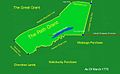
 1775 Watauga Grant.png 1,684 × 1,013; 930 KB
-
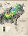 1860-61 Secession in Appalachia by County.jpg 1,887 × 2,393; 1.82 MB
-
 1861 Secession vote in East Tennessee by county.svg 394 × 194; 437 KB
-
 8FranklinCounties.png 1,340 × 1,029; 210 KB
-
 Charles Robertson Grant Map.jpg 552 × 452; 33 KB
-
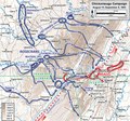 Chickamauga Campaign August-September 1863.pdf 1,200 × 1,125; 3.85 MB
-
 Chickamauga Wars, theater of operations.jpg 3,000 × 2,400; 2.7 MB
-
 DeSoto Map Leg 2 HRoe 2008.jpg 600 × 470; 290 KB
-
 East-tennessee-bridge-burnings-1861.jpg 416 × 310; 22 KB
-
 History of Tennessee, its people and its institutions (1900) (14779613264).jpg 1,886 × 1,374; 332 KB
-

-
 Map-cherokee-invasion-watauga-1776.gif 416 × 285; 9 KB
-
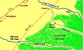
 Nolichucky Watauga Grants Map Greenville.jpg 416 × 268; 27 KB
-
 Overhill-cherokee-little-tennessee.jpg 510 × 220; 41 KB
-
 Overhill-cherokee-map-full.jpg 525 × 319; 61 KB
-
 Path Grant 8.15.13.jpg 1,565 × 961; 117 KB
-
 PATH GRANT location map rev.png 800 × 475; 171 KB
-
 Southwest Territory Counties (1790).svg 792 × 200; 329 KB
-
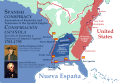 Spanish Conspiracy.svg 1,185 × 811; 5.87 MB
-
 TENNESSEE and ALABAMA portions - Indian land cessions in the United States.jpg 1,064 × 824; 195 KB
-
 Tennessee County Tennessee.svg 792 × 200; 87 KB
-
 TENNESSEE detail - Indian land cessions in the United States.jpg 824 × 1,064; 160 KB
-
 TENNESSEE map - Indian land cessions in the United States.jpg 820 × 535; 122 KB
-
 Tipton Phase sites HRoe 2010 Randolph TN.jpg 606 × 750; 88 KB
-
 Trails of Tears en.png 2,025 × 1,547; 3.04 MB
-
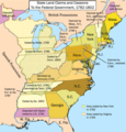 United States land claims and cessions 1782-1802.png 747 × 782; 145 KB
-
 Watauga.Lochaber. corner.jpg 792 × 612; 230 KB
-
 Wilderness road en.png 1,254 × 796; 1.74 MB


_(14779613264).jpg)


.svg)