Category:Maps showing 1934
| ← 1930 1931 1932 1933 1934 1935 1936 1937 1938 1939→ |
English: Maps showing the year 1934 (i.e. history maps)
See also category: 1934 maps. and 1930s maps for old maps created in this time.
See also category: 1934 maps. and 1930s maps for old maps created in this time.
Subcategories
This category has only the following subcategory.
Media in category "Maps showing 1934"
The following 4 files are in this category, out of 4 total.
-
Evolution of United States standard time zone boundaries.webm 29 s, 3,507 × 2,480; 4.58 MB
-
 Political Evolution of Central America and the Caribbean 1934 na.png 1,000 × 750; 121 KB
-
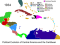
 Political Evolution of Central America and the Caribbean 1934.png 1,000 × 750; 151 KB
-
 Tour de France 1934.png 599 × 599; 335 KB


