Category:Maps showing 1939
| ← 1930 1931 1932 1933 1934 1935 1936 1937 1938 1939→ |
English: Maps showing the year 1939 (i.e. history maps)
See also category: 1939 maps. and 1930s maps for old maps created in this time.
See also category: 1939 maps. and 1930s maps for old maps created in this time.
Subcategories
This category has the following 2 subcategories, out of 2 total.
M
Media in category "Maps showing 1939"
The following 26 files are in this category, out of 26 total.
-
 1939 Europe Map Flag.png 7,500 × 7,600; 25.25 MB
-
 Africa 1939.png 356 × 340; 16 KB
-
 Africa colonization 1939.PNG 322 × 568; 24 KB
-
 Flag map of Colonial Africa (1939).png 1,969 × 2,098; 526 KB
-
 Albanian Kingdom (1939).svg 450 × 456; 452 KB
-
 Alberta Highway 034 in 1939.png 624 × 384; 22 KB
-
 Baltic Sea Borderlines 1939 blank.png 1,516 × 1,178; 35 KB
-
 Blank map of Europe March - September 1939.svg 450 × 456; 472 KB
-
 BlankMap-World-1939.png 1,425 × 625; 48 KB
-
 CA Route 152 Realignment 1939.png 1,447 × 579; 347 KB
-
Evolution of United States standard time zone boundaries.webm 29 s, 3,507 × 2,480; 4.58 MB
-
 French Republic 1939.svg 450 × 456; 446 KB
-
 German Reich (1939).svg 450 × 456; 453 KB
-
 Germany March - September 1939.svg 450 × 456; 518 KB
-

-

-
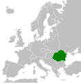 Kingdom of Romania (1939).svg 450 × 456; 454 KB
-
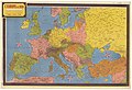 L'Europe en 1939 - Dessinée par Jacques Mercier - btv1b531214931.jpg 11,586 × 7,890; 12.55 MB
-
 Map of Africa in 1939.svg 365 × 365; 1.53 MB
-
 Mapa del África colonial (1939).svg 1,525 × 1,440; 912 KB
-
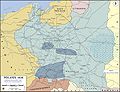
 Poland in 1939.jpg 503 × 550; 121 KB
-
 SS Winnipeg journey (1939).svg 714 × 842; 708 KB
-
 United States Coast Guard Auxiliary Organization.gif 695 × 403; 42 KB
-
 WW2 Map.png 1,094 × 1,117; 513 KB
-
 WWII-Poland-1939-communications and industry.jpg 1,280 × 984; 1.15 MB
-
 Карта Карпатської України (1939).png 980 × 985; 68 KB


.png)
.svg)


.svg)

._Summer_1939._26,_5_kms_-_btv1b531969802.jpg)
_100_kms_-_btv1b53196982z.jpg)
.svg)


.svg)

.svg)


.png)