Category:Maps showing 2012
| ← 2010 2011 2012 2013 2014 2015 2016 2017 2018 2019→ |
English: Maps showing the year 2012 (i.e. history maps)
See also category: 2012 maps. and 2010s maps for old maps created in this time.
See also category: 2012 maps. and 2010s maps for old maps created in this time.
Subcategories
This category has the following 2 subcategories, out of 2 total.
D
- Dakar Rally 2012 route maps (4 F)
U
Media in category "Maps showing 2012"
The following 15 files are in this category, out of 15 total.
-
 2012 Afghanistan Country Profile (30249978823).jpg 11,704 × 7,625; 40.54 MB
-
 2012 Africa Population Density (30249983173).jpg 1,956 × 2,286; 697 KB
-
 2012 ATP tournaments distribution map.svg 863 × 443; 1.32 MB
-
 2012 Density Map.png 1,995 × 1,281; 119 KB
-
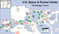 2012 Great Moonbuggy Race Course Map.png 847 × 499; 39 KB
-
 2012AuroraShootingLocation.png 1,518 × 2,202; 2.23 MB
-
 African Cup of Nations 2012.png 677 × 681; 34 KB
-
 Algerian legislative election 2012 by province.svg 756 × 960; 45 KB
-
 Canada total fertility rate by province 2012.png 706 × 599; 161 KB
-
 Location map Washington DC Cleveland Park to Southwest Waterfront.png 717 × 734; 718 KB
-
 Map of 2012 Aurora shooting.png 1,000 × 1,000; 665 KB
-
 Map of 2012 Aurora Shooting.svg 1,000 × 1,000; 2.84 MB
-
 Turkey GDP(PPP) per capita income by province 2012.png 1,200 × 515; 222 KB
-
 US Wireline Broadband 31Dec2012.tiff 761 × 384; 297 KB
-
 WalesLocal2012.png 882 × 992; 19 KB
.jpg)
.jpg)


_per_capita_income_by_province_2012.png)
