Category:March, Cambridgeshire

Fenland market town and civil parish in the Isle of Ely area of Cambridgeshire, England  | |||||
| Upload media | |||||
| Instance of | |||||
|---|---|---|---|---|---|
| Location | Fenland, Cambridgeshire, East of England, England | ||||
| Population |
| ||||
| Said to be the same as | March, Cambridgeshire (Wikimedia duplicated page, civil parish) | ||||
 | |||||
Nederlands: March is een plaats en civil parish in het graafschap Cambridgeshire. Het is het bestuurlijke centrum van het district Fenland. De plaats telt 19.042 inwoners.
Română: March este un oraş în comitatul Cambridgeshire, regiunea East, Anglia. Oraşul se află în districtul Fenland a cărui reşedinţă este.
Subcategories
This category has the following 12 subcategories, out of 12 total.
Media in category "March, Cambridgeshire"
The following 200 files are in this category, out of 980 total.
(previous page) (next page)-

-
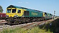
 66414 in Marcch Recep No2.jpg 3,265 × 4,255; 1.56 MB
-
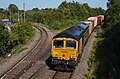
 66414 March Down Reception sidings 100823.jpg 5,953 × 2,791; 2.59 MB
-
 66414 March East 100823.jpg 4,825 × 2,689; 2.58 MB
-
 66414 static March Reception 100823.jpg 4,021 × 2,143; 1.01 MB
-
 66724 March West Jnc 100823.jpg 5,293 × 2,539; 3.81 MB
-
 66724 March West Jnc close 100823.jpg 4,747 × 2,257; 1.67 MB
-
 66782 March West Junc 100823.jpg 5,311 × 3,517; 4.64 MB
-
 A bend in the river near Flood's Ferry - geograph.org.uk - 3571377.jpg 4,320 × 3,240; 5.67 MB
-
 A class 158 crossing the fens - geograph.org.uk - 6248684.jpg 683 × 1,024; 203 KB
-
 A heavy ex-GER J20 class 0-6-0 at March Shed, 1951 - geograph.org.uk - 4802543.jpg 2,420 × 1,321; 1.27 MB
-
 A hill in the Fens. - geograph.org.uk - 440606.jpg 640 × 480; 60 KB
-
 A modern terrace of houses overlooking the river in March - geograph.org.uk - 6435077.jpg 4,032 × 3,024; 5.08 MB
-
 A new entrance to Grange Farm near March - geograph.org.uk - 3017792.jpg 4,320 × 3,240; 5.35 MB
-
 A141 approaching Mill Hill roundabout - geograph.org.uk - 1819838.jpg 640 × 480; 142 KB
-
 A141 at Hostmoor Avenue junction - geograph.org.uk - 5128396.jpg 640 × 480; 38 KB
-
 A141 bypassing March - geograph.org.uk - 5679296.jpg 640 × 428; 79 KB
-
 A141 bypassing March - geograph.org.uk - 5679309.jpg 640 × 428; 83 KB
-
 A141 bypassing March - geograph.org.uk - 5679313.jpg 640 × 428; 99 KB
-
 A141 Isle of Ely Way, March - geograph.org.uk - 6296889.jpg 4,000 × 3,000; 3.8 MB
-
 A141 Isle of Ely Way, March - geograph.org.uk - 6296959.jpg 4,608 × 3,456; 3.85 MB
-
 A141 Isle of Ely Way, March - geograph.org.uk - 6296976.jpg 4,608 × 3,456; 4.34 MB
-
 A141 nearing Knight's End Crossroads - geograph.org.uk - 5679305.jpg 640 × 428; 89 KB
-
 A141 nearing roundabout at Peas Hill - geograph.org.uk - 5679320.jpg 640 × 428; 100 KB
-
 A141 nears Hobb's Lots Bridge - geograph.org.uk - 5128402.jpg 640 × 481; 47 KB
-
 A141 nears Knight's End Crossroads - geograph.org.uk - 5125319.jpg 640 × 480; 52 KB
-
 A141 nears the River Nene bridge - geograph.org.uk - 5128388.jpg 640 × 481; 42 KB
-
 A141 north of Grandford House - geograph.org.uk - 5128398.jpg 640 × 480; 40 KB
-
 A141 roundabout - geograph.org.uk - 5446616.jpg 640 × 480; 45 KB
-
 A141 southbound - geograph.org.uk - 5446426.jpg 640 × 480; 43 KB
-
 A141 southbound - geograph.org.uk - 5446532.jpg 640 × 496; 53 KB
-
 A141 southbound - geograph.org.uk - 5446539.jpg 640 × 480; 39 KB
-
 A141 southbound - geograph.org.uk - 5446543.jpg 640 × 480; 36 KB
-
 A141 southbound - geograph.org.uk - 5446545.jpg 640 × 480; 41 KB
-
 A141 southbound - geograph.org.uk - 5446549.jpg 640 × 480; 48 KB
-
 A141 southbound - geograph.org.uk - 5446553.jpg 640 × 480; 35 KB
-
 A141 southbound - geograph.org.uk - 5446561.jpg 640 × 480; 36 KB
-
 A141 southbound - geograph.org.uk - 5446564.jpg 640 × 480; 37 KB
-
 A141 southbound - geograph.org.uk - 5446591.jpg 640 × 480; 43 KB
-
 A141 southbound - geograph.org.uk - 5446596.jpg 640 × 480; 39 KB
-
 A141 southbound - geograph.org.uk - 5446607.jpg 640 × 480; 42 KB
-
 A141 southbound lay-by - geograph.org.uk - 5446576.jpg 640 × 480; 37 KB
-
 A141 west of March - geograph.org.uk - 5128385.jpg 640 × 481; 41 KB
-
 A141 Wisbech Road heading north - geograph.org.uk - 5679323.jpg 640 × 428; 81 KB
-
 A141 Wisbech Road heading north - geograph.org.uk - 5679330.jpg 640 × 428; 111 KB
-
 A141 Wisbech Road heading north - geograph.org.uk - 5679355.jpg 640 × 428; 91 KB
-
 A605 heading towards Peterborough. - geograph.org.uk - 3144958.jpg 640 × 480; 78 KB
-
 A605 near Goosetree Farm - geograph.org.uk - 4923200.jpg 800 × 548; 88 KB
-
 A605 towards Peterborough - geograph.org.uk - 3144964.jpg 640 × 480; 72 KB
-
 A605 towards Peterborough - geograph.org.uk - 3144976.jpg 640 × 480; 57 KB
-
 A607 Wisbech Road near Bedford Farm - geograph.org.uk - 4923168.jpg 800 × 594; 111 KB
-
 Across the fields from Elm Road, March - geograph.org.uk - 2324689.jpg 2,848 × 2,136; 2.9 MB
-
 Allotments by the railway line - geograph.org.uk - 4380329.jpg 640 × 426; 72 KB
-
 Angels in the double hammerbeam roof - geograph.org.uk - 6420650.jpg 3,072 × 4,608; 2.66 MB
-

-
 At the end of Graysmoor Drove - geograph.org.uk - 1870807.jpg 2,848 × 2,136; 2.83 MB
-
 Australia Farm - geograph.org.uk - 4386699.jpg 640 × 426; 48 KB
-
 Australia Farm - geograph.org.uk - 4386700.jpg 640 × 390; 37 KB
-
 Australia Farm on Whittlesey Road - geograph.org.uk - 3193816.jpg 4,320 × 3,240; 5.49 MB
-
 Autumn sown cereal crop - geograph.org.uk - 2255021.jpg 1,600 × 1,200; 988 KB
-
 B1099 - geograph.org.uk - 4380282.jpg 640 × 365; 51 KB
-
 Badgeney Cottage - geograph.org.uk - 866492.jpg 640 × 480; 91 KB
-
 Badgeney End Pumping Station - geograph.org.uk - 5230703.jpg 800 × 482; 99 KB
-
 Badgeney Rd - geograph.org.uk - 4380291.jpg 640 × 426; 66 KB
-
 Barn at Stonea Farm - geograph.org.uk - 4236978.jpg 640 × 428; 60 KB
-
 Barns, Otter Holt Farm - geograph.org.uk - 4345070.jpg 640 × 430; 31 KB
-
 Bedford Farm - geograph.org.uk - 3144971.jpg 1,600 × 903; 219 KB
-
 Beet pile by Creek Road - geograph.org.uk - 1576111.jpg 640 × 480; 148 KB
-

-

-
 Below sea level - geograph.org.uk - 4345034.jpg 640 × 326; 18 KB
-
 Below sea level - geograph.org.uk - 4386702.jpg 640 × 426; 42 KB
-
 Bend in the A605 - geograph.org.uk - 3144986.jpg 640 × 480; 50 KB
-
 Bend in the A605 at Goosetree Farm - geograph.org.uk - 4923204.jpg 800 × 575; 126 KB
-
 Beneath the A141 (Isle of Ely Way) - geograph.org.uk - 6559004.jpg 3,776 × 2,520; 3.57 MB
-
 Big sky and flat fields - The Fens - geograph.org.uk - 3208054.jpg 4,320 × 3,240; 5.33 MB
-
 Binnimoor Drain - geograph.org.uk - 4380212.jpg 640 × 426; 51 KB
-
 Binnimoor Drain - geograph.org.uk - 5899134.jpg 5,183 × 3,704; 4.3 MB
-
 Binnimoor Road - geograph.org.uk - 4104792.jpg 640 × 406; 56 KB
-
 Black Drove looking towards the railway - geograph.org.uk - 3555752.jpg 4,320 × 3,240; 5.47 MB
-

-
 Black soils, Horse Moor - geograph.org.uk - 4380211.jpg 640 × 426; 49 KB
-
 Blackhall, West Fen Drove, Turves - geograph.org.uk - 3215241.jpg 4,320 × 3,240; 5.85 MB
-

-

-

-

-
 Bridge on Floods Ferry Road - geograph.org.uk - 6337852.jpg 4,608 × 3,456; 3.9 MB
-
 Bridge on the March bypass - geograph.org.uk - 5518396.jpg 4,320 × 3,240; 4.34 MB
-
 Bridge over drain, Binnimoor Road - geograph.org.uk - 4104798.jpg 640 × 427; 73 KB
-
 Bridge Over Horse Moor Drain. - geograph.org.uk - 2399343.jpg 800 × 600; 116 KB
-
 Bridge Over the River Nene (old course) - geograph.org.uk - 665536.jpg 451 × 640; 112 KB
-
 Bridge over the Twenty Foot River - geograph.org.uk - 2061052.jpg 1,600 × 1,200; 849 KB
-
 Broken railings near the entrance to School Farm - geograph.org.uk - 3193786.jpg 4,320 × 3,240; 5.53 MB
-
 Building a hill in the Fens - geograph.org.uk - 2324745.jpg 2,848 × 2,136; 2.92 MB
-
 Building a straw stack near March - Photo 1 of 5 - geograph.org.uk - 3111802.jpg 4,320 × 3,240; 5.49 MB
-
 Building a straw stack near March - Photo 2 of 5 - geograph.org.uk - 3111808.jpg 4,320 × 3,240; 5.28 MB
-
 Building a straw stack near March - Photo 3 of 5 - geograph.org.uk - 3111813.jpg 4,320 × 3,240; 5.73 MB
-
 Building a straw stack near March - Photo 4 of 5 - geograph.org.uk - 3111819.jpg 4,320 × 3,240; 5.72 MB
-
 Building a straw stack near March - Photo 5 of 5 - geograph.org.uk - 3111826.jpg 4,320 × 3,240; 5.19 MB
-
 Buildings by Twenty Foot River - geograph.org.uk - 2252731.jpg 1,600 × 1,200; 723 KB
-
 Bulrushes bursting open - geograph.org.uk - 2324757.jpg 2,848 × 2,136; 3.14 MB
-
 Bungalow on The Avenue, March - geograph.org.uk - 6321176.jpg 1,892 × 1,236; 1.24 MB
-
 Bungalow on Wimblington Road, March - geograph.org.uk - 6322010.jpg 1,892 × 1,236; 1.5 MB
-
 Bungalow on Wisbech Road, Westry - geograph.org.uk - 6025521.jpg 1,920 × 1,280; 718 KB
-
 Bungalows on Highfield Road - geograph.org.uk - 847070.jpg 640 × 480; 57 KB
-
 Burnt out wind turbine on Ranson Moor near March - geograph.org.uk - 5792357.jpg 3,426 × 2,514; 932 KB
-

-
 Burrowmoor Pumping Station - geograph.org.uk - 1172117.jpg 640 × 480; 81 KB
-
 Bus top on Wimblington Road (B1101) - geograph.org.uk - 5495915.jpg 640 × 480; 90 KB
-
 Byway past Bradney Farm - geograph.org.uk - 2255015.jpg 1,600 × 1,200; 947 KB
-
 B^M, March - geograph.org.uk - 6222766.jpg 1,600 × 1,024; 217 KB
-
 Cambridgeshire Fen - geograph.org.uk - 1930181.jpg 800 × 531; 88 KB
-
 Canal boat on the Twenty Foot River - geograph.org.uk - 1870840.jpg 2,848 × 2,136; 2.87 MB
-
 Caravanning, camping and boating in The Fens - geograph.org.uk - 3206083.jpg 4,320 × 3,240; 5.44 MB
-
 Cemetery Gates - geograph.org.uk - 948214.jpg 640 × 480; 95 KB
-
 Coleseed Business Park - geograph.org.uk - 4358253.jpg 640 × 349; 32 KB
-
 Coleseed Business Park - geograph.org.uk - 4358256.jpg 640 × 346; 38 KB
-
 Coleseed House and Farm - geograph.org.uk - 4380256.jpg 640 × 426; 38 KB
-
 Coleseed Lodge - geograph.org.uk - 4358227.jpg 640 × 336; 21 KB
-
 Coleseed Lodge - geograph.org.uk - 4358238.jpg 640 × 510; 50 KB
-
 Coleseed Rd - geograph.org.uk - 4380258.jpg 640 × 426; 69 KB
-
 Copse near a lay-by on the March bypass - geograph.org.uk - 3108814.jpg 4,320 × 3,240; 5.89 MB
-
 Covered Reservoir - geograph.org.uk - 2390296.jpg 800 × 600; 146 KB
-
 Creek Cottage and the River Nene - geograph.org.uk - 5230721.jpg 800 × 555; 115 KB
-
 Creek Fen Pump - geograph.org.uk - 3338639.jpg 800 × 536; 171 KB
-
 Creek Fen, March - Factory fire - geograph.org.uk - 4010722.jpg 4,320 × 3,240; 5.02 MB
-
 Creek Rd - geograph.org.uk - 4380304.jpg 640 × 426; 76 KB
-
 Creek Road - geograph.org.uk - 1576106.jpg 640 × 480; 154 KB
-
 Creek Road - geograph.org.uk - 4106563.jpg 613 × 358; 46 KB
-
 Creek Road - geograph.org.uk - 4106567.jpg 640 × 373; 48 KB
-
 Creek Road, March - geograph.org.uk - 3987797.jpg 640 × 480; 61 KB
-
 Creek Road, March - geograph.org.uk - 3987798.jpg 640 × 480; 62 KB
-
 Crop field near Bedlam Farm - geograph.org.uk - 4104771.jpg 640 × 433; 73 KB
-
 Crop field near Dodd's Farm - geograph.org.uk - 4437663.jpg 640 × 424; 48 KB
-
 Crop field off Binnimoor Road - geograph.org.uk - 4104790.jpg 640 × 385; 91 KB
-
 Crop field off Rodham Road - geograph.org.uk - 4104810.jpg 640 × 480; 74 KB
-
 Crop field off Upwell Road - geograph.org.uk - 4104779.jpg 640 × 430; 81 KB
-
 Crop field off Wisbech Road - geograph.org.uk - 3986597.jpg 640 × 480; 66 KB
-
 Crop field, Longhill Farm - geograph.org.uk - 3981771.jpg 640 × 480; 88 KB
-
 Crop field, Newlands - geograph.org.uk - 3986762.jpg 640 × 480; 56 KB
-
 Crop field, Reed Fen - geograph.org.uk - 4104817.jpg 640 × 456; 76 KB
-
 Crop field, Stafford Farm - geograph.org.uk - 3144991.jpg 640 × 480; 79 KB
-
 Crop field, Whitemoor Yard - geograph.org.uk - 3981806.jpg 640 × 480; 62 KB
-
 Crop field, Willow Farm - geograph.org.uk - 4104804.jpg 640 × 480; 83 KB
-
 Crop of onions on Binnimoor Fen near March - geograph.org.uk - 3111318.jpg 4,320 × 3,240; 5.6 MB
-

-

-

-
 Cross Road sign - geograph.org.uk - 6334960.jpg 4,000 × 3,000; 5.3 MB
-
 Cross Road, March - geograph.org.uk - 6334964.jpg 4,608 × 3,456; 3.94 MB
-
 Cross Road, March - geograph.org.uk - 6336933.jpg 4,608 × 3,456; 3.83 MB
-
 Crossroads on the A141 March Bypass - geograph.org.uk - 6023744.jpg 1,920 × 1,280; 656 KB
-
 Crowden's Farm on White Moor - geograph.org.uk - 2579494.jpg 4,320 × 3,240; 5.89 MB
-
 Cruising into March - geograph.org.uk - 3108785.jpg 4,320 × 3,240; 5.91 MB
-
 Culvert - geograph.org.uk - 3720059.jpg 800 × 532; 143 KB
-
 Culvert at Upwell Road - geograph.org.uk - 992674.jpg 640 × 480; 65 KB
-
 Culvert Under The Hump - geograph.org.uk - 1988227.jpg 800 × 536; 185 KB
-
 Cycle route 63 - geograph.org.uk - 2061091.jpg 1,600 × 1,200; 768 KB
-
 Cycle Route 63 alongside Whitemoor Prison - geograph.org.uk - 6561529.jpg 3,776 × 2,520; 3.5 MB
-
 Cycle Route 63 at Twenty Foot Road - geograph.org.uk - 6561565.jpg 3,776 × 2,520; 4.16 MB
-
 Dangerous site - geograph.org.uk - 1575185.jpg 640 × 480; 119 KB
-
 Dead end lane to Staffurth's Bridge Farm - geograph.org.uk - 3206011.jpg 4,320 × 3,240; 5.66 MB
-
 Development land east of the March bypass in Cambridgeshire - geograph.org.uk - 5764929.jpg 4,032 × 3,024; 4.28 MB
-
 Devon Farm Bridge - geograph.org.uk - 1193262.jpg 640 × 480; 50 KB
-
 Diana Tandoori - geograph.org.uk - 861397.jpg 640 × 480; 57 KB
-
 Ditch and dumpers - geograph.org.uk - 866537.jpg 640 × 480; 87 KB
-
 Ditch by Creek Road - geograph.org.uk - 1580092.jpg 640 × 480; 132 KB
-
 Don't trees grow a lot in 50 years^ - geograph.org.uk - 866386.jpg 640 × 480; 88 KB
-
 Donkey ass donkey - geograph.org.uk - 1870485.jpg 2,848 × 2,136; 2.96 MB
-
 Doorway of Jenyn's House - geograph.org.uk - 3613743.jpg 2,592 × 1,944; 1.27 MB
-
 Drain and farmland on West Fen - geograph.org.uk - 4165441.jpg 4,320 × 3,240; 5.49 MB
-
 Drain beside Binnimoor Road - geograph.org.uk - 4104794.jpg 640 × 480; 75 KB
-
 Drain near Australia Farm - geograph.org.uk - 4439152.jpg 640 × 444; 56 KB
-
 Drain near Rutland Farm - geograph.org.uk - 3144982.jpg 640 × 480; 110 KB
-
 Drain off Upwell Road (B1099) - geograph.org.uk - 4104783.jpg 640 × 480; 89 KB
-
 Drain on the side of Binnimoor Road, March - geograph.org.uk - 3111292.jpg 4,320 × 3,240; 5.32 MB
-
 Drain south of Hake's Drove - geograph.org.uk - 4165457.jpg 4,320 × 3,240; 5.73 MB
-
 Drain under Middle Road - geograph.org.uk - 4345075.jpg 640 × 430; 34 KB
-
 Elizabeth II postbox on Station Road, March - geograph.org.uk - 5497761.jpg 1,424 × 2,144; 412 KB
-
 Elizabeth II postbox on The Avenue, March - geograph.org.uk - 5497772.jpg 2,136 × 2,848; 1.12 MB
-
 Elm Rd - geograph.org.uk - 4358163.jpg 640 × 385; 45 KB
-
 Emerging winter cereal - geograph.org.uk - 3193316.jpg 4,320 × 3,240; 5.83 MB
-
 EMR train running from Peterborough to Norwich - geograph.org.uk - 6552596.jpg 3,776 × 2,520; 3.84 MB
-
 Entrance of The Auction Field - geograph.org.uk - 5941457.jpg 4,608 × 3,456; 4.38 MB
-
 Entrance to Fenland Crematorium - geograph.org.uk - 6297033.jpg 4,608 × 3,456; 4.17 MB
-
 Entrance to Fenland Crematorium - geograph.org.uk - 6297040.jpg 4,608 × 3,456; 3.95 MB
-
 Entrance to Linwood Farm - geograph.org.uk - 6296965.jpg 4,000 × 3,000; 4.51 MB
-
 Entrance to March - geograph.org.uk - 5446430.jpg 640 × 480; 35 KB
-
 Entrance to Riverside - geograph.org.uk - 6339757.jpg 4,608 × 3,456; 4.02 MB
-
 Entrance to Riverside - geograph.org.uk - 6457972.jpg 3,456 × 4,608; 3.99 MB
-
 Entrance to Staffurths Bridge Farm - geograph.org.uk - 6337604.jpg 4,608 × 3,456; 3.94 MB
-
 Entrance to Westry - geograph.org.uk - 5446435.jpg 640 × 480; 37 KB
-
 Estover Road, March - geograph.org.uk - 3981742.jpg 640 × 480; 66 KB
-
 Factory fire on Creek Fen, March - geograph.org.uk - 4010705.jpg 4,320 × 3,240; 5.14 MB
-
 Farm building at Norwood Farm - geograph.org.uk - 5228035.jpg 800 × 562; 109 KB
-
 Farm building near Andrew's Farm - geograph.org.uk - 5233441.jpg 800 × 639; 186 KB
-
 Farm building, Lancaster Farm - geograph.org.uk - 3144968.jpg 640 × 422; 60 KB
-
 Farm buildings of Upwell Road - geograph.org.uk - 4106517.jpg 640 × 395; 65 KB
-
 Farm buildings, Otterholts - geograph.org.uk - 4437656.jpg 640 × 345; 37 KB


_-_geograph.org.uk_-_6260250.jpg)


_-_geograph.org.uk_-_6559004.jpg)


_-_geograph.org.uk_-_5229002.jpg)
_in_March,_Cambridgeshire_-_geograph.org.uk_-_6427688.jpg)
_near_March,_Cambridgeshire_-_geograph.org.uk_-_5764913.jpg)
,_March_-_geograph.org.uk_-_5228108.jpg)


_-_geograph.org.uk_-_665536.jpg)


_-_geograph.org.uk_-_5495915.jpg)


_-_geograph.org.uk_-_6252834.jpg)
_-_geograph.org.uk_-_6252841.jpg)


_-_geograph.org.uk_-_4104783.jpg)


