Category:Metropolitan Borough of Kirklees
metropolitan borough in West Yorkshire, England   | |||||
| Upload media | |||||
| Instance of | |||||
|---|---|---|---|---|---|
| Location | West Yorkshire, Yorkshire and the Humber, England | ||||
| Capital | |||||
| Legislative body |
| ||||
| Inception |
| ||||
| Population |
| ||||
| Area |
| ||||
| official website | |||||
 | |||||
| Index: | * - A - B - C - D - E - F - G - H - I - J - K - L - M - N - O - P - Q - R - S - T - U - V - W - X - Y - Z 0–9 - a - b - c - d - e - f - g - h - i - j - k - l - m - n - o - p - q - r - s - t - u - v - w - x - y - z - ~ |

English: The Metropolitan Borough of Kirklees is a metropolitan borough of West Yorkshire, England. It has a population of 401,000 and includes the settlements of Batley, Birstall, Cleckheaton, Denby Dale, Dewsbury, Heckmondwike, Holmfirth, Huddersfield, Kirkburton, Marsden, Meltham, Mirfield and Slaithwaite. Huddersfield is the largest settlement of the district, and its centre of administration.
Subcategories
This category has the following 35 subcategories, out of 35 total.
Media in category "Metropolitan Borough of Kirklees"
The following 200 files are in this category, out of 7,545 total.
(previous page) (next page)-
-

-
 Approaching Dalton bank Nature Reserve - geograph.org.uk - 5259414.jpg 1,600 × 1,200; 570 KB
-
 Approaching Watermans House - geograph.org.uk - 2780994.jpg 3,072 × 2,304; 1.16 MB
-
 Area of woodland behind Thornfield Road - geograph.org.uk - 3440154.jpg 1,200 × 1,600; 944 KB
-
 Artificial Lake near Sunnybank Farm - geograph.org.uk - 5812800.jpg 5,184 × 3,456; 6.08 MB
-
 Ash Walk - Beech Avenue - geograph.org.uk - 4777445.jpg 640 × 480; 63 KB
-
 Athletics Stadium - geograph.org.uk - 4630432.jpg 640 × 426; 54 KB
-
 Autumn hedgerow near Molly Carr Wood - geograph.org.uk - 2577716.jpg 3,240 × 4,320; 2.97 MB
-
 Babes in the Wood junction, Woodkirk - geograph.org.uk - 6261726.jpg 1,024 × 768; 98 KB
-
 Back Lane near Golgreave - geograph.org.uk - 2917679.jpg 3,072 × 2,304; 1.19 MB
-
 Back of Prospect Road seen from Windy Back Lane - geograph.org.uk - 6195940.jpg 2,000 × 1,338; 2.81 MB
-
 Back to the back, back way to Back Armitage Road - geograph.org.uk - 4164097.jpg 683 × 1,024; 170 KB
-
 Ballroyd Clough - Haughs Road - geograph.org.uk - 4643567.jpg 640 × 480; 126 KB
-
 Ballroyd Clough - Thornhill Road - geograph.org.uk - 4789982.jpg 640 × 480; 135 KB
-
 Bank House Farm - geograph.org.uk - 2923664.jpg 1,024 × 768; 143 KB
-
 Bare earth and autumn trees - geograph.org.uk - 2148732.jpg 1,024 × 768; 167 KB
-
 Barn and disused houses at The Hill - geograph.org.uk - 3600051.jpg 2,000 × 1,500; 1.25 MB
-
 Barn O'Cot - geograph.org.uk - 5965646.jpg 640 × 426; 80 KB
-
 Barrett, near Wilberlee, Colne Valley - geograph.org.uk - 3369954.jpg 4,320 × 3,240; 3.01 MB
-
-
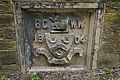
 Batley Corporation Water Works air valve marker plate - geograph.org.uk - 3572710.jpg 2,000 × 1,490; 1.43 MB
-
 Batley Corporation Water Works air valve marker plate - geograph.org.uk - 3572726.jpg 1,500 × 2,000; 1.26 MB
-
 Bay Hall Mills, Bay Hall - geograph.org.uk - 4457108.jpg 2,481 × 1,875; 958 KB
-
 Beck - Bradford Road - geograph.org.uk - 1828079.jpg 480 × 640; 108 KB
-
 Beck - Huddersfield Road - geograph.org.uk - 1839356.jpg 640 × 480; 97 KB
-
 Beck - off Bradford Road - geograph.org.uk - 2894867.jpg 480 × 640; 120 KB
-
-

-
 Beck by Batley Bus Station - geograph.org.uk - 2527532.jpg 480 × 640; 131 KB
-
 Below Bank Nook - geograph.org.uk - 2935354.jpg 640 × 480; 82 KB
-
 Bench and path leading to Bradley Mills Road - geograph.org.uk - 4794013.jpg 1,024 × 768; 334 KB
-
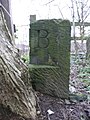
 Benchmark on canal bridge 10, Fieldhouse Lane - geograph.org.uk - 3203605.jpg 2,048 × 1,536; 511 KB
-
-
 Benchmark on Lodge Farm Bridge - geograph.org.uk - 2902780.jpg 3,072 × 2,304; 1.54 MB
-
 Benholmley Hill Wood. - geograph.org.uk - 2606507.jpg 4,320 × 3,240; 3.01 MB
-
 Benny Parr Close off Broomsdale Road, Lower Soothill - geograph.org.uk - 6033309.jpg 1,600 × 1,064; 419 KB
-
 Bierley Marsh - off Hunsworth Lane - geograph.org.uk - 2466959.jpg 640 × 480; 88 KB
-
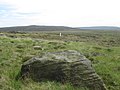
 Big rock by the Kirklees Way - geograph.org.uk - 4171607.jpg 640 × 427; 73 KB
-
 Binn Edge, near Marsden - geograph.org.uk - 2585607.jpg 4,320 × 3,240; 3.43 MB
-
 Birkhouse Boiler Works - geograph.org.uk - 4610993.jpg 640 × 420; 85 KB
-
 Birks - geograph.org.uk - 3053554.jpg 1,600 × 1,200; 344 KB
-
 Birstall Victoria ARLFC's ground - geograph.org.uk - 6150612.jpg 2,000 × 1,218; 2.23 MB
-
 Black Moss - geograph.org.uk - 6238288.jpg 640 × 427; 107 KB
-
 Blackberry Picking - geograph.org.uk - 2081217.jpg 3,968 × 2,976; 2.3 MB
-
 Blacker Edge - geograph.org.uk - 5965399.jpg 640 × 480; 65 KB
-
 Blacker Edge towards March Hill - geograph.org.uk - 5965407.jpg 3,942 × 2,748; 3.09 MB
-
 Blake Clough Farm - geograph.org.uk - 2562025.jpg 3,872 × 2,592; 4.63 MB
-
 Bleak moorland. - geograph.org.uk - 3519348.jpg 640 × 497; 83 KB
-
 Blocked footpath near Green Hill Farm, Marsden - geograph.org.uk - 5833029.jpg 2,000 × 1,500; 1,014 KB
-
 Blocks of stone next to a quarry track, Lingards - geograph.org.uk - 4682107.jpg 2,048 × 1,536; 1.09 MB
-
 Blue bell alongside the River Colne - geograph.org.uk - 4631398.jpg 1,024 × 768; 270 KB
-
 Bluebells in a field, Meltham - geograph.org.uk - 4953075.jpg 2,000 × 1,500; 1.4 MB
-
 Bluebells in woodland - geograph.org.uk - 1886050.jpg 1,024 × 768; 229 KB
-
 Bluebells on hillside - geograph.org.uk - 1886064.jpg 768 × 1,024; 521 KB
-
 Boardwalk on the old route of the Colne Valley Circular Walk - geograph.org.uk - 3726742.jpg 1,536 × 2,048; 1.17 MB
-
 Bog, Featherbed Moss - geograph.org.uk - 6238295.jpg 640 × 427; 136 KB
-
 Booth Bank from across the valley - geograph.org.uk - 3733738.jpg 640 × 480; 64 KB
-
 Boulder on Deanhead Moor - geograph.org.uk - 5130795.jpg 1,500 × 2,000; 1.46 MB
-
 Boulder with rabbit at Wham Head - geograph.org.uk - 4015945.jpg 1,600 × 1,200; 610 KB
-
 Boundary between two arable fields - geograph.org.uk - 2148711.jpg 1,024 × 768; 221 KB
-
 Boundary Stone at Howden Clough - geograph.org.uk - 3345300.jpg 1,500 × 2,000; 713 KB
-
 Boundary Stone at Howden Clough - geograph.org.uk - 3345308.jpg 1,500 × 2,000; 1.11 MB
-
 Boundary stone on Deer Hill, Meltham - geograph.org.uk - 4682141.jpg 2,048 × 1,536; 800 KB
-
 Boundary stone, Clifton side - geograph.org.uk - 2998974.jpg 2,000 × 1,500; 993 KB
-
 Boundary stone, Huddersfield Road - geograph.org.uk - 2418401.jpg 1,500 × 2,000; 1.31 MB
-
 Boundary Stone, White Reaps, Lingards - geograph.org.uk - 4683210.jpg 2,048 × 1,536; 1.02 MB
-
 Boundary stone, White Reaps, Lingards - geograph.org.uk - 4683212.jpg 1,536 × 2,048; 750 KB
-
 Bowling down towards Marsden - geograph.org.uk - 4172702.jpg 640 × 427; 66 KB
-
 Bradford City Water Works plaque On Pits Lane - geograph.org.uk - 3958708.jpg 1,600 × 1,064; 774 KB
-
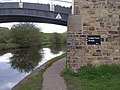
 Bradley - Colne (canal) Bridge - geograph.org.uk - 2640745.jpg 1,600 × 1,177; 755 KB
-
 Bradley - pipe bridge over canal - geograph.org.uk - 2640741.jpg 640 × 480; 105 KB
-

-
 Bradley Brook near Slaithwaite - geograph.org.uk - 2660488.jpg 3,240 × 4,320; 3.01 MB
-
 Bradley Junction - geograph.org.uk - 6203506.jpg 2,000 × 1,155; 1.49 MB
-
 Bradshaw Clough - geograph.org.uk - 2562252.jpg 3,872 × 2,592; 5.17 MB
-
 Bradshaw Lane at Newgate - geograph.org.uk - 2987245.jpg 800 × 600; 103 KB
-
 Branches on the moor - geograph.org.uk - 4689238.jpg 4,608 × 3,456; 2.36 MB
-
 Brearley Bridge - geograph.org.uk - 2415263.jpg 2,000 × 1,500; 967 KB
-
-
 Brewerton Lane - Staincliffe Road - geograph.org.uk - 3414648.jpg 640 × 480; 85 KB
-
 Brian Robinson artwork - geograph.org.uk - 5004418.jpg 600 × 800; 131 KB
-
 Brides ^ Maids - Oxford Road - geograph.org.uk - 1988545.jpg 640 × 496; 66 KB
-
 Bridge - geograph.org.uk - 2244877.jpg 640 × 482; 92 KB
-
 Bridge 15 on Sustrans route 66 - geograph.org.uk - 3273165.jpg 2,848 × 2,136; 1.58 MB
-
 Bridge 22 Lodge Farm, Calder ^ Hebble Navigation - geograph.org.uk - 5750234.jpg 1,600 × 1,065; 629 KB
-
 Bridge 36 on Huddersfield Narrow Canal - geograph.org.uk - 3574196.jpg 4,000 × 2,248; 6.33 MB
-
 Bridge 44a, Huddersfield Narrow Canal - geograph.org.uk - 1885994.jpg 1,024 × 768; 136 KB
-
 Bridge 7 (Leeds Road), Huddersfield Broad Canal - geograph.org.uk - 4317344.jpg 4,608 × 3,456; 3.64 MB
-
 Bridge and towpath, Huddersfield Narrow Canal - geograph.org.uk - 5540036.jpg 4,032 × 3,024; 4.76 MB
-

-

-
-
 Bridge MVL 3-61 - Bank Gate - geograph.org.uk - 5051075.jpg 640 × 480; 76 KB
-
 Bridge MVL 3-85 - Gledholt Bank - geograph.org.uk - 4812877.jpg 640 × 459; 80 KB
-
 Bridge MVL3-102 - Leeds Road - geograph.org.uk - 4106370.jpg 640 × 480; 72 KB
-
 Bridge MVN 2-202 - Calder Road - geograph.org.uk - 1834492.jpg 640 × 480; 58 KB
-
 Bridge MVN2 207 02 - Forge Lane - geograph.org.uk - 4241621.jpg 640 × 480; 82 KB
-
 Bridge near Slaithwaite Station - geograph.org.uk - 2420329.jpg 640 × 480; 90 KB
-
 Bridge No. 39, Ingham Colliery, Thornhill - geograph.org.uk - 2368336.jpg 2,000 × 1,500; 932 KB
-
 Bridge over a stream, Haigh Clough, Marsden - geograph.org.uk - 5843380.jpg 2,000 × 1,500; 1.03 MB
-
 Bridge over canal towpath - geograph.org.uk - 5004344.jpg 800 × 600; 200 KB
-

-

-
 Bridge over Listing Lane, Spen Valley Ringway - geograph.org.uk - 6151639.jpg 2,000 × 1,392; 2.22 MB
-

-
 Bridge over stream on Wood Lane - geograph.org.uk - 3476920.jpg 480 × 640; 109 KB
-
 Bridge over the A629 - geograph.org.uk - 4389549.jpg 640 × 480; 52 KB
-
 Bridge over the Calder below Scout Hill - geograph.org.uk - 5629372.jpg 1,024 × 768; 163 KB
-

-
 Bridge over the River Colne - geograph.org.uk - 5004367.jpg 800 × 600; 170 KB
-
 Bridge PEH-14 - Bridge Street - geograph.org.uk - 2155542.jpg 640 × 480; 112 KB
-
 Bridge PEH-15 - Wain Park - geograph.org.uk - 2155550.jpg 640 × 545; 120 KB
-
 Bridge PEH-17 - off Robin Hood Hill - geograph.org.uk - 2154765.jpg 480 × 640; 113 KB
-
 Bridge PEH-6 - Swan Lane - geograph.org.uk - 1948197.jpg 640 × 480; 118 KB
-
 Bridge ^42, Platt Road - geograph.org.uk - 5058594.jpg 1,200 × 799; 580 KB
-
 Bridge ^45, Lees Hill Lane - geograph.org.uk - 5058611.jpg 1,200 × 799; 390 KB
-
 Bridge ^53 a footbridge at Sandhill Cottages - geograph.org.uk - 5057838.jpg 1,200 × 799; 442 KB
-
 Bridge ^56 Marsden Lane - geograph.org.uk - 5057783.jpg 1,200 × 799; 597 KB
-

-
 Bridleway - Birkby Hall Road - geograph.org.uk - 4471695.jpg 640 × 480; 114 KB
-
 Bridleway - Bradley Road - geograph.org.uk - 3949635.jpg 480 × 640; 117 KB
-
 Bridleway - Halifax Old Road - geograph.org.uk - 4471958.jpg 640 × 480; 141 KB
-
 Bridleway - Halifax Road - geograph.org.uk - 3441822.jpg 480 × 640; 78 KB
-
 Bridleway - Lightridge Road - geograph.org.uk - 3911191.jpg 640 × 480; 128 KB
-
 Bridleway - Meltham Road - geograph.org.uk - 2141385.jpg 480 × 640; 142 KB
-
 Bridleway - Mill Forest Way - geograph.org.uk - 3280152.jpg 480 × 640; 121 KB
-

-
 Bridleway - Norwood Road - geograph.org.uk - 4471710.jpg 480 × 640; 110 KB
-
 Bridleway - Nova Lane - geograph.org.uk - 2894799.jpg 640 × 480; 123 KB
-
 Bridleway - Nutter Lane - geograph.org.uk - 2894791.jpg 480 × 640; 111 KB
-
 Bridleway - off Birkby Road - geograph.org.uk - 4577487.jpg 480 × 640; 105 KB
-
 Bridleway - off Bradford Road - geograph.org.uk - 2895077.jpg 480 × 640; 80 KB
-
 Bridleway - Reap Hirst Road - geograph.org.uk - 4577521.jpg 480 × 640; 105 KB
-
 Bridleway - Steeplands - geograph.org.uk - 3949633.jpg 640 × 480; 93 KB
-
 Bridleway - Stubs Beck Lane - geograph.org.uk - 2803591.jpg 480 × 640; 66 KB
-
 Bridleway - The Ghyll - geograph.org.uk - 3911112.jpg 480 × 640; 81 KB
-

-
 Bridleway along the east side of Jordan Wood - geograph.org.uk - 5260550.jpg 1,024 × 768; 357 KB
-
 Bridleway crossing Willmer Green Clough - geograph.org.uk - 4367240.jpg 6,000 × 4,000; 5.8 MB
-
 Bridleway heading towards Hartshead from Leeds Road - geograph.org.uk - 6203376.jpg 2,000 × 1,398; 2.19 MB
-
-
 Bridleway off Mill Forest Way - geograph.org.uk - 5126444.jpg 1,024 × 682; 251 KB
-
 Bridleway over the disused railway north of Oakwell Hall - geograph.org.uk - 4144581.jpg 1,600 × 1,200; 311 KB
-
 Bridleway passes under the M62 west of Moorbottom - geograph.org.uk - 4053766.jpg 1,600 × 1,200; 620 KB
-
 Bridleway to Marsden - geograph.org.uk - 4367224.jpg 6,000 × 4,000; 4.17 MB
-
 Bridleway to the bridge over the A650 - geograph.org.uk - 4144577.jpg 1,600 × 1,200; 315 KB
-
 Bridleway to Whitley Lower - geograph.org.uk - 3831218.jpg 1,600 × 1,200; 986 KB
-
 Bridleway towards Cowcliffe Hill - geograph.org.uk - 5755657.jpg 1,600 × 1,065; 1,004 KB
-
 Bridleway towards Cowcliffe Hill - geograph.org.uk - 5755658.jpg 1,600 × 1,065; 781 KB
-
 Bridleway towards Deanhead - geograph.org.uk - 2781034.jpg 3,072 × 2,304; 1.38 MB
-
 Bridleway towards Halifax Old Road - geograph.org.uk - 5755664.jpg 1,600 × 1,065; 1.02 MB
-
 Bridleway under the M62 north of Oakwell Hall - geograph.org.uk - 4144578.jpg 1,600 × 1,200; 315 KB
-
 Bridleway, Cold Royd - geograph.org.uk - 3309468.jpg 3,240 × 4,320; 2.99 MB
-
 Bridleway, near Outlane - geograph.org.uk - 3371765.jpg 4,320 × 3,240; 2.96 MB
-
 Briggate Bridge - geograph.org.uk - 4794160.jpg 1,024 × 768; 344 KB
-

-
 Britannia Trading Estate in Golcar - geograph.org.uk - 4475627.jpg 2,995 × 1,635; 1.14 MB
-

-
 Broad Oak Bowling Club - geograph.org.uk - 4296796.jpg 1,600 × 1,200; 402 KB
-

-
 Brock Bank - Coule Royd - geograph.org.uk - 4741385.jpg 640 × 480; 61 KB
-
 Brock Bank - Harpe Inge - geograph.org.uk - 4741381.jpg 640 × 480; 57 KB
-
 Broken Cross, Almondbury - geograph.org.uk - 3389037.jpg 3,240 × 4,320; 2.97 MB
-
 Broken wall on Close Flat - geograph.org.uk - 6275633.jpg 640 × 480; 104 KB
-
 Brooks Yard - Fall Lane - geograph.org.uk - 3769187.jpg 640 × 480; 98 KB
-
 Broomhill Close, Lower Soothill - geograph.org.uk - 6033316.jpg 1,600 × 1,064; 492 KB
-

-
 Bryan Road - Birkby Road - geograph.org.uk - 4577584.jpg 640 × 480; 86 KB
-
 Bryan Road - viewed from Binham Road - geograph.org.uk - 4577599.jpg 640 × 480; 110 KB
-
 Buckden Road - Thornhill Road - geograph.org.uk - 4662404.jpg 640 × 480; 83 KB
-
 Buckstones House - geograph.org.uk - 5965420.jpg 3,148 × 1,940; 2.39 MB
-
 Building off Howarth Lane - geograph.org.uk - 4403710.jpg 2,000 × 1,446; 1.22 MB
-

-
 Building site, Leeds Road - geograph.org.uk - 3405943.jpg 2,000 × 1,376; 698 KB
-
 Building work at the Dyer’s Arms, Chain Road, Lingards - geograph.org.uk - 3215221.jpg 2,000 × 1,423; 566 KB
-
-

-
 Bull above Bradshaw Clough - geograph.org.uk - 2562216.jpg 3,872 × 2,592; 3.05 MB
-
 Bull Green Road - Thornhill Road - geograph.org.uk - 4789979.jpg 640 × 480; 102 KB
-
 Bull Green Road from Haughs Lane - geograph.org.uk - 5054903.jpg 1,200 × 799; 409 KB
-
 Bungalow Fisheries - geograph.org.uk - 5054864.jpg 1,200 × 799; 359 KB
-
 Bunny Park - Horse Bank Drive - geograph.org.uk - 4976237.jpg 640 × 480; 72 KB
-
 Burdett Mill, Milnsbridge - geograph.org.uk - 2624387.jpg 418 × 640; 84 KB
-
 Burial Ground - Deep Lane - geograph.org.uk - 4945370.jpg 640 × 480; 141 KB
-
 Burn Road near Cliffe Farm - geograph.org.uk - 3230431.jpg 4,000 × 3,000; 3.22 MB
-
 Burniston Drive Oakes - geograph.org.uk - 4919918.jpg 4,606 × 3,454; 4.18 MB
-
 Burns Close - Bradford Road - geograph.org.uk - 2895102.jpg 640 × 411; 49 KB
-
 Burnside Close - Windmill Lane - geograph.org.uk - 2888075.jpg 640 × 480; 51 KB
-
 Burnt Plats Lane, Slaithwaite - geograph.org.uk - 5812439.jpg 2,048 × 1,536; 958 KB
-

-

-
 Bus stop on White Rose Avenue - geograph.org.uk - 4794184.jpg 1,024 × 768; 126 KB
-
 Bush Babies nursery, Cleckheaton - geograph.org.uk - 6130502.jpg 1,024 × 768; 215 KB
-
 Business units on Leeds Road - geograph.org.uk - 4269953.jpg 640 × 417; 32 KB
-
 Businesses on Warehouse Hill Road, Marsden - geograph.org.uk - 5057773.jpg 1,200 × 799; 432 KB
-
 Buttercup Meadow - geograph.org.uk - 3507791.jpg 2,000 × 1,500; 985 KB
-
 By the Huddersfield line in Dewsbury - geograph.org.uk - 4213862.jpg 640 × 430; 72 KB
-
 By the Huddersfield line in Dewsbury - geograph.org.uk - 4213892.jpg 640 × 430; 56 KB
-
 By-way, Ashes Common Farm, near Almondbury - geograph.org.uk - 3309894.jpg 4,320 × 3,240; 3.04 MB

,_Dan_Clough_Moss_-_geograph.org.uk_-_5965383.jpg)


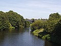
_Bridge_-_geograph.org.uk_-_2640745.jpg)


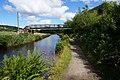
,_Huddersfield_Broad_Canal_-_geograph.org.uk_-_4317344.jpg)


