Category:Middleton, Cumbria
village and civil parish in South Lakeland, Cumbria, United Kingdom  | |||||
| Upload media | |||||
| Instance of | |||||
|---|---|---|---|---|---|
| Location | South Lakeland, Cumbria, North West England, England | ||||
 | |||||
Subcategories
This category has the following 5 subcategories, out of 5 total.
Media in category "Middleton, Cumbria"
The following 174 files are in this category, out of 174 total.
-
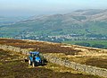 A tractor on the fell - geograph.org.uk - 3679212.jpg 663 × 480; 139 KB
-
 A tributary of Ashdale Gill - geograph.org.uk - 2313348.jpg 640 × 480; 100 KB
-
 A683 - geograph.org.uk - 4500475.jpg 4,725 × 2,930; 1.93 MB
-
 A683 - geograph.org.uk - 4523362.jpg 4,735 × 3,055; 1.97 MB
-
 A683 at Blackbeck Bridge - geograph.org.uk - 4002778.jpg 640 × 394; 99 KB
-
 A683 at entrance to Hawkin Hall - geograph.org.uk - 4003183.jpg 640 × 358; 63 KB
-

-
-
 A683, a Roman road, south of Low Stockdale Bridge - geograph.org.uk - 5175736.jpg 1,600 × 1,279; 936 KB
-
 Abba Farm - geograph.org.uk - 4055825.jpg 640 × 480; 119 KB
-
 Access Lane leading to Low Fellside - geograph.org.uk - 4394577.jpg 5,184 × 3,456; 5.89 MB
-
 Applegarth - geograph.org.uk - 4523223.jpg 5,184 × 2,873; 1.64 MB
-

-
 Approaching low bridge sign - geograph.org.uk - 4003616.jpg 640 × 374; 68 KB
-
 Ashdale Gill - geograph.org.uk - 2313346.jpg 640 × 480; 117 KB
-
 Barbon - geograph.org.uk - 4500478.jpg 5,183 × 3,054; 1.84 MB
-
 Barn and bales at Ellers - geograph.org.uk - 4054893.jpg 640 × 480; 108 KB
-
 Barn at Ellers - geograph.org.uk - 708258.jpg 640 × 463; 98 KB
-
 Barn below Sowermire Wood - geograph.org.uk - 2314306.jpg 640 × 480; 79 KB
-
 Beck above Fellside - geograph.org.uk - 1123620.jpg 640 × 480; 87 KB
-
 Beck House - geograph.org.uk - 4523020.jpg 4,732 × 2,750; 1.82 MB
-
 Bench Mark near Middleton - geograph.org.uk - 1814313.jpg 480 × 640; 184 KB
-
 Benchmark on the Calf Top trig point - geograph.org.uk - 5988008.jpg 675 × 1,024; 189 KB
-

-
 Bend in A683 as it passes through Park Wood - geograph.org.uk - 3534855.jpg 1,024 × 683; 298 KB
-
 Beside Sowermire Wood - geograph.org.uk - 4394573.jpg 5,184 × 3,456; 6.93 MB
-
 Betweengates Lane - geograph.org.uk - 4610292.jpg 1,024 × 767; 686 KB
-
 Boggy pools on Castle Knott - geograph.org.uk - 2313356.jpg 640 × 480; 100 KB
-
 Boggy puddle on Combe Top - geograph.org.uk - 1659661.jpg 640 × 482; 79 KB
-
 Borwens - geograph.org.uk - 4393357.jpg 5,184 × 3,456; 7.47 MB
-
 Borwens - geograph.org.uk - 4523221.jpg 4,936 × 2,625; 1.86 MB
-
 Boundary stone, Hun Bank - geograph.org.uk - 2676366.jpg 488 × 640; 134 KB
-
 Boundary wall, Barkin - geograph.org.uk - 2313728.jpg 640 × 480; 90 KB
-
 Bridge of dismantled railway over Jordan Lane - geograph.org.uk - 3534909.jpg 1,024 × 683; 316 KB
-
 Bridge over disused railway, Barbon - geograph.org.uk - 2313336.jpg 640 × 480; 193 KB
-
 Bridleway above Middleton Bridge - geograph.org.uk - 3896534.jpg 640 × 480; 157 KB
-
 Bridleway, Middleton Bridge - geograph.org.uk - 1812645.jpg 640 × 480; 226 KB
-
 Bus shelter at Middleton - geograph.org.uk - 5175745.jpg 1,600 × 800; 535 KB
-
 Calf Foot, Middleton Fell - geograph.org.uk - 2314214.jpg 640 × 480; 133 KB
-
 Calf Foot, Middleton Fell - geograph.org.uk - 2314235.jpg 640 × 480; 58 KB
-
 Calf Top in snow - geograph.org.uk - 4281283.jpg 3,264 × 2,448; 3.09 MB
-
 Calf Top trig point in the mist - geograph.org.uk - 5988223.jpg 1,024 × 730; 109 KB
-
 Calf, Middleton Fell - geograph.org.uk - 2313763.jpg 480 × 640; 85 KB
-
 Cartsaddle Hill, Middleton Fell - geograph.org.uk - 3675702.jpg 600 × 800; 172 KB
-
 Cattle by the old railway - geograph.org.uk - 3896464.jpg 800 × 600; 147 KB
-
 Church of the Holy Ghost - geograph.org.uk - 5116684.jpg 1,280 × 960; 1.12 MB
-
 Church of the Holy Ghost, Middleton - geograph.org.uk - 5138886.jpg 1,800 × 1,200; 1.52 MB
-
 Church of the Holy Ghost, Middleton - geograph.org.uk - 5175739.jpg 1,600 × 1,198; 817 KB
-
 Church of the Holy Ghost, Middleton - geograph.org.uk - 5349726.jpg 2,592 × 1,944; 1.74 MB
-
 Churchyard at Middleton, in Lunesdale - geograph.org.uk - 2655931.jpg 3,264 × 2,448; 4.65 MB
-
 Churchyard, The Church of the Holy Ghost - geograph.org.uk - 1812465.jpg 640 × 480; 154 KB
-
-

-
 Course of old railway - geograph.org.uk - 3502778.jpg 640 × 480; 105 KB
-
 Course of old railway, Middleton - geograph.org.uk - 4054857.jpg 640 × 480; 96 KB
-
 Cut bench mark, Hawking Hall - geograph.org.uk - 4055808.jpg 640 × 480; 150 KB
-
 Date stone at Ullathorns, Middleton - geograph.org.uk - 4055318.jpg 649 × 480; 126 KB
-
 Deer, Middleton Fell - geograph.org.uk - 2313755.jpg 597 × 640; 147 KB
-
 Descending from Combe Top - geograph.org.uk - 3675831.jpg 640 × 480; 99 KB
-
 Disused Railway Bridge at Sowermire Farm - geograph.org.uk - 4393383.jpg 5,184 × 3,456; 5.95 MB
-
 Disused Railway in the Lune Valley - geograph.org.uk - 4394580.jpg 5,184 × 3,456; 5.92 MB
-
 Dog and chickens, Borwens - geograph.org.uk - 2314354.jpg 640 × 480; 180 KB
-
 Eller Beck - geograph.org.uk - 4393047.jpg 5,184 × 3,456; 6.92 MB
-
 Ellers Farm - geograph.org.uk - 339910.jpg 640 × 480; 99 KB
-
 Entrance to Middleton Hall - geograph.org.uk - 5175724.jpg 1,200 × 1,600; 805 KB
-
 Ewe and lamb, Fellside - geograph.org.uk - 3896574.jpg 600 × 800; 196 KB
-
 Ewe and lambs near Middleton - geograph.org.uk - 1812573.jpg 640 × 480; 149 KB
-
 Farmhouse at Ullathorns, Middleton - geograph.org.uk - 4055312.jpg 640 × 480; 84 KB
-
 Fellside - geograph.org.uk - 3677083.jpg 800 × 600; 161 KB
-
 Fellside below Brown Knott - geograph.org.uk - 1123640.jpg 640 × 480; 70 KB
-
 Fellside Road - geograph.org.uk - 1123583.jpg 640 × 480; 78 KB
-
 Fields near Bainsbank - geograph.org.uk - 5175750.jpg 1,600 × 1,200; 618 KB
-
 Fields near Beckside - geograph.org.uk - 2318522.jpg 640 × 480; 51 KB
-
 Flank of Calf - geograph.org.uk - 1909913.jpg 640 × 480; 101 KB
-
 Footbridge, Millhouse Gill - geograph.org.uk - 2314271.jpg 640 × 480; 121 KB
-

-
 Ford over Ridding Beck - geograph.org.uk - 3677071.jpg 640 × 480; 121 KB
-
 Ford over the beck at Treasonfield - geograph.org.uk - 2910480.jpg 640 × 480; 121 KB
-
 Ford over the Lune at Hawking Hall - geograph.org.uk - 4055350.jpg 800 × 600; 151 KB
-
 Frith Plantation - geograph.org.uk - 3675689.jpg 640 × 480; 106 KB
-
 Gawklands - geograph.org.uk - 2313344.jpg 640 × 480; 129 KB
-
 Graffiti on Sammy's Pike - geograph.org.uk - 3675796.jpg 640 × 480; 194 KB
-
 Grassland and woodland at Middleton - geograph.org.uk - 5116676.jpg 1,280 × 960; 1.06 MB
-
 Grassland at Middleton - geograph.org.uk - 5116680.jpg 4,000 × 3,000; 5.9 MB
-

-
 Heading for Holme Knott - geograph.org.uk - 3896564.jpg 800 × 600; 103 KB
-
 High Green - geograph.org.uk - 3675675.jpg 640 × 480; 109 KB
-
 High Holme - geograph.org.uk - 4506160.jpg 640 × 480; 71 KB
-
 High Road at Middleton - geograph.org.uk - 4394584.jpg 5,184 × 3,456; 7.4 MB
-
 High Stockdale Bridge - geograph.org.uk - 4523359.jpg 4,142 × 2,232; 1.77 MB
-
 Holme Knott - geograph.org.uk - 1123551.jpg 640 × 480; 85 KB
-
 Holme Knott - geograph.org.uk - 2288423.jpg 1,024 × 490; 107 KB
-
 Holme Knott - geograph.org.uk - 2291761.jpg 800 × 449; 87 KB
-
 It's cold and wet outside^ - geograph.org.uk - 4506180.jpg 600 × 800; 126 KB
-
 Jordan Lane, on the course of a Roman Road - geograph.org.uk - 3534903.jpg 1,024 × 683; 329 KB
-
 Leaving Calf Top - geograph.org.uk - 3675812.jpg 800 × 600; 117 KB
-
 Looking down from Combe Top - geograph.org.uk - 1659650.jpg 640 × 482; 63 KB
-
 Looking towards Cartsaddle Hill - geograph.org.uk - 5116686.jpg 2,861 × 2,318; 3.06 MB
-
 Low bridge over A683 - geograph.org.uk - 4003617.jpg 640 × 464; 201 KB
-
 Low Lane - geograph.org.uk - 4056206.jpg 640 × 480; 133 KB
-
 Middleton farmscape - geograph.org.uk - 2655938.jpg 3,264 × 2,448; 3.92 MB
-
 Milestone near Middleton - geograph.org.uk - 1812550.jpg 640 × 480; 148 KB
-
 Milestone near Middleton - geograph.org.uk - 1812565.jpg 480 × 640; 217 KB
-
 Milestone near Middleton - geograph.org.uk - 1814291.jpg 640 × 480; 199 KB
-
 Milestone near Middleton Bridge, Cumbria.jpg 683 × 1,024; 291 KB
-
 Milestone near Middleton Hall.jpg 480 × 640; 243 KB
-
 Milestone on A683 road, Middleton.jpg 1,024 × 683; 321 KB
-
 Milestone on the A683, Middleton - geograph.org.uk - 4055340.jpg 480 × 640; 158 KB
-

-
-
 Millbeck - geograph.org.uk - 4523046.jpg 5,108 × 2,682; 1.55 MB
-
 Millhouse Gill - geograph.org.uk - 1909904.jpg 640 × 480; 96 KB
-
 No access to the open fell at Mill House - geograph.org.uk - 4054884.jpg 682 × 480; 137 KB
-
 On Castle Knott - geograph.org.uk - 1909286.jpg 640 × 480; 57 KB
-
 On Castle Knott - geograph.org.uk - 1909296.jpg 640 × 480; 73 KB
-
 On the path down to Fellside - geograph.org.uk - 3677062.jpg 640 × 480; 137 KB
-

-
 Ordnance Survey Cut Mark - geograph.org.uk - 4091383.jpg 4,000 × 3,000; 4.94 MB
-
 Ordnance Survey Flush Bracket 11380 - geograph.org.uk - 4091398.jpg 4,000 × 3,000; 2.82 MB
-
 Ordnance Survey Flush Bracket S1036 - geograph.org.uk - 4091366.jpg 4,000 × 3,000; 4.1 MB
-
 Pasture off Betweengates Lane - geograph.org.uk - 4610294.jpg 1,024 × 768; 816 KB
-
 Permissive route by Brow Gill - geograph.org.uk - 3675685.jpg 640 × 480; 86 KB
-
 Prehistoric homestead, Borwens - geograph.org.uk - 2314347.jpg 640 × 480; 138 KB
-
 Renewable energy at Fellside - geograph.org.uk - 3681970.jpg 680 × 480; 94 KB
-
 Rigmaden Bridge - geograph.org.uk - 1213202.jpg 640 × 369; 160 KB
-
 Rigmaden Bridge - geograph.org.uk - 4395476.jpg 5,184 × 3,456; 5.92 MB
-
 Rigmaden Park - geograph.org.uk - 4055848.jpg 640 × 493; 114 KB
-
 Rigmaden Park - geograph.org.uk - 4523231.jpg 2,849 × 1,908; 1.89 MB
-
 River Rawthey - geograph.org.uk - 1812681.jpg 640 × 480; 140 KB
-
 River Rawthey - geograph.org.uk - 1812690.jpg 640 × 480; 133 KB
-
 River Rawthey - geograph.org.uk - 5855527.jpg 1,187 × 1,600; 722 KB
-
 River Rawthey from Middleton Bridge - geograph.org.uk - 1918491.jpg 640 × 480; 128 KB
-
 Ruined building, Middleton Fell - geograph.org.uk - 3675721.jpg 640 × 480; 93 KB
-
 Sammy's Pike, Middleton Fell - geograph.org.uk - 2313745.jpg 480 × 640; 116 KB
-
 Semi-ruined barn, Middleton Head - geograph.org.uk - 3677344.jpg 640 × 480; 116 KB
-
 Sheep near Middleton Hall Bridge - geograph.org.uk - 1812602.jpg 640 × 481; 123 KB
-
 Sheepfold, Castle Knott - geograph.org.uk - 1909289.jpg 640 × 480; 62 KB
-
 Sheepfold, Millhouse Gill - geograph.org.uk - 2314246.jpg 640 × 480; 155 KB
-

-
 Small tarn, Calf Top - geograph.org.uk - 3677374.jpg 600 × 800; 114 KB
-
 Small tributary of the Lune - geograph.org.uk - 3502776.jpg 640 × 480; 95 KB
-
 Sowermire Farm - geograph.org.uk - 4393387.jpg 5,184 × 3,456; 5.63 MB
-
 Stone Barn below Sowermire Wood - geograph.org.uk - 4393401.jpg 5,184 × 3,456; 7.07 MB
-
 Stream near Borwens - geograph.org.uk - 4393367.jpg 5,184 × 3,456; 6.74 MB
-
 Swan Inn ahead at Middleton - geograph.org.uk - 4003614.jpg 640 × 482; 146 KB
-
 Tarn on Holme Knott - geograph.org.uk - 3897046.jpg 800 × 600; 126 KB
-
 The bridleway south of Low Waterside - geograph.org.uk - 3675669.jpg 640 × 480; 99 KB
-
 The Head - geograph.org.uk - 4500292.jpg 5,098 × 2,873; 1.75 MB
-
 The Head at Middleton - geograph.org.uk - 4003625.jpg 533 × 347; 52 KB
-
 The Head Inn at Middleton Head - geograph.org.uk - 5175715.jpg 1,600 × 1,200; 757 KB
-
 The head of Ashdale Gill - geograph.org.uk - 2313351.jpg 640 × 480; 119 KB
-
 The old Clapham to Lowgill railway - geograph.org.uk - 4506138.jpg 640 × 480; 85 KB
-

-
 The track above Fellside - geograph.org.uk - 3897032.jpg 800 × 600; 143 KB
-
 The track to Eskholme - geograph.org.uk - 2313339.jpg 640 × 480; 137 KB
-
 The upper flanks of Middleton Fell - geograph.org.uk - 3675735.jpg 640 × 480; 95 KB
-
 Three Little Boys, Ashdale Gill - geograph.org.uk - 2314461.jpg 800 × 600; 146 KB
-
 Track in Lunesdale. - geograph.org.uk - 27507.jpg 640 × 480; 149 KB
-
 Track on Brown Knott (2) - geograph.org.uk - 3676481.jpg 800 × 600; 162 KB
-
 Track on Brown Knott - geograph.org.uk - 3676467.jpg 640 × 480; 115 KB
-
 Trees at Low Fellside - geograph.org.uk - 2314288.jpg 800 × 600; 204 KB
-
 Trig point at summit of Holme Knott - geograph.org.uk - 5607900.jpg 1,499 × 968; 1.26 MB
-
 Trig point on Calf Top - geograph.org.uk - 5607914.jpg 1,500 × 907; 1.37 MB
-
 Turning for Rigmaden from A683 - geograph.org.uk - 4002875.jpg 640 × 487; 76 KB
-
 Ullathorns - geograph.org.uk - 4523356.jpg 4,600 × 2,509; 1.96 MB
-
 View from Rigmaden Farm - geograph.org.uk - 555882.jpg 640 × 480; 86 KB
-
 Wall on Calf Top - geograph.org.uk - 1909887.jpg 640 × 480; 68 KB
-
 Wall, Barkin Top - geograph.org.uk - 1909893.jpg 640 × 480; 61 KB
-
 Walls and track on Long End - geograph.org.uk - 3675837.jpg 640 × 480; 133 KB
-
 Woodland stream, Sowermire - geograph.org.uk - 2314321.jpg 640 × 480; 148 KB
-
 Wrestle Gill, Middleton Fell - geograph.org.uk - 3675820.jpg 640 × 480; 102 KB
-
 Yewtree and the Lune Valley - geograph.org.uk - 2313343.jpg 640 × 480; 99 KB
-
 Larum Gill - geograph.org.uk - 617275.jpg 640 × 480; 65 KB
-
 Track in Lunesdale. - geograph.org.uk - 27507 (cropped).jpg 565 × 424; 124 KB


_-_geograph.org.uk_-_4054830.jpg)


_-_geograph.org.uk_-_3676481.jpg)


.jpg)