Category:Old county maps of Westmorland
Ceremonial counties of England: Bedfordshire · Berkshire · Buckinghamshire · Cambridgeshire · Cheshire · Cornwall · Derbyshire · Devon · Dorset · Durham · East Riding of Yorkshire · Essex · Gloucestershire · Hampshire · Herefordshire · Hertfordshire · Kent · Lancashire · Leicestershire · Lincolnshire · Norfolk · Northamptonshire · Northumberland · Nottinghamshire · Oxfordshire · Rutland · Shropshire · Somerset · Staffordshire · Suffolk · Surrey · Warwickshire · Wiltshire · Worcestershire
City-counties:
Former historic counties: Cumberland · Huntingdonshire · Middlesex · North Riding of Yorkshire · Sussex · West Riding of Yorkshire · Westmorland · Yorkshire
Other former counties:
City-counties:
Former historic counties: Cumberland · Huntingdonshire · Middlesex · North Riding of Yorkshire · Sussex · West Riding of Yorkshire · Westmorland · Yorkshire
Other former counties:
Media in category "Old county maps of Westmorland"
The following 8 files are in this category, out of 8 total.
-
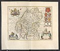
 "Westmoria Comitatus, anglice Westmorland" (21637523924).jpg 3,886 × 3,037; 2.1 MB
-
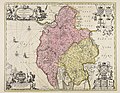
 Cumbria & Westmoria vulgo Cumberland & Westmorland (8642493049).jpg 800 × 668; 140 KB
-
-
 Maps of England circa 1670, Cumberland, Westmoreland 9 of 40 (13433786323).jpg 4,925 × 6,565; 4.66 MB
-
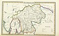
 Aikin(1800) p091 - Westmorland.jpg 1,952 × 1,165; 397 KB
-
 Gray1824.westmoreland.jpg 819 × 940; 117 KB
-
 Pigot and Co (1842) p2.444 - Map of Westmorland.jpg 2,144 × 1,310; 736 KB
-
 Cumbria & Westmoria vulgo Cumberland & Westmorland - CBT 6596122.jpg 6,084 × 4,715; 8.4 MB
.jpg)
.jpg)
.5.(53).jpg)
.jpg)
_p091_-_Westmorland.jpg)

_p2.444_-_Map_of_Westmorland.jpg)
