Category:Old maps of Baden-Württemberg
Federal states of Germany:
Urban districts (cities): Freiburg · Heidelberg · Heilbronn · Karlsruhe · Mannheim · Ulm
Use the appropriate category for maps showing all or a large part of Baden-Württemberg. See subcategories for smaller areas:
| If the map shows | Category to use |
|---|---|
| Baden-Württemberg on a recently created map | Category:Maps of Baden-Württemberg or its subcategories |
| Baden-Württemberg on a map created more than 70 years ago | Category:Old maps of Baden-Württemberg or its subcategories |
| the history of Baden-Württemberg on a recently created map | Category:Maps of the history of Baden-Württemberg or its subcategories |
| the history of Baden-Württemberg on a map created more than 70 years ago | Category:Old maps of the history of Baden-Württemberg or its subcategories |
Subcategories
This category has the following 17 subcategories, out of 17 total.
J
- Johann Christoph Hurter (6 F)
K
M
O
- Old maps of Allgäu (4 F)
- Old maps of Breisach am Rhein (12 F)
R
Media in category "Old maps of Baden-Württemberg"
The following 164 files are in this category, out of 164 total.
-
 Wuitbreiding.jpg 261 × 350; 35 KB
-
 WuerttembergPutzger1905.jpg 1,407 × 1,785; 526 KB
-
-

-

-
-

-

-

-

-

-

-

-

-

-

-
 Amt Möhringen 1800.jpg 1,558 × 1,124; 391 KB
-
 Atlas Ortelius KB PPN369376781-054av-054br.jpg 3,000 × 2,194; 4.43 MB
-
 Atlas Ortelius KB PPN369376781-055av-055br.jpg 3,000 × 2,194; 4.76 MB
-
 Baden Bayerische Pfalz 1905.png 1,505 × 2,000; 1.83 MB
-
 BadenPutzger1905.jpg 899 × 1,404; 587 KB
-
 BadenUitbreiding.jpg 433 × 716; 91 KB
-
 Bayersbrunner Vorst.jpg 1,386 × 1,377; 516 KB
-
 Besitzungen des Chorherrenstifts Ellwangen 1602.jpg 1,556 × 670; 944 KB
-
 Bishopric of Strasbourg 1547.png 536 × 522; 599 KB
-
 Bistum Konstanz Karte mit Dekanaten 1779.jpg 4,496 × 3,330; 5.95 MB
-
 Bistum Konstanz.jpg 428 × 600; 175 KB
-
 Bistum Konstanz.png 428 × 600; 17 KB
-
 Bistum Speyer Diözesankarte 300sw.jpg 6,949 × 4,851; 22.62 MB
-
 Brigobanne tab peut.jpg 1,059 × 991; 1.5 MB
-
 Buchau on the Federsee.jpg 1,053 × 665; 236 KB
-
 Circulus Suevicus - CBT 5877230.jpg 5,600 × 4,760; 8.07 MB
-
 Clarenna Tabula Peutingeriana.jpg 1,159 × 994; 1.17 MB
-
 D-BW-FN-Überlingen-Lippertsreute - Karte von 1788.png 956 × 899; 2.05 MB
-
 D-BW-KN-Mühlingen-Madachhof - Karte von 1765 (Ausschnitt).png 1,280 × 720; 1.95 MB
-
 D-BW-KN-Mühlingen-Madachhof - Karte von 1789 (Ausschnitt).png 1,280 × 720; 1.13 MB
-
 D-BW-KN-Mühlingen-Mainwangen - Karte von 1765 (Ausschnitt).png 1,600 × 900; 2.78 MB
-
 D-BW-KN-Mühlingen-Mainwangen - Karte von 1789 (Ausschnitt).png 1,595 × 900; 1.87 MB
-
 D-BW-KN-Mühlingen-Schwackenreute - Karte von 1760 (Ausschnitt).png 1,510 × 572; 1.5 MB
-
 D-BW-KN-Mühlingen-Zoznegg - Karte von 1760 (Ausschnitt).png 478 × 517; 494 KB
-
 D-BW-KN-Stockach-Wahlwies (2. Hälfte 18. Jh.).png 467 × 475; 411 KB
-
 Duchy of Württemberg and other territories of Swabia.jpg 2,147 × 1,700; 2.6 MB
-
 Elzas in de middeleeuwen.png 234 × 339; 41 KB
-
 Esseratsweiler um 1700.jpg 1,024 × 768; 147 KB
-
 Flurkarte Heuneburg um1800.jpg 320 × 267; 14 KB
-
 Dreizeilenplan freudenstadt 1599-1600.jpg 4,427 × 4,600; 5.47 MB
-
 Freudenstadt Dreizeilenplan.jpg 980 × 1,001; 1.09 MB
-
 Gammertingen 1717.jpg 750 × 498; 91 KB
-
 Gemarkungskarte Deisendorf.jpg 810 × 1,060; 121 KB
-
 German2 shepherd.jpg 1,485 × 2,355; 703 KB
-
 Grafschaft Eberstein in Schwaben - Map - Krieg von Hochfelden.JPG 1,270 × 1,971; 1.24 MB
-

-
 Herrschaft Justingen.gif 1,717 × 881; 586 KB
-
 Hertzogthum Würtenberg im Schwäbischen Creis Teutzschlandes mit angräntzenden Gegenden.jpg 2,759 × 2,497; 2.62 MB
-
 Hettingen 1717.jpg 432 × 648; 279 KB
-
 Höllentalbahn aus Bahnkarte Deutschland 1899.png 450 × 250; 259 KB
-

-
 Kappel-Rheinau Gemarkungsplan 1866.jpg 4,418 × 3,721; 2.91 MB
-
 Karte Archidiaconate und Decanate des Bischtums Constanz.jpg 4,212 × 4,377; 5.69 MB
-
 Karte Kellerei Billigheim-Allfeld.png 2,859 × 2,322; 86 KB
-
 Karte Klettgau 1806.PNG 813 × 614; 1.1 MB
-
 Karte Markgräflerland.svg 589 × 673; 160 KB
-
 Karte Oberamt Weinsberg 1923.jpg 7,447 × 6,534; 5.3 MB
-
 Klosterkarte Beuron.jpg 615 × 665; 553 KB
-
 Koenigreich Wuerttemberg 1905.png 1,544 × 2,100; 1.93 MB
-
 Komburg und Schwäbisch Hall c1570.jpg 3,990 × 1,730; 347 KB
-
 Landkarte 168 Weingarten 1914.jpg 2,362 × 2,358; 2.53 MB
-
 LieuxKeplerWurtemberg.png 1,413 × 1,013; 1.44 MB
-
 Lottenweiler.jpg 2,170 × 2,495; 656 KB
-
 Map Baden Hohenzollern Wuerttemberg 1892 Part Black Forest.jpg 4,529 × 6,370; 9.4 MB
-
 Map of 'County of Nellenburg'.jpg 1,672 × 1,572; 723 KB
-
 Meyers b16 s0772a.jpg 800 × 1,052; 434 KB
-
 OAB Sulz Karte.jpg 4,176 × 4,644; 3.46 MB
-
 OAB Sulz Karte.png 4,176 × 4,644; 7.79 MB
-
 OABoeblingen-Karte.png 2,326 × 2,640; 3.88 MB
-
 OAVaihingenKarte a.jpg 3,309 × 2,493; 512 KB
-
 OAVaihingenKarte b.jpg 3,309 × 2,493; 504 KB
-
 OAVaihingenKarte.jpg 3,200 × 3,650; 1,012 KB
-
 Oberamt Aalen Karte 001.jpg 3,454 × 4,117; 2.09 MB
-
 Oberamt Aalen Karte 001.png 3,454 × 4,117; 2.02 MB
-
 Oberamt Biberach Karte Teil a.jpg 6,529 × 4,411; 4.8 MB
-
 Oberamt Biberach Karte Teil b.jpg 6,563 × 2,222; 2.48 MB
-
 Oberamt Biberach Karte.jpg 6,565 × 6,635; 4.89 MB
-
 Oberamt gmuend 1870.jpg 2,550 × 3,493; 4.27 MB
-
 Oberamt Leutkirch Karte.jpg 5,510 × 6,880; 2.86 MB
-
 Oberamt Ravensburg Karte.jpg 6,557 × 7,272; 6.3 MB
-
 Oberamt Riedlingen Karte.jpg 5,510 × 6,352; 5.65 MB
-
 Oberamt Saulgau Karte a.jpg 7,016 × 5,100; 3.67 MB
-
 Oberamt Saulgau Karte b.jpg 7,015 × 3,531; 5.23 MB
-
 Oberamt Saulgau Karte.jpg 7,000 × 8,000; 8.47 MB
-
 Oberamt Tettnang Karte Teil a.jpg 6,714 × 3,788; 1.35 MB
-
 Oberamt Tettnang Karte.jpg 6,700 × 7,700; 3.6 MB
-
 Oberamt Tettnang KarteTeil b.jpg 6,960 × 3,934; 1.55 MB
-
 Oberamt Waldsee Karte.jpg 4,263 × 4,903; 3.68 MB
-
 Oberraderach um1630.jpg 4,526 × 3,665; 4.67 MB
-
 Peutinger Karte Ausschnitt Hochrhein.jpg 1,166 × 723; 572 KB
-
 Quellen Bußbachtal.jpg 324 × 354; 39 KB
-
 Ravensburg 1908 Ausschnitt.jpg 511 × 390; 176 KB
-
 Ravensburg 1908.jpg 2,362 × 2,309; 2.97 MB
-
 Reichenau Gemarkungsplan 1876.jpg 4,114 × 3,396; 2 MB
-
 Reichenau Gemarkungsplan 1876.pdf 3,506 × 2,479; 1.24 MB
-
 Reichsherrschaft Bonndorf 1806 V2.PNG 582 × 495; 773 KB
-
 Reilly 150.jpg 1,037 × 937; 416 KB
-
 Reilly 151.jpg 1,072 × 996; 436 KB
-
 Reilly 152.jpg 1,022 × 897; 413 KB
-
 Reilly 153 HAAB.jpg 874 × 633; 683 KB
-
 Reilly 153.jpg 1,051 × 787; 382 KB
-
 Reilly 180.jpg 1,330 × 1,196; 603 KB
-
 Reilly 182.jpg 1,147 × 837; 463 KB
-
 Reilly 185.jpg 1,345 × 1,106; 575 KB
-
 Reilly 186.jpg 1,167 × 1,032; 628 KB
-
 Reilly 187.jpg 1,188 × 1,065; 691 KB
-
 Reilly 188.jpg 1,194 × 1,086; 720 KB
-
 Reilly 189.jpg 1,335 × 1,023; 641 KB
-
 Reilly 190.jpg 1,215 × 954; 555 KB
-
 Reilly 191.jpg 1,077 × 947; 427 KB
-
 Reilly 192.jpg 1,156 × 907; 422 KB
-
 Reilly 192b.jpg 1,564 × 1,208; 710 KB
-
 Reilly 193.jpg 1,111 × 987; 486 KB
-
 Reilly 194 HAAB.jpg 1,023 × 786; 862 KB
-
 Reilly 194.jpg 1,224 × 912; 534 KB
-
 Reilly 195.jpg 1,125 × 1,032; 557 KB
-
 Reilly 196 HAAB.jpg 1,007 × 719; 628 KB
-
 Reilly 196.jpg 1,186 × 847; 435 KB
-
 Reilly 198.jpg 1,032 × 842; 374 KB
-
 Reilly 206.jpg 1,146 × 987; 587 KB
-
 Reilly 219.jpg 1,265 × 992; 565 KB
-
 Reilly 225.jpg 1,009 × 793; 384 KB
-
 Reilly 234.jpg 1,102 × 932; 506 KB
-
 Reilly 250.jpg 1,265 × 903; 505 KB
-
 Reilly 253.jpg 1,375 × 907; 534 KB
-
 Reilly Allgemeiner Postatlas Bayern Schwaben.jpg 500 × 332; 32 KB
-

-
 Salem Mappa 1765.jpg 3,250 × 2,594; 2.09 MB
-
 Schlacht bei Schliengen Woerl.jpg 380 × 720; 134 KB
-
 Schloss Herteneck.Quad.1600.jpg 208 × 155; 52 KB
-
 Schluchsee-Ursee.jpg 982 × 692; 89 KB
-

-
 Seekreis Baden 1800 Baumann.jpg 7,483 × 4,326; 6.01 MB
-
 Seltzlin map 1572.JPG 3,780 × 5,040; 9.14 MB
-
 St. Agatha (Illerrieden) im Ortsplan von Illerrieden 1828.jpg 1,256 × 881; 603 KB
-
 Stabsamt Bräunlingen 1800.jpg 1,202 × 642; 185 KB
-
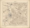
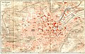 Stadtplan-Stuttgart-1893.jpg 994 × 626; 272 KB
-
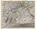 Stielers Handatlas 1891 12.jpg 5,199 × 4,250; 8.49 MB
-
 Stielers Handatlas 1891 15.jpg 5,099 × 4,250; 8.02 MB
-
 Stromberger Forst Georg Gadner.jpeg 3,352 × 3,288; 2.82 MB
-
 Sueddeutsche Staaten.jpg 913 × 768; 272 KB
-
 Sulm Karte 1923.jpg 4,020 × 3,480; 2.32 MB
-
 Teutzchlandes Schwaebischer Creiss samt dazugehörigen Provintzen.jpg 3,532 × 2,482; 2.97 MB
-
 The Breisgau, circa 1720.jpg 1,102 × 1,276; 1.01 MB
-
 Tiergarten Nill, 010.jpg 775 × 967; 656 KB
-
 Tiergarten Nill, 013.jpg 939 × 807; 691 KB
-
 Topographische Karte 1 25000 Blatt 14 (6720) Gundelsheim 1902.jpg 8,714 × 8,099; 21.96 MB
-
 Topographische Karte 1 25000 Blatt 15 (6721) Kochendorf 1902 2.jpg 8,691 × 8,127; 21.77 MB
-
 Topographische Karte 1 25000 Blatt 21 (6819) Niederhofen 1902.jpg 8,697 × 8,136; 20.34 MB
-
 Topographische Karte 1 25000 Blatt 22 (6820) Schwaigern 1902.jpg 8,733 × 8,160; 22.89 MB
-
 Topographische Karte 1 25000 Blatt 23 (6821) Heilbronn 1902 2.jpg 8,718 × 8,118; 24.28 MB
-
 Topographische Karte 1 25000 Blatt 32 (6920) Lauffen am Neckar 1902 2.jpg 8,720 × 8,146; 23.58 MB
-
 Topographische Karte 1 25000 Blatt 33 (6921) Grossbottwar 1901.jpg 8,703 × 8,147; 23.1 MB
-
 Topographische Karte 1 25000 Blatt 7 und 8 (6621) Boettingerhof und Siglingen 1904.jpg 8,817 × 8,214; 23.55 MB
-
 Ulm-Wiblingen-Fugger.png 298 × 473; 294 KB
-
 Waldburg-Zeil und Trauchburg Karte 1725.jpg 2,767 × 3,641; 2.84 MB
-
 Wasserleitung HD-MA-Rheinkarte.jpg 1,719 × 1,183; 595 KB
-
 Württemberg 168 Weingarten 1914.jpg 4,401 × 4,113; 12.89 MB


_-_Geographicus_-_GermanySouth-pikerton-1818.jpg)
.jpg)
.jpg)
.jpg)
.jpg)
.jpg)
.jpg)
.jpg)
.jpg)
.jpg)
.jpg)
.jpg)
.jpg)
.jpg)


.png)
.png)
.png)
.png)
.png)
.png)


.jpg)


.jpg)


.jpg)


_im_Ortsplan_von_Illerrieden_1828.jpg)


_Gundelsheim_1902.jpg)
_Kochendorf_1902_2.jpg)
_Niederhofen_1902.jpg)
_Schwaigern_1902.jpg)
_Heilbronn_1902_2.jpg)
_Lauffen_am_Neckar_1902_2.jpg)
_Grossbottwar_1901.jpg)
_Boettingerhof_und_Siglingen_1904.jpg)


.png)