Category:Old maps of Staten Island, New York City
Subcategories
This category has the following 6 subcategories, out of 6 total.
B
Media in category "Old maps of Staten Island, New York City"
The following 58 files are in this category, out of 58 total.
-
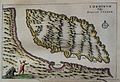 "I. Ordinum vulgo Staten Eyland." (22226748046).jpg 1,978 × 1,354; 453 KB
-
 A Map of the Staten Island Rapid Transit Company from 1885.png 497 × 586; 642 KB
-

-
 Annals of the New York Academy of Sciences (1880) (17793496253).jpg 2,356 × 2,668; 1.51 MB
-
 Area District Map Section No. 20 NYPL1637952.tiff 7,230 × 5,428; 112.28 MB
-
 Area District Map Section No. 21 NYPL1637953.tiff 7,230 × 5,428; 112.28 MB
-
 Area District Map Section No. 26 NYPL1637958.tiff 7,230 × 5,428; 112.28 MB
-
 Area District Map Section No. 27 NYPL1637959.tiff 7,230 × 5,428; 112.28 MB
-
 Area District Map Section No. 32 NYPL1637964.tiff 7,230 × 5,428; 112.28 MB
-
 Area District Map Section No. 33 NYPL1637965.tiff 7,230 × 5,428; 112.28 MB
-
 Area District Map Section No. 34 NYPL1637966.tiff 7,230 × 5,428; 112.28 MB
-
 Area District Map Section No. 35 NYPL1637967.tiff 7,230 × 5,428; 112.28 MB
-

-

-

-

-

-
 EB9 New York - City and vicinity.jpg 3,837 × 5,476; 4.69 MB
-
-
 Index NYPL1957324.tiff 5,382 × 7,158, 2 pages; 110.28 MB
-
 Index to Streets and Avenues, Atlas Borough of Richmond, City of New York. NYPL1643842.tiff 5,428 × 6,842; 106.26 MB
-
 Key - Location Map NYPL1957078.tiff 5,404 × 7,201, 2 pages; 111.4 MB
-
 Key Continued NYPL1957326.tiff 5,382 × 7,158, 2 pages; 110.28 MB
-
 Key NYPL1957325.tiff 5,382 × 7,158, 2 pages; 110.28 MB
-
 Key NYPL1989965.tiff 5,390 × 7,173, 2 pages; 110.68 MB
-

-
 National Prohibition Park, Staten Island, N.Y. NYPL 5376736.jpg 2,559 × 1,978; 5.64 MB
-
-

-

-

-

-

-
-

-

-

-

-

-

-
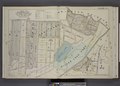
 Part of Ward 4. (Map bound by Jackson Ave, Lower Bay, New Dorp Lane, Richmond Road) NYPL1643840.tiff 7,230 × 5,166; 106.86 MB
-

-

-

-
 Part of Ward 5. (Map bound by Amboy Road, Beach St, Pier and Bulkhead Line) NYPL1643852.tiff 7,230 × 5,166; 106.86 MB
-

-
 Part of Ward 5. (Map bound by Old Pier and Bulkhead Line, Church St, Amboy Ave) NYPL1643853.tiff 7,230 × 5,166; 106.86 MB
-

-

-

-

-
-

-

-
-
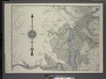
 Staten Island 1891.jpg 6,731 × 10,395; 7.85 MB
-
 Staten Island map 1891.jpg 7,389 × 11,373; 16.45 MB
-
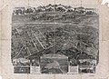
 Treat's illustrated New York, Philadelphia and surroundings (1876) (14759977921).jpg 4,352 × 2,542; 993 KB
.jpg)
_(17793496253).jpg)


.jpg)
_cropped_from_Richmond_Queens_Kings_counties_map_by_David_Burr_1839.jpg)


_(14759977921).jpg)