Category:Old maps of Texas
States of the United States: Alabama · Alaska · Arizona · Arkansas · California · Colorado · Connecticut · Delaware · Florida · Georgia · Hawaii · Idaho · Illinois · Indiana · Iowa · Kansas · Kentucky · Louisiana · Maine · Maryland · Massachusetts · Michigan · Minnesota · Mississippi · Missouri · Montana · Nebraska · Nevada · New Hampshire · New Jersey · New Mexico · New York · North Carolina · North Dakota · Ohio · Oklahoma · Oregon · Pennsylvania · Rhode Island · South Carolina · South Dakota · Tennessee · Texas · Utah · Vermont · Virginia · Washington · West Virginia · Wisconsin · Wyoming – District of Columbia: Washington, D.C.
Guam · Northern Mariana Islands · Puerto Rico
Guam · Northern Mariana Islands · Puerto Rico
Subcategories
This category has the following 11 subcategories, out of 11 total.
- 17th-century maps of Texas (4 F)
- 18th-century maps of Texas (12 F)
C
O
- Old geological maps of Texas (5 F)
- Old railroad maps of Texas (2 F)
Media in category "Old maps of Texas"
The following 200 files are in this category, out of 1,032 total.
(previous page) (next page)-
 (Map of portions of Jeff Davis County and Presidio County, Texas). LOC 2010587197.jpg 6,742 × 8,664; 6.53 MB
-
 (Map of portions of Jeff Davis County and Presidio County, Texas). LOC 2010587197.tif 6,742 × 8,664; 167.12 MB
-

-

-
 County map of Texas; Galveston Bay and vicinity (inset). NYPL1510813.tiff 6,299 × 5,248; 95.24 MB
-
 269 of 'Amerika, seet fra et Landbostandpunkt. (With illustrations.)' (11285340026).jpg 1,360 × 1,338; 379 KB
-

-

-
 395 of 'A History of the United States of America, etc' (11149340054).jpg 1,265 × 508; 173 KB
-

-
 A map of Louisiana and of the River Mississipi (4231931192).jpg 2,000 × 1,782; 3.83 MB
-
 Administrative map, Texas, area 2 LOC 92684522.jpg 8,967 × 6,244; 3.62 MB
-
 Administrative map, Texas, area 2 LOC 92684522.tif 8,967 × 6,244; 160.19 MB
-
 Aeroplane view of business district Amarillo, Texas. LOC 75696586.jpg 6,160 × 5,440; 5.58 MB
-
 Aeroplane view of business district Amarillo, Texas. LOC 75696586.tif 6,160 × 5,440; 95.87 MB
-
 Alonso Alvarez de Pineda Map of Gulf Coast.png 814 × 630; 102 KB
-
 Amistad National Recreation Area, Texas LOC 2002625063.jpg 9,930 × 4,674; 5.79 MB
-
 Amistad National Recreation Area, Texas LOC 2002625063.tif 9,930 × 4,674; 132.79 MB
-
 Amistad National Recreation Area, Texas LOC 2002630361.jpg 9,945 × 4,686; 6.26 MB
-
 Amistad National Recreation Area, Texas LOC 2002630361.tif 9,945 × 4,686; 133.33 MB
-
 Amistad National Recreation Area, Texas LOC 2007632555.jpg 9,960 × 4,683; 6.41 MB
-
 Amistad National Recreation Area, Texas LOC 2007632555.tif 9,960 × 4,683; 133.45 MB
-
 Amistad National Recreation Area, Texas LOC 2008626435.jpg 9,924 × 4,680; 5.91 MB
-
 Amistad National Recreation Area, Texas LOC 2008626435.tif 9,924 × 4,680; 132.88 MB
-
 Amistad National Recreation Area, Texas LOC 2010592141.jpg 9,990 × 4,698; 6.33 MB
-
 Amistad National Recreation Area, Texas LOC 2010592141.tif 9,990 × 4,698; 134.28 MB
-
 Amistad National Recreation Area, Texas LOC 2010592529.jpg 9,945 × 4,668; 6.23 MB
-
 Amistad National Recreation Area, Texas LOC 2010592529.tif 9,945 × 4,668; 132.82 MB
-
 Amistad National Recreation Area, Texas LOC 2012586332.jpg 9,984 × 4,674; 6.37 MB
-
 Amistad National Recreation Area, Texas LOC 2012586332.tif 9,984 × 4,674; 133.51 MB
-
 Amistad National Recreation Area, Texas LOC 80691846.jpg 4,930 × 6,800; 4.44 MB
-
 Amistad National Recreation Area, Texas LOC 80691846.tif 4,930 × 6,800; 95.91 MB
-
 Amistad National Recreation Area, Texas LOC 92682999.jpg 9,906 × 4,678; 6.44 MB
-
 Amistad National Recreation Area, Texas LOC 92682999.tif 9,906 × 4,678; 132.58 MB
-
 Amistad National Recreation Area, Texas LOC 94680504.jpg 9,900 × 4,675; 6.27 MB
-
 Amistad National Recreation Area, Texas LOC 94680504.tif 9,900 × 4,675; 132.42 MB
-
 Amistad National Recreation Area, Texas LOC 97684131.jpg 9,945 × 4,691; 6.17 MB
-
 Amistad National Recreation Area, Texas LOC 97684131.tif 9,945 × 4,691; 133.47 MB
-
 Amistad National Recreation Area, Texas LOC 99444712.jpg 9,945 × 4,673; 5.97 MB
-
 Amistad National Recreation Area, Texas LOC 99444712.tif 9,945 × 4,673; 132.96 MB
-
 Amistad National Recreation Area, Texas. Aug. 1970. LOC 73695962.jpg 4,920 × 6,800; 4.34 MB
-
 Amistad National Recreation Area, Texas. LOC 77695562.jpg 4,926 × 6,800; 4.28 MB
-
 Amistad National Recreation Area, Texas. LOC 77695562.tif 4,926 × 6,800; 95.84 MB
-
 Amistad Recreation Area, Texas LOC 88694601.jpg 4,939 × 6,767; 4.26 MB
-
 Amistad Recreation Area, Texas LOC 88694601.tif 4,939 × 6,767; 95.62 MB
-
 Amistad Recreation Area, Texas LOC 91682393.jpg 4,915 × 6,800; 4.42 MB
-
 Amistad Recreation Area, Texas LOC 91682393.tif 4,915 × 6,800; 95.62 MB
-
 Atascosa Co. LOC 2012592001.jpg 12,781 × 14,459; 22.94 MB
-
 Atascosa Co. LOC 2012592001.tif 12,781 × 14,459; 528.72 MB
-
 Bell County LOC 2012592007.jpg 16,355 × 14,124; 34.43 MB
-
 Big Bend National Park LOC 84692713.tif 10,074 × 7,116; 205.1 MB
-
 Big Bend National Park, Texas LOC 2001623219.tif 10,102 × 7,133; 206.16 MB
-
 Big Bend National Park, Texas LOC 2005627243.jpg 10,134 × 7,110; 9.39 MB
-
 Big Bend National Park, Texas LOC 2005627243.tif 10,134 × 7,110; 206.14 MB
-
 Big Bend National Park, Texas LOC 2010592503.jpg 10,134 × 7,172; 10.67 MB
-
 Big Bend National Park, Texas LOC 2010592503.tif 10,134 × 7,172; 207.94 MB
-
 Big Bend National Park, Texas LOC 2010592515.jpg 10,118 × 7,142; 8.86 MB
-
 Big Bend National Park, Texas LOC 2010592515.tif 10,118 × 7,142; 206.75 MB
-
 Big Bend National Park, Texas LOC 2011590439.jpg 10,102 × 7,141; 9.27 MB
-
 Big Bend National Park, Texas LOC 2011590439.tif 10,102 × 7,141; 206.39 MB
-
 Big Bend National Park, Texas LOC 2014590106.jpg 10,079 × 7,180; 9.58 MB
-
 Big Bend National Park, Texas LOC 2014590106.tif 10,079 × 7,180; 207.04 MB
-
 Big Bend National Park, Texas LOC 87693955.tif 10,065 × 7,131; 205.35 MB
-
 Big Bend National Park, Texas LOC 90681683.jpg 10,073 × 7,136; 11.75 MB
-
 Big Bend National Park, Texas LOC 90681683.tif 10,073 × 7,136; 205.65 MB
-
 Big Bend National Park, Texas LOC 93684157.jpg 10,118 × 7,165; 12.63 MB
-
 Big Bend National Park, Texas LOC 93684157.tif 10,118 × 7,165; 207.41 MB
-
 Big Bend National Park, Texas LOC 95685262.jpg 10,071 × 7,134; 10.36 MB
-
 Big Bend National Park, Texas LOC 95685262.tif 10,071 × 7,134; 205.55 MB
-
 Big Bend National Park, Texas LOC 95685296.jpg 10,117 × 7,126; 10.31 MB
-
 Big Bend National Park, Texas LOC 95685296.tif 10,117 × 7,126; 206.26 MB
-
 Big Bend, general information. LOC 90681755.jpg 6,608 × 5,248; 4.78 MB
-
 Big Thicket National Preserve, Texas - official map and guide LOC 2002626313.jpg 9,994 × 7,093; 7.67 MB
-
 Big Thicket National Preserve, Texas - official map and guide LOC 2002626313.tif 9,994 × 7,093; 202.81 MB
-
 Big Thicket National Preserve, Texas - official map and guide LOC 91684724.jpg 10,064 × 7,093; 9.03 MB
-
 Big Thicket National Preserve, Texas - official map and guide LOC 91684724.tif 10,064 × 7,093; 204.23 MB
-
 Big Thicket National Preserve, Texas - official map and guide LOC 93684153.jpg 10,078 × 7,107; 10.23 MB
-
 Big Thicket National Preserve, Texas - official map and guide LOC 93684153.tif 10,078 × 7,107; 204.92 MB
-
 Big Thicket National Preserve, Texas - official map and guide LOC 95685304.jpg 10,091 × 7,109; 9.19 MB
-
 Big Thicket National Preserve, Texas - official map and guide LOC 95685304.tif 10,091 × 7,109; 205.24 MB
-
 Big Thicket National Preserve, Texas - official map and guide LOC 97684127.jpg 10,055 × 7,108; 7.92 MB
-
 Big Thicket National Preserve, Texas - official map and guide LOC 97684127.tif 10,055 × 7,108; 204.48 MB
-
 Big Thicket National Preserve, Texas LOC 2011590240.jpg 10,116 × 7,122; 8.23 MB
-
 Big Thicket National Preserve, Texas LOC 2011590240.tif 10,116 × 7,122; 206.13 MB
-
 Big Thicket National Preserve, Texas LOC 2011590633.jpg 10,093 × 7,123; 8.55 MB
-
 Big Thicket National Preserve, Texas LOC 2011590633.tif 10,093 × 7,123; 205.69 MB
-
 Big Thicket National Preserve, Texas LOC 2013592116.jpg 10,093 × 7,123; 8.54 MB
-
 Big Thicket National Preserve, Texas LOC 2013592116.tif 10,093 × 7,123; 205.69 MB
-
 Big Thicket National Preserve, Texas LOC 2014590122.jpg 10,046 × 6,986; 7.6 MB
-
 Big Thicket National Preserve, Texas LOC 2014590122.tif 10,046 × 6,986; 200.79 MB
-
 Big Thicket National Preserve, Texas LOC 83693531.jpg 10,049 × 7,120; 10.11 MB
-
 Big Thicket National Preserve, Texas LOC 83693531.tif 10,049 × 7,120; 204.7 MB
-
 Big Thicket National Preserve, Texas LOC 89691375.jpg 10,057 × 7,135; 9.74 MB
-
 Big Thicket National Preserve, Texas LOC 89691375.tif 10,057 × 7,135; 205.3 MB
-
 Bird's-eye view of Fort Worth, Texas. LOC 75696595.jpg 3,101 × 2,740; 1.01 MB
-
 Bird's-eye view of Fort Worth, Texas. LOC 75696595.tif 3,101 × 2,740; 24.31 MB
-
 Bissell's railway junction point map of Texas LOC 2001622051.jpg 8,693 × 11,035; 10.36 MB
-
 Bissell's railway junction point map of Texas LOC 2001622051.tif 8,693 × 11,035; 274.45 MB
-
 Blanco County LOC 2012590172.jpg 10,201 × 13,764; 24.63 MB
-
 Blanco County LOC 2012590172.tif 10,201 × 13,764; 401.71 MB
-
 Borden County - J.D. Hedick, Draftsman. LOC 2012590173.jpg 11,201 × 12,633; 18.57 MB
-
 Borden County - J.D. Hedick, Draftsman. LOC 2012590173.tif 11,201 × 12,633; 404.84 MB
-
 Bosque County LOC 2012592009.jpg 11,504 × 14,630; 27.39 MB
-
 Boundaries between Brownsville, Texas and Matamoros, Tam. (Mexico) LOC 98686043.jpg 3,656 × 4,632; 2.1 MB
-
 Boundaries between Brownsville, Texas and Matamoros, Tam. (Mexico) LOC 98686043.tif 3,656 × 4,632; 48.45 MB
-
 Buescher Topographic CCC.png 11,241 × 7,596; 26.98 MB
-
 Bulletin (1911) (19801029984).jpg 1,518 × 3,268; 711 KB
-
 Burr's Ferry (and vicinity, Sabine River, Louisana and Texas.) - NARA - 305711.tif 5,400 × 3,732; 57.66 MB
-

-
 Calhoun Co. LOC 2012590174.jpg 11,891 × 14,070; 35.39 MB
-
 Calhoun Co. LOC 2012590174.tif 11,891 × 14,070; 478.67 MB
-
 Chamizal National Memorial, Texas LOC 2014590012.jpg 5,212 × 9,643; 6.71 MB
-
 Chamizal National Memorial, Texas LOC 2014590012.tif 5,212 × 9,643; 143.79 MB
-
 Chamizal National Memorial, Texas, official map and guide LOC 2014590026.jpg 7,277 × 5,333; 6.24 MB
-
 Chamizal National Memorial, Texas, official map and guide LOC 2014590026.tif 7,277 × 5,333; 111.03 MB
-
 Coastal zone management counties of Texas LOC 81692256.jpg 2,373 × 3,106; 749 KB
-
 Coastal zone management counties of Texas LOC 81692256.tif 2,373 × 3,106; 21.09 MB
-
 Colonists' and emigrants' route to Texas. LOC 79691569.jpg 8,023 × 4,864; 6.78 MB
-
 Colonists' and emigrants' route to Texas. LOC 79691569.tif 8,023 × 4,864; 111.65 MB
-
-

-
 Cordova's map of Texas.jpg 598 × 599; 133 KB
-

-

-
 Cottonwood Creek. LOC gm69002764.jpg 9,251 × 5,245; 6.04 MB
-
 Cottonwood Creek. LOC gm69002764.tif 9,251 × 5,245; 138.82 MB
-
 Crockett Co. LOC 2012592047.jpg 13,105 × 10,069; 15.47 MB
-
 Crockett Co. LOC 2012592047.tif 13,105 × 10,069; 377.52 MB
-
 Crosby County - General Land Office, April 1892 LOC 2009583805.tif 7,618 × 9,570; 208.58 MB
-
 Davy Crockett National Forest, Texas. LOC 75695969.jpg 6,697 × 8,043; 6.66 MB
-
 Davy Crockett National Forest, Texas. LOC 75695969.tif 6,697 × 8,043; 154.11 MB
-
 Dawson County LOC 2009583505.jpg 7,548 × 9,517; 7.39 MB
-
 Dawson County LOC 2009583505.tif 7,548 × 9,517; 205.52 MB
-
 Deaf Smith Co. LOC 2012586904.jpg 15,243 × 11,621; 17.66 MB
-
 Deaf Smith Co. LOC 2012586904.tif 15,243 × 11,621; 506.8 MB
-
 Delta Co. LOC 2012586905.jpg 11,325 × 8,654; 10.48 MB
-
 Delta Co. LOC 2012586905.tif 11,325 × 8,654; 280.4 MB
-
 Denison, Grayson County, Texas 1891. LOC 73693317.jpg 10,480 × 6,896; 16.8 MB
-
 Denison, Grayson County, Texas 1891. LOC 73693317.tif 10,480 × 6,896; 206.77 MB
-
 Denison, Texas, Grayson County 1886. LOC 75696589.jpg 8,776 × 6,080; 12.06 MB
-
 Denison, Texas, Grayson County 1886. LOC 75696589.tif 8,776 × 6,080; 152.66 MB
-
 Denton County, Texas. LOC 2005625370.jpg 6,523 × 5,026; 3.97 MB
-
 Denton County, Texas. LOC 2005625370.tif 6,523 × 5,026; 93.8 MB
-
 DeSoto Map Leg 4 HRoe 2008.jpg 610 × 537; 433 KB
-
 Dickens County. LOC 2012590159.jpg 5,578 × 7,208; 5.41 MB
-
 Dickens County. LOC 2012590159.tif 5,578 × 7,208; 115.03 MB
-
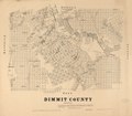
 Dimmit County. LOC 2012590152.jpg 14,013 × 11,935; 24.41 MB
-
 Dimmit County. LOC 2012590158.jpg 7,497 × 6,520; 6.17 MB
-
 Dimmit County. LOC 2012590158.tif 7,497 × 6,520; 139.85 MB
-
 Dominant soil orders, Texas LOC 2013592269.jpg 3,264 × 2,534; 698 KB
-
 Dominant soil orders, Texas LOC 2013592269.tif 3,264 × 2,534; 23.66 MB
-
 Dominant soil texture, Texas LOC 2013592260.jpg 3,284 × 2,529; 755 KB
-
 Dominant soil texture, Texas LOC 2013592260.tif 3,284 × 2,529; 23.76 MB
-

-
 EB1911 Texas.jpg 2,619 × 1,828; 2.8 MB
-
 EB9 Texas - geographical divisions.jpg 855 × 787; 173 KB
-
 EB9 Texas - geological map.jpg 1,279 × 1,187; 411 KB
-
 EB9 Texas.jpg 3,886 × 5,413; 3.49 MB
-
 Edwards Co. LOC 2012590150.jpg 9,542 × 8,371; 12.75 MB
-
 Edwards Co. LOC 2012590150.tif 9,542 × 8,371; 228.53 MB
-

-

-
 Ellis Co., Texas. LOC 2012591105.jpg 7,493 × 5,737; 6.22 MB
-
 Ellis Co., Texas. LOC 2012591105.tif 7,493 × 5,737; 122.99 MB
-
 Erath Co., Texas. LOC 2012591103.jpg 7,058 × 8,220; 7.87 MB
-
 Erath Co., Texas. LOC 2012591103.tif 7,058 × 8,220; 165.99 MB
-

-

-
 Fannin County, Texas LOC 2010589961.jpg 6,844 × 8,802; 5.97 MB
-
 Fannin County, Texas LOC 2010589961.tif 6,844 × 8,802; 172.35 MB
-
 Fisher Co. LOC 2009583508.jpg 7,083 × 8,810; 7.72 MB
-
 Fisher Co. LOC 2009583508.tif 7,083 × 8,810; 178.53 MB
-
 Fisher County, Texas LOC 2012590154.jpg 4,921 × 6,481; 4.31 MB
-
 Fisher County, Texas LOC 2012590154.tif 4,921 × 6,481; 91.25 MB
-
 Flooded areas, Medina River, San Antonio, Texas. LOC 77693098.jpg 6,382 × 9,755; 8.16 MB
-
 Flooded areas, Medina River, San Antonio, Texas. LOC 77693098.tif 6,382 × 9,755; 178.12 MB
-
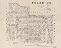 Foard Co. LOC 2012590153.jpg 7,042 × 5,591; 5.9 MB
-
 Foard Co. LOC 2012590153.tif 7,042 × 5,591; 112.64 MB
-
 Fort Davis LOC 2003629346.jpg 6,094 × 5,678; 4.41 MB
-
 Fort Davis LOC 2003629346.tif 6,094 × 5,678; 99 MB
-
 Fort Davis LOC 79691754.jpg 6,101 × 5,701; 4.72 MB
-
 Fort Davis LOC 79691754.tif 6,101 × 5,701; 99.51 MB
-
 Fort Davis LOC 95681305.jpg 6,049 × 5,695; 4.62 MB
-
 Fort Davis LOC 95681305.tif 6,049 × 5,695; 98.56 MB
-
 Fort Davis LOC 96681214.jpg 6,033 × 5,693; 4.84 MB
-
 Fort Davis LOC 96681214.tif 6,033 × 5,693; 98.26 MB
-
 Fort Davis National Historic Site, Texas LOC 2003629310.jpg 5,203 × 9,466; 6.92 MB
-
 Fort Davis National Historic Site, Texas LOC 2003629310.tif 5,203 × 9,466; 140.91 MB
-
 Fort Davis National Historic Site, Texas LOC 2003629311.jpg 5,092 × 9,598; 6.62 MB
-
 Fort Davis National Historic Site, Texas LOC 2003629311.tif 5,092 × 9,598; 139.83 MB
-
 Fort Davis National Historic Site, Texas LOC 2003629333.jpg 5,105 × 9,600; 6.93 MB
-
 Fort Davis National Historic Site, Texas LOC 2003629333.tif 5,105 × 9,600; 140.21 MB
-
 Fort Davis National Historic Site, Texas LOC 2006627132.jpg 5,141 × 9,512; 7 MB
-
 Fort Davis National Historic Site, Texas LOC 2006627132.tif 5,141 × 9,512; 139.91 MB
-
 Fort Davis National Historic Site, Texas LOC 2010592138.tif 5,161 × 9,600; 141.75 MB
-
 Fort Davis National Historic Site, Texas LOC 2011590244.jpg 5,234 × 9,590; 8.04 MB
-
 Fort Davis National Historic Site, Texas LOC 2011590244.tif 5,234 × 9,590; 143.61 MB
-
 Fort Davis National Historic Site, Texas LOC 2011590585.jpg 5,178 × 9,510; 7.17 MB
-
 Fort Davis National Historic Site, Texas LOC 2011590585.tif 5,178 × 9,510; 140.88 MB
-
 Fort Davis National Historic Site, Texas LOC 2014589358.jpg 5,139 × 9,543; 7.05 MB
._LOC_2010587197.jpg)
._LOC_2001622106.jpg)
%27_(11285340026).jpg)
.jpg)
.jpg)
.jpg)
.jpg)


_LOC_98686043.jpg)

_(19801029984).jpg)


._LOC_gm70001579.jpg)

._LOC_98688644.jpg)


.jpg)