Category:Old maps of Warwickshire
Ceremonial counties of England: Bedfordshire · Berkshire · Buckinghamshire · Cambridgeshire · Cheshire · Cornwall · Cumbria · Derbyshire · Devon · Dorset · Durham · East Riding of Yorkshire · East Sussex · Essex · Gloucestershire · Greater London · Greater Manchester · Hampshire · Herefordshire · Hertfordshire · Isle of Wight · Kent · Lancashire · Leicestershire · Lincolnshire · Norfolk · North Yorkshire · Northamptonshire · Northumberland · Nottinghamshire · Oxfordshire · Rutland · Shropshire · Somerset · South Yorkshire · Staffordshire · Suffolk · Surrey · Warwickshire · West Midlands · West Sussex · West Yorkshire · Wiltshire · Worcestershire
City-counties: Bristol · City of London
Former historic counties: Cumberland · Huntingdonshire · Middlesex · Sussex · Westmorland · Yorkshire
Other former counties:
City-counties: Bristol · City of London
Former historic counties: Cumberland · Huntingdonshire · Middlesex · Sussex · Westmorland · Yorkshire
Other former counties:
Subcategories
This category has the following 6 subcategories, out of 6 total.
- Old county maps of Warwickshire (10 F)
C
O
W
- Old maps of Warwick, England (4 F)
- Warwickshire RJD 1914 (6 F)
Media in category "Old maps of Warwickshire"
The following 28 files are in this category, out of 28 total.
-
 Smethick Alcester & Broom Walsall RJD 89.jpg 2,868 × 1,788; 601 KB
-

-

-
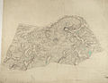
 17th Century map of Warwickshire.jpg 3,456 × 2,592; 5.83 MB
-

-
 Ordnance Survey Drawings - Chipping Campden, Gloucestershire (OSD 221).jpg 2,966 × 4,000; 3.85 MB
-
 Ordnance Survey Drawings - Ladbroke, Warwickshire (OSD 227).jpg 4,000 × 2,904; 3.26 MB
-
 Ordnance Survey Drawings - Daventry, Northamptonshire (OSD 254).jpg 4,000 × 3,097; 3.2 MB
-
 Ordnance Survey Drawings - Rugby, Warwickshire (OSD 260).jpg 4,000 × 2,836; 3.63 MB
-
 Ordnance Survey Drawings - Shipston, Warwickshire (OSD 226).jpg 3,212 × 4,000; 3.17 MB
-
 Ordnance Survey Drawings - Warwick, Warwickshire (OSD 255).jpg 3,505 × 5,765; 2.81 MB
-
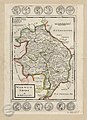
 1813 James Wallis County Map Warwickshire Hand Colour Small Book Print.jpg 2,304 × 3,332; 3.74 MB
-
 Ordnance Survey Drawings - Birmingham (OSD 256).jpg 4,000 × 2,531; 3.86 MB
-
 Ordnance Survey Drawings - Henley-in-Arden (OSD 220).jpg 4,000 × 2,878; 3.64 MB
-
 Ordnance Survey Drawings - Sutton Coldfield (OSD 257).jpg 4,000 × 2,666; 3.52 MB
-
 1889 George Philip County Map Warwickshire Print London Geographical.jpg 3,968 × 5,577; 8.94 MB
-

-

-
 98 of 'England and Wales Delineated, etc' (11033413103).jpg 2,384 × 1,453; 841 KB
-
 Four-shire-stone-map.png 1,154 × 1,027; 2.53 MB
-

-

-
 MILLER(1896) p8 - Warwickshire.jpg 2,564 × 2,167; 1.2 MB
-
 Moor Hall estate plan (1930) - 2023-06-18 - Andy Mabbett - 01 (retouched).jpg 2,435 × 3,128; 4.2 MB
-
 Moor Hall estate plan (1930) - 2023-06-18 - Andy Mabbett - 01.jpg 3,000 × 4,000; 3.71 MB
-
 Moor Hall estate plan (1930) - 2023-06-18 - Andy Mabbett - 02.jpg 4,000 × 3,000; 3.06 MB
-
 Stratford On Avon historic map 1902.jpg 1,504 × 1,200; 522 KB
-
 Warwick Shire - By H. Moll Geographer - btv1b530566183.jpg 3,016 × 4,168; 1.93 MB

.jpg)
.jpg)

.jpg)
.jpg)
.jpg)
.jpg)
.jpg)
.jpg)
.jpg)

.jpg)
.jpg)
.jpg)

)%27_(11205051513)_(Leam-Cov_crop).jpg)
)%27_(11205051513).jpg)
.jpg)

.jpg)
.jpg)
_p8_-_Warwickshire.jpg)
_-_2023-06-18_-_Andy_Mabbett_-_01_(retouched).jpg)
_-_2023-06-18_-_Andy_Mabbett_-_01.jpg)
_-_2023-06-18_-_Andy_Mabbett_-_02.jpg)

