Category:Old maps of the Balkans
Subcategories
This category has the following 29 subcategories, out of 29 total.
Media in category "Old maps of the Balkans"
The following 97 files are in this category, out of 97 total.
-

-
 Roman provinces of Illyricum, Macedonia, Dacia, Moesia, Pannonia and Thracia.jpg 2,817 × 2,284; 1.41 MB
-
 195 of 'The Greek Islands and Turkey after the War' (11180923365).jpg 2,128 × 1,401; 1.08 MB
-
 356 of 'The International Geography. ... Edited by H. R. Mill' (11290094896).jpg 1,038 × 1,042; 350 KB
-

-
 8 of 'Turkey in Europe ... With two maps' (11118101504).jpg 5,172 × 4,015; 5.57 MB
-

-

-
 A new map of ancient Greece Thrace, Moesia, Ilyricum and the isles adjoyning. NYPL1630713.tiff 7,230 × 5,428; 112.28 MB
-
 Albanian vilayet.jpg 600 × 926; 329 KB
-

-

-

-
 Balkan general map.jpg 546 × 608; 92 KB
-
 Balkan Wars Boundaries cleanup.jpg 1,044 × 1,471; 633 KB
-
 Balkan Wars Boundaries.jpg 1,026 × 1,454; 571 KB
-
 Balkans 750.jpg 297 × 211; 69 KB
-
 Balkans in 9th century.jpg 1,195 × 847; 339 KB
-
 Balkans-ethnique.JPG 1,258 × 1,266; 457 KB
-
 Bartholomew's war map of Italy and the Balkan States (5008442).jpg 5,000 × 3,756; 4.16 MB
-
-

-
 Central and Eastern Europe at the time of Augustus 6 AD.jpg 2,600 × 1,899; 740 KB
-
 Country about the Lower Danube in Roman Times.jpg 673 × 740; 141 KB
-
 Cviic 1913 Ethnic Map.jpg 2,000 × 1,690; 793 KB
-

-
 D266- N° 464. — Amoindrissement de la Turquie durant le XIXe siècle. - Liv3-Ch20.png 1,444 × 1,852; 264 KB
-
 D531-Territoire du Bas Danube.-Liv2-ch10.png 1,436 × 1,687; 272 KB
-
 D535- N° 406. Plus grande Turquie. - liv3-ch14.png 1,436 × 1,754; 524 KB
-
 Die Europaeische Türkei, Griechenland und die Ionischen Inseln.jpg 5,570 × 4,553; 9.19 MB
-
 Die Europaeische Türkei.jpg 5,559 × 4,554; 10.25 MB
-
 Epirus antiquus tabula.jpg 1,000 × 954; 362 KB
-
 Epirus antiquus tabula.png 1,000 × 954; 367 KB
-

-
 Hellas, Thessalia, Epirus terrarum antiquus 1861.jpg 1,518 × 1,281; 2 MB
-

-
 KR 24 Estats de l'Empire du grand seigneur dit sultan et Ottomans empereur.jpg 2,280 × 1,659; 447 KB
-
 Kriegstheater zwischen Russland Und Der Ottomanischen Pforte 01.jpg 4,675 × 11,001; 8.57 MB
-
 Map - Special Collections University of Amsterdam - OTM- HB-KZL 32.02.25.tif 7,352 × 6,239; 131.23 MB
-
 Map - Special Collections University of Amsterdam - OTM- HB-KZL 32.03.13.tif 7,344 × 6,330; 133 MB
-
 Map - Special Collections University of Amsterdam - OTM- HB-KZL 32.03.25.tif 7,377 × 6,214; 131.15 MB
-
 Map - Special Collections University of Amsterdam - OTM- HB-KZL 32.03.26.tif 7,457 × 6,130; 130.78 MB
-
 Map - Special Collections University of Amsterdam - OTM- HB-KZL 32.03.28.tif 7,285 × 5,998; 125.01 MB
-
 Map - Special Collections University of Amsterdam - OTM- HB-KZL 32.03.29.tif 7,583 × 6,305; 136.79 MB
-
 Map - Special Collections University of Amsterdam - OTM- HB-KZL 33.06.19.tif 7,210 × 6,122; 126.29 MB
-
 Map - Special Collections University of Amsterdam - OTM- HB-KZL 33.06.20.tif 7,552 × 6,254; 135.13 MB
-
 Map - Special Collections University of Amsterdam - OTM- HB-KZL 33.06.23.tif 8,154 × 6,893; 160.81 MB
-
 Map - Special Collections University of Amsterdam - OTM- HB-KZL 33.06.24.tif 7,707 × 6,380; 140.68 MB
-
 Map - Special Collections University of Amsterdam - OTM- HB-KZL 34.19.24.tif 11,048 × 6,509; 205.74 MB
-
 Map - Special Collections University of Amsterdam - OTM- HB-KZL 34.19.25.tif 10,577 × 5,871; 177.66 MB
-
 Map Balkans.jpg 1,276 × 1,736; 342 KB
-
 Map ITS NOT A MACEDONIAN - SKOPIANO MAP !!!! EthnographicalMapofCentralandSouthE.JPG 1,770 × 1,498; 547 KB
-
 Map of partition of Yugoslavia.jpg 1,347 × 798; 504 KB
-
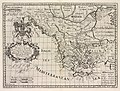
 Map of the Balkan Peninsula (5008561).jpg 3,825 × 5,000; 2.98 MB
-

-
 Mapaduca.png 1,563 × 1,233; 4.04 MB
-
 Meyers b14 s0024a.jpg 800 × 619; 247 KB
-
 Meyers b3 s0247a.jpg 2,048 × 1,722; 999 KB
-
 Minia Enoz Line.jpg 694 × 469; 70 KB
-
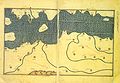
 Muhammad al-Idrisi - Oxford transcript of V-4.jpg 2,102 × 1,450; 1.72 MB
-
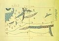 Muhammad al-Idrisi - Oxford transcript of VI-4.jpg 2,106 × 1,448; 1.65 MB
-
 Muhammad al-Idrisi - Oxford transcript of VI-5.jpg 2,105 × 1,452; 1.53 MB
-
 Muhammad al-Idrisi - Paris transcript of V-4.jpg 2,114 × 1,461; 2.02 MB
-
 Muhammad al-Idrisi - Paris transcript of VI-4.jpg 2,112 × 1,459; 1.98 MB
-
 Muhammad al-Idrisi - Paris transcript of VI-5.jpg 2,112 × 1,462; 1.9 MB
-
 Muhammad al-Idrisi - Saint Petersburg transcript of V-4.jpg 2,120 × 1,470; 1.9 MB
-
 Muhammad al-Idrisi - Saint Petersburg transcript of VI-4.jpg 2,107 × 1,458; 1.81 MB
-
 Muhammad al-Idrisi - Saint Petersburg transcript of VI-5.jpg 2,108 × 1,462; 1.96 MB
-
 Muhammad al-Idrisi - Sofia transcript of V-4.jpg 2,107 × 1,448; 1.57 MB
-
 Muhammad al-Idrisi - Sofia transcript of VI-4.jpg 2,109 × 1,456; 1.57 MB
-
 Muhammad al-Idrisi - Sofia transcript of VI-5.jpg 2,114 × 1,463; 1.94 MB
-
 NationalitiesOfSoutheasternEuropePallasNagyLexikon.jpg 695 × 1,136; 700 KB
-
 Second part of Turkey in Europe .. (NYPL b13919861-5207415).tiff 7,758 × 10,326, 2 pages; 229.46 MB
-
 Turquie in Europe (NYPL b14428893-1503429).jpg 5,739 × 5,248; 4.88 MB
-
-

-
 Old german map Italy and Balkans.jpg 1,455 × 884; 663 KB
-
 Post Roman Balkans.jpg 2,038 × 1,677; 721 KB
-
 Rascia Banat02.jpg 912 × 1,498; 1.62 MB
-
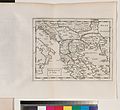
 Regni Hungariae, Graeciae et Moreae ac regionum quae ei quondam fuere Christiani RMG F8182.tiff 4,800 × 4,007; 55.03 MB
-
 Reilly Karte von dem Oschmanischen Reiche in Europa.jpg 734 × 588; 124 KB
-
 Roman provinces of Macedonia.jpg 2,104 × 1,031; 763 KB
-
 Romania, Bulgaria, Walachia et Syrfia. NYPL1632251.tiff 7,230 × 5,428; 112.28 MB
-
 SDUK - Turkey I. Containing the Northern Provinces.jpg 6,336 × 5,104; 13.48 MB
-
 Six engravings and one map MET sftr57372002.jpg 843 × 750; 283 KB
-
 Slaven.jpg 3,216 × 2,754; 5.22 MB
-
-
 The states & provinces of the Balkan Peninsula (5003770).jpg 3,777 × 5,000; 2.52 MB
-
 The story of the map of Europe, its making and its changing (1916) (14755308266).jpg 2,896 × 1,988; 615 KB
-
 The story of the map of Europe, its making and its changing (1916) (14776044264).jpg 3,008 × 1,988; 753 KB
-
 The Strand coloured detail map of the Balkan states (5003785).jpg 4,101 × 5,000; 3.8 MB
-

-
 Treaty of Berlin - Balkan Europe map.jpg 1,739 × 1,224; 468 KB
-
 W & A K Johnston's war map of the Balkan States (5008033).jpg 4,003 × 5,000; 3.14 MB
-
 Western Balkans Banner.jpg 7,038 × 1,006; 1.34 MB
-
 BASA-121K-1-367-14-Balkan Peninsula Map.jpeg 2,550 × 2,944; 1.1 MB
-
 Этнографическая карта Балкан, 1895 г.jpg 2,814 × 3,773; 3.58 MB


.jpg)
.jpg)
%27_(11165579794).jpg)
.jpg)


.jpg)


.jpg)


.jpg)


,_BI-B-FM-090-16.jpg)


.jpg)
.jpg)


.jpg)
.jpg)
.jpg)


.jpg)
_(14755308266).jpg)
_(14776044264).jpg)
.jpg)


.jpg)

