Category:Old maps showing history of Europe

Use the appropriate category for maps showing all or a large part of Europe. See subcategories for smaller areas:
| If the map shows | Category to use |
|---|---|
| Europe on a recently created map | Category:Maps of Europe or its subcategories |
| Europe on a map created more than 70 years ago | Category:Old maps of Europe or its subcategories |
| the history of Europe on a recently created map | Category:Maps of the history of Europe or its subcategories |
| the history of Europe on a map created more than 70 years ago | Category:Old maps of the history of Europe or its subcategories |
Subcategories
This category has the following 21 subcategories, out of 21 total.
A
F
- Formae Orbis Antiqui (Kiepert) (10 F)
H
M
- Map of Europe by Treaty, 1875 (82 F)
O
- Old maps of Kievan Rus (4 F)
- Old maps of Roman Italy (36 F)
- Orbis Terrarum Antiquus (14 F)
S
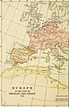
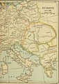
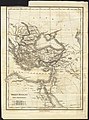
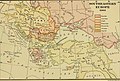
Media in category "Old maps showing history of Europe"
The following 180 files are in this category, out of 180 total.
-
 'Europe in the beginning of the 9th Century', 1878 map.jpg 847 × 600; 179 KB
-
 Ostrogoti.jpg 836 × 1,152; 921 KB
-
-

-
-
-

-

-

-

-
 151 of 'An Introduction to the study of the Middle Ages, 375-814' (11252796894).jpg 1,297 × 1,993; 660 KB
-
 18 of '(The Rise of the Dutch Republic ... A new edition.)' (11162570873).jpg 1,762 × 2,792; 1.54 MB
-
 Polska Rosja Skandynawia w IX w.jpg 1,408 × 1,180; 522 KB
-
 (9) L' EUROPE SOUS CHARLES-QUINT (1556).jpg 2,562 × 1,738; 2 MB
-
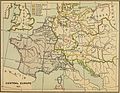
 Mitteleuropa BV042511874.jpg 1,954 × 1,337; 295 KB
-
 Mitteleuropa BV042512124.jpg 1,954 × 1,337; 302 KB
-
 Boundaries of Germany Under Terms of Treaty 0492 original.jpg 3,288 × 4,761; 9.18 MB
-
-

-

-
 49 of 'Ten Centuries of European Progress. (With maps.)' (11212126205).jpg 2,160 × 1,328; 746 KB
-
 49 of 'The Leading Facts of French History' (11291556076).jpg 1,309 × 1,216; 494 KB
-

-
-
 62 of 'An Introduction to the study of the Middle Ages, 375-814' (11252519004).jpg 1,297 × 1,993; 564 KB
-
 71 of 'The Leading Facts of French History' (11198869674).jpg 1,905 × 1,296; 526 KB
-
 90 of 'An Introduction to the study of the Middle Ages, 375-814' (11251102085).jpg 1,297 × 1,993; 696 KB
-
-

-
 A general history for colleges and high schools (1889) (14761599451).jpg 2,572 × 1,984; 836 KB
-
 A general history for colleges and high schools (1889) (14764728485).jpg 1,874 × 2,508; 834 KB
-
 A General Sketch of Political History from the Earlist Times - Europe in 1789.jpg 1,946 × 3,030; 2.47 MB
-

-
 A history of mediaeval and modern Europe for secondary schools (1914) (14597755280).jpg 1,956 × 3,020; 643 KB
-
 A history of mediaeval and modern Europe for secondary schools (1914) (14597756099).jpg 3,008 × 1,864; 689 KB
-
 A history of mediaeval and modern Europe for secondary schools (1914) (14597826460).jpg 2,928 × 1,800; 720 KB
-
 A history of mediaeval and modern Europe for secondary schools (1914) (14597951827).jpg 2,016 × 3,080; 935 KB
-
 A history of mediaeval and modern Europe for secondary schools (1914) (14597998627).jpg 1,876 × 2,916; 764 KB
-
 A history of mediaeval and modern Europe for secondary schools (1914) (14784160252).jpg 1,972 × 2,896; 655 KB
-
 A history of mediæval and modern Europe for secondary schools (1920) (14577675500).jpg 1,816 × 2,558; 397 KB
-
 A history of mediæval and modern Europe for secondary schools (1920) (14577721279).jpg 1,872 × 1,364; 274 KB
-
 A history of mediæval and modern Europe for secondary schools (1920) (14577740320).jpg 1,503 × 2,310; 350 KB
-
 A history of mediæval and modern Europe for secondary schools (1920) (14577906747).jpg 1,642 × 2,510; 399 KB
-
 A history of mediæval and modern Europe for secondary schools (1920) (14577940227).jpg 2,384 × 1,563; 269 KB
-
 A history of mediæval and modern Europe for secondary schools (1920) (14578018297).jpg 2,416 × 1,470; 371 KB
-
 A history of mediæval and modern Europe for secondary schools (1920) (14761308231).jpg 1,346 × 2,212; 333 KB
-
 A history of mediæval and modern Europe for secondary schools (1920) (14762013094).jpg 2,384 × 1,480; 315 KB
-
 A history of mediæval and modern Europe for secondary schools (1920) (14764108302).jpg 1,360 × 1,846; 365 KB
-
 A history of the Christian church (1918) (14579301569).jpg 2,368 × 3,628; 1.1 MB
-
 A Short History of the World, p0272.jpg 1,356 × 1,099; 471 KB
-
 A Short History of the World, p0355.jpg 1,212 × 1,106; 396 KB
-
 A Short History of the World, p0390.jpg 1,322 × 1,295; 466 KB
-

-
 Armenia in 13th century.jpg 2,496 × 1,952; 3.69 MB
-
 Aryan tribes 1000-500 B.C.jpg 1,458 × 720; 370 KB
-
 Brockhaus and Efron Encyclopedic Dictionary b55 446-0.jpg 2,538 × 3,277; 1.96 MB
-
 Brockhaus' Konversations-Lexikon (1892) (14778819004).jpg 1,608 × 2,294; 864 KB
-
 Campagnes du contingent du Hesse-Darmstadt sous le premier empire. LOC 98687112.jpg 10,896 × 5,728; 6.96 MB
-
 Campagnes du contingent du Hesse-Darmstadt sous le premier empire. LOC 98687112.tif 10,896 × 5,728; 178.56 MB
-
 Central europe 1648 sheperd.jpg 2,314 × 1,880; 925 KB
-
 Dankaerts-Historis-9240.tif 4,374 × 3,540; 44.34 MB
-
 Deutsch-Französischer Krieg 1870 und 1871 - Marschroute des XII. Armeekorps.jpg 9,492 × 6,644; 29.81 MB
-
 Die Reiche im Süden Europa's - Julius Loewenberg.tif 5,072 × 3,968; 39.04 MB
-
 Europa 1400.jpg 3,054 × 2,436; 2.01 MB
-
 Europa by Pomponiusz Mela 1st century.jpg 1,024 × 880; 449 KB
-
 Europa V-XVII.jpg 1,699 × 1,276; 398 KB
-
 Europa XVIII-XIX.jpg 1,693 × 1,276; 404 KB
-
 Europam, Sive Celticam Veterem 1595.jpg 920 × 698; 268 KB
-
 Europe 1142.jpg 1,327 × 959; 536 KB
-
 Europe 912.jpg 998 × 1,024; 414 KB
-
 Europe about 1560.jpg 2,398 × 1,929; 1.25 MB
-
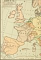
 Europe in 1740.jpg 797 × 552; 753 KB
-
 Europe since 1815 (1910) (14578180419).jpg 1,738 × 3,151; 641 KB
-
 Europe since 1815 (1910) (14578372177).jpg 1,834 × 2,980; 856 KB
-
 Europe since 1815 (1910) (14578384147).jpg 1,850 × 1,700; 440 KB
-
 EvropaiSredizemnomorieto9.pdf 1,633 × 1,233; 1.78 MB
-
 Expansion of christianity.jpg 1,388 × 1,131; 406 KB
-
 First.Crusade.Map.jpg 1,730 × 1,402; 730 KB
-
 Griechenland Und Die Ionischen Inseln.jpg 5,470 × 4,478; 7.3 MB
-
 Hellas, Thessalia, Epirus terrarum antiquus 1861.jpg 1,518 × 1,281; 2 MB
-
 HRE-at-its-peak.jpg 2,276 × 1,456; 1.05 MB
-

-
-

-

-

-

-

-
-
-

-
-

-
-

-

-

-

-

-
-

-
-

-
 Italia inf., Sicilia, Sardinia, Corsica terrarum antiquus 1861.jpg 1,512 × 1,278; 1.93 MB
-
 Italia sup., Raetia, Noricum, Pannonia, Illyricum terrarum antiquus 1861.jpg 1,473 × 1,305; 2 MB
-
 Karte heerstraße.svg 1,083 × 683; 53 KB
-
 Königsegg location map.png 820 × 580; 1.29 MB
-
 Le Royaume De France - Zusatz.jpg 2,582 × 3,607; 3.36 MB
-
 Map by Fredericus de Wit with Europa personification.jpg 723 × 526; 452 KB
-
 Map Europe around 560 AD - Touring Club Italiano CART-TRC-50 01.jpg 3,873 × 3,205; 1.52 MB
-
 Map of ancient Europe, 1683.jpg 600 × 907; 219 KB
-
 Map of Medieval Universities.jpg 1,127 × 986; 574 KB
-
 MAPA HISTORICO DE EUROPA.jpg 1,302 × 1,044; 1.09 MB
-
 Mediaeval and modern history (1905) (14594652047).jpg 2,080 × 2,968; 812 KB
-
 Mediaeval and modern history (1905) (14594677028).jpg 2,084 × 2,946; 893 KB
-
 Mediaeval and modern history (1905) (14594880967).jpg 1,792 × 2,890; 751 KB
-
 Mediaeval and modern history (1905) (14778171521).jpg 2,035 × 3,257; 1,015 KB
-
 Mediaeval and modern history (1905) (14778210391).jpg 2,040 × 3,012; 756 KB
-
 Mediaeval and modern history (1905) (14778297811).jpg 1,916 × 2,914; 612 KB
-
 Mediaeval and modern history (1905) (14778903084).jpg 1,818 × 2,896; 683 KB
-
 Mediaeval and modern history (1905) (14780904382).jpg 1,888 × 2,966; 767 KB
-
 Mediaeval and modern history (1905) (14781004902).jpg 2,095 × 2,972; 1.03 MB
-
 Mediaeval and modern history (1905) (14781075452).jpg 2,013 × 2,862; 1.07 MB
-
 Mediaeval and modern history (1905) (14781381245).jpg 2,128 × 1,824; 648 KB
-
 Mediaeval and modern history (1905) (14800964923).jpg 1,891 × 2,932; 749 KB
-
 Medieval and modern history; an outline of its development (1903) (14772943151).jpg 2,184 × 2,984; 825 KB
-
 Medieval and modern history; an outline of its development (1903) (14773732974).jpg 2,192 × 3,088; 943 KB
-
 Medieval and modern history; an outline of its development (1903) (14775769172).jpg 2,148 × 2,980; 691 KB
-
 Medieval and modern history; an outline of its development (1903) (14776103205).jpg 2,160 × 2,984; 843 KB
-
 Medieval and modern history; an outline of its development (1903) (14795948423).jpg 2,216 × 1,924; 524 KB
-
 Medieval Europe from 395 to 1270 (1902) (14766824795).jpg 2,432 × 1,900; 1.04 MB
-
 NIE 1905 Europe - About 1500.jpg 1,576 × 1,246; 365 KB
-
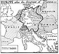
 NIE 1905 Europe - After the Congress of Vienna.jpg 1,577 × 1,245; 403 KB
-
 NIE 1905 Europe - Time of Napoleon's Greatest Power.jpg 1,576 × 1,270; 358 KB
-
 Occupied territories in the Balkans, end of April 1913.png 1,015 × 1,014; 1.63 MB
-
 Orbis Romani pars occidentalis (7537859008).jpg 1,512 × 2,000; 2.62 MB
-

-
 Orbis Romani pars orientalis (8358154606).jpg 591 × 800; 120 KB
-
 Outlines of nineteenth century history (1906) (14760987626).jpg 2,688 × 1,812; 1.39 MB
-

-
-

-

-
 Passing of the Great Race - Map 1.jpg 2,472 × 1,619; 3.39 MB
-
 Passing of the Great Race - Map 2.jpg 2,474 × 1,619; 3.46 MB
-
 Passing of the Great Race - Map 3.jpg 2,057 × 1,531; 2.34 MB
-
 Passing of the Great Race - Map 4.jpg 2,192 × 1,533; 2.58 MB
-
 Polska w 1000 Wojciech Ketrzynski 1894.jpg 1,006 × 1,030; 418 KB
-
-
 Public Schools Historical Atlas - Crusades.jpg 1,468 × 1,176; 410 KB
-
 Public Schools Historical Atlas - Europe 1135.jpg 2,234 × 1,734; 1,013 KB
-
 Public Schools Historical Atlas - Europe 13th century.jpg 1,132 × 918; 374 KB
-
 Public Schools Historical Atlas - Europe 476-493.jpg 1,579 × 1,239; 610 KB
-
 Russland BV042518413.jpg 1,954 × 1,337; 326 KB
-
 Russland BV042518433.jpg 1,201 × 1,329; 229 KB
-
 Révai nagy lexikona; az ismeretek enciklopédiája (1911) (14782298054).jpg 1,790 × 2,962; 747 KB
-
 Sarmatia et Scythia, Russia et Tartaria Europaea.jpg 4,000 × 3,707; 3.73 MB
-
 Shepherd-c-138-139.jpg 1,542 × 1,919; 752 KB
-
 Special Karte von Suedpreussen - IfL Signatur HK892-899 Zusatz.jpg 3,670 × 2,632; 3.12 MB
-
 Special Karte von Suedpreussen - IfL Signatur HK892.jpg 8,914 × 6,811; 19.31 MB
-
 Special Karte von Suedpreussen - IfL Signatur HK893.jpg 8,900 × 6,727; 17.94 MB
-
 Special Karte von Suedpreussen - IfL Signatur HK894.jpg 7,754 × 6,737; 16.43 MB
-
 Special Karte von Suedpreussen - IfL Signatur HK895.jpg 7,846 × 6,855; 21.01 MB
-
 Special Karte von Suedpreussen - IfL Signatur HK896.jpg 8,853 × 6,694; 22.24 MB
-
 Special Karte von Suedpreussen - IfL Signatur HK897.jpg 9,018 × 6,847; 25.92 MB
-
 Special Karte von Suedpreussen - IfL Signatur HK898.jpg 8,903 × 6,741; 25.3 MB
-
 Special Karte von Suedpreussen - IfL Signatur HK899.jpg 8,956 × 6,872; 24.81 MB
-
 The ancient world, from the earliest times to 800 A. D (1913) (14594854790).jpg 2,100 × 2,904; 1.53 MB
-
 The ancient world, from the earliest times to 800 A. D (1913) (14594896389).jpg 2,688 × 1,772; 1.15 MB
-
 The ancient world, from the earliest times to 800 A. D (1913) (14758604346).jpg 2,214 × 3,240; 1.6 MB
-
 The ancient world, from the earliest times to 800 A. D (1913) (14778408681).jpg 2,896 × 1,868; 1.06 MB
-
 The ancient world, from the earliest times to 800 A. D (1913) (14781594475).jpg 2,832 × 1,816; 1.28 MB
-
 The ancient world, from the earliest times to 800 A. D (1913) (14801420413).jpg 2,088 × 3,108; 1.53 MB
-
 The founding of a new world (1898) (14740308906).jpg 1,868 × 2,396; 513 KB
-
 The story of the map of Europe, its making and its changing (1916) (14775224031).jpg 2,008 × 2,816; 593 KB
-
 The story of the map of Europe, its making and its changing (1916) (14775963804).jpg 2,736 × 1,756; 937 KB
-
 Utrecht Treaty.png 1,064 × 840; 1.68 MB
-
 Utrecht Treaty.svg 290 × 225; 766 KB
-
 Western Europe in the time of Charles V (1525).jpg 2,212 × 2,829; 1.9 MB
-
 Östliches Deutschland oder Böhmen, Mähren und Schlesien.jpg 5,566 × 4,538; 9.05 MB


%27_(11166650576).jpg)
.jpg)
.jpg)
.jpg)
.jpg)
.jpg)
%27_(11247270836).jpg)
.jpg)
.jpg)
%27_(11162570873).jpg)

_L%27_EUROPE_SOUS_CHARLES-QUINT_(1556).jpg)


.jpg)
.jpg)
.jpg)
%27_(11212126205).jpg)
.jpg)
.jpg)
.jpg)
.jpg)
.jpg)
.jpg)
.jpg)
_(14761599451).jpg)
_(14764728485).jpg)

_(14774471771).jpg)
_(14597755280).jpg)
_(14597756099).jpg)
_(14597826460).jpg)
_(14597951827).jpg)
_(14597998627).jpg)
_(14784160252).jpg)
_(14577675500).jpg)
_(14577721279).jpg)
_(14577740320).jpg)
_(14577906747).jpg)
_(14577940227).jpg)
_(14578018297).jpg)
_(14761308231).jpg)
_(14762013094).jpg)
_(14764108302).jpg)
_(14579301569).jpg)


_(14761837056).jpg)


_(14778819004).jpg)


_(14578180419).jpg)
_(14578372177).jpg)
_(14578384147).jpg)


.jpg)
.jpg)
.jpg)
.jpg)
.jpg)
.jpg)
.jpg)
.jpg)
.jpg)
.jpg)
.jpg)
.jpg)
.jpg)
.jpg)
.jpg)
.jpg)
.jpg)
.jpg)
.jpg)
.jpg)
.jpg)
.jpg)


_(14594652047).jpg)
_(14594677028).jpg)
_(14594880967).jpg)
_(14778171521).jpg)
_(14778210391).jpg)
_(14778297811).jpg)
_(14778903084).jpg)
_(14780904382).jpg)
_(14781004902).jpg)
_(14781075452).jpg)
_(14781381245).jpg)
_(14800964923).jpg)
_(14772943151).jpg)
_(14773732974).jpg)
_(14775769172).jpg)
_(14776103205).jpg)
_(14795948423).jpg)
_(14766824795).jpg)


.jpg)
.jpg)
.jpg)
_(14760987626).jpg)
_(14596696887).jpg)
_(14760223906).jpg)
_(14803047633).jpg)
_(14803076703).jpg)


_(14595874327).jpg)


_(14782298054).jpg)


_(14594854790).jpg)
_(14594896389).jpg)
_(14758604346).jpg)
_(14778408681).jpg)
_(14781594475).jpg)
_(14801420413).jpg)
_(14740308906).jpg)
_(14775224031).jpg)
_(14775963804).jpg)


.jpg)

%27_(11025227055).jpg)