Category:Pauri Garhwal district
district of Uttarakhand, India .svg) | |||||
| Upload media | |||||
| Instance of | |||||
|---|---|---|---|---|---|
| Location |
| ||||
| Capital | |||||
| Population |
| ||||
| Area |
| ||||
| official website | |||||
 | |||||
Subcategories
This category has the following 13 subcategories, out of 13 total.
B
- Bhullar Lake (4 F)
- Binsar Devta (9 F)
D
- Dudhatoli (11 F)
J
K
L
M
- Satpal Maharaj (30 F)
P
S
- Shivalaya, Kukhar Gaon (2 F)
Media in category "Pauri Garhwal district"
The following 90 files are in this category, out of 90 total.
-
 1000 yrs old architecture.jpg 3,456 × 4,608; 5.17 MB
-
 A fresh water spring in Binsar.jpg 1,836 × 3,264; 2.09 MB
-
 A freshwater spring near Rangaon, Thalisain.jpg 4,096 × 2,304; 3.38 MB
-
 A Spotted deer.jpg 3,264 × 2,448; 2.68 MB
-
 Alakananda river.jpg 3,840 × 2,160; 2.65 MB
-
 Amotha Pauri Garhwal Uttarakhand India 02.jpg 4,032 × 3,024; 3.39 MB
-
 Ancient rock idols in Binsar.jpg 1,836 × 3,264; 1.49 MB
-
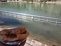
 Bhulla Tal Lake in Lansdowne town of Uttarakhand, India.jpg 4,809 × 2,640; 3.9 MB
-
 Brahmadhungi.jpg 1,836 × 3,264; 1.96 MB
-

-
 Corbett 11.jpg 4,453 × 2,518; 2.89 MB
-
 Corbett 12.jpg 4,452 × 2,425; 3.21 MB
-
 Corbett 14.jpg 2,592 × 1,456; 1.03 MB
-
 CORBETT NATIONAL PARK 6.jpg 1,536 × 2,048; 394 KB
-
 CORBETT NATIONAL PARK 9.jpg 2,048 × 1,536; 556 KB
-
 Deeba Danda.jpg 2,048 × 1,080; 316 KB
-
 Deeba Temple in Isoti.jpg 1,066 × 975; 390 KB
-
 Deers fleeing a tiger (Unsplash).jpg 6,000 × 4,000; 20.5 MB
-
 Devrajkhal - panoramio.jpg 1,600 × 1,200; 264 KB
-
 Diba hill view from Devrajkhal - panoramio.jpg 2,048 × 1,536; 1.04 MB
-
 Dronagiri and Nanda Ghunti.jpg 5,152 × 3,864; 6.22 MB
-
 Dronagiri Parvat.jpg 5,152 × 3,864; 5.97 MB
-
 Gadkhark village temple.jpg 1,280 × 958; 245 KB
-
 Ganges, Rishikesh (8746970679).jpg 1,280 × 960; 460 KB
-
 Ganges, Rishikesh (8746970737).jpg 1,280 × 960; 423 KB
-
 Ganges, Rishikesh (8748091220).jpg 1,280 × 960; 409 KB
-
 Ganges, Rishikesh (8748091296).jpg 1,280 × 960; 417 KB
-
 Garhwal.jpg 180 × 135; 7 KB
-
 Heavenly view in winter - panoramio.jpg 2,048 × 1,536; 760 KB
-
 Himalayas from Kalinka.jpg 1,600 × 1,200; 270 KB
-
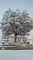 Holy oak tree covered with snow.jpg 720 × 1,280; 88 KB
-
 Idol of Kali inside the temple.jpg 1,024 × 683; 559 KB
-
 Isoti Village in Pauri Garhwal.jpg 965 × 923; 637 KB
-
 Kalinka Snowfall.jpg 720 × 405; 17 KB
-
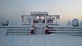
 Kalinka temple during Snowfall.jpg 720 × 960; 75 KB
-
 Kalinka Temple.jpg 5,152 × 3,864; 6.42 MB
-
 Kedarnath Peak.jpg 5,152 × 3,864; 6.18 MB
-
 Khedgaon view from Mald Bara - panoramio.jpg 2,048 × 1,536; 962 KB
-
 Khirsu-park.JPG 4,928 × 3,264; 6.7 MB
-
 Khirsu.JPG 4,928 × 3,264; 5.64 MB
-
 Khunjyali village from Mald bara - panoramio.jpg 2,048 × 1,536; 1.16 MB
-
 Kyunkaleshwar Mahadev.jpg 804 × 534; 156 KB
-
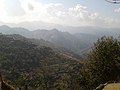
 Looking towards Chamoli.jpg 5,152 × 3,864; 3.68 MB
-
 Lopping oak twigs for fodder.jpg 4,096 × 2,304; 3.67 MB
-
 Maroda Gaon.jpg 800 × 600; 73 KB
-
 Maroda pic.jpg 1,600 × 1,200; 345 KB
-
 Maroda, kandwalsyun.jpg 972 × 648; 70 KB
-
 Maroda.JPG 4,320 × 3,240; 5.22 MB
-
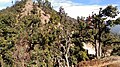
 Massive West Himalayan Fir tees.jpg 5,152 × 3,864; 7.43 MB
-
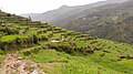
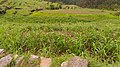 Millet fields in Nayaar river valley.jpg 4,096 × 2,304; 3.31 MB
-
 Nagchula.jpg 5,152 × 3,864; 6.16 MB
-
 Naithana pul.jpg 4,000 × 3,000; 4.58 MB
-
 Near Douriya Village, enroute Bindeshwar Mahadev temple.jpg 4,096 × 2,304; 2.37 MB
-
 Oriental Scenery Part 4 Fig 17.jpg 808 × 585; 108 KB
-
 Pabau Bazar and Village view - panoramio.jpg 2,560 × 1,920; 2.04 MB
-
 Panchachuli Pithauragarh.jpg 5,152 × 3,864; 5.82 MB
-

-
 Pauri Garhwal district.svg 1,250 × 1,125; 137 KB
-
 Pauri garhwal.jpg 1,280 × 588; 188 KB
-
 Pauri Town.jpg 4,000 × 1,800; 3.31 MB
-
 Pauriii.jpg 3,264 × 2,448; 1.38 MB
-
 Paurisanjay.jpg 637 × 647; 180 KB
-
 Peethsain.jpg 5,152 × 3,864; 6.8 MB
-
 Pine Forest Kandoliya Pauri.JPG 4,928 × 3,264; 8.62 MB
-
 Pine Forest pauri.JPG 4,928 × 3,264; 8.13 MB
-
 Rajiv Gandhi Navodaya Vidyalaya - panoramio.jpg 2,560 × 1,920; 1.54 MB
-
 Rishikesh (8748090522).jpg 1,280 × 960; 510 KB
-
 Rishikesh (8748090536).jpg 960 × 1,280; 390 KB
-
 Rishikesh (8748090716).jpg 960 × 1,280; 342 KB
-
 Rishikesh (8748090902).jpg 1,280 × 960; 510 KB
-
 Rishikesh (8748091200).jpg 1,280 × 960; 435 KB
-
 Shrine enroute Binsar.jpg 3,264 × 1,836; 1.1 MB
-
 Sinduri Village.jpg 713 × 713; 300 KB
-
 Snowfall at Kalinka.jpg 720 × 405; 24 KB
-
 Sri Gadwall District Map.png 350 × 231; 46 KB
-
 Sunlight passing through oak trees.jpg 5,152 × 3,864; 8.9 MB
-
 Tarakund Mahadev-1.jpg 5,184 × 3,456; 5.21 MB
-
 Tarakund Mahadev-2.jpg 5,184 × 3,456; 6.04 MB
-
 Tarakund Mahadev-3.jpg 5,184 × 3,456; 5.13 MB
-
 Tarakund Mahadev-4.jpg 5,184 × 3,456; 5.82 MB
-
 Tarakund Mahadev-5.jpg 5,184 × 3,456; 4.56 MB
-
 Tarakund Mahadev-6.jpg 5,184 × 3,456; 6.29 MB
-
 Tarakund Mahadev-7.jpg 5,184 × 3,456; 4.13 MB
-
 Temple building during snowfall.jpg 720 × 960; 47 KB
-
 Temple complex snowfall.jpg 720 × 960; 50 KB
-
 View from Upside.jpg 4,208 × 2,368; 5.21 MB
-
 View in the Koah Nullah - British Library X432 4(15).jpg 976 × 696; 209 KB
-
 Village temple.jpg 2,656 × 1,992; 1.85 MB
-
 VJ01939.jpg 4,896 × 3,672; 6.91 MB
-
 Waterfall4.jpg 960 × 637; 328 KB


.jpg)


.jpg)
.jpg)
.jpg)
.jpg)


.jpg)
.jpg)
.jpg)
.jpg)
.jpg)


.jpg)


