Category:SVG maps of French Polynesia
Administrative regions and territorial collectivity of Metropolitan France (‡ since start of 2016):
Auvergne-Rhône-Alpes‡ · Bourgogne-Franche-Comté‡ · Brittany · Centre-Val de Loire · Corsica · Grand Est‡ · Hauts-de-France‡ · Île-de-France · Normandy‡ · New Aquitaine‡ · Occitania‡ · Pays de la Loire · Provence-Alpes-Côte d'Azur
Former administrative regions of Metropolitan France (until end of 2015):
Alsace · Aquitaine · Auvergne · Burgundy · Champagne-Ardenne · Franche-Comté · Languedoc-Roussillon · Limousin · Lorraine · Midi-Pyrénées · Nord-Pas-de-Calais · Lower Normandy · Upper Normandy · Picardy · Poitou-Charentes · Rhône-Alpes
Overseas departments and regions: Guadeloupe · Martinique · French Guiana · Réunion · Mayotte
Overseas collectivities: Saint Barthélemy · Saint-Martin · Saint Pierre and Miquelon · French Polynesia · Wallis and Futuna · French Southern and Antarctic Lands+
Sui generis territories: New Caledonia · Clipperton Island+
Departments of Metropolitan France: Ardennes [08] · departmental district of the Rhône [69] · Rhône [69D]‡ · Metropolis of Lyon [69M]‡ · Paris [75] · Somme [80] · Territoire de Belfort [90]
Overseas departments and regions: Guadeloupe [971] · Martinique [972] · French Guiana [973] · Réunion [974] · Mayotte [976]
Overseas collectivities: Saint Pierre and Miquelon [975] · Saint Barthélemy [977] · Saint-Martin [978] · Wallis and Futuna [986] · French Polynesia [987] · French Southern and Antarctic Lands [984]+
Sui generis territories: New Caledonia [988] · Clipperton Island [989]+

Subcategories
This category has the following 5 subcategories, out of 5 total.
Media in category "SVG maps of French Polynesia"
The following 13 files are in this category, out of 13 total.
-
 Députés sortants de Polynésie française en 2017.svg 918 × 532; 5 KB
-
 Eiao vegetation map.svg 1,400 × 1,400; 3.21 MB
-
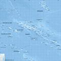
 French Polynesia relief map BG.svg 1,260 × 1,260; 1.43 MB
-
 French Polynesia relief map RU.svg 1,260 × 1,260; 1.43 MB
-
 French Polynesia relief map with communes-mk.svg 1,260 × 1,260; 1.4 MB
-
 French Polynesia relief map with communes.svg 1,260 × 1,260; 1.52 MB
-
 French Polynesia relief map.svg 1,260 × 1,260; 1.52 MB
-
 Frenchpolynesia w1 locator.svg 1,000 × 1,000; 82 KB
-
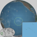 Frenchpolynesia w2 locator.svg 1,000 × 1,000; 173 KB
-
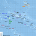
 Map of French Polynesia-fr.svg 2,102 × 2,102; 453 KB
-
 Mapa de Tahiti.svg 1,016 × 571; 429 KB
-
 Maritime boundaries between UK and France in Pacific Ocean-fr.svg 2,934 × 1,584; 750 KB
-
 Tahiti législatives 1981.svg 1,993 × 1,190; 20 KB


