Category:Saint John the Evangelist, Colemere
| Object location | | View all coordinates using: OpenStreetMap |
|---|
church in Shropshire, UK  | |||||
| Upload media | |||||
| Instance of | |||||
|---|---|---|---|---|---|
| Dedicated to | |||||
| Location | Welshampton and Lyneal, Shropshire, West Midlands, England | ||||
| Diocese | |||||
| Heritage designation |
| ||||
| Religion or worldview | |||||
 | |||||
Media in category "Saint John the Evangelist, Colemere"
The following 2 files are in this category, out of 2 total.
-
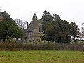
 Colemere Church - geograph.org.uk - 225019.jpg 640 × 426; 111 KB
-
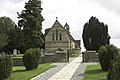
 Colemere church and churchyard - geograph.org.uk - 4267822.jpg 1,600 × 1,200; 1.03 MB
