Category:Schools in the London Borough of Islington

Wikimedia category | |||||
| Upload media | |||||
| Instance of | |||||
|---|---|---|---|---|---|
| Category combines topics | |||||
| London | |||||
capital and largest city of England and the United Kingdom     .svg)   | |||||
| Pronunciation audio | |||||
| Instance of |
| ||||
| Location |
| ||||
| Located in or next to body of water | |||||
| Official language | |||||
| Head of government |
| ||||
| Inception |
| ||||
| Significant event |
| ||||
| Highest point |
| ||||
| Population |
| ||||
| Area |
| ||||
| Elevation above sea level |
| ||||
| Replaces | |||||
| IATA airport code |
| ||||
| Different from | |||||
| official website | |||||
 | |||||
Subcategories
This category has the following 11 subcategories, out of 11 total.
C
- St Paul's Church, Islington (10 F)
- Central Foundation Boys' School (15 F)
E
H
- Highbury Fields School (1 F)
Media in category "Schools in the London Borough of Islington"
The following 26 files are in this category, out of 26 total.
-
 Arts & Media School, Islington badge.jpg 261 × 300; 21 KB
-
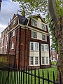
 Ashmount Primary School - geograph.org.uk - 3824277.jpg 1,024 × 768; 645 KB
-
 Blessed Sacrement Primary School, London Borough of Islington 0589.JPG 3,264 × 2,448; 4.04 MB
-

-
 Former Special Girls School - geograph.org.uk - 3855378.jpg 640 × 416; 67 KB
-

-
 French Hospital plaque.jpg 960 × 720; 259 KB
-
 Highbury College, London. Etching. Wellcome V0014792.jpg 2,850 × 2,533; 2.92 MB
-
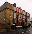
 Highbury Grove School, Islington - geograph.org.uk - 3374376.jpg 4,288 × 3,216; 5.9 MB
-
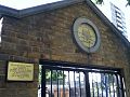
 Islington, former Sunday School (detail) - geograph.org.uk - 2463382.jpg 768 × 1,024; 171 KB
-
 Islington, former Sunday School - geograph.org.uk - 2463380.jpg 768 × 1,024; 175 KB
-
 Lady Owen's School, Islington. Wood engraving, 1840. Wellcome V0013551.jpg 2,800 × 2,614; 3.13 MB
-
 Laycock Primary School - geograph.org.uk - 4083352.jpg 957 × 1,280; 309 KB
-
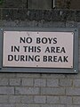
 London School Board plaque ^ LCC shield - geograph.org.uk - 3515448.jpg 455 × 640; 394 KB
-

-
 London School Board plaque, Holloway - geograph.org.uk - 3754350.jpg 719 × 1,024; 656 KB
-
 Montem Primary School, Holloway - geograph.org.uk - 5316736.jpg 1,487 × 1,600; 846 KB
-
 Pateman Primary School, Holloway - geograph.org.uk - 4780962.jpg 2,736 × 2,945; 1.75 MB
-
-
 St John's Highbury Vale Primary School - geograph.org.uk - 4093280.jpg 531 × 600; 111 KB
-
 Thornhill Primary School - geograph.org.uk - 110227.jpg 640 × 482; 105 KB
-

-
 Vittoria Primary School, N1 - geograph.org.uk - 4750126.jpg 640 × 428; 82 KB
-
 Whitehall Park School, Hornsey Lane - geograph.org.uk - 5586887.jpg 1,600 × 1,322; 587 KB
-
 William Tyndale Primary School.jpg 3,024 × 4,032; 6.6 MB
-
 Yerbury Primary School, Upper Holloway - geograph.org.uk - 4458683.jpg 557 × 600; 135 KB


_-_geograph.org.uk_-_2463382.jpg)


