Category:Scissett
village in United Kingdom  | |||||
| Upload media | |||||
| Instance of | |||||
|---|---|---|---|---|---|
| Location | Denby Dale, Kirklees, West Yorkshire, Yorkshire and the Humber, England | ||||
 | |||||
English: Scissett is a village in West Yorkshire, England. It is 14 km (8 mi) south east of Huddersfield and 16 km (10 mi) north west of Barnsley. According to the 2001 census, the village had a population of 1,324.[1] Scissett is also halfway between the villages of Clayton West, Skelmanthorpe and Denby Dale on the A636 road to Wakefield.
Subcategories
This category has only the following subcategory.
A
Media in category "Scissett"
The following 27 files are in this category, out of 27 total.
-

-
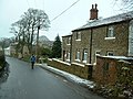 Bagden Lane - Toppit Cottage - geograph.org.uk - 95978.jpg 640 × 480; 123 KB
-
 Block, Nortonthorpe Mills.jpg 2,000 × 1,428; 902 KB
-

-
 Dangerous bend near Nether End - geograph.org.uk - 99644.jpg 640 × 426; 111 KB
-
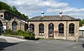 Engine House, Nortonthorpe Mills.jpg 2,000 × 1,213; 920 KB
-
 Hollin House Lane to Emley Moor Mast - geograph.org.uk - 545854.jpg 640 × 480; 75 KB
-
 John Kaye's School, Clayton West - geograph.org.uk - 38992.jpg 640 × 480; 130 KB
-
 Milepost, Wakefield Road, Scissett.jpg 480 × 640; 324 KB
-
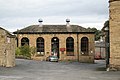 Nortonthorpe Mills, Scissett - geograph.org.uk - 256748.jpg 640 × 427; 79 KB
-
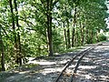 Passing loop, Cuckoos Nest Halt (geograph 5892181).jpg 1,024 × 767; 358 KB
-
 River Dearne, Scissett - geograph.org.uk - 215486.jpg 480 × 640; 142 KB
-
 Silos in a huddle - geograph.org.uk - 99664.jpg 640 × 426; 115 KB
-

-

-
 Bagden Hall - geograph.org.uk - 99683.jpg 640 × 426; 168 KB
-
 Blue and Green - geograph.org.uk - 545821.jpg 640 × 480; 66 KB
-
 Blue Sky and Green Field - geograph.org.uk - 545828.jpg 640 × 480; 63 KB
-
 Brow Lane - geograph.org.uk - 758571.jpg 640 × 480; 78 KB
-
 Deffer Wood - geograph.org.uk - 95971.jpg 640 × 480; 131 KB
-
 Descending from Pool Hill - geograph.org.uk - 117503.jpg 640 × 480; 92 KB
-
 Dry Valley near Scissett - geograph.org.uk - 215476.jpg 640 × 480; 75 KB
-
 Footpath and the River Dearne - geograph.org.uk - 86959.jpg 640 × 480; 190 KB
-
 Footpath to Deffer Wood - geograph.org.uk - 545838.jpg 640 × 480; 86 KB
-
 Footpath up to Toppit Farm - geograph.org.uk - 95980.jpg 640 × 480; 101 KB
-
 Hollin House Lane Footpath and Stile - geograph.org.uk - 545843.jpg 640 × 480; 117 KB
-
 Intersection of footpaths, Deffer Wood - geograph.org.uk - 95988.jpg 640 × 480; 174 KB
.jpg)


.jpg)


_(2850866419)_(2).jpg)


