Category:September 2007 in Lincolnshire
Ceremonial counties of England: Bedfordshire · Berkshire · Buckinghamshire · Cambridgeshire · Cheshire · Cornwall · Cumbria · Derbyshire · Devon · Dorset · Durham · East Riding of Yorkshire · East Sussex · Essex · Gloucestershire · Greater London · Greater Manchester · Hampshire · Herefordshire · Hertfordshire · Isle of Wight · Kent · Lancashire · Leicestershire · Lincolnshire · Merseyside · Norfolk · North Yorkshire · Northamptonshire · Northumberland · Nottinghamshire · Oxfordshire · Rutland · Shropshire · Somerset · South Yorkshire · Staffordshire · Suffolk · Surrey · Tyne and Wear · Warwickshire · West Midlands · West Sussex · West Yorkshire · Wiltshire · Worcestershire
City-counties: Bristol ·
Former historic counties:
Other former counties:
City-counties: Bristol ·
Former historic counties:
Other former counties:
Deutsch: Bilder, die im September 2007 in Lincolnshire aufgenommen worden sind. Bitte beachten Sie, dass dies weder das Datum des Uploads noch das Datum des Scannens eines Fotos ist.
English: Images/pictures taken in Lincolnshire during September 2007. Note this is not the date of the upload, nor the date a photo was scanned.
Español: Fotografías o imágenes tomadas en Lincolnshire durante septiembre 2007. No es la fecha de subida ni escaneo, sino la fecha en que las fotografías o imágenes se crearon.
Esperanto: Bildoj faritaj en Lincolnshire en septembro 2007. Tio ne estas la dato, kiam la bildoj estis alŝutitaj aŭ skanitaj.
Français : Photographies ou images prises en Lincolnshire durant septembre 2007. Ce n'est pas la date du téléchargement ou du scan.
Galego: Fotografías ou imaxes tomadas en Lincolnshire durante setembro 2007. Non é a data de subida nin escaneamento, senón a data na que se crearon as fotografías ou imaxes.
Italiano: Fotografie o immagini scattate a Lincolnshire nel settembre 2007. Nota bene: la data non si riferisce né a quella di upload né a quella in cui la foto è stata digitalizzata.
Norsk bokmål: Bilder tatt i Lincolnshire i løpet av september 2007. Merk at dette ikke er datoen for opplasting, eller når et bilde har blitt skannet.
Norsk nynorsk: Bilete teke i Lincolnshire i løpet av september 2007. Merk at dette ikkje er datoen for opplasting, eller når eit bilete har vorte skanna.
Русский: Изображения, сделанные в Lincolnshire в течение сентябрь 2007 (не дата загрузки изображения).
Українська: Зображення, зроблені в Lincolnshire протягом вересень 2007. Зауважте, що це не дата завантаження чи дата сканування фотографії.
| September 2006 | ← | September 2007 | → | September 2008 | |||||||
| Jan | Feb | Mar | Apr | May | Jun | Jul | Aug | Sep | Oct | Nov | Dec |
| 124 | 104 | 205 | 385 | 171 | 183 | 107 | 116 | 122 | 168 | 31 | 98 |
|---|---|---|---|---|---|---|---|---|---|---|---|
Subcategories
This category has the following 21 subcategories, out of 21 total.
L
Media in category "September 2007 in Lincolnshire"
The following 101 files are in this category, out of 101 total.
-
 Goxhill Haven Outfall - geograph.org.uk - 542213.jpg 640 × 480; 113 KB
-
 Humber Bank Footpath - High Tide - geograph.org.uk - 541918.jpg 640 × 426; 136 KB
-
 Lagoon, Sand Haile Flats - geograph.org.uk - 546442.jpg 640 × 480; 103 KB
-
 Arable farmland, Fishtoft - geograph.org.uk - 557679.jpg 640 × 480; 121 KB
-
 Footpath to Horncastle - geograph.org.uk - 555855.jpg 640 × 480; 81 KB
-
 Lincolnshire landscape near Kirton - geograph.org.uk - 544993.jpg 640 × 480; 111 KB
-
 Footpath near Northorpe - geograph.org.uk - 544606.jpg 640 × 480; 69 KB
-

-
 Monson Road, Northorpe - geograph.org.uk - 544985.jpg 640 × 480; 85 KB
-
 Thorpe House From a Distance - geograph.org.uk - 548725.jpg 640 × 480; 149 KB
-
 Saltfleetby - Theddlethorpe Dunes - geograph.org.uk - 549224.jpg 640 × 480; 91 KB
-
 Saltmarsh At Saltfleet - geograph.org.uk - 549267.jpg 640 × 460; 120 KB
-
 Former Wesleyan Chapel, Fishtoft - geograph.org.uk - 557692.jpg 640 × 480; 68 KB
-
 Former Wesleyan Chapel, Fishtoft - geograph.org.uk - 557706.jpg 640 × 480; 80 KB
-
 Almost Finished - Maltkiln Mews - geograph.org.uk - 553575.jpg 640 × 480; 120 KB
-
 Harvesting Field Beans on Horkstow Wolds - geograph.org.uk - 553560.jpg 640 × 457; 131 KB
-
 Horkstow Bridge - geograph.org.uk - 554545.jpg 640 × 480; 122 KB
-
 Manor Top Farm - geograph.org.uk - 553640.jpg 640 × 466; 212 KB
-
 Farmland Northeast Of Keelby - geograph.org.uk - 554620.jpg 640 × 480; 104 KB
-
 Reedbed at Barrow Haven - geograph.org.uk - 559506.jpg 640 × 480; 141 KB
-
 The Hide - geograph.org.uk - 559498.jpg 480 × 640; 245 KB
-
 Outbuilding near Highall Wood - geograph.org.uk - 555884.jpg 640 × 480; 85 KB
-
 B road through Old Woodhall - geograph.org.uk - 555957.jpg 640 × 480; 108 KB
-
 Reeds Beck Farm - geograph.org.uk - 555930.jpg 640 × 480; 83 KB
-
 Cattle near the Wellington Monument - geograph.org.uk - 555917.jpg 640 × 480; 106 KB
-
 Field of sunflowers near Woodhall Spa - geograph.org.uk - 555922.jpg 640 × 480; 147 KB
-
 Wellington Monument near Woodhall Spa - geograph.org.uk - 555914.jpg 480 × 640; 124 KB
-
 On final approach - geograph.org.uk - 1048781.jpg 640 × 480; 38 KB
-
 Footpath beside hedge - geograph.org.uk - 1048969.jpg 640 × 480; 92 KB
-
 Footpath to Vale House Farm - geograph.org.uk - 1048795.jpg 640 × 480; 85 KB
-
 Silhouetted by clouds - geograph.org.uk - 1048985.jpg 640 × 480; 65 KB
-
 A180 westbound near Ulceby - geograph.org.uk - 1049012.jpg 640 × 480; 76 KB
-
 College Road, Goxhill - geograph.org.uk - 564287.jpg 640 × 480; 133 KB
-
 Wartime Relic - College Road, Goxhill - geograph.org.uk - 564274.jpg 640 × 480; 139 KB
-
 Bench on the Humber Bank - geograph.org.uk - 566438.jpg 640 × 426; 109 KB
-
 Near Barrow Wold Farm - geograph.org.uk - 568024.jpg 640 × 426; 160 KB
-
 Near Barrow Wold Farm - geograph.org.uk - 568032.jpg 640 × 426; 116 KB
-
-
 The Thornton Hunt Inn, Thornton Curtis - geograph.org.uk - 568169.jpg 640 × 585; 158 KB
-
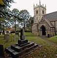 Thornton Curtis Churchyard - geograph.org.uk - 567741.jpg 624 × 640; 197 KB
-
 Hedge Development on the Burnham Road - geograph.org.uk - 567768.jpg 640 × 426; 102 KB
-
 The Pond, Wootton - geograph.org.uk - 567731.jpg 640 × 325; 99 KB
-
 Walkers Book Shop, High Street, Stamford - geograph.org.uk - 573628.jpg 640 × 480; 132 KB
-
 Clouds over Killingholme - geograph.org.uk - 570062.jpg 640 × 480; 76 KB
-
 Looking towards South Cliff Farm - geograph.org.uk - 569801.jpg 640 × 426; 128 KB
-
 St. Mary's Lane, Barton Upon Humber - geograph.org.uk - 571509.jpg 640 × 480; 148 KB
-
 The Seat at the End of the Path - geograph.org.uk - 569933.jpg 640 × 426; 121 KB
-
 Horsegate Field Road and Drain - geograph.org.uk - 562370.jpg 640 × 492; 199 KB
-
 Haven Farm - geograph.org.uk - 562347.jpg 640 × 426; 126 KB
-
 Humber Bank Footpath - geograph.org.uk - 562351.jpg 640 × 426; 95 KB
-
 Howe Lane Level Crossing, Goxhill - geograph.org.uk - 564332.jpg 640 × 480; 103 KB
-
 Meller's Coaches, Howe Lane, Goxhill - geograph.org.uk - 565386.jpg 640 × 428; 105 KB
-
 Near East Marsh Farm - geograph.org.uk - 565430.jpg 640 × 480; 136 KB
-
 Maltkiln Lane, Barton Waterside - geograph.org.uk - 566563.jpg 640 × 426; 108 KB
-
 Market Place, Boston - geograph.org.uk - 588114.jpg 640 × 480; 68 KB
-
 Pescod Hall, Boston - geograph.org.uk - 588147.jpg 640 × 480; 85 KB
-
 Post Office, Boston - geograph.org.uk - 588126.jpg 640 × 480; 82 KB
-
 McDonald's, 122 High Street, Scunthorpe - geograph.org.uk - 568498.jpg 530 × 640; 159 KB
-
 Shops on Laneham Street, Scunthorpe - geograph.org.uk - 568081.jpg 640 × 495; 144 KB
-
 The Geneva Bar Cafe, Scunthorpe - geograph.org.uk - 568073.jpg 640 × 543; 159 KB
-
 Destination, South Ferriby - geograph.org.uk - 569927.jpg 640 × 606; 115 KB
-
 ABM Pauls Malt Kiln - geograph.org.uk - 597153 (cropped).jpg 426 × 472; 181 KB
-
 ABM Pauls Malt Kiln - geograph.org.uk - 597153.jpg 426 × 640; 239 KB
-
 Rear of the Wellington pub - geograph.org.uk - 597171.jpg 640 × 488; 383 KB
-
 63.jpg 808 × 608; 653 KB
-
 Shops on Red Lion Street, Boston - geograph.org.uk - 588118.jpg 640 × 480; 86 KB
-

-
 CH Radar Tower, Stenigot - geograph.org.uk - 552895.jpg 425 × 640; 87 KB
-
 Clover in a field near Dalby - geograph.org.uk - 551907.jpg 640 × 480; 71 KB
-
-
 Footbridge - geograph.org.uk - 546255.jpg 640 × 480; 135 KB
-
 Footbridge Over Drain - geograph.org.uk - 546216.jpg 640 × 480; 127 KB
-
 Foreshore posts - geograph.org.uk - 569251.jpg 640 × 512; 188 KB
-
 Free School Lane, Lincoln - geograph.org.uk - 560221.jpg 640 × 480; 84 KB
-
 Going nowhere - geograph.org.uk - 953982.jpg 640 × 427; 66 KB
-
 Grey Day on the Humber - geograph.org.uk - 562376.jpg 640 × 480; 69 KB
-
 Horsegate Field Road - geograph.org.uk - 565416.jpg 640 × 482; 100 KB
-
 Humber buoy - geograph.org.uk - 569222.jpg 640 × 458; 167 KB
-
 The Church of St Leonard, Kirkstead - geograph.org.uk - 556171.jpg 480 × 640; 101 KB
-
 The Church of St Leonard, Kirkstead - geograph.org.uk - 556206.jpg 640 × 480; 119 KB
-
 L'Ings Farm - geograph.org.uk - 591500.jpg 640 × 426; 412 KB
-
 Lincoln Station, Lincoln - geograph.org.uk - 559988.jpg 640 × 480; 83 KB
-
 Looking Across The Saltmarsh - geograph.org.uk - 549313.jpg 640 × 465; 128 KB
-
-
 Marshalling in miniature - geograph.org.uk - 542399.jpg 640 × 427; 78 KB
-
 N L Johnson's Bus Depot, Goxhill - geograph.org.uk - 564319.jpg 640 × 464; 136 KB
-
 P and O Ferries seen from Goxhill Haven - geograph.org.uk - 542254.jpg 640 × 424; 106 KB
-
 Preparing the Ground - geograph.org.uk - 545929.jpg 640 × 480; 124 KB
-
 Preparing the Ground - geograph.org.uk - 546453.jpg 640 × 480; 86 KB
-
 Prospect Farm - geograph.org.uk - 551330.jpg 610 × 640; 224 KB
-
 River Witham Reflection - geograph.org.uk - 624783.jpg 640 × 426; 131 KB
-
 Rotavating at Dalby - geograph.org.uk - 554762.jpg 640 × 480; 101 KB
-
 Stile and footpath at Langton by Spilsby - geograph.org.uk - 554601.jpg 640 × 480; 114 KB
-
 Stile at Thorpe Farm, Skendleby - geograph.org.uk - 554394.jpg 640 × 480; 129 KB
-
 Stile near Thorpe Farm, Skendleby - geograph.org.uk - 554346.jpg 640 × 480; 133 KB
-
 Farmland along Bowden Road - geograph.org.uk - 571893.jpg 640 × 452; 116 KB
-
 Farmland by the River Witham - geograph.org.uk - 557175.jpg 640 × 480; 99 KB
-
 Field South of Wootton Pond - geograph.org.uk - 567755.jpg 640 × 426; 110 KB
-
 Footpath at Cut End, Boston - geograph.org.uk - 558215.jpg 640 × 480; 107 KB
-
 Havenside footpath, Boston - geograph.org.uk - 557155.jpg 640 × 480; 105 KB
-
 Hesitating At The Gate^ - geograph.org.uk - 546385.jpg 640 × 480; 86 KB


.jpg)


