Category:September 2007 in the East Riding of Yorkshire
Ceremonial counties of England: Bedfordshire · Berkshire · Buckinghamshire · Cambridgeshire · Cheshire · Cornwall · Cumbria · Derbyshire · Devon · Dorset · Durham · East Riding of Yorkshire · East Sussex · Essex · Gloucestershire · Greater London · Greater Manchester · Hampshire · Herefordshire · Hertfordshire · Isle of Wight · Kent · Lancashire · Leicestershire · Lincolnshire · Merseyside · Norfolk · North Yorkshire · Northamptonshire · Northumberland · Nottinghamshire · Oxfordshire · Rutland · Shropshire · Somerset · South Yorkshire · Staffordshire · Suffolk · Surrey · Tyne and Wear · Warwickshire · West Midlands · West Sussex · West Yorkshire · Wiltshire · Worcestershire
City-counties: Bristol ·
Former historic counties:
Other former counties:
City-counties: Bristol ·
Former historic counties:
Other former counties:
Deutsch: Bilder, die im September 2007 in the East Riding of Yorkshire aufgenommen worden sind. Bitte beachten Sie, dass dies weder das Datum des Uploads noch das Datum des Scannens eines Fotos ist.
English: Images/pictures taken in the East Riding of Yorkshire during September 2007. Note this is not the date of the upload, nor the date a photo was scanned.
Español: Fotografías o imágenes tomadas en the East Riding of Yorkshire durante septiembre 2007. No es la fecha de subida ni escaneo, sino la fecha en que las fotografías o imágenes se crearon.
Esperanto: Bildoj faritaj en the East Riding of Yorkshire en septembro 2007. Tio ne estas la dato, kiam la bildoj estis alŝutitaj aŭ skanitaj.
Français : Photographies ou images prises en the East Riding of Yorkshire durant septembre 2007. Ce n'est pas la date du téléchargement ou du scan.
Galego: Fotografías ou imaxes tomadas en the East Riding of Yorkshire durante setembro 2007. Non é a data de subida nin escaneamento, senón a data na que se crearon as fotografías ou imaxes.
Italiano: Fotografie o immagini scattate a the East Riding of Yorkshire nel settembre 2007. Nota bene: la data non si riferisce né a quella di upload né a quella in cui la foto è stata digitalizzata.
Norsk bokmål: Bilder tatt i the East Riding of Yorkshire i løpet av september 2007. Merk at dette ikke er datoen for opplasting, eller når et bilde har blitt skannet.
Norsk nynorsk: Bilete teke i the East Riding of Yorkshire i løpet av september 2007. Merk at dette ikkje er datoen for opplasting, eller når eit bilete har vorte skanna.
Русский: Изображения, сделанные в the East Riding of Yorkshire в течение сентябрь 2007 (не дата загрузки изображения).
Українська: Зображення, зроблені в the East Riding of Yorkshire протягом вересень 2007. Зауважте, що це не дата завантаження чи дата сканування фотографії.
| September 2006 | ← | September 2007 | → | September 2008 | |||||||
| Jan | Feb | Mar | Apr | May | Jun | Jul | Aug | Sep | Oct | Nov | Dec |
| 423 | 213 | 243 | 454 | 293 | 321 | 283 | 416 | 246 | 542 | 252 | 216 |
|---|---|---|---|---|---|---|---|---|---|---|---|
Subcategories
This category has only the following subcategory.
Media in category "September 2007 in the East Riding of Yorkshire"
The following 200 files are in this category, out of 245 total.
(previous page) (next page)-
 Market Place, South Cave - geograph.org.uk - 570910.jpg 640 × 484; 83 KB
-
 A footpath near Wauldby Manor Farm - geograph.org.uk - 565028.jpg 640 × 480; 128 KB
-
 A Yorkshire Wolds' Bridleway - geograph.org.uk - 565030.jpg 640 × 480; 104 KB
-
 A Yorkshire Wolds' Bridleway - geograph.org.uk - 565034.jpg 640 × 480; 78 KB
-
 Aldbrough Cemetery - geograph.org.uk - 560355.jpg 480 × 640; 108 KB
-
 All Saints Church, Brantingham - geograph.org.uk - 570923.jpg 640 × 480; 84 KB
-
 Awaiting restoration - geograph.org.uk - 548135.jpg 480 × 640; 121 KB
-
 Bainton Road - geograph.org.uk - 541959.jpg 480 × 640; 81 KB
-
 Bainton Roundabout - geograph.org.uk - 541955.jpg 640 × 480; 77 KB
-
 Beverley Road, Withernwick - geograph.org.uk - 561265.jpg 640 × 480; 74 KB
-
 Black Bush - geograph.org.uk - 561075.jpg 640 × 445; 103 KB
-
 Black Bush - geograph.org.uk - 561076.jpg 473 × 640; 126 KB
-
 Blasket Pond, North Ferriby - geograph.org.uk - 542835.jpg 640 × 468; 196 KB
-
 Boothferry Bridge 2.jpg 640 × 480; 104 KB
-
 Brantingham - geograph.org.uk - 570946.jpg 640 × 468; 100 KB
-
 Bridge and Beacon, North Ferriby - geograph.org.uk - 569234.jpg 640 × 455; 151 KB
-
 Bridleway Intersection - geograph.org.uk - 565298.jpg 640 × 475; 161 KB
-
 Bridleway north west of Hedon - geograph.org.uk - 566035.jpg 640 × 480; 156 KB
-
 Bridleway on the outskirts of Hedon - geograph.org.uk - 566038.jpg 640 × 480; 183 KB
-
 Bridleway to Cottam - geograph.org.uk - 565302.jpg 640 × 480; 104 KB
-
 Bridleway to Cowlam - geograph.org.uk - 565306.jpg 640 × 468; 128 KB
-
 Bridleway to Garton Bottom - geograph.org.uk - 565311.jpg 640 × 480; 140 KB
-
 Burstwick Drain - geograph.org.uk - 561498.jpg 640 × 480; 92 KB
-
 Cabbage looking - geograph.org.uk - 563747.jpg 561 × 640; 197 KB
-
 Cally in the Morning - geograph.org.uk - 553259.jpg 640 × 480; 137 KB
-

-
 Carlton Lane, Aldbrough - geograph.org.uk - 560365.jpg 487 × 640; 158 KB
-
 Cast Iron Pump Brantingham.jpg 474 × 640; 118 KB
-
 Castle Hill Hospital, 50's building - panoramio.jpg 1,300 × 866; 580 KB
-
 Chalky field - geograph.org.uk - 664026.jpg 640 × 480; 114 KB
-
 Charcoal Kiln - geograph.org.uk - 555673.jpg 480 × 640; 159 KB
-
 Cliff Top At Danes Dyke - geograph.org.uk - 557877.jpg 640 × 480; 81 KB
-
 Collapsed Pillbox - geograph.org.uk - 551068.jpg 640 × 480; 81 KB
-
 Coniston Lane, Thirtleby - geograph.org.uk - 551276.jpg 640 × 480; 79 KB
-
 Cony Hill, Rise - geograph.org.uk - 561334.jpg 640 × 448; 48 KB
-
 Cony Hill, Rise - geograph.org.uk - 561340.jpg 640 × 478; 101 KB
-
 Coppiced Woodland - geograph.org.uk - 555664.jpg 640 × 480; 178 KB
-
 Cottam House Farm.jpg 640 × 478; 128 KB
-
 Cottingham Road - geograph.org.uk - 541972.jpg 640 × 480; 96 KB
-
 Crossed wires - geograph.org.uk - 566858.jpg 438 × 640; 189 KB
-
 Crossed Wires II - geograph.org.uk - 566910.jpg 640 × 458; 152 KB
-
 Dale Road, Swanland - geograph.org.uk - 567296.jpg 640 × 492; 197 KB
-
 Danes Drive, Hessle - geograph.org.uk - 541866.jpg 640 × 589; 173 KB
-
 Danes' Dyke and Dykes Plantation - geograph.org.uk - 551036.jpg 640 × 480; 93 KB
-
 Double Gates Slipway and Beach - geograph.org.uk - 543944.jpg 640 × 480; 99 KB
-
 Driffield Farmers' Market - geograph.org.uk - 541948.jpg 640 × 459; 69 KB
-
 Dykes End - geograph.org.uk - 551020.jpg 640 × 480; 76 KB
-
 Early morning walkers, Pickhill - geograph.org.uk - 555833.jpg 616 × 640; 209 KB
-
 East Carlton - geograph.org.uk - 560662.jpg 640 × 457; 72 KB
-
 East Carlton - geograph.org.uk - 560688.jpg 480 × 640; 101 KB
-
 East or west^ - geograph.org.uk - 541875.jpg 640 × 460; 175 KB
-
 Ellerby Gatehouse.jpg 640 × 455; 101 KB
-
 Ellerby Road, Skirlaugh - geograph.org.uk - 551340.jpg 480 × 640; 136 KB
-
 Ellerby School - geograph.org.uk - 551326.jpg 640 × 445; 74 KB
-
 Elmswell Wold - geograph.org.uk - 565318.jpg 640 × 467; 103 KB
-
 Endike Lane, Hull - geograph.org.uk - 569788.jpg 640 × 454; 216 KB
-

-
 Ferriby High Road - geograph.org.uk - 569274.jpg 640 × 480; 211 KB
-
 Field and copse - geograph.org.uk - 542849.jpg 640 × 464; 185 KB
-

-
 Fields near Tranby Croft - geograph.org.uk - 542919.jpg 484 × 640; 209 KB
-
 Fishing Boats At North Landing - geograph.org.uk - 557899.jpg 640 × 480; 102 KB
-
 Footpath to Howden Marsh - geograph.org.uk - 555442.jpg 640 × 480; 124 KB
-
 Foreshore posts - geograph.org.uk - 569251.jpg 640 × 512; 188 KB
-
 Fosham Garth Farm - geograph.org.uk - 561082.jpg 640 × 482; 107 KB
-
 Frog Hall Cottage, Preston - geograph.org.uk - 549706.jpg 640 × 456; 112 KB
-
 From the road to North Newbald - geograph.org.uk - 551336.jpg 640 × 480; 80 KB
-
 From the Wauldby Green Bridleway - geograph.org.uk - 565065.jpg 640 × 480; 96 KB
-
 Garton on the Wolds - geograph.org.uk - 565324.jpg 640 × 474; 134 KB
-
 Given Dale - geograph.org.uk - 555700.jpg 640 × 480; 111 KB
-
 Great Gutter Lane (West) - geograph.org.uk - 549120.jpg 640 × 465; 173 KB
-
 Great Gutter Lane bridleway - geograph.org.uk - 549117.jpg 569 × 640; 193 KB
-
 Great Wold, South Cave - geograph.org.uk - 570913.jpg 456 × 640; 131 KB
-
 Haggs Farm fields - geograph.org.uk - 563779.jpg 499 × 640; 200 KB
-
 Hawker Dragonfly - geograph.org.uk - 544414.jpg 640 × 460; 110 KB
-
 Hazelmere, Skirlaugh - geograph.org.uk - 551362.jpg 640 × 459; 85 KB
-
 Hedon Meadow - geograph.org.uk - 566040.jpg 640 × 480; 98 KB
-
 Herb Robert in Millington Wood - geograph.org.uk - 555693.jpg 480 × 640; 58 KB
-
 Hesslewood outfall pipe - geograph.org.uk - 569241.jpg 493 × 640; 214 KB
-
 Holy Trinity Church, Cottam - geograph.org.uk - 565290.jpg 640 × 480; 99 KB
-
 Home Farm hotel - geograph.org.uk - 541869.jpg 640 × 421; 210 KB
-
 Hornsea Groyne - geograph.org.uk - 548935.jpg 480 × 640; 109 KB
-
 Horsedale - geograph.org.uk - 664025.jpg 640 × 480; 86 KB
-
 Humber Bridge Control Offices - geograph.org.uk - 561528.jpg 640 × 426; 93 KB
-

-
 Humber buoy - geograph.org.uk - 569222.jpg 640 × 458; 167 KB
-
 Humber Dale and bridge - geograph.org.uk - 542875.jpg 640 × 438; 160 KB
-
 Kemp Road, Swanland - geograph.org.uk - 542881.jpg 640 × 480; 190 KB
-
 Keyingham Cemetery - geograph.org.uk - 562574.jpg 640 × 476; 107 KB
-
 Kilnwick church.jpg 3,264 × 2,448; 3.97 MB
-
 Kilnwick East Belt Plantation.jpg 3,264 × 2,448; 3.54 MB
-
 Kilnwick House 2007.jpg 3,264 × 2,448; 4.37 MB
-
 Kilnwick walled garden.jpg 3,264 × 2,448; 3.28 MB
-
 L Dike, West Newton - geograph.org.uk - 561051.jpg 457 × 640; 83 KB
-
 Lambwath Stream, High Fosham - geograph.org.uk - 561086.jpg 640 × 460; 113 KB
-
 Lambwath Stream, Withernwick - geograph.org.uk - 561084.jpg 460 × 640; 88 KB
-
 Landslip On The Cliff Top Path - geograph.org.uk - 557887.jpg 640 × 480; 151 KB
-
 Lidl, Willerby - geograph.org.uk - 549124.jpg 640 × 406; 156 KB
-
 Lightning Tree - geograph.org.uk - 565084.jpg 480 × 640; 84 KB
-
 Littlefield Plantation - geograph.org.uk - 565035.jpg 640 × 480; 122 KB
-
 Livingstone Road, Hessle - geograph.org.uk - 543941.jpg 640 × 485; 109 KB
-
 Lock Keepers House - geograph.org.uk - 548168.jpg 480 × 640; 82 KB
-
 Looking towards Brafford's Clump - geograph.org.uk - 565080.jpg 640 × 424; 82 KB
-
 Low Fosham - geograph.org.uk - 560836.jpg 640 × 444; 63 KB
-
 Low Fosham - geograph.org.uk - 560850.jpg 640 × 491; 113 KB
-
 Low Road semis - geograph.org.uk - 563761.jpg 640 × 450; 179 KB
-
 Lower Welton Dale - geograph.org.uk - 565138.jpg 640 × 480; 86 KB
-
 Main Road Skirlaugh.jpg 640 × 439; 99 KB
-
 Main Street Withernwick.jpg 640 × 443; 80 KB
-
 Millington Wood - geograph.org.uk - 555653.jpg 480 × 640; 162 KB
-
 Millington Wood - geograph.org.uk - 555688.jpg 480 × 640; 163 KB
-
 Mitsubishi Motors, Hull - geograph.org.uk - 543955.jpg 640 × 495; 126 KB
-
 Mount Airy Farm - geograph.org.uk - 570917.jpg 469 × 640; 93 KB
-
 Near Sledmere - Junction to B1251 - geograph.org.uk - 545409.jpg 640 × 413; 80 KB
-
 North End Field, Withernwick - geograph.org.uk - 561208.jpg 640 × 480; 62 KB
-
 North Lodge, De La Pole Hospital - geograph.org.uk - 563798.jpg 640 × 425; 184 KB
-
 North of Riplingham Road - geograph.org.uk - 549112.jpg 640 × 429; 190 KB
-
 Oak Cottages, Rise - geograph.org.uk - 561326.jpg 444 × 640; 70 KB
-
 Oak Cottages, Rise - geograph.org.uk - 561328.jpg 640 × 455; 90 KB
-
 Offices on Livingstone Road, Hessle - geograph.org.uk - 542182.jpg 640 × 426; 117 KB
-
 OK Nurseries, North Ferriby - geograph.org.uk - 542867.jpg 640 × 485; 199 KB
-
 Old Air Base Huts - geograph.org.uk - 583438.jpg 640 × 480; 85 KB
-
 On the 'Beverley 20' Path - geograph.org.uk - 565022.jpg 640 × 480; 103 KB
-
 On the 'Beverley 20' Path - geograph.org.uk - 565025.jpg 640 × 480; 162 KB
-
 On the bank of Hedon Haven - geograph.org.uk - 557089.jpg 640 × 480; 133 KB
-
 On the track to Welton - geograph.org.uk - 565087.jpg 640 × 480; 122 KB
-
 Ouse Motorway Bridge.jpg 640 × 480; 116 KB
-
 Outfall pipe and muddy channel - geograph.org.uk - 569245.jpg 458 × 640; 213 KB
-
 P and O Ferries seen from Goxhill Haven - geograph.org.uk - 542254.jpg 640 × 424; 106 KB
-
 Path near Paull - geograph.org.uk - 570040.jpg 640 × 480; 151 KB
-
 Paull Lagoon - geograph.org.uk - 570009.jpg 640 × 468; 103 KB
-
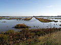 Paull Tidal Lagoon - geograph.org.uk - 570002.jpg 640 × 480; 120 KB
-
 Pea fields near Huggate - geograph.org.uk - 664027.jpg 640 × 480; 53 KB
-
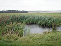 Pond along the Minster Way - geograph.org.uk - 664020.jpg 600 × 450; 107 KB
-
 Poplar Grange, Wyton - geograph.org.uk - 551269.jpg 467 × 640; 121 KB
-

-
 Ramer's Plantation, Woodhall Park - geograph.org.uk - 551290.jpg 640 × 480; 120 KB
-
 Red House Wyton.jpg 640 × 441; 103 KB
-
 Redcliff Sand - geograph.org.uk - 553594.jpg 640 × 480; 97 KB
-
 Reflections at Howden Marsh - geograph.org.uk - 555423.jpg 480 × 640; 135 KB
-
 Right side of the tracks - geograph.org.uk - 569221.jpg 495 × 640; 179 KB
-

-
 Saltend Power Station seen from Goxhill Haven.jpg 640 × 568; 110 KB
-
 Sand Martins' Nesting Holes - geograph.org.uk - 544025.jpg 640 × 427; 75 KB
-
 Sherwood Drive, Anlaby Common - geograph.org.uk - 563771.jpg 504 × 640; 151 KB
-
 Ship on the Humber - geograph.org.uk - 557100.jpg 640 × 480; 82 KB
-
 Site of Cottam Airfield.jpg 640 × 459; 86 KB
-
 Skirlaugh Road Old Ellerby.jpg 640 × 462; 81 KB
-
 Skirlaugh Road, Ellerby - geograph.org.uk - 551343.jpg 640 × 288; 42 KB
-

-
 Small Humber Lighthouse - geograph.org.uk - 570022.jpg 640 × 515; 103 KB
-
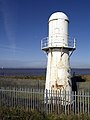 Small Lighthouse near Paull - geograph.org.uk - 570013.jpg 480 × 640; 114 KB
-
 South End, Withernwick - geograph.org.uk - 561098.jpg 640 × 480; 94 KB
-
 South of Thirtleby - geograph.org.uk - 551273.jpg 640 × 425; 109 KB
-
 Southern Yorkshire Wolds' Bridleway - geograph.org.uk - 565040.jpg 640 × 480; 113 KB
-
 Southfield House, Old Ellerby - geograph.org.uk - 551310.jpg 640 × 462; 91 KB
-
 Spacey Field, Coniston - geograph.org.uk - 551279.jpg 640 × 471; 105 KB
-
 Spacey Field, Coniston - geograph.org.uk - 551283.jpg 640 × 474; 79 KB
-
 Spot the other Moorhen - geograph.org.uk - 548201.jpg 480 × 640; 173 KB
-
 St Albans, Withernwick - geograph.org.uk - 561114.jpg 475 × 640; 98 KB
-
 St Albans, Withernwick.jpg 640 × 445; 69 KB
-
 St Augustine's Church, Skirlaugh - geograph.org.uk - 551353.jpg 487 × 640; 98 KB
-
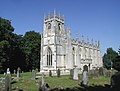 St Augustine's Church, Skirlaugh - geograph.org.uk - 551356.jpg 640 × 486; 84 KB
-
 St James Church, Old Ellerby.jpg 640 × 477; 124 KB
-
 St Mary's Church, Elloughton - geograph.org.uk - 570956.jpg 476 × 640; 93 KB
-

-
 Stubbly Field - geograph.org.uk - 548213.jpg 480 × 640; 80 KB
-
 Sunflower field - geograph.org.uk - 555436.jpg 480 × 640; 119 KB
-
 Swanbridge Veterinary Hospital - geograph.org.uk - 566845.jpg 640 × 427; 160 KB
-
 Swanland Dale - geograph.org.uk - 566871.jpg 640 × 513; 195 KB
-
 Swanland Primary School - geograph.org.uk - 542893.jpg 640 × 423; 207 KB
-
 Swanland sheep - geograph.org.uk - 566866.jpg 502 × 640; 200 KB
-
 The Beach above Hornsea - geograph.org.uk - 544009.jpg 640 × 427; 92 KB
-
 The Beach North of Hornsea - geograph.org.uk - 543994.jpg 640 × 480; 61 KB
-
 The Blue Bell, Old Ellerby - geograph.org.uk - 551315.jpg 640 × 450; 72 KB
-
 The bridleway from Wauldby Green - geograph.org.uk - 565074.jpg 640 × 480; 109 KB
-
 The bridleway to Wauldby Green - geograph.org.uk - 565058.jpg 640 × 480; 110 KB
-
 The bridleway to Wauldby Green - geograph.org.uk - 565071.jpg 640 × 480; 130 KB
-
 The Country Park Inn, Hessle - geograph.org.uk - 553608.jpg 640 × 480; 122 KB
-
 The Country Park Inn, Hessle - geograph.org.uk - 553622.jpg 640 × 480; 153 KB
-
 The First Groyne on Hornsea Beach - geograph.org.uk - 543960.jpg 640 × 480; 99 KB
-
 The Green, Brantingham - geograph.org.uk - 570937.jpg 640 × 479; 139 KB
-
 The Green, Old Ellerby - geograph.org.uk - 551296.jpg 454 × 640; 75 KB
-
 The Hudson Way - geograph.org.uk - 551345.jpg 480 × 640; 104 KB
-
 The Humber River Bank - geograph.org.uk - 570030.jpg 640 × 480; 178 KB
-
 The hundred year old shed - geograph.org.uk - 561258.jpg 640 × 493; 145 KB
-
 The Lodge, Town Street - geograph.org.uk - 1631732.jpg 640 × 480; 113 KB
-
 The Long and Winding Fence - geograph.org.uk - 551352.jpg 640 × 432; 98 KB
-
 The path through Dale Plantation - geograph.org.uk - 565123.jpg 640 × 480; 155 KB
-
 The road to North Newbald - geograph.org.uk - 551334.jpg 640 × 480; 49 KB
-
 The Rush - geograph.org.uk - 547843.jpg 480 × 640; 122 KB
-
 The stream in Welton - geograph.org.uk - 565146.jpg 640 × 480; 121 KB
-
 The Top Lock on the Pocklington Canal - geograph.org.uk - 548095.jpg 640 × 480; 112 KB
-
 The track down to Wauldby Scrogs - geograph.org.uk - 565056.jpg 640 × 480; 166 KB
-
 The track from Welton Dale to Welton - geograph.org.uk - 565144.jpg 640 × 480; 163 KB
-
 Thirtleby and Wyton Drain - geograph.org.uk - 551274.jpg 640 × 429; 108 KB
-
 Three Wolds' Pylons - geograph.org.uk - 551338.jpg 640 × 480; 69 KB
-

-
 Track over Elmswell Wold - geograph.org.uk - 565313.jpg 640 × 480; 104 KB
-
 Track through Millington Wood - geograph.org.uk - 555659.jpg 480 × 640; 113 KB


_-_geograph.org.uk_-_549120.jpg)


_-_geograph.org.uk_-_545397.jpg)


