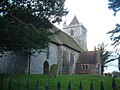
Category:St Augustine's Church, East Langdon
| Object location | | View all coordinates using: OpenStreetMap |
|---|
church in East Langdon, Kent, England, United Kingdom  | |||||
| Upload media | |||||
| Instance of | |||||
|---|---|---|---|---|---|
| Dedicated to | |||||
| Location | East Langdon, Langdon, Dover, Kent, South East England, England | ||||
| Diocese | |||||
| Heritage designation |
| ||||
| Religion or worldview | |||||
 | |||||
Media in category "St Augustine's Church, East Langdon"
The following 6 files are in this category, out of 6 total.
-
 Langdon's church - panoramio.jpg 1,000 × 690; 453 KB
-
 St Augustine's church - geograph.org.uk - 625159.jpg 480 × 640; 88 KB
-

-
 St Augustine's Church, East Langdon.jpg 640 × 480; 109 KB
-

-
 The porch of St Augustine's church - geograph.org.uk - 624994.jpg 480 × 640; 73 KB


