Category:Topographic maps of Isère
Departments of Metropolitan France: Ain [01] · Aisne [02] · Allier [03] · Alpes-de-Haute-Provence [04] · Hautes-Alpes [05] · Alpes-Maritimes [06] · Ardèche [07] · Ardennes [08] · Ariège [09] · Aube [10] · Aude [11] · Aveyron [12] · Bouches-du-Rhône [13] · Calvados [14] · Cantal [15] · Charente [16] · Charente-Maritime [17] · Cher [18] · Corrèze [19] · Corse-du-Sud [2A]† · Haute-Corse [2B]† · Côte-d’Or [21] · Côtes-d'Armor [22] · Creuse [23] · Dordogne [24] · Doubs [25] · Drôme [26] · Eure [27] · Eure-et-Loir [28] · Finistère [29] · Gard [30] · Haute-Garonne [31] · Gers [32] · Gironde [33] · Hérault [34] · Ille-et-Vilaine [35] · Indre [36] · Indre-et-Loire [37] · Isère [38] · Jura [39] · Landes [40] · Loir-et-Cher [41] · Loire [42] · Haute-Loire [43] · Loire-Atlantique [44] · Loiret [45] · Lot [46] · Lot-et-Garonne [47] · Lozère [48] · Maine-et-Loire [49] · Manche [50] · Marne [51] · Haute-Marne [52] · Mayenne [53] · Meurthe-et-Moselle [54] · Meuse [55] · Morbihan [56] · Moselle [57] · Nièvre [58] · Nord [59] · Oise [60] · Orne [61] · Pas-de-Calais [62] · Puy-de-Dôme [63] · Pyrénées-Atlantiques [64] · Hautes-Pyrénées [65] · Pyrénées-Orientales [66] · Bas-Rhin [67] · Haut-Rhin [68] · departmental district of the Rhône [69] · Haute-Saône [70] · Saône-et-Loire [71] · Sarthe [72] · Savoie [73] · Haute-Savoie [74] · Paris [75] · Seine-Maritime [76] · Seine-et-Marne [77] · Yvelines [78] · Deux-Sèvres [79] · Somme [80] · Tarn [81] · Tarn-et-Garonne [82] · Var [83] · Vaucluse [84] · Vendée [85] · Vienne [86] · Haute-Vienne [87] · Vosges [88] · Yonne [89] · Territoire de Belfort [90] · Essonne [91] · Hauts-de-Seine [92] · Seine-Saint-Denis [93] · Val-de-Marne [94] · Val-d'Oise [95]
Overseas departments and regions: Guadeloupe [971] · Martinique [972] · French Guiana [973] · Réunion [974] · Mayotte [976]
Overseas collectivities: Saint Pierre and Miquelon [975] · Saint Barthélemy [977] · Saint-Martin [978] · Wallis and Futuna [986] · French Polynesia [987]
Sui generis territories: New Caledonia [988]
Subcategories
This category has the following 4 subcategories, out of 4 total.
*
- Relief maps of Isère (3 F)
O
- Old topographic maps of Isère (18 F)
- Orthophotos of Isère (1 F)
Media in category "Topographic maps of Isère"
The following 56 files are in this category, out of 56 total.
-
 Isère carte géographique-Nord-Isère.svg 1,050 × 1,050; 588 KB
-
 Isère carte géographique.svg 1,050 × 1,050; 579 KB
-
 Isère department relief location map.jpeg 1,050 × 1,050; 412 KB
-
 Apprieu OSM 02.png 473 × 503; 266 KB
-
 Arandon-Passins OSM 02.png 638 × 691; 456 KB
-
 Autrans-meaudre-topographie.jpeg 1,653 × 2,338; 1.35 MB
-
 Barraux OSM 02.png 307 × 431; 319 KB
-
 Besse (Isère) OSM 02.png 341 × 455; 405 KB
-
 Bonnefamille OSM 02.png 464 × 408; 336 KB
-
 Bougé-Chambalud OSM 02.png 520 × 420; 301 KB
-
 Brion (Isère) OSM 02.png 407 × 580; 213 KB
-
 Carte Massif Devoluy.svg 1,025 × 1,176; 2.8 MB
-
 Charantonnay OSM 02.png 697 × 660; 370 KB
-
 Charavines OSM 02.png 818 × 1,278; 2.22 MB
-
 Chasse-sur-Rhône OSM 02.png 897 × 495; 444 KB
-
 Chonas-l'Amballan OSM 02.png 592 × 493; 393 KB
-
 Chuzelles OSM 02.png 344 × 487; 292 KB
-
 Corbelin (Isère) OSM 02.png 420 × 352; 271 KB
-
 Doissin OSM 02.png 339 × 394; 145 KB
-
 Eymeux OSM 02.png 960 × 708; 512 KB
-
 Four (Isère) OSM 02.png 361 × 516; 197 KB
-
 Frontonas OSM 02.png 1,244 × 994; 2.08 MB
-
 Heyrieux OSM 02.png 305 × 496; 156 KB
-
 La Motte-Saint-Martin OSM 02.png 281 × 437; 175 KB
-
 La Pierre OSM 02.png 853 × 799; 481 KB
-
 Laval-en-Belledonne OSM 02.png 843 × 515; 618 KB
-
 Le Péage-de-Roussillon OSM 02.png 720 × 696; 527 KB
-
 Malsanne (rivière).png 396 × 476; 264 KB
-
 Merlas OSM 02.png 589 × 487; 355 KB
-
 Monestier-de-Clermont OSM 02.png 208 × 464; 122 KB
-
 Monsteroux-Milieu OSM 02.png 671 × 773; 438 KB
-
 Mont-Saint-Martin (Isère) OSM 02.png 455 × 590; 731 KB
-
 Montbonnot-Saint-Martin OSM 02.png 571 × 593; 766 KB
-
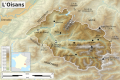 Oisans topographic map-fr.svg 1,953 × 1,302; 2.34 MB
-
 Pont-Évêque OSM 02.png 782 × 618; 444 KB
-
 Pontcharra OSM 02.png 395 × 581; 271 KB
-
 Saint-Antoine EM 1866 small.jpg 2,064 × 2,972; 8.1 MB
-
 Saint-Bernard (Isère) OSM 02.png 687 × 729; 679 KB
-
 Saint-Geoire-en-Valdaine OSM 02.png 411 × 452; 219 KB
-
 Saint-Guillaume (Isère) OSM 02.png 410 × 381; 191 KB
-
 Saint-Honoré (Isère) OSM 02.png 576 × 651; 449 KB
-
 Saint-Jean-le-Vieux (Isère) OSM 02.png 445 × 390; 419 KB
-
 Saint-Laurent-en-Beaumont OSM 02.png 907 × 572; 567 KB
-
 Saint-Marcellin (Isère) OSM 02.png 439 × 552; 292 KB
-
 Saint-Martin-d'Hères OSM 02.png 298 × 398; 165 KB
-
 Saint-Paul-d'Izeaux OSM 02.png 586 × 471; 443 KB
-
 Saint-Victor-de-Morestel OSM 02.png 443 × 539; 234 KB
-
 Saint-Égrève OSM 02.png 600 × 585; 948 KB
-
 Sarcenas OSM 02.png 777 × 730; 691 KB
-
 Serpaize OSM 02.png 946 × 601; 464 KB
-
 Seyssins OSM 02.png 794 × 573; 618 KB
-
 Vienne (Isère) OSM 02.png 529 × 582; 805 KB
-
 Villard-Notre-Dame OSM 02.png 255 × 504; 172 KB
-
 Voiron OSM 02.png 383 × 600; 633 KB
-
 Voreppe OSM 02.png 729 × 595; 575 KB
-
 Échirolles OSM 02.png 687 × 609; 542 KB


_OSM_02.png)


_OSM_02.png)


_OSM_02.png)


_OSM_02.png)


.png)


_OSM_02.png)


_OSM_02.png)

_OSM_02.png)
_OSM_02.png)
_OSM_02.png)

_OSM_02.png)


_OSM_02.png)


