Category:Travel maps of Michigan
States of the United States: Alabama · Alaska · Arizona · Arkansas · California · Colorado · Delaware · Florida · Georgia · Hawaii · Idaho · Illinois · Indiana · Iowa · Kansas · Kentucky · Louisiana · Maine · Maryland · Massachusetts · Michigan · Minnesota · Mississippi · Missouri · Montana · Nebraska · Nevada · New Hampshire · New Jersey · New Mexico · New York · North Carolina · North Dakota · Ohio · Oklahoma · Oregon · Pennsylvania · Rhode Island · South Carolina · South Dakota · Tennessee · Texas · Utah · Virginia · Washington · Wisconsin · Wyoming – Washington, D.C.
American Samoa · Guam · Northern Mariana Islands · Puerto Rico
American Samoa · Guam · Northern Mariana Islands · Puerto Rico
Subcategories
This category has only the following subcategory.
Media in category "Travel maps of Michigan"
The following 4 files are in this category, out of 4 total.
-
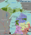 Michigan regions map (ru).png 1,736 × 2,000; 997 KB
-
 Michigan regions map.png 1,736 × 2,000; 1,014 KB
-
 Michigan regions map.svg 830 × 957; 1.94 MB
-
 The Street railway journal (1902) (14761229915).jpg 2,906 × 3,912; 835 KB
.png)


_(14761229915).jpg)