Category:Travel maps of New York (state)
States of the United States: Alabama · Alaska · Arizona · Arkansas · California · Colorado · Delaware · Florida · Georgia · Hawaii · Idaho · Illinois · Indiana · Iowa · Kansas · Kentucky · Louisiana · Maine · Maryland · Massachusetts · Michigan · Minnesota · Mississippi · Missouri · Montana · Nebraska · Nevada · New Hampshire · New Jersey · New Mexico · New York · North Carolina · North Dakota · Ohio · Oklahoma · Oregon · Pennsylvania · Rhode Island · South Carolina · South Dakota · Tennessee · Texas · Utah · Virginia · Washington · Wisconsin · Wyoming – Washington, D.C.
American Samoa · Guam · Northern Mariana Islands · Puerto Rico
American Samoa · Guam · Northern Mariana Islands · Puerto Rico
Subcategories
This category has the following 6 subcategories, out of 6 total.
Media in category "Travel maps of New York (state)"
The following 28 files are in this category, out of 28 total.
-
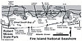 FireIslandNSMap.jpg 432 × 220; 43 KB
-
 Indian etourist visa.jpg 2,560 × 1,440; 2.3 MB
-
 Map - Apple Country NY.png 3,418 × 2,579; 1.21 MB
-
 Map - Apple Country NY.svg 805 × 607; 3.35 MB
-
 Map - Childs NY.png 1,709 × 1,504; 352 KB
-
 Map - Childs NY.svg 1,709 × 1,504; 1.13 MB
-
 Map - Clarence NY.png 3,000 × 4,017; 2.06 MB
-
 Map - Clarence NY.svg 1,235 × 1,653; 2.64 MB
-
 Map - Letchworth State Park - overview.png 2,400 × 2,100; 938 KB
-
 Map - Letchworth State Park - overview.svg 2,400 × 2,100; 1.55 MB
-
 Map - Monroe County NY.png 3,418 × 3,008; 1.62 MB
-
 Map - Monroe County NY.svg 3,418 × 3,008; 4.85 MB
-
 Map - Orleans County NY.png 3,418 × 3,008; 1.15 MB
-
 Map - Orleans County NY.svg 3,418 × 3,008; 3.66 MB
-
 Map - Palmyra NY 01.png 2,811 × 2,607; 1.06 MB
-
 Map - Palmyra NY 02.svg 1,171 × 1,086; 4.17 MB
-
 New York - Finger Lakes region map with road shields.png 2,640 × 2,320; 896 KB
-
 New York - Finger Lakes region map with road shields.svg 1,583 × 1,156; 803 KB
-
 New York - Major Routes map.png 2,959 × 2,252; 475 KB
-
 New York - Major Routes map.svg 633 × 476; 1.45 MB
-
 New York - Niagara Frontier region map.png 1,989 × 1,899; 582 KB
-
 New York - Niagara Frontier region map.svg 1,583 × 1,156; 758 KB
-
 New York regions map.png 3,218 × 2,428; 615 KB
-
 New York regions map.svg 633 × 476; 762 KB
-
 NY regions draft 2.png 851 × 639; 99 KB
-
 NY regions draft.png 1,144 × 859; 185 KB
-
 NY regions draft3.png 851 × 639; 99 KB
-
 Steuben County NY.jpg 765 × 746; 278 KB


