Category:United Kingdom photographs taken on 2008-01-03
Countries of Europe: Armenia‡ · Austria · Belgium · Bulgaria · Czech Republic · Denmark · Finland · France‡ · Germany · Greece · Republic of Ireland · Italy · Latvia · Netherlands‡ · Poland · Portugal‡ · Romania · Russia‡ · Serbia · Slovakia · Spain‡ · Turkey‡ · Ukraine · United Kingdom
‡: partly located in Europe
‡: partly located in Europe
| ← | 3 January 2008 | → | ||
| ← | January 2008 | → | ||

United Kingdom photographs taken on 3 January 2008.
Image files should be categorized here automatically using {{taken on}} template. Direct categorisation is also possible, if automatic is impossible.
Subcategories
This category has only the following subcategory.
Media in category "United Kingdom photographs taken on 2008-01-03"
The following 200 files are in this category, out of 582 total.
(previous page) (next page)-
 'M-F Ulysses' in Belfast (2) - geograph.org.uk - 647993.jpg 640 × 450; 55 KB
-
 'M-F Ulysses' in Belfast - geograph.org.uk - 647985.jpg 640 × 579; 90 KB
-
 'The Dancing Bear' Brimham Rocks - geograph.org.uk - 652589.jpg 480 × 640; 94 KB
-
 'The Turtle' Brimham Rocks - geograph.org.uk - 652594.jpg 446 × 640; 57 KB
-
 'Zhe Hai 128' in Belfast - geograph.org.uk - 648020.jpg 640 × 439; 51 KB
-
 A slightly snowy Bangor scene - geograph.org.uk - 648045.jpg 640 × 480; 86 KB
-

-
 Allendale Market Square - geograph.org.uk - 648716.jpg 640 × 424; 80 KB
-
 Allendale Town (2) - geograph.org.uk - 648759.jpg 640 × 423; 119 KB
-
 Allendale Town (3) - geograph.org.uk - 648866.jpg 640 × 480; 83 KB
-

-
 Allt Coire Sgoireadail - geograph.org.uk - 655232.jpg 640 × 480; 98 KB
-
 Alongside Harrogate Grammar School - geograph.org.uk - 648006.jpg 478 × 640; 327 KB
-
 Altnagelvin Junction.jpg 640 × 480; 134 KB
-
 Arable land - geograph.org.uk - 652333.jpg 640 × 480; 88 KB
-
 Arnison Terrace (2) - geograph.org.uk - 648712.jpg 640 × 480; 81 KB
-
 Austin A35 in Asterley - geograph.org.uk - 652357.jpg 640 × 480; 60 KB
-
 Avenue at Linley Hall - geograph.org.uk - 652490.jpg 640 × 480; 112 KB
-
 Barton Stacey - Bus Stop - geograph.org.uk - 647981.jpg 640 × 540; 152 KB
-
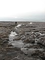
 Beach at Seasalter - geograph.org.uk - 647589.jpg 640 × 459; 116 KB
-
 Beeston Lads Club - 3rd Jan 08 - geograph.org.uk - 647533.jpg 640 × 427; 66 KB
-

-
 Boulderfield, Buidhe Bheinn - geograph.org.uk - 653502.jpg 640 × 480; 95 KB
-
 Brent Geese over Reculver oyster farm - geograph.org.uk - 647613.jpg 640 × 480; 66 KB
-
 Bridge End - geograph.org.uk - 648723.jpg 640 × 480; 119 KB
-
 Brimham Rocks - geograph.org.uk - 652593.jpg 640 × 480; 86 KB
-
 Broomhill Farm - geograph.org.uk - 648307.jpg 640 × 314; 53 KB
-
 Broomstair Bridge - geograph.org.uk - 797051.jpg 640 × 480; 112 KB
-
 BT management centre building - geograph.org.uk - 647746.jpg 640 × 480; 58 KB
-
 Buidhe Bheinn - East top - geograph.org.uk - 653849.jpg 640 × 480; 98 KB
-
 Buidhe Bheinn - geograph.org.uk - 653480.jpg 640 × 480; 92 KB
-
 Buidhe Bheinn - geograph.org.uk - 653716.jpg 640 × 480; 95 KB
-
 Buidhe Bheinn - geograph.org.uk - 653721.jpg 638 × 434; 87 KB
-
 Buidhe Bheinn - geograph.org.uk - 653732.jpg 640 × 480; 74 KB
-
 Buidhe Bheinn - geograph.org.uk - 653841.jpg 640 × 480; 80 KB
-
 Buidhe Bheinn - geograph.org.uk - 653858.jpg 640 × 359; 66 KB
-
 Bus shelter by the old A5 - geograph.org.uk - 648479.jpg 640 × 480; 83 KB
-
 Cadha nam Bò Ruadh - South top - geograph.org.uk - 654462.jpg 640 × 480; 81 KB
-
 Cae Howel - geograph.org.uk - 651583.jpg 640 × 480; 59 KB
-
 Cairn, Knee of Cairnsmore - geograph.org.uk - 654782.jpg 640 × 480; 53 KB
-
 Cairn, Roinn a'Roidh - geograph.org.uk - 911886.jpg 640 × 480; 104 KB
-
 Cairnsmore of Fleet path - geograph.org.uk - 652211.jpg 640 × 480; 80 KB
-
 Cairnsmore of Fleet, north side - geograph.org.uk - 654772.jpg 640 × 480; 56 KB
-
 Canal and Motorway - geograph.org.uk - 1117790.jpg 640 × 480; 116 KB
-
 Canal View - geograph.org.uk - 648312.jpg 640 × 480; 63 KB
-
 Cant Clough Farm - geograph.org.uk - 659261.jpg 640 × 427; 35 KB
-
 Chapel at White Grit - geograph.org.uk - 652401.jpg 640 × 480; 91 KB
-
 Cherry tree walk in snow - geograph.org.uk - 650168.jpg 640 × 478; 274 KB
-
 Chillington Junction - geograph.org.uk - 649181.jpg 640 × 480; 81 KB
-
 Chillington View - geograph.org.uk - 649222.jpg 640 × 480; 67 KB
-
 Coate Moor Plantation - geograph.org.uk - 651436.jpg 640 × 427; 117 KB
-
 Cobbled Path - geograph.org.uk - 797069.jpg 640 × 480; 155 KB
-
 Coire Lair - geograph.org.uk - 653737.jpg 640 × 480; 81 KB
-
 Common Moor - geograph.org.uk - 647797.jpg 640 × 480; 94 KB
-
 Cottage in Edgerley - geograph.org.uk - 651579.jpg 640 × 480; 120 KB
-
 Church at Cottam. (ruin) - geograph.org.uk - 1035872.jpg 640 × 480; 62 KB
-

-
 Crawley - Mowbray & Tussock corner - Bewbush - bike - panoramio.jpg 672 × 896; 291 KB
-
 Crawley - Mowbray & Tussock corner - Bewbush - panoramio.jpg 896 × 672; 151 KB
-
 Crawley - Town Centre - The Martlets - panoramio.jpg 896 × 672; 178 KB
-
 Crawley County Mall - panoramio - jeffwarder.jpg 896 × 672; 197 KB
-
 Crawley County Mall - panoramio.jpg 896 × 672; 211 KB
-
 Crawley night view from Tussock Close in Bewbush - panoramio.jpg 896 × 672; 173 KB
-
 St Paul's Church. - geograph.org.uk - 649793.jpg 640 × 480; 111 KB
-
 Curry's Bridge near Ballymena - geograph.org.uk - 647754.jpg 640 × 416; 102 KB
-
 Cycle path near Cynheidre - geograph.org.uk - 651944.jpg 640 × 480; 117 KB
-
 Dalkeith Park House in the snow - geograph.org.uk - 854808.jpg 640 × 480; 75 KB
-
 Day Three-zing - Flickr - Menage a Moi.jpg 2,592 × 1,944; 2.5 MB
-
 Bellingham Drove - geograph.org.uk - 647759.jpg 640 × 468; 54 KB
-
 Derelict farmhouse at Etherley.jpg 2,833 × 1,821; 1.41 MB
-
 Dock cranes, Belfast (1) - geograph.org.uk - 647997.jpg 640 × 630; 80 KB
-
 Dock cranes, Belfast (2) - geograph.org.uk - 648007.jpg 480 × 640; 52 KB
-
 Double Bridge - geograph.org.uk - 651310.jpg 640 × 398; 114 KB
-
 Drive to Hogstow Hall - geograph.org.uk - 652379.jpg 640 × 480; 89 KB
-
 Drumbreddan Bay - geograph.org.uk - 647514.jpg 640 × 480; 75 KB
-
 Drumbreddan Farm - geograph.org.uk - 647539.jpg 640 × 480; 59 KB
-
 Drury Lane Farm - geograph.org.uk - 652387.jpg 640 × 480; 62 KB
-
 Dry stone wall and Plum Trees adjacent to the Engine Pond.jpg 3,648 × 2,736; 2.29 MB
-
 Dyke, Buidhe Bheinn - geograph.org.uk - 654455.jpg 640 × 480; 62 KB
-
 East Looe valley at Trelaske - geograph.org.uk - 647791.jpg 640 × 480; 80 KB
-
 St. Michael's church, Edgton, Shropshire - geograph.org.uk - 652584.jpg 640 × 480; 107 KB
-
 Edinburgh Castle in winter - geograph.org.uk - 1302454.jpg 640 × 480; 55 KB
-
 Electricity sub-station at Oundle - geograph.org.uk - 647768.jpg 640 × 480; 76 KB
-
 Elgar walk - geograph.org.uk - 650147.jpg 640 × 478; 304 KB
-
 Ellel Grange Side Elevation - geograph.org.uk - 651828.jpg 640 × 564; 101 KB
-
 Entrance to the Blackett Level (2) - geograph.org.uk - 648742.jpg 640 × 480; 126 KB
-
 Entrance to the Valley Gardens - geograph.org.uk - 650149.jpg 640 × 478; 262 KB
-
 Etherley Railway Incline (Bridleway between Low Etherley and Greenfields).jpg 3,648 × 2,736; 2.82 MB
-
 Farmhouse and Bones Plantation - geograph.org.uk - 647529.jpg 640 × 480; 53 KB
-
 Farringdon Circle line anticlock.JPG 1,600 × 1,200; 623 KB
-
 Fence, Crammery Hill - geograph.org.uk - 654756.jpg 640 × 480; 104 KB
-
 Finchley Central roundel.JPG 1,600 × 1,200; 595 KB
-
 Five Roads Junction - geograph.org.uk - 651934.jpg 640 × 480; 63 KB
-

-

-
 Footpath alongside the River East Allen - geograph.org.uk - 648733.jpg 640 × 480; 149 KB
-
 Footpath by River Tame - geograph.org.uk - 1117765.jpg 640 × 480; 164 KB
-
 Footpath Junction - geograph.org.uk - 1012582.jpg 640 × 480; 176 KB
-
 Footpath signs, Kinloch Hourn - geograph.org.uk - 652739.jpg 480 × 640; 110 KB
-
 Footpath to Allenmills - geograph.org.uk - 648727.jpg 480 × 640; 150 KB
-
 Former gates to Sherborne House - geograph.org.uk - 650008.jpg 640 × 480; 104 KB
-
 Former track bed. South of the Engine Pond 1.jpg 3,648 × 2,736; 2.44 MB
-
 Foundations, Roseberry Ironstone Mine - geograph.org.uk - 651430.jpg 640 × 427; 98 KB
-
 Frosty Footpath - geograph.org.uk - 797059.jpg 640 × 480; 153 KB
-
 Frosty stones - geograph.org.uk - 654766.jpg 480 × 640; 128 KB
-

-

-
 Gritting the A823 - geograph.org.uk - 1399554.jpg 640 × 480; 49 KB
-
 Grounds of Sherborne House - geograph.org.uk - 650012.jpg 640 × 480; 103 KB
-
 Grwyn - Groyne - geograph.org.uk - 651564.jpg 640 × 428; 93 KB
-
 Grwyn - Groyne - geograph.org.uk - 651568.jpg 640 × 428; 74 KB
-

-
 Hailes Street under snow - geograph.org.uk - 1302451.jpg 640 × 480; 84 KB
-
 Half-timbered houses in Edgton - geograph.org.uk - 652585.jpg 640 × 480; 88 KB
-
-
 Victoria Avenue, Harrogate - geograph.org.uk - 647966.jpg 478 × 640; 298 KB
-
 Hasty Bank From Carr Ridge - geograph.org.uk - 651405.jpg 640 × 427; 79 KB
-
 Hereford cathedral 001.JPG 1,200 × 900; 379 KB
-
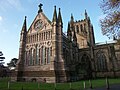 Hereford cathedral 002.JPG 1,200 × 900; 242 KB
-
 Hereford cathedral 003.JPG 1,200 × 900; 233 KB
-
 Hunting Bridge - geograph.org.uk - 648314.jpg 640 × 480; 56 KB
-
 Hurstwood Hall - geograph.org.uk - 1147691.jpg 640 × 427; 108 KB
-
 Ice polished rock - geograph.org.uk - 654662.jpg 640 × 480; 111 KB
-
 Icy path - geograph.org.uk - 654758.jpg 480 × 640; 93 KB
-
 Icy path - geograph.org.uk - 654761.jpg 480 × 640; 71 KB
-
 Incine fence south of the Engine Pond.jpg 3,648 × 2,736; 2.49 MB
-
 Iona Abbey Cloisters, Detail - geograph.org.uk - 654726.jpg 480 × 640; 81 KB
-
 Jump Jet on Chetwynd Barracks - geograph.org.uk - 647658.jpg 640 × 427; 41 KB
-
 Junction Bridge And Lock - geograph.org.uk - 651313.jpg 640 × 427; 101 KB
-
 Kirstead Hall in the snow - geograph.org.uk - 967594.jpg 640 × 480; 90 KB
-
 Lady House Farm - geograph.org.uk - 652386.jpg 640 × 480; 74 KB
-
 Langsett Reservoir north side tower - geograph.org.uk - 649349.jpg 640 × 480; 111 KB
-
 Leaning lamppost - geograph.org.uk - 647980.jpg 640 × 478; 239 KB
-
 Lettermay Burn - geograph.org.uk - 754874.jpg 640 × 480; 88 KB
-
 Library gardens - geograph.org.uk - 647962.jpg 640 × 478; 311 KB
-
 Loch Ba on Rannoch Moor in Winter - geograph.org.uk - 1060086.jpg 640 × 481; 56 KB
-

-

-
 Looking into the gloom - geograph.org.uk - 654780.jpg 640 × 480; 47 KB
-
 Lower Avenue Path - geograph.org.uk - 648306.jpg 640 × 480; 135 KB
-
 Lower Hattons Path - geograph.org.uk - 648315.jpg 480 × 640; 66 KB
-
 Ludlow Food Centre - geograph.org.uk - 652578.jpg 640 × 480; 66 KB
-
 M54Motorway2.jpg 640 × 480; 40 KB
-
 Manchester Road Bridge - geograph.org.uk - 1012625.jpg 640 × 480; 124 KB
-
 Manchester Road Bridge - geograph.org.uk - 797099.jpg 640 × 480; 105 KB
-
 Manchester Road Bridge - geograph.org.uk - 797105.jpg 640 × 480; 121 KB
-
 Meikle Mulltaggart - geograph.org.uk - 654778.jpg 640 × 480; 74 KB
-
 Minsterley Play Area - geograph.org.uk - 652367.jpg 640 × 480; 113 KB
-
 Minsterley sewage works - geograph.org.uk - 652363.jpg 640 × 283; 39 KB
-
 Montpellier - geograph.org.uk - 650162.jpg 478 × 640; 265 KB
-
 Moorland south west of Loch Niarsco - geograph.org.uk - 647667.jpg 640 × 425; 178 KB
-
 Moss Moor trig - geograph.org.uk - 652724.jpg 640 × 480; 66 KB
-
 Motorway over the Canal - geograph.org.uk - 797085.jpg 640 × 480; 127 KB
-
 Mount Farm - geograph.org.uk - 647645.jpg 640 × 480; 123 KB
-
 Moylgrove Parish Church - geograph.org.uk - 647637.jpg 640 × 481; 160 KB
-
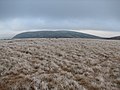
 Myndtown and The Long Mynd - geograph.org.uk - 652518.jpg 640 × 480; 42 KB
-
 Near summit of Beinn Odhar Bheag - geograph.org.uk - 791216.jpg 500 × 375; 51 KB
-
 New track to equestrian business - geograph.org.uk - 649634.jpg 640 × 480; 58 KB
-
 Nick of the Saddle - geograph.org.uk - 654776.jpg 480 × 640; 79 KB
-
 No 8 Bridge - geograph.org.uk - 648313.jpg 640 × 480; 81 KB
-
 North Fife Fields By The Tay - geograph.org.uk - 1399582.jpg 640 × 480; 63 KB
-
 North ridge of Buidhe Bheinn - geograph.org.uk - 653744.jpg 640 × 454; 71 KB
-
 North side of Buidhe Bheinn - geograph.org.uk - 653846.jpg 640 × 480; 75 KB
-
 Northern Sea Wall, Reculver - geograph.org.uk - 647609.jpg 640 × 480; 85 KB
-
 Oak trees, Cairnsmore - geograph.org.uk - 652207.jpg 640 × 480; 116 KB
-
 Oakridge Infant School - geograph.org.uk - 650004.jpg 640 × 463; 58 KB
-
 Oakridge Primary School - geograph.org.uk - 650006.jpg 640 × 458; 73 KB
-
 Oe-hnl (2163247194).jpg 1,600 × 979; 1.21 MB
-
 Old Farming Implement, Airyholme Farm - geograph.org.uk - 651409.jpg 640 × 427; 117 KB
-
 Old Midford Road, near Midford - geograph.org.uk - 647655.jpg 640 × 395; 70 KB
-
 Old Midford Road, near Midford - geograph.org.uk - 648153.jpg 640 × 479; 95 KB
-
 Old sluice gate near Ballymena - geograph.org.uk - 647801.jpg 640 × 418; 116 KB
-
 On Clieves Hill - geograph.org.uk - 649030.jpg 640 × 480; 78 KB
-
 One Stop - geograph.org.uk - 649996.jpg 640 × 450; 63 KB
-
 Otley Road - geograph.org.uk - 648000.jpg 478 × 640; 327 KB
-
 Outflow from Loch Niarsco - geograph.org.uk - 647689.jpg 640 × 425; 262 KB
-
 Over the plain - geograph.org.uk - 649039.jpg 640 × 480; 66 KB
-
 Over West Park stray - geograph.org.uk - 647995.jpg 640 × 478; 251 KB
-
 Park Hall Farm - geograph.org.uk - 647743.jpg 640 × 480; 73 KB
-
 Parke Farm - geograph.org.uk - 647630.jpg 640 × 480; 126 KB
-
 Parkland at Tedsmore Hall - geograph.org.uk - 647750.jpg 640 × 480; 101 KB
-
 Passing under the M54 - geograph.org.uk - 649083.jpg 640 × 480; 90 KB
-
 Pasture land south of Eardiston - geograph.org.uk - 647758.jpg 640 × 480; 91 KB
-

-
 Path on Bardrochwood Moor - geograph.org.uk - 654745.jpg 480 × 640; 70 KB
-
 Path on Crammery Hill - geograph.org.uk - 654752.jpg 640 × 480; 87 KB
-
 Path to Upper Hattons - geograph.org.uk - 649095.jpg 640 × 480; 72 KB
-
 Path's end - geograph.org.uk - 653507.jpg 640 × 480; 106 KB
-
 Peak Forest Canal - geograph.org.uk - 1012594.jpg 640 × 480; 127 KB
-
 Peak Forest Canal - geograph.org.uk - 1012604.jpg 640 × 480; 126 KB
-
 Peak Forest Canal - geograph.org.uk - 1012612.jpg 640 × 480; 134 KB
-
 Peak Forest Canal - geograph.org.uk - 1012618.jpg 640 × 606; 119 KB
-
 Peak Forest Canal - geograph.org.uk - 1117802.jpg 640 × 480; 117 KB
-
 Peak Forest Canal - geograph.org.uk - 1117806.jpg 640 × 480; 117 KB
-
 Peak Forest Canal - geograph.org.uk - 797076.jpg 640 × 480; 140 KB
-
 Peak Forest Canal - geograph.org.uk - 797091.jpg 640 × 480; 128 KB
-
 Pencnwch Bach Farm - geograph.org.uk - 647651.jpg 640 × 480; 122 KB
-
 Penygroes Chapel - geograph.org.uk - 647659.jpg 640 × 480; 79 KB
-
 Perched block, Buidhe Bheinn - geograph.org.uk - 653546.jpg 480 × 640; 108 KB
-
 Pillbox A110, Old Lodge Warren - geograph.org.uk - 648062.jpg 640 × 479; 143 KB
_-_geograph.org.uk_-_647993.jpg)


_-_geograph.org.uk_-_648759.jpg)
_-_geograph.org.uk_-_648866.jpg)


_-_geograph.org.uk_-_648712.jpg)


_-_geograph.org.uk_-_1035872.jpg)


_-_geograph.org.uk_-_647997.jpg)
_-_geograph.org.uk_-_648007.jpg)


_-_geograph.org.uk_-_648742.jpg)

.jpg)


_-_geograph.org.uk_-_648746.jpg)
_-_geograph.org.uk_-_648750.jpg)


.jpg)


_-_geograph.org.uk_-_648855.jpg)


