Category:United Kingdom photographs taken on 2008-01-04
Countries of Europe: Albania · Austria · Azerbaijan‡ · Belgium · Czech Republic · Denmark · France‡ · Georgia‡ · Germany · Hungary · Republic of Ireland · Italy · Latvia · Lithuania · Malta · Netherlands‡ · Poland · Portugal‡ · Romania · Russia‡ · Serbia · Spain‡ · Switzerland · Turkey‡ · Ukraine · United Kingdom
‡: partly located in Europe
‡: partly located in Europe
| ← | 4 January 2008 | → | ||
| ← | January 2008 | → | ||

United Kingdom photographs taken on 4 January 2008.
Image files should be categorized here automatically using {{taken on}} template. Direct categorisation is also possible, if automatic is impossible.
Subcategories
This category has the following 2 subcategories, out of 2 total.
E
Media in category "United Kingdom photographs taken on 2008-01-04"
The following 200 files are in this category, out of 493 total.
(previous page) (next page)-
 A pumping station - geograph.org.uk - 649239.jpg 640 × 427; 42 KB
-
 A Rare Drop Of Snow - geograph.org.uk - 649376.jpg 640 × 475; 65 KB
-
 A Snowy Scene - geograph.org.uk - 648672.jpg 640 × 426; 51 KB
-
 A Snowy Scene ^1 - geograph.org.uk - 648682.jpg 640 × 426; 85 KB
-
 A3124 at Southdown - geograph.org.uk - 655058.jpg 640 × 480; 62 KB
-
 A40 High Holborn - geograph.org.uk - 653625.jpg 640 × 480; 80 KB
-
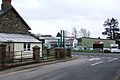
 Agincourt Square, Monmouth - geograph.org.uk - 649050.jpg 480 × 640; 94 KB
-
 Agincourt Street, Monmouth - geograph.org.uk - 649056.jpg 640 × 480; 70 KB
-
 Arrowsmith House, Gregson Lane - geograph.org.uk - 726913.jpg 640 × 497; 77 KB
-
 Asquith Avenue - geograph.org.uk - 648572.jpg 640 × 488; 33 KB
-
 Ballinshoe Castle - geograph.org.uk - 648625.jpg 640 × 425; 88 KB
-
 Baptist Church, Monmouth - geograph.org.uk - 648854.jpg 480 × 640; 98 KB
-

-
 Barn, High Bullen - geograph.org.uk - 656498.jpg 640 × 480; 75 KB
-
 Barton Stacey - BT repairing a phone line - geograph.org.uk - 648760.jpg 640 × 512; 144 KB
-
 Barton Stacey - Bus Stop (2) - geograph.org.uk - 648740.jpg 640 × 512; 122 KB
-
 Barton Stacey - The Start of Gravel Lane - geograph.org.uk - 648745.jpg 640 × 512; 117 KB
-
 Beaufort Arms, Raglan - geograph.org.uk - 648832.jpg 640 × 480; 53 KB
-
 Beeston Lads Club - 4th Jan 2008 - geograph.org.uk - 648415.jpg 640 × 427; 68 KB
-
 Blaikie's Hill in winter - geograph.org.uk - 649312.jpg 640 × 480; 112 KB
-
 Bleak mid-winter, Cranny, Omagh - geograph.org.uk - 648510.jpg 640 × 480; 81 KB
-
-
 Buckhurst Hill railway station - geograph.org.uk - 648768.jpg 640 × 441; 67 KB
-

-
 Buckhurst Hill, St John's Pond - geograph.org.uk - 648998.jpg 640 × 480; 92 KB
-
 Buckhurst Hill, Stradbroke Grove - geograph.org.uk - 648777.jpg 640 × 480; 68 KB
-
 Buckhurst Hill, Thornwood House - geograph.org.uk - 648798.jpg 640 × 480; 81 KB
-

-
 Bulk ore wagons, Isle of Grain - geograph.org.uk - 648322.jpg 640 × 480; 100 KB
-
 Busy Lock - geograph.org.uk - 651315.jpg 640 × 552; 107 KB
-
 Camowen River, Omagh - geograph.org.uk - 648454.jpg 640 × 268; 55 KB
-
 Carnegie Hall, Clashmore - geograph.org.uk - 648524.jpg 640 × 427; 52 KB
-

-
 Church Road - geograph.org.uk - 648430.jpg 640 × 480; 88 KB
-
 Church spire, Monmouth - geograph.org.uk - 649045.jpg 480 × 640; 52 KB
-
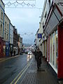
 Church Street - geograph.org.uk - 651292.jpg 427 × 640; 84 KB
-
 Church Street, Monmouth - geograph.org.uk - 649049.jpg 480 × 640; 62 KB
-
 Church Stretton Station - geograph.org.uk - 648829.jpg 640 × 474; 72 KB
-
 Churchyard of English Martyrs' Catholic Church, Whalley, Lancashire.jpg 640 × 480; 122 KB
-
 City Hall and ferris wheel - geograph.org.uk - 654645.jpg 640 × 466; 89 KB
-
 Commercial Road in Jarrow - geograph.org.uk - 1597956.jpg 640 × 480; 43 KB
-
 Cottage in the snow, Omagh - geograph.org.uk - 648446.jpg 640 × 264; 27 KB
-
 Cranny in the snow, Omagh - geograph.org.uk - 648451.jpg 640 × 377; 78 KB
-
 Cranny, Omagh - geograph.org.uk - 648473.jpg 640 × 299; 60 KB
-
 Crossroads Moira Rd - geograph.org.uk - 648990.jpg 640 × 426; 82 KB
-
 Deep Moor tip - geograph.org.uk - 658488.jpg 640 × 337; 58 KB
-
 Delve's Grave Cross - geograph.org.uk - 649208.jpg 640 × 480; 105 KB
-
 Desborough Sailing Club - geograph.org.uk - 648469.jpg 480 × 640; 97 KB
-
 Development of the Tube Works - geograph.org.uk - 648620.jpg 640 × 480; 101 KB
-
 Dodscott Brook - geograph.org.uk - 657425.jpg 640 × 480; 128 KB
-
 Dodscott Wood - geograph.org.uk - 656904.jpg 640 × 480; 121 KB
-
 Drumbane Level Crossing - geograph.org.uk - 649984.jpg 640 × 426; 80 KB
-
 Drumbane Road, Moira - geograph.org.uk - 649987.jpg 640 × 426; 90 KB
-
 Drumshangan - geograph.org.uk - 654787.jpg 640 × 480; 108 KB
-
 Dunchurch-Daventry Road - geograph.org.uk - 648466.jpg 640 × 480; 92 KB
-
 Dunchurch-Glebe Farm - geograph.org.uk - 648394.jpg 640 × 480; 62 KB
-

-
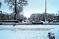
 Edinburgh skyline - geograph.org.uk - 648277.jpg 640 × 477; 72 KB
-
 Edinburgh skyline - geograph.org.uk - 648282.jpg 640 × 435; 67 KB
-
 Edinburgh Technopole in the snow - geograph.org.uk - 1576920.jpg 640 × 480; 67 KB
-
 Elm Corner, Seymour Hill - geograph.org.uk - 649994.jpg 640 × 426; 84 KB
-
 English Martyrs Catholic Church, Whalley - geograph.org.uk - 649912.jpg 640 × 480; 203 KB
-

-
 Entrance to Dodscott Wood - geograph.org.uk - 656874.jpg 640 × 480; 114 KB
-
 Entrance to Thamesport - geograph.org.uk - 648320.jpg 640 × 480; 60 KB
-
 Entrance to the O2 Vue - geograph.org.uk - 665915.jpg 426 × 640; 73 KB
-
 Eroded lane edge - geograph.org.uk - 656924.jpg 480 × 640; 131 KB
-
 Evans Halshaw - Whitehall Road - geograph.org.uk - 648623.jpg 640 × 401; 27 KB
-
 Farm buildings, Woolleigh Barton - geograph.org.uk - 648594.jpg 640 × 480; 84 KB
-
 Fenceline on Leitir Fhearna - geograph.org.uk - 716646.jpg 640 × 480; 69 KB
-
 Field above Blinsham Wood - geograph.org.uk - 655147.jpg 640 × 480; 97 KB
-
 Field at Southdown - geograph.org.uk - 655078.jpg 640 × 480; 113 KB
-
 Fields and Forest after a snowfall - geograph.org.uk - 648695.jpg 640 × 480; 281 KB
-
 Fields near Dodscott - geograph.org.uk - 657216.jpg 640 × 480; 102 KB
-
 Figurehead, Monmouth - geograph.org.uk - 649060.jpg 480 × 640; 63 KB
-
 Finkle Lane - Gildersome - geograph.org.uk - 648932.jpg 640 × 437; 30 KB
-
 Fly-tipping near Belle Vue Lodge - geograph.org.uk - 658510.jpg 480 × 640; 148 KB
-
 Footpath to Nether Scotch Hall - geograph.org.uk - 649891.jpg 640 × 480; 68 KB
-
 Footpath to Snowland - geograph.org.uk - 649936.jpg 640 × 480; 76 KB
-
 Frozen lochan, Druim Fada - geograph.org.uk - 656895.jpg 640 × 480; 41 KB
-
 Galashiels on a winter's night - geograph.org.uk - 758866.jpg 640 × 480; 45 KB
-
 Gates and straw - geograph.org.uk - 648662.jpg 640 × 338; 64 KB
-
 Georgian Villas, Omagh - geograph.org.uk - 648513.jpg 640 × 285; 43 KB
-
 Giant Redwood Tree, Abinger Common - geograph.org.uk - 648905.jpg 480 × 640; 69 KB
-
 Gildersome Arms - Asquith Avenue - geograph.org.uk - 648645.jpg 640 × 414; 27 KB
-

-
 Gildersome Cemetery - Church Street - geograph.org.uk - 648927.jpg 640 × 409; 34 KB
-
 Gildersome Library - Town Street - geograph.org.uk - 648922.jpg 640 × 378; 40 KB
-
 Gildersome Play Area - Town Street - geograph.org.uk - 648924.jpg 640 × 450; 42 KB
-
 Glenroan Mote - geograph.org.uk - 648758.jpg 640 × 330; 180 KB
-
 Global warming^ - geograph.org.uk - 659856.jpg 640 × 480; 92 KB
-
 Great Castle House, Monmouth - geograph.org.uk - 649064.jpg 640 × 480; 59 KB
-
 Great Tower, Monmouth Castle - geograph.org.uk - 649346.jpg 640 × 480; 87 KB
-
 Green lane to Delve's Grave Cross - geograph.org.uk - 658534.jpg 480 × 640; 118 KB
-
 Green lane to Higher Darracott - geograph.org.uk - 658522.jpg 480 × 640; 111 KB
-
 Green Line coach on finchley road.jpg 3,648 × 2,736; 4.18 MB
-
 Handbrake turns, Cranny, Omagh - geograph.org.uk - 648481.jpg 640 × 480; 63 KB
-
 Harpenden Town FC - geograph.org.uk - 651352.jpg 640 × 480; 61 KB
-
 Hauxwell Hall - geograph.org.uk - 652565.jpg 640 × 480; 133 KB
-
 Hauxwell Hall gatehouse. - geograph.org.uk - 652569.jpg 640 × 480; 110 KB
-
 Henry v Trefynwy.jpg 400 × 660; 109 KB
-
 Henry V, Shire Hall, Monmouth - geograph.org.uk - 649052.jpg 480 × 640; 88 KB
-
 Hereford Cathedral - geograph.org.uk - 649354.jpg 640 × 480; 80 KB
-
 High Bullen - geograph.org.uk - 656487.jpg 640 × 480; 59 KB
-
 High Bullen Garage - geograph.org.uk - 656701.jpg 640 × 429; 62 KB
-
 Higher Darracott - geograph.org.uk - 649227.jpg 640 × 452; 59 KB
-
 Home Farm Dairy, near Corscombe - geograph.org.uk - 648396.jpg 640 × 480; 72 KB
-
 House in Woodwater Lane - geograph.org.uk - 1111332.jpg 640 × 461; 74 KB
-
 Indian Bean Tree - geograph.org.uk - 648858.jpg 480 × 640; 71 KB
-
 Industrial unit near Halstock - geograph.org.uk - 648426.jpg 640 × 480; 49 KB
-

-
 Interior of St Cadog's Church, Raglan - geograph.org.uk - 648837.jpg 526 × 640; 75 KB
-
 John Lewis store Sheffield - geograph.org.uk - 654648.jpg 640 × 579; 118 KB
-

-
 Kingsway Cars, Dunmurry - geograph.org.uk - 650081.jpg 640 × 431; 84 KB
-
 Kingsway, Dunmurry - geograph.org.uk - 650067.jpg 640 × 426; 99 KB
-
 Kingsway, Dunmurry - geograph.org.uk - 650070.jpg 640 × 426; 90 KB
-
 Kingsway, Seymour Hill - geograph.org.uk - 650059.jpg 640 × 426; 100 KB
-
 Knockgreenan Avenue, Omagh - geograph.org.uk - 648434.jpg 640 × 267; 35 KB
-
 Ladhope Bank - geograph.org.uk - 649326.jpg 640 × 480; 116 KB
-
 Ladies football match Wonford - geograph.org.uk - 1111271.jpg 640 × 443; 77 KB
-

-
 Lane from Blinsham - geograph.org.uk - 655689.jpg 480 × 640; 153 KB
-
 Lane in Torridge valley - geograph.org.uk - 655159.jpg 579 × 640; 104 KB
-
 Lane junction near Torrington - geograph.org.uk - 649236.jpg 480 × 640; 79 KB
-
 Lane junction west of Kingscott - geograph.org.uk - 648772.jpg 640 × 480; 78 KB
-
 Lane near Dodscott Brook - geograph.org.uk - 658242.jpg 480 × 640; 110 KB
-
 Lane near Dodscott Wood - geograph.org.uk - 656920.jpg 640 × 480; 138 KB
-
 Lane near Dodscott Wood - geograph.org.uk - 656975.jpg 640 × 480; 128 KB
-
 Lane near Dodscott Wood - geograph.org.uk - 656987.jpg 480 × 640; 121 KB
-
 Lane past Blinsham Wood - geograph.org.uk - 655174.jpg 480 × 640; 110 KB
-
 Lane to Deep Moor - geograph.org.uk - 656514.jpg 640 × 412; 63 KB
-
 Larch Grove - geograph.org.uk - 655718.jpg 640 × 426; 105 KB
-
 Lawns Lane - geograph.org.uk - 648604.jpg 640 × 366; 34 KB
-

-
 Leek field on the Welsh border - geograph.org.uk - 649860.jpg 640 × 480; 112 KB
-
 Leighty Water - geograph.org.uk - 649024.jpg 640 × 423; 74 KB
-
 Little Water of Fleet - geograph.org.uk - 654796.jpg 480 × 640; 122 KB
-
 Loch Braighe Griomabhal - geograph.org.uk - 732693.jpg 480 × 640; 58 KB
-
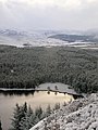
 Loch Kemp - geograph.org.uk - 718996.jpg 640 × 479; 55 KB
-
 Loch Kemp and lodge - geograph.org.uk - 718995.jpg 640 × 479; 52 KB
-
 Loch Pàiteag - geograph.org.uk - 718993.jpg 479 × 640; 64 KB
-
 Loch Uladail - geograph.org.uk - 734715.jpg 640 × 480; 52 KB
-
 Log piles in old quarry - geograph.org.uk - 655102.jpg 640 × 480; 123 KB
-
 Longwool sheep, Heronslake - geograph.org.uk - 655806.jpg 640 × 480; 103 KB
-
 Main Entrance, Seymour Hill - geograph.org.uk - 649190.jpg 640 × 426; 96 KB
-
 Marshy valley - geograph.org.uk - 648751.jpg 640 × 480; 324 KB
-
 McClay Park, Omagh - geograph.org.uk - 648436.jpg 640 × 259; 43 KB
-
 Mealisbhal - geograph.org.uk - 732509.jpg 640 × 480; 55 KB
-
 Meanders on the Woolleigh Brook - geograph.org.uk - 648764.jpg 480 × 640; 81 KB
-
 Medway Power Station, Isle of Grain - geograph.org.uk - 648321.jpg 640 × 456; 103 KB
-
 Melrose Abbey burial ground - geograph.org.uk - 698026.jpg 640 × 480; 137 KB
-
 Mill Eyot - geograph.org.uk - 648484.jpg 480 × 640; 62 KB
-
 Monmouth Castle Ruins - geograph.org.uk - 649343.jpg 640 × 480; 59 KB
-
 Monmouth Library - geograph.org.uk - 649042.jpg 640 × 488; 70 KB
-
 Monmouth Priory - geograph.org.uk - 648841.jpg 640 × 480; 95 KB
-

-
 Monnow Street, Monmouth - geograph.org.uk - 649059.jpg 480 × 640; 77 KB
-
 Mushroom Farm Ludwell Lane - geograph.org.uk - 1111291.jpg 640 × 465; 38 KB
-
 Nauticalia Figures - geograph.org.uk - 648512.jpg 640 × 499; 71 KB
-

-
 Nelson Forgeries - geograph.org.uk - 649352.jpg 480 × 640; 69 KB
-

-
 New Lane - Gildersome Lane - geograph.org.uk - 648937.jpg 640 × 428; 30 KB
-
 Oak trees in hedgerows - geograph.org.uk - 649652.jpg 640 × 479; 66 KB
-
 Oakland Way - geograph.org.uk - 655725.jpg 640 × 426; 81 KB
-
 Old Dee embankment - geograph.org.uk - 649826.jpg 640 × 480; 121 KB
-
 Old garage at High Bullen - geograph.org.uk - 649055.jpg 640 × 446; 65 KB
-

-
 Old Shepperton - geograph.org.uk - 648480.jpg 640 × 323; 52 KB
-
 Oldfleet Drain - geograph.org.uk - 649273.jpg 640 × 427; 81 KB
-
 Ospisdale House - geograph.org.uk - 648518.jpg 640 × 422; 87 KB
-
 Out door canteen - geograph.org.uk - 649923.jpg 640 × 480; 150 KB
-
 Outfall detail - geograph.org.uk - 652939.jpg 640 × 427; 55 KB
-
 Parkland Drive Exeter - geograph.org.uk - 1111308.jpg 640 × 451; 74 KB
-
 Pastures above Low Parkgates - geograph.org.uk - 649916.jpg 640 × 480; 81 KB
-
 Pastures above Park Gates Farm (2) - geograph.org.uk - 649913.jpg 640 × 480; 50 KB
-

-

-
 Pastures and track near The Spittal - geograph.org.uk - 649900.jpg 640 × 480; 107 KB
-

-
-

-
-
 Pastures near High Scotch Hall (2) - geograph.org.uk - 649856.jpg 640 × 480; 38 KB
-
 Pastures near High Scotch Hall (3) - geograph.org.uk - 649889.jpg 640 × 480; 35 KB
-
 Pastures near Park Gates Farm (2) - geograph.org.uk - 649896.jpg 640 × 480; 26 KB
-
 Peat bank - geograph.org.uk - 648391.jpg 640 × 480; 79 KB
-
 Pembroke Close - geograph.org.uk - 648570.jpg 640 × 421; 22 KB
-
 Pen in Torridge valley - geograph.org.uk - 655474.jpg 640 × 480; 102 KB
-
 Pipe line - geograph.org.uk - 649369.jpg 640 × 427; 72 KB
-
 Plantation in Warnscale Bottom - geograph.org.uk - 1081922.jpg 640 × 480; 49 KB
-
 Plantation near The Spittal (2) - geograph.org.uk - 649852.jpg 640 × 480; 43 KB
-
 Plantation near The Spittal (2) - geograph.org.uk - 649940.jpg 640 × 480; 96 KB
-
 Plaque on the Priory, Monmouth. - geograph.org.uk - 648844.jpg 480 × 640; 98 KB
-

-

-
 Pond at Home Farm, Weston, Dorset - geograph.org.uk - 648390.jpg 640 × 480; 105 KB
-
 Pond on a cold day - geograph.org.uk - 648691.jpg 640 × 323; 214 KB
-


_-_geograph.org.uk_-_648740.jpg)


_-_geograph.org.uk_-_649913.jpg)


_-_geograph.org.uk_-_649899.jpg)
_-_geograph.org.uk_-_649902.jpg)
_-_geograph.org.uk_-_649904.jpg)
_-_geograph.org.uk_-_649856.jpg)
_-_geograph.org.uk_-_649889.jpg)
_-_geograph.org.uk_-_649896.jpg)


_-_geograph.org.uk_-_649852.jpg)
_-_geograph.org.uk_-_649940.jpg)


