Category:Westnewton, Northumberland
village in Northumberland, United Kingdom  | |||||
| Upload media | |||||
| Instance of | |||||
|---|---|---|---|---|---|
| Location | Kirknewton, Northumberland, North East England, England | ||||
 | |||||
English: Category:Villages in Northumberland
Media in category "Westnewton, Northumberland"
The following 49 files are in this category, out of 49 total.
-
 And...^ - geograph.org.uk - 409728.jpg 640 × 480; 108 KB
-
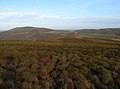
 Autumn Colours - geograph.org.uk - 269475.jpg 640 × 443; 54 KB
-
 Bales of it^ - geograph.org.uk - 158596.jpg 640 × 480; 75 KB
-
 Blackhaggs Rigg - geograph.org.uk - 269488.jpg 640 × 475; 58 KB
-
 Bowmont Water - geograph.org.uk - 410776.jpg 640 × 480; 86 KB
-
 Bridge over Elsdon Burn - geograph.org.uk - 1438704.jpg 640 × 478; 112 KB
-

-
 College Burn and Bowmont Water - geograph.org.uk - 152852.jpg 640 × 436; 167 KB
-
 College Valley - geograph.org.uk - 269478.jpg 640 × 485; 62 KB
-
 Dunsdale, Lambden Valley - geograph.org.uk - 766430.jpg 640 × 480; 60 KB
-
 Elsdon Valley - geograph.org.uk - 147911.jpg 640 × 464; 98 KB
-
 Fleehope - geograph.org.uk - 269494.jpg 640 × 455; 81 KB
-
 Lane to Hethpool - geograph.org.uk - 570864.jpg 640 × 480; 123 KB
-
 Looking east to Yeavering Bell - geograph.org.uk - 165368.jpg 640 × 464; 100 KB
-

-
 Minor road through Westnewton - geograph-3445955.jpg 4,550 × 3,378; 5.04 MB
-
 The Cheviot - geograph.org.uk - 246415.jpg 640 × 486; 65 KB
-
 View from Crookhouse - geograph.org.uk - 411244.jpg 640 × 480; 87 KB
-
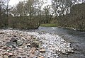
 Westnewton Burn - geograph.org.uk - 165372.jpg 640 × 509; 159 KB
-
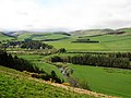
 Westnewton from the south-east - geograph.org.uk - 1739717.jpg 1,024 × 582; 141 KB
-
 Bellyside Burn Valley - geograph.org.uk - 486354.jpg 640 × 480; 100 KB
-
 Bizzle Crags - geograph.org.uk - 486342.jpg 640 × 480; 116 KB
-
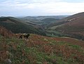
 Black Labrador - geograph.org.uk - 249279.jpg 640 × 545; 84 KB
-
 Bowmont Water - geograph.org.uk - 165374.jpg 640 × 456; 150 KB
-
 Building near Kirknewton - geograph.org.uk - 1514733.jpg 640 × 427; 184 KB
-
 Cairn - geograph.org.uk - 269533.jpg 640 × 479; 72 KB
-
 Cairn atop Great Hetha. - geograph.org.uk - 287287.jpg 640 × 427; 75 KB
-
 Cheviot Hills near Westnewton - geograph.org.uk - 411260.jpg 640 × 480; 115 KB
-
 Coldburn Farm, Lambden Valley - geograph.org.uk - 486252.jpg 640 × 425; 109 KB
-
 Coldburn Hill - geograph.org.uk - 390352.jpg 640 × 480; 90 KB
-
 College Valley - geograph.org.uk - 147895.jpg 640 × 461; 125 KB
-
 Dam in the burn - geograph.org.uk - 158604.jpg 640 × 480; 123 KB
-
 Dunsdale Crag, Lambden Valley - geograph.org.uk - 486268.jpg 640 × 480; 106 KB
-
 Dunsdale Farm in the Lambden Valley - geograph.org.uk - 486383.jpg 640 × 480; 99 KB
-
 Feral Goats on the side of Easter Tor - geograph.org.uk - 75761.jpg 640 × 480; 268 KB
-
 Forestry - geograph.org.uk - 147908.jpg 640 × 505; 110 KB
-
 From the slopes of Little Hetha - geograph.org.uk - 777708.jpg 640 × 480; 54 KB
-
 Great Hetha - geograph.org.uk - 147905.jpg 640 × 502; 97 KB
-
 Hare Law - geograph.org.uk - 246431.jpg 640 × 480; 69 KB
-
 Hetha Valley - geograph.org.uk - 147910.jpg 640 × 531; 135 KB
-
 July flora in the College Valley - geograph.org.uk - 486228.jpg 640 × 436; 110 KB
-
 Loft Hill - geograph.org.uk - 269530.jpg 640 × 541; 76 KB
-
 Newton Tors - geograph.org.uk - 246418.jpg 640 × 468; 61 KB
-
 Road to Goldscleugh - geograph.org.uk - 486320.jpg 640 × 480; 77 KB
-
 Summit cairn of Great Hetha - geograph.org.uk - 147902.jpg 640 × 515; 138 KB
-
 Summit Cairn, Loft Hill - geograph.org.uk - 269491.jpg 640 × 459; 81 KB
-
 Trowupburn. - geograph.org.uk - 147909.jpg 640 × 483; 97 KB
-
 Wester Tor - geograph.org.uk - 246426.jpg 640 × 480; 85 KB
-
 Which way to go^ - geograph.org.uk - 158617.jpg 640 × 480; 46 KB


