Commons:Wiki Loves Monuments in Switzerland/Basel-Landschaft/A-M
Aesch
| Location | Upload | Photo | Object | Cat. | Coordinates | KGS-Nr | |
|---|---|---|---|---|---|---|---|
| Aesch | 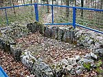
|
Dolmen von Aesch | A | 47°28′14″N 7°35′49″E / 47.470555555°N 7.596944444°E | 1371 | ||
| Aesch | 
|
Schloss Aesch | B | 47°27′57″N 7°35′57″E / 47.46575°N 7.59923°E | 1372 | ||
| Aesch | 
|
Schulanlage Neumatt, Sekundarschulhaus | A | 47°28′22″N 7°35′39″E / 47.472883°N 7.594035°E | 9014 | ||
| Aesch | 
|
Ruine Frohberg | B | 47°28′04″N 7°33′43″E / 47.46784°N 7.56197°E | 1373 | ||
| Aesch | 
|
Heimatmuseum Aesch | B | 47°27′57″N 7°35′55″E / 47.46583°N 7.5986°E | 12054 | ||
| Aesch | 
|
Frühmittelalterliches Gräberfeld Steinacker | B | 47°28′32″N 7°35′42″E / 47.47563°N 7.5949°E | 12053 | ||
| Aesch | 
|
Römische-katholische Pfarrkirche St. Joseph | B | 47°28′00″N 7°35′47″E / 47.46673°N 7.59647°E | 12055 | ||
| Aesch | 
|
Tannmatt / Leerenacker, römischer Gutshof | B | 47°28′28″N 7°34′52″E / 47.47439°N 7.58111°E | 1374 | ||
| Aesch | 
|
Wegkapelle | B | 47°28′15″N 7°35′50″E / 47.47095°N 7.59715°E | 12056 | ||
Allschwil
| Location | Upload | Photo | Object | Cat. | Coordinates | KGS-Nr | |
|---|---|---|---|---|---|---|---|
| Allschwil | 
|
Heimatmuseum Allschwil | B | 47°33′06″N 7°32′21″E / 47.55166°N 7.53904°E | 12058 | ||
| Allschwil | 
|
Alte evangelische-reformierte Kirche | B | 47°33′12″N 7°33′09″E / 47.5533°N 7.55249°E | 1376 | ||
| Allschwil | 
|
Christkatholische Pfarrkirche St. Peter und Paul | B | 47°33′02″N 7°32′08″E / 47.55053°N 7.53548°E | 1377 | ||
| Allschwil | 
|
Evangelische-reformierte Christuskirche | B | 47°33′13″N 7°33′10″E / 47.55348°N 7.5529°E | 12057 | ||
| Allschwil | 
|
Figurengruppe in der römische-katholische Kirche St. Peter und Paul | B | 47°33′09″N 7°32′23″E / 47.55255°N 7.53985°E | 12061 | ||
| Allschwil | 
|
Heimatmuseum | B | 47°33′06″N 7°32′21″E / 47.55169°N 7.53907°E | 1378 | ||
| Allschwil | 
|
Pfarrhaus (christkatholisches Pfarramt) | B | 47°33′05″N 7°32′07″E / 47.55135°N 7.53529°E | 12059 | ||
| Allschwil | 
|
Restaurant Landhuus | B | 47°33′04″N 7°32′13″E / 47.55112°N 7.53695°E | 12060 | ||
| Allschwil | 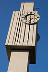
|
Röm.-kath. Kirche St. Peter und Paul | B | 47°33′09″N 7°32′23″E / 47.55255°N 7.53985°E | 9926 | ||
| Allschwil | 
|
Wohnhaus | B | 47°33′08″N 7°32′16″E / 47.55222°N 7.53789°E | 12062 | ||
| Allschwil | 
|
Wohnhaus (ehemaliges Doktorhuus) | B | 47°33′04″N 7°32′07″E / 47.551°N 7.53515°E | 12063 | ||
| Allschwil | 
|
Wohnhaus (ehemaliges Pfarrhaus) | B | 47°32′59″N 7°32′17″E / 47.54969°N 7.53799°E | 12064 | ||
| Allschwil | 
|
Allschwil | ISOS | 47°33′03″N 7°32′09″E / 47.550833333°N 7.535833333°E | |||
Anwil
| Location | Upload | Photo | Object | Cat. | Coordinates | KGS-Nr | |
|---|---|---|---|---|---|---|---|
| Anwil | 
|
Altes Dorfschulhaus | B | 47°27′05″N 7°56′24″E / 47.45135°N 7.93987°E | 12065 | ||
| Anwil | 
|
Dorfbrunnen | B | 47°27′02″N 7°56′28″E / 47.45047°N 7.94119°E | 12066 | ||
| Anwil | 
|
Wohnhaus | B | 47°27′09″N 7°56′22″E / 47.45253°N 7.93933°E | 12067 | ||
| Anwil | 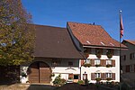
|
Anwil | ISOS | 47°27′03″N 7°56′29″E / 47.450833333°N 7.941388888°E | |||
Arboldswil
| Location | Upload | Photo | Object | Cat. | Coordinates | KGS-Nr | |
|---|---|---|---|---|---|---|---|
| Arboldswil | 
|
Prähistorische Höhensiedlung Kastelenfluh | B | 47°24′47″N 7°42′39″E / 47.413°N 7.71078°E | 12068 | ||
| Arboldswil | 
|
Wohnhaus | B | 47°25′01″N 7°42′58″E / 47.41695°N 7.7161°E | 12069 | ||
Arisdorf
| Location | Upload | Photo | Object | Cat. | Coordinates | KGS-Nr | |
|---|---|---|---|---|---|---|---|
| Arisdorf | 
|
Ehemalige Mühle | B | 47°30′51″N 7°45′46″E / 47.51414°N 7.7627°E | 12071 | ||
| Arisdorf | 
|
Ehemaliges Bauernhaus im Chrüz mit Linde | B | 47°30′11″N 7°45′53″E / 47.50299°N 7.76467°E | 12070 | ||
| Arisdorf | 
|
Geisspitz / Eileten, hallstattzeitliche Höhensiedlung | B | 47°30′30″N 7°47′06″E / 47.50823°N 7.78508°E | 9564 | ||
| Arisdorf | 
|
Heuschürli beim Baechhof | B | 47°30′28″N 7°46′38″E / 47.50765°N 7.77724°E | 12072 | ||
| Arisdorf | 
|
Reformiertes Pfarrhaus Arisdorf | B | 47°30′39″N 7°45′53″E / 47.51071°N 7.76475°E | 1382 | ||
| Arisdorf | 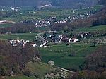
|
Arisdorf | ISOS | 47°30′46″N 7°45′54″E / 47.512777777°N 7.765°E | |||
Arlesheim
Augst
| Location | Upload | Photo | Object | Cat. | Coordinates | KGS-Nr | |
|---|---|---|---|---|---|---|---|
| Augst | 
|
Villa Clavel auf Castelen | A | 47°32′04″N 7°43′16″E / 47.53448°N 7.72124°E | 1393 | ||
| Augst | 
|
Augusta Raurica | A | 47°32′03″N 7°43′18″E / 47.534032°N 7.721728°E | 8469 | ||
| Augst | 
|
Staustufe Augst/Wyhlen | B | 47°32′14″N 7°42′27″E / 47.537277777°N 7.707555555°E | 9045 | ||
| Augst | 
|
Ehinger'sches Gut | B | 47°32′08″N 7°42′53″E / 47.53544°N 7.71466°E | 12078 | ||
| Augst | 
|
Gasthof Rössli | B | 47°32′09″N 7°43′07″E / 47.53572°N 7.7187°E | 1392 | ||
| Augst | 
|
Augusta Raurica | A | 47°31′59″N 7°43′20″E / 47.53319°N 7.72229°E | 1391 | ||
Bennwil
| Location | Upload | Photo | Object | Cat. | Coordinates | KGS-Nr | |
|---|---|---|---|---|---|---|---|
| Bennwil | 
|
Ötschberg, neolithische Siedlung | A | 47°24′43″N 7°46′14″E / 47.41204°N 7.77054°E | 9566 | ||
| Bennwil | 
|
Dorfmuseum Bennwil | B | 47°24′14″N 7°46′49″E / 47.40394°N 7.78034°E | 12267 | ||
| Bennwil | 
|
Bauernhaus | B | 47°24′16″N 7°46′53″E / 47.40456°N 7.78147°E | 9761 | ||
| Bennwil | 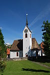
|
Evangelische-reformierte Kirche St. Martin | B | 47°24′09″N 7°46′48″E / 47.40259°N 7.78007°E | 12079 | ||
| Bennwil | 
|
Getreidespeicher | B | 47°24′19″N 7°46′57″E / 47.40526°N 7.78238°E | 12080 | ||
| Bennwil | 
|
Heuschürli Weihermatt | B | 47°24′32″N 7°47′22″E / 47.40897°N 7.7894°E | 12081 | ||
| Bennwil | 
|
Pfarrhaus (ev.-ref. Pfarramt) | B | 47°24′08″N 7°46′50″E / 47.40228°N 7.78049°E | 12082 | ||
| Bennwil | 
|
Römischer Gutshof, frühmittelalterliche Kirche | B | 47°24′09″N 7°46′48″E / 47.40257°N 7.78°E | 12083 | ||
| Bennwil | 
|
Bennwil | ISOS | 47°24′11″N 7°46′48″E / 47.40317°N 7.77987°E | |||
Biel-Benken
| Location | Upload | Photo | Object | Cat. | Coordinates | KGS-Nr | |
|---|---|---|---|---|---|---|---|
| Biel-Benken | 
|
Benken, reformierte Kirche und Pfarrhaus | B | 47°30′15″N 7°31′08″E / 47.50422°N 7.51879°E | 1395 | ||
| Biel-Benken | 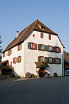
|
Mühle | B | 47°30′19″N 7°30′54″E / 47.50526°N 7.51501°E | 12084 | ||
Binningen
Birsfelden
| Location | Upload | Photo | Object | Cat. | Coordinates | KGS-Nr | |
|---|---|---|---|---|---|---|---|
| Birsfelden | 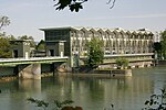
|
Kraftwerk Birsfelden | A+ISOS | 47°33′38″N 7°37′33″E / 47.560555555°N 7.625833333°E | 1401 | ||
| Birsfelden | 
|
Römisch-katholische Kirche Bruder Klaus | A | 47°33′06″N 7°37′33″E / 47.55163°N 7.62591°E | 9730 | ||
| Birsfelden | 
|
Sternenfeld, Teil der spätrömischen Rheinbefestigung | A | 47°33′24″N 7°38′21″E / 47.55669°N 7.63925°E | 11656 | ||
| Birsfelden | 
|
Birsfelder Museum | B | 47°33′19″N 7°37′29″E / 47.55515°N 7.62464°E | 12269 | ||
Blauen
| Location | Upload | Photo | Object | Cat. | Coordinates | KGS-Nr | |
|---|---|---|---|---|---|---|---|
| Blauen | 
|
Guter Brunnen | B | 47°27′01″N 7°31′08″E / 47.45026°N 7.51887°E | 12090 | ||
| Blauen | 
|
Römische-katholische Kirche | B | 47°27′03″N 7°31′05″E / 47.45071°N 7.51792°E | 1402 | ||
| Blauen | 
|
St. Wendelins-Kapelle | B | 47°26′49″N 7°32′31″E / 47.44704°N 7.54191°E | 12091 | ||
Böckten
| Location | Upload | Photo | Object | Cat. | Coordinates | KGS-Nr | |
|---|---|---|---|---|---|---|---|
| Böckten | 
|
Bauernhaus | B | 47°27′45″N 7°50′06″E / 47.46255°N 7.83504°E | 9762 | ||
| Böckten | 
|
Bauernhaus | B | 47°27′44″N 7°50′07″E / 47.46232°N 7.8352°E | 12092 | ||
| Böckten | 
|
Geschäftshaus | B | 47°27′46″N 7°50′09″E / 47.4628°N 7.83595°E | 12093 | ||
Bottmingen
| Location | Upload | Photo | Object | Cat. | Coordinates | KGS-Nr | |
|---|---|---|---|---|---|---|---|
| Bottmingen | 
|
Dorfmuseum Bottmingen | B | 47°31′21″N 7°34′14″E / 47.52262°N 7.57066°E | 12095 | ||
| Bottmingen | 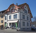
|
Cafe Streuli | B | 47°31′24″N 7°34′17″E / 47.5232°N 7.57129°E | 12094 | ||
| Bottmingen | 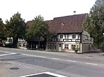
|
Dorfmuseum, Gemeindestube | B | 47°31′22″N 7°34′14″E / 47.52265°N 7.5706°E | 12096 | ||
| Bottmingen | 
|
Ehemaliges Schulhaus | B | 47°31′22″N 7°34′15″E / 47.52282°N 7.57086°E | 12097 | ||
| Bottmingen | 
|
Schulhaus Hämisgarten | B | 47°31′19″N 7°34′20″E / 47.52197°N 7.57225°E | 1404 | ||
| Bottmingen | 
|
Schloss Bottmingen | A | 47°31′25″N 7°34′13″E / 47.52360278°N 7.57034722°E | 1403 | ||
Bretzwil
| Location | Upload | Photo | Object | Cat. | Coordinates | KGS-Nr | |
|---|---|---|---|---|---|---|---|
| Bretzwil | 
|
Ruine Ramstein | B | 47°23′25″N 7°39′15″E / 47.39018°N 7.65424°E | 12098 | ||
| Bretzwil | 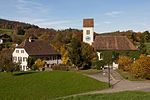
|
Evangelische-reformierte Kirche | B | 47°23′54″N 7°39′17″E / 47.39832°N 7.65482°E | 1405 | ||
| Bretzwil | 
|
Evangelisches-reformiertes Pfarrhaus mit Nebengebäude | B | 47°23′54″N 7°39′16″E / 47.39831°N 7.65438°E | 12099 | ||
Brislach
| Location | Upload | Photo | Object | Cat. | Coordinates | KGS-Nr | |
|---|---|---|---|---|---|---|---|
| Brislach | 
|
Kohlerhöhle, paläolithische Wohnhöhle | A | 47°25′55″N 7°34′06″E / 47.43205°N 7.56827°E | 1406 | ||
| Brislach | 
|
Römische-katholische Fiechtenhof-Kapelle | B | 47°24′43″N 7°31′35″E / 47.41194°N 7.52627°E | 1407 | ||
Bubendorf
| Location | Upload | Photo | Object | Cat. | Coordinates | KGS-Nr | |
|---|---|---|---|---|---|---|---|
| Bubendorf | 
|
Ruine Gutenfels | B | 47°25′22″N 7°43′36″E / 47.42267°N 7.72674°E | 12100 | ||
| Bubendorf | 
|
Krippen- und Spielzeugmuseum | B | 47°26′58″N 7°44′12″E / 47.44944°N 7.73673°E | 12305 | ||
| Bubendorf | 
|
Ehemaliger Dinghof | B | 47°27′03″N 7°44′10″E / 47.45081°N 7.73603°E | 1411 | ||
| Bubendorf | 
|
Evangelisches-reformiertes Pfarrhaus | B | 47°27′00″N 7°44′07″E / 47.44996°N 7.73527°E | 1413 | ||
| Bubendorf | 
|
Hofgut Beuggenweid | B | 47°26′18″N 7°43′34″E / 47.43841°N 7.72602°E | 1412 | ||
| Bubendorf | 
|
Hotel Bad Bubendorf | B | 47°27′35″N 7°44′32″E / 47.45978°N 7.74212°E | 1409 | ||
| Bubendorf | 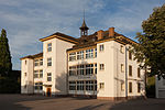
|
Schulhaus | B | 47°26′58″N 7°44′13″E / 47.44936°N 7.73682°E | 1414 | ||
| Bubendorf | 
|
Afghanistan-Institut | B | 47°27′09″N 7°44′12″E / 47.45261°N 7.73657°E | 12101 | ||
| Bubendorf | 
|
Schloss Wildenstein | A | 47°25′49″N 7°44′09″E / 47.43015°N 7.73582°E | 1408 | ||
Burg im Leimental
| Location | Upload | Photo | Object | Cat. | Coordinates | KGS-Nr | |
|---|---|---|---|---|---|---|---|
| Burg im Leimental | 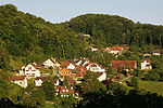
|
Burg im Leimental | ISOS | 47°26′59″N 7°26′00″E / 47.449722222°N 7.433333333°E | |||
| Burg im Leimental | 
|
Ruine Alt-Biederthal | B | 47°27′22″N 7°26′11″E / 47.45605°N 7.43636°E | 12104 | ||
| Burg im Leimental | 
|
Burgruine Schönenberg | B | 47°27′24″N 7°26′17″E / 47.45658°N 7.438°E | 12103 | ||
| Burg im Leimental | 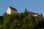
|
Schloss Burg | A | 47°27′24″N 7°26′26″E / 47.45676°N 7.44063°E | 1415 | ||
Buus
| Location | Upload | Photo | Object | Cat. | Coordinates | KGS-Nr | |
|---|---|---|---|---|---|---|---|
| Buus | 
|
Buus | ISOS | 47°30′19″N 7°51′52″E / 47.505277777°N 7.864444444°E | |||
| Buus | 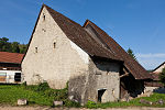
|
Ständerhaus | A | 47°30′16″N 7°51′53″E / 47.50433°N 7.86459°E | 1418 | ||
| Buus | 
|
Evangelische-reformierte Kirche | B | 47°30′21″N 7°51′59″E / 47.50587°N 7.86635°E | 12105 | ||
| Buus | 
|
Evangelisches-reformiertes Pfarrhaus | B | 47°30′22″N 7°51′57″E / 47.50614°N 7.86582°E | 1417 | ||
Diegten
| Location | Upload | Photo | Object | Cat. | Coordinates | KGS-Nr | |
|---|---|---|---|---|---|---|---|
| Diegten | 
|
Burg Ränggen | B | 47°23′36″N 7°48′24″E / 47.39331°N 7.80658°E | 12106 | ||
| Diegten | 
|
Evangelische-reformierte Kirche | B | 47°24′56″N 7°48′40″E / 47.41557°N 7.81103°E | 1419 | ||
| Diegten | 
|
Evangelisches-reformiertes Pfarrhaus mit Scheune | B | 47°24′52″N 7°48′41″E / 47.4145°N 7.81137°E | 12107 | ||
Dittingen
| Location | Upload | Photo | Object | Cat. | Coordinates | KGS-Nr | |
|---|---|---|---|---|---|---|---|
| Dittingen | 
|
Römische-katholische Kirche St. Nikolaus | B | 47°26′32″N 7°29′46″E / 47.44218°N 7.49615°E | 12108 | ||
| Dittingen | 
|
Steinzeitliche Faunafundstelle Schachleten | B | 47°25′43″N 7°29′44″E / 47.42868°N 7.49561°E | 12109 | ||
Duggingen
| Location | Upload | Photo | Object | Cat. | Coordinates | KGS-Nr | |
|---|---|---|---|---|---|---|---|
| Duggingen | 
|
Burg Bärenfels | B | 47°27′48″N 7°36′50″E / 47.46338°N 7.61383°E | 1421 | ||
| Duggingen | 
|
Schloss Angenstein | A+ISOS | 47°27′48″N 7°36′18″E / 47.4633°N 7.60487°E | 1420 | ||
Eptingen
| Location | Upload | Photo | Object | Cat. | Coordinates | KGS-Nr | |
|---|---|---|---|---|---|---|---|
| Eptingen | 
|
August-Suter-Museum | B | 47°23′10″N 7°49′08″E / 47.38615°N 7.81894°E | 12307 | ||
| Eptingen | 
|
Alte Mühle mit Schopf | B | 47°23′09″N 7°49′14″E / 47.38575°N 7.82065°E | 12110 | ||
| Eptingen | 
|
Burg Witwald | B | 47°23′32″N 7°49′11″E / 47.39228°N 7.81981°E | 12111 | ||
| Eptingen | 
|
Burgruine Alt-Wildeptingen, Schanz | B | 47°23′25″N 7°49′21″E / 47.39029°N 7.82246°E | 1424 | ||
| Eptingen | 
|
Höhlenburg Riedfluh | B | 47°23′29″N 7°48′35″E / 47.39132°N 7.80974°E | 1423 | ||
Ettingen
| Location | Upload | Photo | Object | Cat. | Coordinates | KGS-Nr | |
|---|---|---|---|---|---|---|---|
| Ettingen | 
|
Ruine Fürstenstein | B | 47°28′04″N 7°31′50″E / 47.46771°N 7.53067°E | 12112 | ||
| Ettingen | 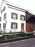
|
Dorfmuseum Ettingen | B | 47°28′45″N 7°32′39″E / 47.47928°N 7.54425°E | 12308 | ||
| Ettingen | 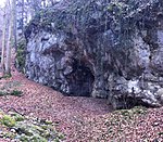
|
Höhle Büttenloch | B | 47°28′38″N 7°32′24″E / 47.47723°N 7.54011°E | 12113 | ||
| Ettingen | 
|
Siedlungswüstung Rinelfingen | B | 47°28′35″N 7°31′53″E / 47.47634°N 7.53148°E | 12114 | ||
| Ettingen | 
|
Wölbäcker Rinelfingen | B | 47°28′16″N 7°31′59″E / 47.47111°N 7.53307°E | 12115 | ||
Frenkendorf
| Location | Upload | Photo | Object | Cat. | Coordinates | KGS-Nr | |
|---|---|---|---|---|---|---|---|
| Frenkendorf | 
|
Hülften-Denkmal | B | 47°30′46″N 7°42′56″E / 47.51291°N 7.71563°E | 12116 | ||
| Frenkendorf | 
|
Ruine Alt-Schauenburg | B | 47°29′45″N 7°40′23″E / 47.4957°N 7.6731°E | 1426 | ||
| Frenkendorf | 
|
Ortsmuseum Frenkendorf | B | 12309 | |||
| Frenkendorf | 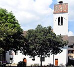
|
Evangelische-reformierte Kirche St. Margaretha | B | 47°30′10″N 7°42′52″E / 47.50285°N 7.71443°E | 12117 | ||
| Frenkendorf | 
|
Pavillon in Burgruine Neu-Schauenburg | B | 47°30′02″N 7°40′57″E / 47.50053°N 7.68248°E | 1427 | ||
| Frenkendorf | 
|
Sammlung moderner Kunst in der Villa Sacher zum Schönenberg | B | 47°30′34″N 7°42′29″E / 47.50952°N 7.70809°E | 12118 | ||
| Frenkendorf | 
|
Schauenburgfluh, gallorömischer Vierecktempel | B | 47°29′58″N 7°40′36″E / 47.49951°N 7.67659°E | 1429 | ||
| Frenkendorf | 
|
Kulturlandschaft Röserental | ISOS | 47°30′04″N 7°41′32″E / 47.501°N 7.6921°E | |||
Füllinsdorf
| Location | Upload | Photo | Object | Cat. | Coordinates | KGS-Nr | |
|---|---|---|---|---|---|---|---|
| Füllinsdorf | 
|
Ruine Altenberg | B | 47°30′34″N 7°44′23″E / 47.50953°N 7.73982°E | 12119 | ||
| Füllinsdorf | 
|
Römische Wasserleitung | B | 47°31′16″N 7°43′28″E / 47.52099°N 7.72434°E | 1430 | ||
| Füllinsdorf | 
|
Wohnhaus und Brunnen | B | 47°30′24″N 7°43′48″E / 47.50664°N 7.72987°E | 12120 | ||
Gelterkinden
Giebenach
| Location | Upload | Photo | Object | Cat. | Coordinates | KGS-Nr | |
|---|---|---|---|---|---|---|---|
| Giebenach | 
|
Bauernhaus | B | 47°31′28″N 7°44′53″E / 47.52437°N 7.748°E | 12130 | ||
Grellingen
| Location | Upload | Photo | Object | Cat. | Coordinates | KGS-Nr | |
|---|---|---|---|---|---|---|---|
| Grellingen | 
|
Mittelsteinzeitlicher Felsschirm, Wachtfelsen | B | 47°26′24″N 7°34′20″E / 47.44005°N 7.57212°E | 12132 | ||
| Grellingen | 
|
Primarschulhaus | B | 47°26′31″N 7°35′23″E / 47.44196°N 7.58983°E | 12131 | ||
| Grellingen | 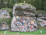
|
Wachtfelsen | B | 47°26′17″N 7°34′16″E / 47.43802°N 7.57117°E | 1436 | ||
Hölstein
| Location | Upload | Photo | Object | Cat. | Coordinates | KGS-Nr | |
|---|---|---|---|---|---|---|---|
| Hölstein | 
|
Gasthof Rössli mit Schopf | B | 47°25′38″N 7°46′17″E / 47.42723°N 7.77146°E | 12133 | ||
| Hölstein | 
|
Herrensitz Neuhaus | B | 47°25′37″N 7°46′18″E / 47.4269°N 7.77159°E | 1438 | ||
Itingen
| Location | Upload | Photo | Object | Cat. | Coordinates | KGS-Nr | |
|---|---|---|---|---|---|---|---|
| Itingen | 
|
Itingen | ISOS | 47°27′53″N 7°47′05″E / 47.46482°N 7.78478°E | |||
| Itingen | 
|
Wohnhaus | B | 47°28′00″N 7°47′03″E / 47.46663°N 7.78429°E | 12135 | ||
| Itingen | 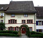
|
Wohnhaus | B | 47°27′57″N 7°47′03″E / 47.46596°N 7.78426°E | 12134 | ||
Känerkinden
| Location | Upload | Photo | Object | Cat. | Coordinates | KGS-Nr | |
|---|---|---|---|---|---|---|---|
| Känerkinden | 
|
Walter Eglin Museum | B | 47°24′42″N 7°50′09″E / 47.41157°N 7.83575°E | 12310 | ||
| Känerkinden | 
|
Untervogthaus | B | 47°24′41″N 7°50′07″E / 47.41131°N 7.83538°E | 12136 | ||
Kilchberg
| Location | Upload | Photo | Object | Cat. | Coordinates | KGS-Nr | |
|---|---|---|---|---|---|---|---|
| Kilchberg | 
|
Kilchberg | ISOS | 47°25′32″N 7°53′55″E / 47.425555555°N 7.898611111°E | |||
| Kilchberg | 
|
Kirche St. Martin | A | 47°25′33″N 7°53′55″E / 47.42585°N 7.89872°E | 1440 | ||
| Kilchberg | 
|
Bauernhaus | B | 47°25′35″N 7°53′53″E / 47.42629°N 7.89799°E | 12137 | ||
| Kilchberg | 
|
Evangelisches-reformiertes Pfarrhaus | B | 47°25′34″N 7°53′54″E / 47.4261°N 7.89844°E | 11663 | ||
Lampenberg
| Location | Upload | Photo | Object | Cat. | Coordinates | KGS-Nr | |
|---|---|---|---|---|---|---|---|
| Lampenberg | 
|
Stälzer, neolithische Silexabbaustelle / Silexschlagplatz | A | 47°25′35″N 7°44′41″E / 47.4265°N 7.74479°E | 9567 | ||
Langenbruck
| Location | Upload | Photo | Object | Cat. | Coordinates | KGS-Nr | |
|---|---|---|---|---|---|---|---|
| Langenbruck | 
|
Kloster Schönthal | ISOS | 47°21′09″N 7°46′15″E / 47.3524°N 7.77076°E | |||
| Langenbruck | [[File:|150x150px|Dürsteltal, mittelalterlicher Bergbau]] | Dürsteltal, mittelalterlicher Bergbau | A | 47°21′13″N 7°46′58″E / 47.353535°N 7.78275°E | 9568 | ||
| Langenbruck | 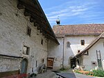
|
Ehemaliges Benediktinerkloster Schönthal | B | 47°21′34″N 7°46′24″E / 47.35954°N 7.7732°E | 1441 | ||
| Langenbruck | 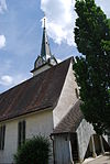
|
Evangelische-reformierte Kirche | B | 47°20′56″N 7°46′02″E / 47.34893°N 7.76725°E | 12138 | ||
| Langenbruck | 
|
Evangelische-reformierte Pfarrhaus | B | 47°20′56″N 7°46′04″E / 47.34877°N 7.76777°E | 12139 | ||
| Langenbruck | 
|
Landhaus Bilsteinfluh | B | 47°21′51″N 7°44′39″E / 47.36427°N 7.74427°E | 10711 | ||
| Langenbruck | 
|
Speicher aus Holz | B | 47°20′21″N 7°47′17″E / 47.33913°N 7.78794°E | 12140 | ||
Läufelfingen
| Location | Upload | Photo | Object | Cat. | Coordinates | KGS-Nr | |
|---|---|---|---|---|---|---|---|
| Läufelfingen | 
|
Ruine Homburg | A | 47°24′11″N 7°51′18″E / 47.402947°N 7.855006°E | 1443 | ||
| Läufelfingen | 
|
Evangelische-reformierte Kirche mit Pfarrhaus und Sigristenhaus | B | 47°23′52″N 7°51′34″E / 47.3979°N 7.85946°E | 1444 | ||
Laufen
| Location | Upload | Photo | Object | Cat. | Coordinates | KGS-Nr | |
|---|---|---|---|---|---|---|---|
| Laufen | 
|
Laufen | ISOS | 47°25′00″N 7°30′00″E / 47.416666666°N 7.5°E | |||
| Laufen | 
|
Christkatholische Kirche St. Katharina | A | 47°25′23″N 7°30′01″E / 47.42303°N 7.50019°E | 1447 | ||
| Laufen | 
|
Museum Laufental | B | 47°25′23″N 7°29′59″E / 47.42293°N 7.49965°E | 12141 | ||
| Laufen | 
|
Neolithisches Steinkistengrab | B | 47°25′24″N 7°30′01″E / 47.42329°N 7.50025°E | 1445 | ||
| Laufen | 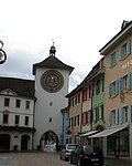
|
Rathaus mit Obertor | B | 47°25′16″N 7°30′03″E / 47.42105°N 7.50071°E | 12142 | ||
| Laufen | 
|
Ringmauer mit Toren | B | 47°25′23″N 7°30′02″E / 47.42312°N 7.50054°E | 12143 | ||
| Laufen | 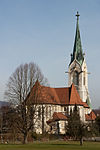
|
Römische-katholische Herz-Jesu-Kirche | B | 47°25′16″N 7°29′53″E / 47.42113°N 7.49806°E | 9933 | ||
| Laufen | 
|
Römische-katholische Kapelle St. Martin | B | 47°25′01″N 7°30′12″E / 47.41686°N 7.50343°E | 1449 | ||
| Laufen | 
|
Stadthaus mit Brunnen | B | 47°25′15″N 7°30′01″E / 47.42081°N 7.50025°E | 12144 | ||
Lausen
| Location | Upload | Photo | Object | Cat. | Coordinates | KGS-Nr | |
|---|---|---|---|---|---|---|---|
| Lausen | 
|
Lausen | ISOS | 47°28′21″N 7°45′35″E / 47.4725°N 7.759722222°E | |||
| Lausen | 
|
Ortsmuseum Lausen | B | 47°28′36″N 7°45′25″E / 47.47659°N 7.75685°E | 12311 | ||
| Lausen | 
|
Ehemalige Papiermühle | B | 47°28′18″N 7°45′47″E / 47.47176°N 7.76309°E | 1452 | ||
| Lausen | 
|
Evangelische-reformierte Kirche mit Sigristenhaus | B | 47°28′35″N 7°45′26″E / 47.47652°N 7.75727°E | 1453 | ||
| Lausen | 
|
Mühleanlage mit Kleinkraftwerk | B | 47°28′20″N 7°45′44″E / 47.4721°N 7.76225°E | 12145 | ||
| Lausen | 
|
Bettenach | A | 47°28′36″N 7°45′26″E / 47.476666666°N 7.757222222°E | 1451 | ||
Lauwil
| Location | Upload | Photo | Object | Cat. | Coordinates | KGS-Nr | |
|---|---|---|---|---|---|---|---|
| Lauwil | 
|
Hofgut Lauwilberg | B | 47°23′04″N 7°40′09″E / 47.38431°N 7.66906°E | 12146 | ||
Liedertswil
| Location | Upload | Photo | Object | Cat. | Coordinates | KGS-Nr | |
|---|---|---|---|---|---|---|---|
| Liedertswil | 
|
Bauernhaus Niederhof | B | 47°23′32″N 7°43′30″E / 47.39212°N 7.72506°E | 12147 | ||
Liesberg
| Location | Upload | Photo | Object | Cat. | Coordinates | KGS-Nr | |
|---|---|---|---|---|---|---|---|
| Liesberg | 
|
Ortsmuseum Liesberg | B | 47°24′11″N 7°25′41″E / 47.40293°N 7.42793°E | 12312 | ||
| Liesberg | 
|
Abri Grubenbalm und weitere Höhlen und Abris | B | 47°23′48″N 7°26′10″E / 47.39668°N 7.43624°E | 12150 | ||
| Liesberg | 
|
Birsbrücken bei der Cementfabrik | B | 47°24′06″N 7°26′33″E / 47.40172°N 7.4426°E | 12148 | ||
| Liesberg | 
|
Liesberg-Höhle | B | 47°23′45″N 7°26′17″E / 47.39587°N 7.43796°E | 12149 | ||
Liestal
Maisprach
| Location | Upload | Photo | Object | Cat. | Coordinates | KGS-Nr | |
|---|---|---|---|---|---|---|---|
| Maisprach | 
|
Maisprach | ISOS | 47°31′28″N 7°50′45″E / 47.524444444°N 7.845833333°E | |||
| Maisprach | 
|
Mühle | A | 47°31′22″N 7°50′50″E / 47.52288°N 7.84718°E | 1473 | ||
| Maisprach | 
|
Alte Fabrik (Uhrensteinfabrik) | B | 47°31′22″N 7°50′52″E / 47.52284°N 7.84769°E | 12159 | ||
| Maisprach | 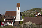
|
Reformierte Kirche mit ehemaligem Beinhaus | B | 47°31′30″N 7°50′38″E / 47.52495°N 7.84387°E | 1474 | ||
Münchenstein
Muttenz
| Location | Upload | Photo | Object | Cat. | Coordinates | KGS-Nr | |
|---|---|---|---|---|---|---|---|
| Muttenz | 
|
Muttenz | ISOS | 47°31′29″N 7°38′57″E / 47.52481°N 7.64905°E | |||
| Muttenz | 
|
Freidorf | A+ISOS | 47°32′13″N 7°37′42″E / 47.536944444°N 7.628333333°E | 1483 | ||
| Muttenz | 
|
Karl Jauslin-Sammlung | B | 47°31′29″N 7°38′50″E / 47.5246°N 7.64735°E | 12167 | ||
| Muttenz | 
|
Ruine Hinterer Wartenberg | B | 47°31′05″N 7°39′15″E / 47.51799°N 7.6541°E | 12170 | ||
| Muttenz | 
|
Ruine Mittlerer Wartenberg | B | 47°31′08″N 7°39′17″E / 47.51898°N 7.65477°E | 12169 | ||
| Muttenz | 
|
Ruine Vorderer Wartenberg | B | 47°31′17″N 7°39′30″E / 47.5215°N 7.65823°E | 1486 | ||
| Muttenz | [[File:|150x150px|Kunsthaus Baselland]] | Kunsthaus Baselland | B | 47°32′27″N 7°37′23″E / 47.54089°N 7.62319°E | 12315 | ||
| Muttenz | 
|
Au-Hard, Teil der spätrömischen Rheinbefestigung | A | 47°32′23″N 7°39′30″E / 47.53984°N 7.65831°E | 11676 | ||
| Muttenz | 
|
Rangierbahnhof, Hauptdienstgebäude | A | 47°32′03″N 7°38′51″E / 47.53416°N 7.64749°E | 1485 | ||
| Muttenz | 
|
Wehrkirche St. Arbogast | A | 47°31′20″N 7°38′44″E / 47.52231°N 7.64553°E | 1484 | ||
| Muttenz | 
|
Bauernhausmuseum | B | 47°31′18″N 7°38′45″E / 47.52156°N 7.64572°E | 12165 | ||
| Muttenz | 
|
Gemeindearchiv Muttenz | B | 47°31′22″N 7°38′44″E / 47.52269°N 7.64566°E | 10571 | ||
| Muttenz | [[File:|150x150px|Ortsmuseum Muttenz]] | Ortsmuseum Muttenz | B | 47°31′29″N 7°38′50″E / 47.5246°N 7.64729°E | 12316 | ||
| Muttenz | 
|
Bahnhof Muttenz | B | 47°32′01″N 7°38′53″E / 47.53359°N 7.64799°E | 12164 | ||
| Muttenz | 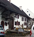
|
Bauernhausmuseum | B | 47°31′18″N 7°38′45″E / 47.52158°N 7.64576°E | 12166 | ||
| Muttenz | 
|
Evangelisches-reformiertes Pfarrhaus | B | 47°31′23″N 7°38′41″E / 47.523°N 7.64479°E | 12168 | ||
| Muttenz | 
|
Gemeindezentrum Mittenza | B | 47°31′23″N 7°38′44″E / 47.52295°N 7.64554°E | 9936 | ||
| Muttenz | 
|
Römisch-katholisches Kirchgemeindezentrum Johannes Maria Vianney | B | 47°31′44″N 7°38′25″E / 47.5289°N 7.64017°E | 14813 | ||
