Commons:Wiki Loves Monuments in Switzerland/Obwalden
← Wiki Loves Monuments 2019 in Switzerland

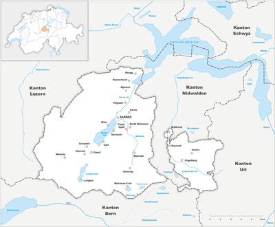
The list of cultural heritage of the Canton Obwalden offers an overview of directories of objects under protection of cultural property in the municipalities of the canton of Obwalden. The directories contain cultural asset of national and regional.
Objects of A and B category and Swiss Heritage Sites. The lists are sorted by municipality:
| Location | Upload | Photo | Object | Cat. | Coordinates | KGS-Nr | |
|---|---|---|---|---|---|---|---|
| Alpnach | Pilatusbahn | Pilatusbahn | A | 46°57′20″N 8°16′37″E / 46.955556°N 8.276944°E | 9742 | ||
| Alpnach | 
|
Uechteren, römischer Gutshof | A | 46°56′06″N 8°16′02″E / 46.935042°N 8.267291°E | 4244 | ||
| Alpnach | 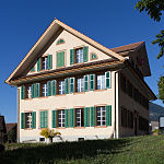
|
Altes Schulhaus, sogenannter Schlosshof, Alpnach Dorf (1839) | B | 46°56′26″N 8°16′24″E / 46.94058°N 8.273242°E | 12265 | ||
| Alpnach | 
|
Bahnhof Alpnachstad (1889) mit Lokremise (dislozierter Teil des 1. Luzerner Bahnhofs 1859) | B | 46°57′18″N 8°16′40″E / 46.955021°N 8.277749°E | 12276 | ||
| Alpnach | 
|
Beinhaus St. Michael, Alpnach Dorf (1501, barock umgebaut) | B | 46°56′27″N 8°16′23″E / 46.940762°N 8.273035°E | 12264 | ||
| Alpnach | 
|
Hotel Pilatus-Kulm, Alpnachstad (1890) | B | 46°58′46″N 8°15′13″E / 46.979529°N 8.253634°E | 12277 | ||
| Alpnach | 
|
Kapelle St. Josef, Alpnachstad (Barockbau 1702) | B | 46°57′13″N 8°16′35″E / 46.953692°N 8.276257°E | 12272 | ||
| Alpnach | 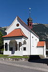
|
Kapelle St. Theodul, Schoried (Barockbau 1711) | B | 46°56′01″N 8°15′19″E / 46.933721°N 8.255314°E | 4241 | ||
| Alpnach | 
|
Majorenhaus, Alpnachstad (ca. 1863) | B | 46°57′18″N 8°16′37″E / 46.954875°N 8.276893°E | 12275 | ||
| Alpnach | 
|
Pfarrhaus, Alpnach Dorf (ca.1680) | B | 46°56′26″N 8°16′26″E / 46.940602°N 8.273912°E | 12271 | ||
| Alpnach | 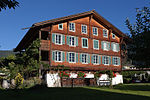
|
Schönenbühlhaus, Schoried (2. Hälfte 16. Jh.) | B | 46°56′05″N 8°15′15″E / 46.934762°N 8.254201°E | 4243 | ||
| Alpnach | 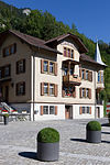
|
Verwaltungsgebäude Pilatusbahn, Alpnachstad (1897) | B | 46°57′20″N 8°16′39″E / 46.95564°N 8.27747°E | 12273 | ||
| Alpnach | 
|
Verwaltungsgebäude Pilatusbahn, Alpnachstad (1897) | B | 46°57′20″N 8°16′39″E / 46.9556°N 8.27744°E | 12274 | ||
| Engelberg | 
|
Kloster Engelberg, Stiftsarchiv | A | 46°49′14″N 8°24′33″E / 46.820578°N 8.409202°E | 8914 | ||
| Engelberg | 
|
Stiftsbibliothek Engelberg | A | 46°49′14″N 8°24′33″E / 46.820578°N 8.409202°E | 9306 | ||
| Engelberg | 
|
Tal Museum Engelberg | B | 46°49′17″N 8°24′27″E / 46.82145°N 8.4076°E | 12278 | ||
| Engelberg | 
|
Herrenhaus in Grafenort mit Gartenpavillon | A | 46°52′11″N 8°22′18″E / 46.869774°N 8.371721°E | 4249 | ||
| Engelberg | 
|
Kapelle Heilig Kreuz | A | 46°52′11″N 8°22′23″E / 46.869637°N 8.373057°E | 4250 | ||
| Engelberg | 
|
Sammlung Benediktinerkloster | A | 46°49′14″N 8°24′33″E / 46.820578°N 8.409202°E | 8550 | ||
| Engelberg | 
|
Bauernhaus, Dellenstein (ca. 1500) | B | 46°48′57″N 8°25′42″E / 46.81583°N 8.428216°E | 12279 | ||
| Engelberg | 
|
Beinhaus vor Klosterkirche (1608, spätgotisch) | B | 46°49′16″N 8°24′32″E / 46.821033°N 8.408916°E | 4246 | ||
| Engelberg | 
|
Haus Bahnhofstrasse 11 (Chalet Cattani), (1904) | B | 46°49′12″N 8°24′09″E / 46.819901°N 8.402369°E | 4248 | ||
| Engelberg | 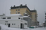
|
Hotel Europäischer Hof mit Kursaal (ehem. Festsaal des Hotels), (1902) | B | 46°49′14″N 8°24′09″E / 46.820475°N 8.402602°E | 12280 | ||
| Engelberg | 
|
Kapelle St. Jakob im Espen (an der Dorfzufahrt), (1648) | B | 46°49′12″N 8°23′36″E / 46.820085°N 8.393304°E | 4251 | ||
| Engelberg | 
|
Kraftwerk Obermatt (1905) | B | 46°50′32″N 8°22′26″E / 46.842231°N 8.373978°E | 12281 | ||
| Engelberg | 
|
Marienkapelle im Holz (1716) | B | 46°49′03″N 8°25′33″E / 46.81756°N 8.425758°E | 4252 | ||
| Engelberg | 
|
Marienkapelle im Horbis («Am Ende der Welt«), (Chor 1490, Schiff 1635) | B | 46°49′53″N 8°25′54″E / 46.831453°N 8.4316495°E | 4253 | ||
| Engelberg | 
|
Wappenhaus (Talmuseum), (1787) | B | 46°49′17″N 8°24′27″E / 46.821423°N 8.407547°E | 4254 | ||
| Engelberg | Kloster Engelberg | Kloster Engelberg | A | 46°49′14″N 8°24′35″E / 46.820555555°N 8.409722222°E | 4247 | ||
| Giswil | 
|
Rudenz | ISOS | 46°49′57″N 8°11′01″E / 46.8324°N 8.18357°E | |||
| Giswil | 
|
Bauernhaus, Diechtigen, Grossteil (1811) | B | 46°51′19″N 8°09′53″E / 46.855311°N 8.164809°E | 4255 | ||
| Giswil | 
|
Bauernhaus, Grossteil (1625) | B | 46°51′07″N 8°10′04″E / 46.851981°N 8.167898°E | 4257 | ||
| Giswil | 
|
Kapelle St. Antonius von Padua, Kleinteil (1667) | B | 46°49′56″N 8°09′21″E / 46.832348°N 8.155743°E | 12284 | ||
| Giswil | 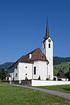
|
Kirche Grossteil (1844) | B | 46°50′46″N 8°10′00″E / 46.846222°N 8.166679°E | 4258 | ||
| Giswil | 
|
Pfarrkirche St. Laurentius (1635) mit Beinhaus (1661) und Pfarrhaus (1737) | B | 46°49′54″N 8°10′43″E / 46.831662°N 8.178672°E | 4259 | ||
| Giswil | 
|
Speicher, Ei, Grossteil (1634) | B | 46°50′21″N 8°10′16″E / 46.839051°N 8.171118°E | 4256 | ||
| Giswil | 
|
Turmruine Rosenberg, Kleinteil (13. Jh.) | B | 46°49′55″N 8°09′20″E / 46.83208°N 8.155477°E | 4261 | ||
| Giswil | 
|
Wohnhaus Spechtsbrenden, Grossteil (1480) | B | 46°50′51″N 8°10′24″E / 46.847618835°N 8.173384701°E | 12285 | ||
| Giswil | 
|
Burgruine Rudenz | B | 46°49′57″N 8°11′04″E / 46.832416°N 8.184423°E | 4260 | ||
| Kanton Obwalden | 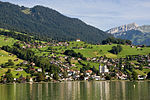
|
Sarnen | ISOS | 46°53′49″N 8°14′49″E / 46.896944444°N 8.246944444°E | |||
| Kanton Obwalden | 
|
Lungern | ISOS | 46°47′14″N 8°09′35″E / 46.787222222°N 8.159722222°E | |||
| Kanton Obwalden | 
|
Sachseln | ISOS | 46°52′04″N 8°14′19″E / 46.867777777°N 8.238611111°E | |||
| Kerns | 
|
Bauernhaus im Huwel | A | 46°54′13″N 8°16′27″E / 46.903704°N 8.27429°E | 4266 | ||
| Kerns | 
|
Bauernhof in der Grosshostett | A | 46°53′21″N 8°17′48″E / 46.889155°N 8.296567°E | 4263 | ||
| Kerns | 
|
Frühneuzeitliche Verhüttungsanlage Melchtal | A | 46°50′24″N 8°16′49″E / 46.840032°N 8.28025°E | 9648 | ||
| Kerns | 
|
Kapelle St. Nikolaus | A | 46°52′12″N 8°16′44″E / 46.87009°N 8.278752°E | 4264 | ||
| Kerns | 
|
Melchsee Frutt, Müllerenhütte, mittelalterlich/neuzeitliche Alpwüstung | A | 46°46′28″N 8°16′48″E / 46.774365°N 8.279879°E | 9647 | ||
| Kerns | 
|
Bauernhaus (Mitte 17. Jh.) mit Ökonomiegebäude, Buechischwand, Melchtal, (ca. 1800) | B | 46°50′52″N 8°17′59″E / 46.847726°N 8.299782°E | 4269 | ||
| Kerns | 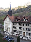
|
Benedikinerinnenkloster Melchtal mit Krankenhaus St. Leonhard und Friedhofskapelle (1882-96) | B | 46°50′01″N 8°17′22″E / 46.833699°N 8.289346°E | 12286 | ||
| Kerns | 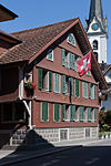
|
Gasthaus Rose (1640) | B | 46°54′05″N 8°16′32″E / 46.90128°N 8.275427°E | 12287 | ||
| Kerns | 
|
Grosshaus Halten, Bauernhaus (1598) | B | 46°53′49″N 8°17′29″E / 46.897006°N 8.291306°E | 4262 | ||
| Kerns | 
|
Kapelle Siebeneich (1722) | B | 46°55′01″N 8°16′45″E / 46.916879°N 8.279097°E | 4267 | ||
| Kerns | 
|
Kapelle St. Katharina in Wisserlen (Barockbau 1642) | B | 46°54′38″N 8°17′47″E / 46.910544°N 8.296325°E | 4268 | ||
| Kerns | 
|
Möslikapelle mit Eremitenzelle des Bruders Ulrich, (1484) | B | 46°51′59″N 8°16′24″E / 46.866526°N 8.273378°E | 4272 | ||
| Kerns | 
|
Pfarrkirche St. Gallus (1761, Chor und Turm wieder aufgebaut 1816) mit Beinhaus (1768) | B | 46°54′07″N 8°16′33″E / 46.901969°N 8.275845°E | 4273 | ||
| Kerns | 
|
St. Antonikapelle, Halten (1640) | B | 46°53′53″N 8°17′32″E / 46.89798°N 8.292188°E | 4274 | ||
| Kerns | 
|
Steinhaus (ca. 1530) | B | 46°54′02″N 8°16′31″E / 46.900669803°N 8.275181658°E | 4275 | ||
| Kerns | 
|
Wallfahrtskirche Maria (1928), Melchtal | B | 46°50′06″N 8°17′22″E / 46.83503°N 8.289354°E | 4276 | ||
| Kerns | 
|
Wohnhaus Röthlin (1838) | B | 46°54′05″N 8°16′26″E / 46.90139°N 8.273841°E | 12288 | ||
| Lungern | 
|
Obsee | ISOS | 46°46′57″N 8°09′08″E / 46.7826°N 8.15209°E | |||
| Lungern | 
|
Bauernhaus mit Dörrhaus,Feld, Obsee (1711) | B | 46°46′54″N 8°09′09″E / 46.781543°N 8.152369°E | 12290 | ||
| Lungern | 
|
Alter Kirchturm, Dorfeingang (spätrom. Turm der alten Kirche, 1275) | B | 46°47′27″N 8°09′45″E / 46.79088°N 8.162434°E | 4278 | ||
| Lungern | 
|
Kapelle St. Antonius von Padua und St. Wendelin, Bürglen (1832) | B | 46°48′43″N 8°09′57″E / 46.811954°N 8.165823°E | 12291 | ||
| Lungern | 
|
Kapelle St. Beat, Obsee (1567) | B | 46°46′58″N 8°09′12″E / 46.78279°N 8.15331°E | 12289 | ||
| Lungern | 
|
Pfarrkirche Herz Jesu mit terrassierter Friedhofsanlage (1893) | B | 46°46′56″N 8°09′32″E / 46.782308°N 8.158869°E | 4280 | ||
| Sachseln | 
|
Museum Bruder Klaus | B | 46°52′06″N 8°14′21″E / 46.8682°N 8.23925°E | 10639 | ||
| Sachseln | 
|
Pfarr- und Wallfahrtskirche Sachseln | A | 46°52′03″N 8°14′24″E / 46.867625°N 8.239889°E | 4289 | ||
| Sachseln | 
|
Bruder-Klausen Geburtshaus | A | 46°52′18″N 8°16′03″E / 46.871638°N 8.267535°E | 4283 | ||
| Sachseln | 
|
Bruder-Klausen Wohnhaus | A | 46°52′19″N 8°16′10″E / 46.872055°N 8.269496°E | 4285 | ||
| Sachseln | 
|
Grabkapelle | A | 46°52′03″N 8°14′24″E / 46.86739°N 8.239964°E | 9744 | ||
| Sachseln | 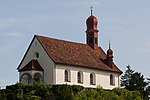
|
Kapelle St. Karl Borromäus | A | 46°52′21″N 8°16′06″E / 46.872424°N 8.268295°E | 4284 | ||
| Sachseln | 
|
Obere Ranftkapelle mit Eremitenklause | A | 46°52′11″N 8°16′16″E / 46.869704°N 8.271138°E | 4286 | ||
| Sachseln | 
|
Untere Ranftkapelle | A | 46°52′07″N 8°16′20″E / 46.868706°N 8.272303°E | 4287 | ||
| Sachseln | 
|
Bauernhaus Wymanngässli (ca. 1510) | B | 46°51′39″N 8°13′39″E / 46.860914°N 8.2275335°E | 12294 | ||
| Sachseln | 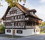
|
Alte Krone, Wohnhaus (1674) | B | 46°52′05″N 8°14′24″E / 46.86804°N 8.2399°E | 4294 | ||
| Sachseln | 
|
Bienenhaus Kreuzmatt (1892) | B | 46°51′46″N 8°13′49″E / 46.862891°N 8.230382°E | 12292 | ||
| Sachseln | 
|
Brunnenmatt, Wohnhaus (1750) | B | 46°51′58″N 8°14′27″E / 46.866166°N 8.24074°E | 4290 | ||
| Sachseln | 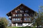
|
Büel, Wohnhaus (1585) | B | 46°52′19″N 8°14′35″E / 46.871871°N 8.243015°E | 4291 | ||
| Sachseln | 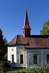
|
Kapelle St. Josef, Edisried (1752) | B | 46°51′39″N 8°13′42″E / 46.860837°N 8.228254°E | 12293 | ||
| Sachseln | 
|
Kapelle St. Katharina (1628) | B | 46°52′08″N 8°14′48″E / 46.868922°N 8.246552°E | 4296 | ||
| Sachseln | 
|
Landhaus Obkirchen (ca. 1600) | B | 46°52′03″N 8°14′32″E / 46.867477°N 8.242268°E | 4295 | ||
| Sachseln | 
|
Peter-Ignaz-von-Flüe-Haus mit Ökonomiegebäude und französischem Garten (1784) | B | 46°52′06″N 8°14′21″E / 46.8682365°N 8.23917°E | 4288 | ||
| Sachseln | 
|
Zun, Wohnhaus (17./18. Jh.) | B | 46°51′48″N 8°13′38″E / 46.863308°N 8.2273325°E | 4298 | ||
| Sachseln | 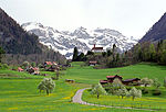
|
Flüeli-Ranft | ISOS | 46°52′18″N 8°16′08″E / 46.8717°N 8.26889°E | |||
| Sarnen | 
|
Ehemalige Kaserne Sarnen | B | 46°53′53″N 8°14′47″E / 46.897978°N 8.246492°E | 4310 | ||
| Sarnen | 
|
Sammlung Meinrad Burch-Korrodi | B | 46°53′29″N 8°14′41″E / 46.891398°N 8.244712°E | 9421 | ||
| Sarnen | 
|
Staatsarchiv Obwalden | A | 46°53′41″N 8°14′56″E / 46.894728°N 8.248928°E | 8973 | ||
| Sarnen | 
|
Grosshaus Hofmatt | B | 46°53′34″N 8°14′21″E / 46.892853°N 8.239181°E | 12301 | ||
| Sarnen | 
|
Grundacherhaus | A | 46°53′38″N 8°14′53″E / 46.893913888°N 8.248141666°E | 4302 | ||
| Sarnen | 
|
Hexenturm | A | 46°53′44″N 8°14′37″E / 46.895683°N 8.243706°E | 4308 | ||
| Sarnen | [[File:|150x150px|Kantonsbibliothek Obwalden]] | Kantonsbibliothek Obwalden | B | 46°53′38″N 8°14′54″E / 46.89389°N 8.24824°E | 11814 | ||
| Sarnen | 
|
Kirchhofen (Sarnen) | ISOS | 46°53′35″N 8°14′18″E / 46.8931°N 8.23831°E | |||
| Sarnen | Kloster St. Andreas | Kloster St. Andreas | B | 46°53′38″N 8°14′44″E / 46.8938°N 8.24547°E | 12296 | ||
| Sarnen | 
|
Kollegiumskirche St. Martin | A | 46°53′30″N 8°14′44″E / 46.891765°N 8.245629°E | 4303 | ||
| Sarnen | 
|
Ramersberg | ISOS | 46°53′50″N 8°13′59″E / 46.8973°N 8.23316°E | |||
| Sarnen | 
|
St. Peter und Paul (Sarnen) | A | 46°53′37″N 8°14′17″E / 46.893599°N 8.238045°E | 4304 | ||
| Sarnen | 
|
Archiv des Benediktinerklosters Muri-Gries | B | 8912 | |||
| Sarnen | 
|
Historisches Museum Obwalden | B | 46°53′53″N 8°14′47″E / 46.89804°N 8.24649°E | 12295 | ||
| Sarnen | 
|
Sammlung Hans Ebersold | B | 10640 | |||
| Sarnen | 
|
Sammlungen des Frauenklosters St. Andreas | A | 46°53′38″N 8°14′44″E / 46.893907°N 8.24553°E | 4301 | ||
| Sarnen | 
|
Beinhaus St. Michael | A | 46°53′37″N 8°14′17″E / 46.893599°N 8.238045°E | 9743 | ||
| Sarnen | 
|
Doppelhaus «am Grund» | A | 46°53′42″N 8°14′46″E / 46.895063°N 8.246138°E | 4300 | ||
| Sarnen | 
|
Musikaliensammlung der Benediktinerinnen-Abtei St. Andreas | A | 9548 | |||
| Sarnen | 
|
Rathaus | A | 46°53′46″N 8°14′42″E / 46.89606°N 8.245063°E | 4305 | ||
| Sarnen | 
|
Schützen- u. Zeughaus Landenberg | A | 46°53′48″N 8°14′38″E / 46.896706°N 8.243997°E | 4299 | ||
| Sarnen | 
|
Altes Gymnasium (Neurenaissance 1890) | B | 46°53′26″N 8°14′44″E / 46.890673°N 8.245488°E | 4306 | ||
| Sarnen | 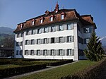
|
Altes Kollegium (barocker Profanbau 1746) | B | 46°53′29″N 8°14′41″E / 46.891398°N 8.244712°E | 4307 | ||
| Sarnen | 
|
Gasthaus Landenberg (1545) | B | 46°53′47″N 8°14′41″E / 46.89639°N 8.2448°E | 4311 | ||
| Sarnen | 
|
Kapelle St. Michael, Wilen (Barockbau 1702) | B | 46°52′50″N 8°13′25″E / 46.880498°N 8.223515°E | 4312 | ||
| Sarnen | 
|
Pulverturm (1659) | B | 46°53′27″N 8°14′32″E / 46.890785°N 8.242341°E | 12302 | ||
| Sarnen | 
|
Rosengarten, Wohnhaus (1600) | B | 46°53′35″N 8°14′39″E / 46.893047°N 8.244251°E | 12300 | ||
| Sarnen | 
|
Rotes Haus, Stammhaus der Familie Wirz (1556, umgebaut 1832) | B | 46°53′42″N 8°14′42″E / 46.894876°N 8.245118°E | 4315 | ||
| Sarnen | 
|
Rotes Haus, Stammhaus der Familie Wirz (1556, umgebaut 1832) | B | 46°53′41″N 8°14′43″E / 46.89482°N 8.24517°E | 12297 | ||
| Sarnen | 
|
Salzherrenhaus (Unterbau 1544, Obergeschoss 1562, Umbau 1891) | B | 46°53′41″N 8°14′46″E / 46.894627°N 8.2460725°E | 4316 | ||
| Sarnen | 
|
Standeskapelle / Dorfkapelle Maria Lauretana (1556) | B | 46°53′44″N 8°14′44″E / 46.895439°N 8.245691°E | 12298 | ||
| Sarnen | 
|
Steinhaus (1546) | B | 46°53′45″N 8°14′45″E / 46.895798°N 8.245828°E | 4317 | ||
| Sarnen | 
|
von Wyl-Haus (1504) | B | 46°53′46″N 8°14′43″E / 46.8962335°N 8.245283°E | 12299 | ||