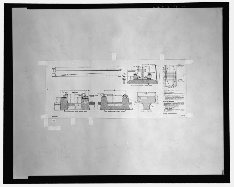
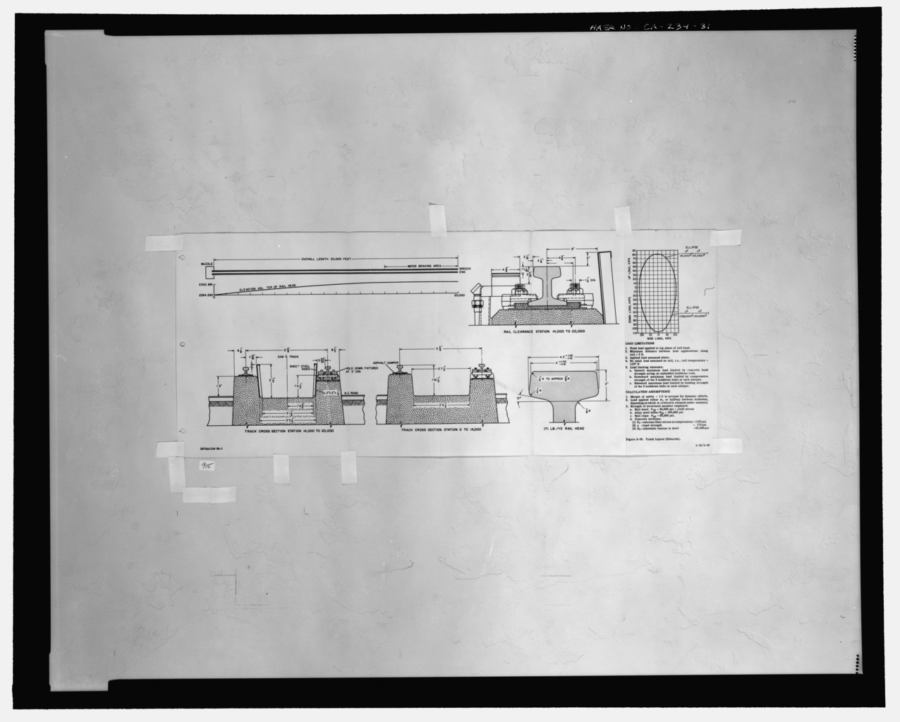
File:"FIGURE 3-10, TRACK LAYOUT (EDWARDS)". Test track footing and rail head cross sections. - Edwards Air Force Base, South Base Sled Track, Edwards Air Force Base, North HAER CAL,19-LANC.V,1-31.tif
Size of this JPG preview of this TIF file: 747 × 600 pixels. Other resolutions: 299 × 240 pixels | 598 × 480 pixels | 957 × 768 pixels | 1,276 × 1,024 pixels | 2,551 × 2,048 pixels | 5,323 × 4,273 pixels.
Original file (5,323 × 4,273 pixels, file size: 21.69 MB, MIME type: image/tiff)
Captions
Captions
Add a one-line explanation of what this file represents
Summary edit
| Photographer |
Related names:
|
|||
| Title |
"FIGURE 3-10, TRACK LAYOUT (EDWARDS)". Test track footing and rail head cross sections. - Edwards Air Force Base, South Base Sled Track, Edwards Air Force Base, North of Avenue B, between 100th and 140th Streets East, Lancaster, Los Angeles County, CA |
|||
| Depicted place | California; Los Angeles County; Lancaster | |||
| Date | Documentation compiled after 1968 | |||
| Dimensions | 8 x 10 in. | |||
| Current location |
Library of Congress Prints and Photographs Division Washington, D.C. 20540 USA http://hdl.loc.gov/loc.pnp/pp.print |
|||
| Accession number |
HAER CAL,19-LANC.V,1-31 |
|||
| Credit line |
|
|||
| Notes |
|
|||
| Source | https://www.loc.gov/pictures/item/ca2560.photos.192948p | |||
| Permission (Reusing this file) |
|

| Object location | | View this and other nearby images on: OpenStreetMap |
|---|
File history
Click on a date/time to view the file as it appeared at that time.
| Date/Time | Thumbnail | Dimensions | User | Comment | |
|---|---|---|---|---|---|
| current | 08:14, 7 July 2014 |  | 5,323 × 4,273 (21.69 MB) | Fæ (talk | contribs) | GWToolset: Creating mediafile for Fæ. HABS 05 July 2014 (401:500) |
You cannot overwrite this file.
File usage on Commons
The following page uses this file: