File:1847 Passage de l'Esla map.jpg
Size of this preview: 443 × 599 pixels. Other resolutions: 177 × 240 pixels | 355 × 480 pixels | 568 × 768 pixels | 758 × 1,024 pixels | 1,630 × 2,203 pixels.
Original file (1,630 × 2,203 pixels, file size: 451 KB, MIME type: image/jpeg)
Captions
Captions
Add a one-line explanation of what this file represents
| Description |
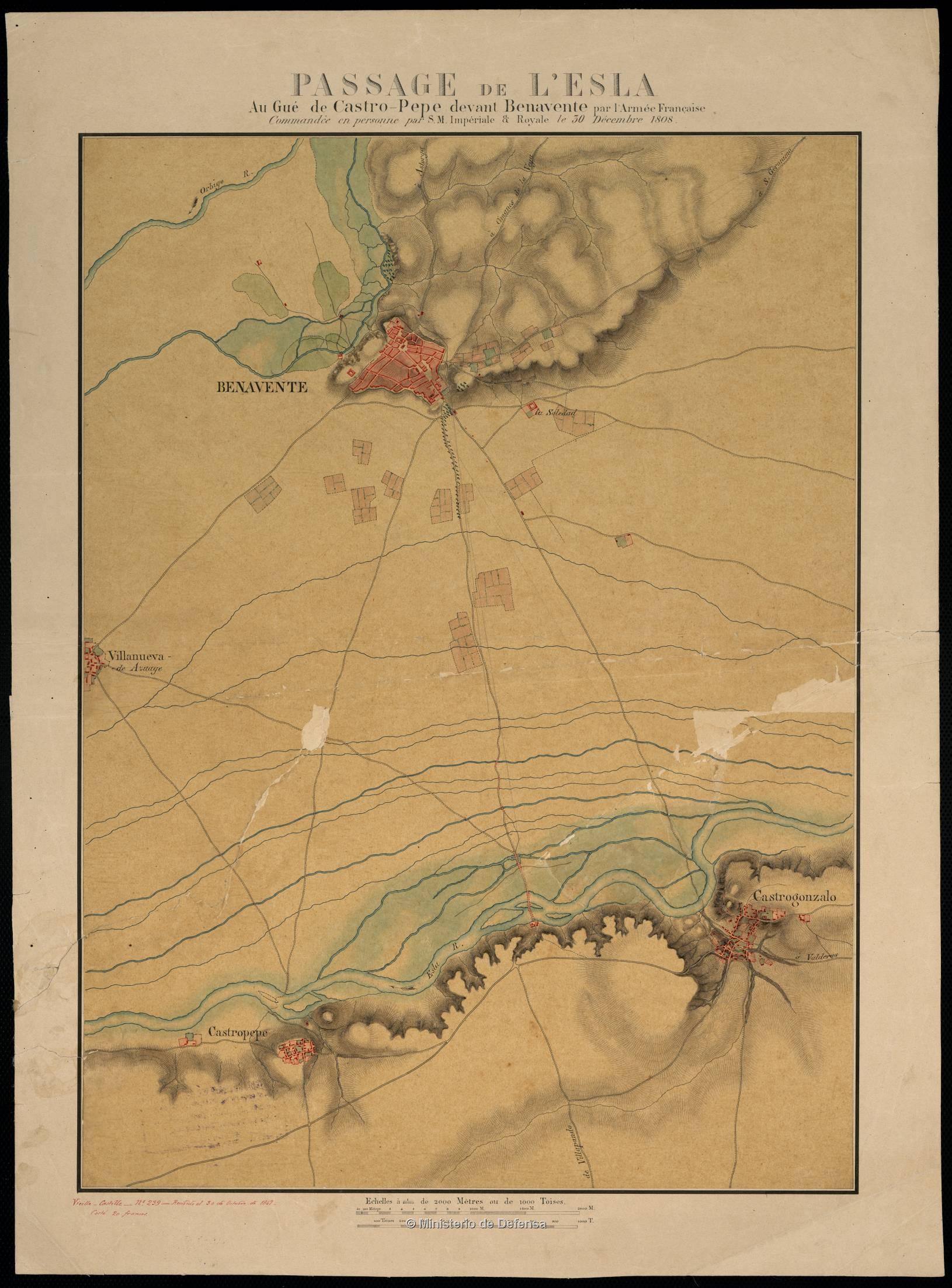
Français : Passage de L'Esla : Au Gué de Castro-Pepe devant Benavente (1847)
Español: Mapa que incluye a Benavente, Castrogonzalo y el río Esla de 1847, que es una copia de un original francés de 1808. |
| Date | (copy of a 1808 french original). |
| Source | http://bvpb.mcu.es/es/consulta/registro.cmd?id=408129 |
| Author | Unknown author |
|
This work is in the public domain in its country of origin and other countries and areas where the copyright term is the author's life plus 100 years or fewer. | |
| This file has been identified as being free of known restrictions under copyright law, including all related and neighboring rights. | |
File history
Click on a date/time to view the file as it appeared at that time.
| Date/Time | Thumbnail | Dimensions | User | Comment | |
|---|---|---|---|---|---|
| current | 11:29, 29 December 2012 | | 1,630 × 2,203 (451 KB) | Asqueladd (talk | contribs) | {{Information |Description={{fr|1=Passage de L'Esla : Au Gué de Castro-Pepe devant Benavente (1847)}} {{es|1=Mapa que incluye a Benavente, Castrogonzalo y el río Esla de 1847, que es una copi de un original francés de 1808.}} |Source=http://bvpb.mcu... |
You cannot overwrite this file.
File usage on Commons
There are no pages that use this file.
File usage on other wikis
The following other wikis use this file:
- Usage on en.wikipedia.org
- Usage on ru.wikipedia.org
- Usage on zh.wikipedia.org