File:1964 Alaska Quake Portage Townsite.jpg

Size of this preview: 800 × 535 pixels. Other resolutions: 320 × 214 pixels | 640 × 428 pixels | 1,024 × 684 pixels | 1,280 × 856 pixels | 2,560 × 1,711 pixels | 3,592 × 2,401 pixels.
Original file (3,592 × 2,401 pixels, file size: 5.14 MB, MIME type: image/jpeg)
Captions
Captions
Add a one-line explanation of what this file represents
| Description |
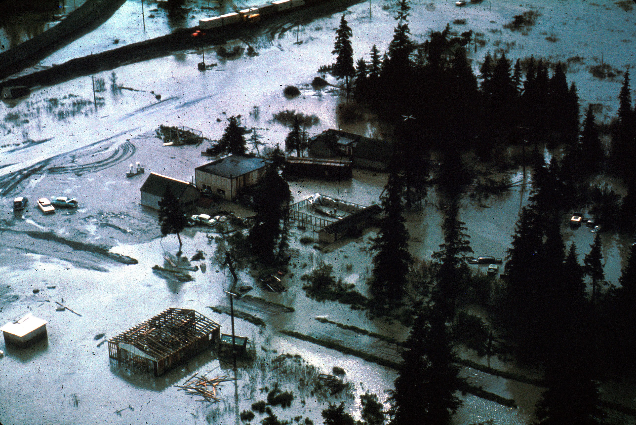
English: Aerial photo of Portage, Alaska townsite after the 1964 Alaska earthquake, taken near railroad siding. The townsite, and in general most land on the seaward side of the Seward Highway, was rendered unusable by 6 feet of subsidence and subsequent flooding at higher tides. Publishing information apart from the web page is unknown. |
|||
| Date | ||||
| Source | http://libraryphoto.cr.usgs.gov/cgi-bin/show_picture.cgi?ID=ID.%20Alaska%20Earthquake%20no.%20%20%20%20%209ct&SIZE=large Web page includes photo description | |||
| Author | Unknown author | |||
| Permission (Reusing this file) |
|
| Camera location | | View this and other nearby images on: OpenStreetMap |
|---|
File history
Click on a date/time to view the file as it appeared at that time.
| Date/Time | Thumbnail | Dimensions | User | Comment | |
|---|---|---|---|---|---|
| current | 05:37, 3 December 2010 | | 3,592 × 2,401 (5.14 MB) | RadioKAOS (talk | contribs) | {{Information |Description={{en|1=Aerial photo of Portage, Alaska townsite after the 1964 Alaska earthquake, taken near railroad siding. The townsite, and in general most land on the seaward side of the Seward Highway, was rendered unusable by 6 feet of |
You cannot overwrite this file.
File usage on Commons
There are no pages that use this file.
File usage on other wikis
The following other wikis use this file:
- Usage on en.wikipedia.org
- Usage on fr.wikipedia.org
- Usage on it.wikipedia.org