File:2010 Census Urban Cluster Reference Map for Waycross, Georgia - DPLA - a5a43b134808548cf526d5290c1493e9.pdf
Size of this JPG preview of this PDF file: 675 × 600 pixels. Other resolutions: 270 × 240 pixels | 540 × 480 pixels | 865 × 768 pixels | 1,153 × 1,024 pixels | 2,306 × 2,048 pixels | 5,404 × 4,800 pixels.
Original file (5,404 × 4,800 pixels, file size: 455 KB, MIME type: application/pdf)
Captions
Captions
Add a one-line explanation of what this file represents
Summary edit
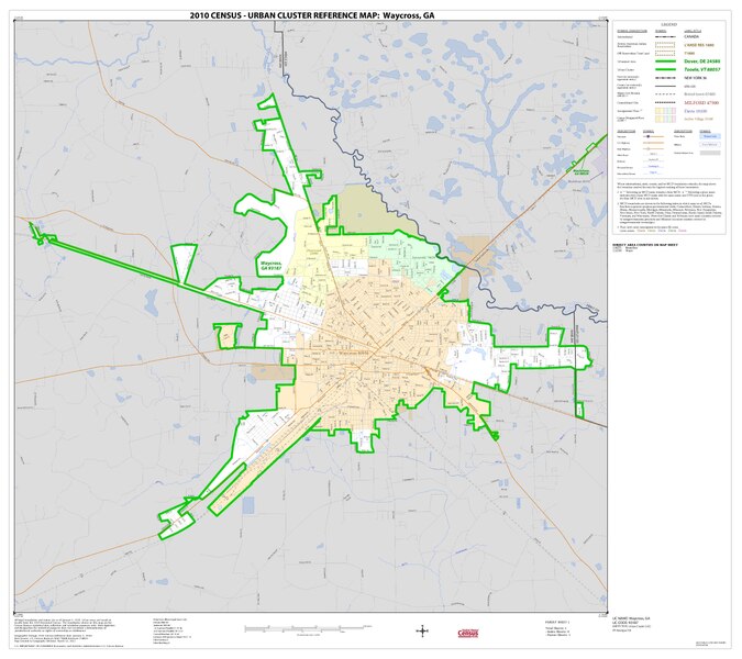
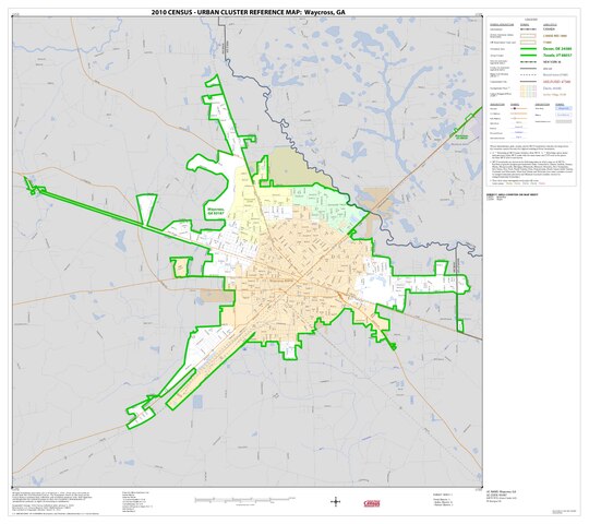
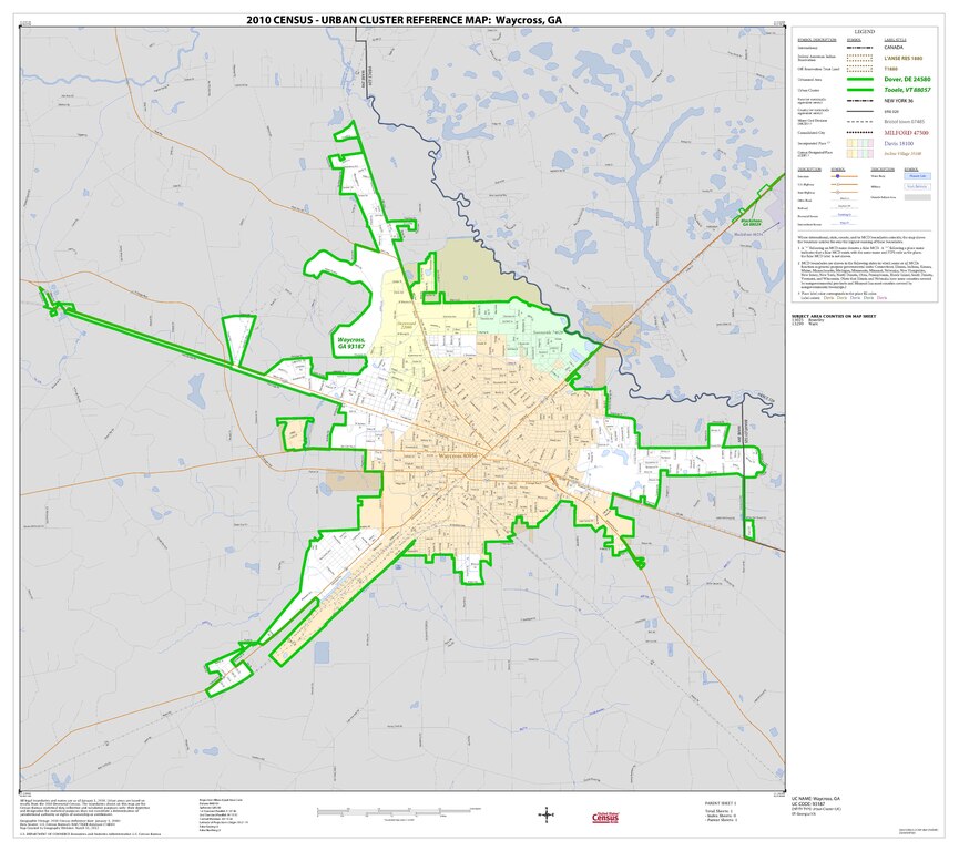
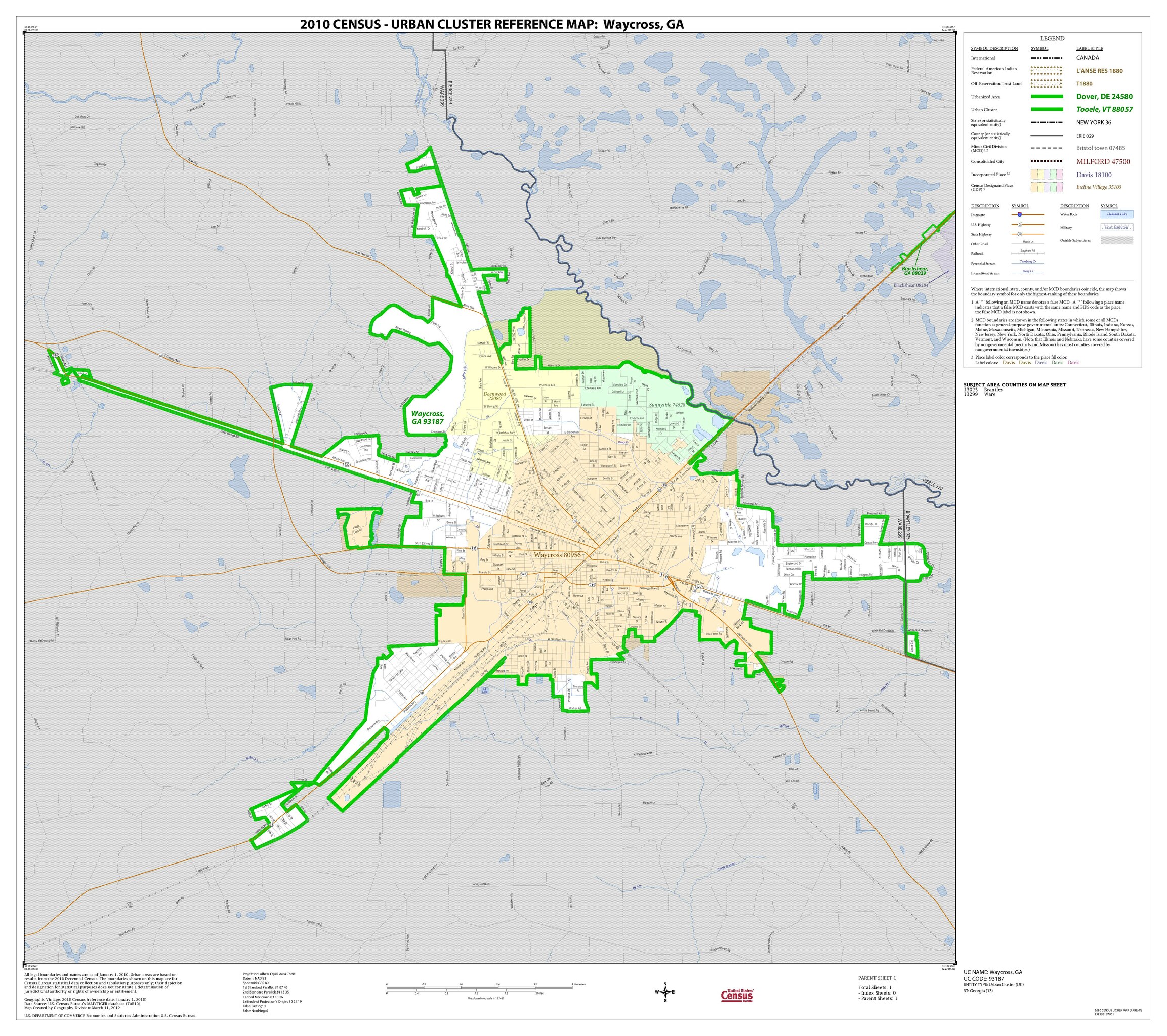
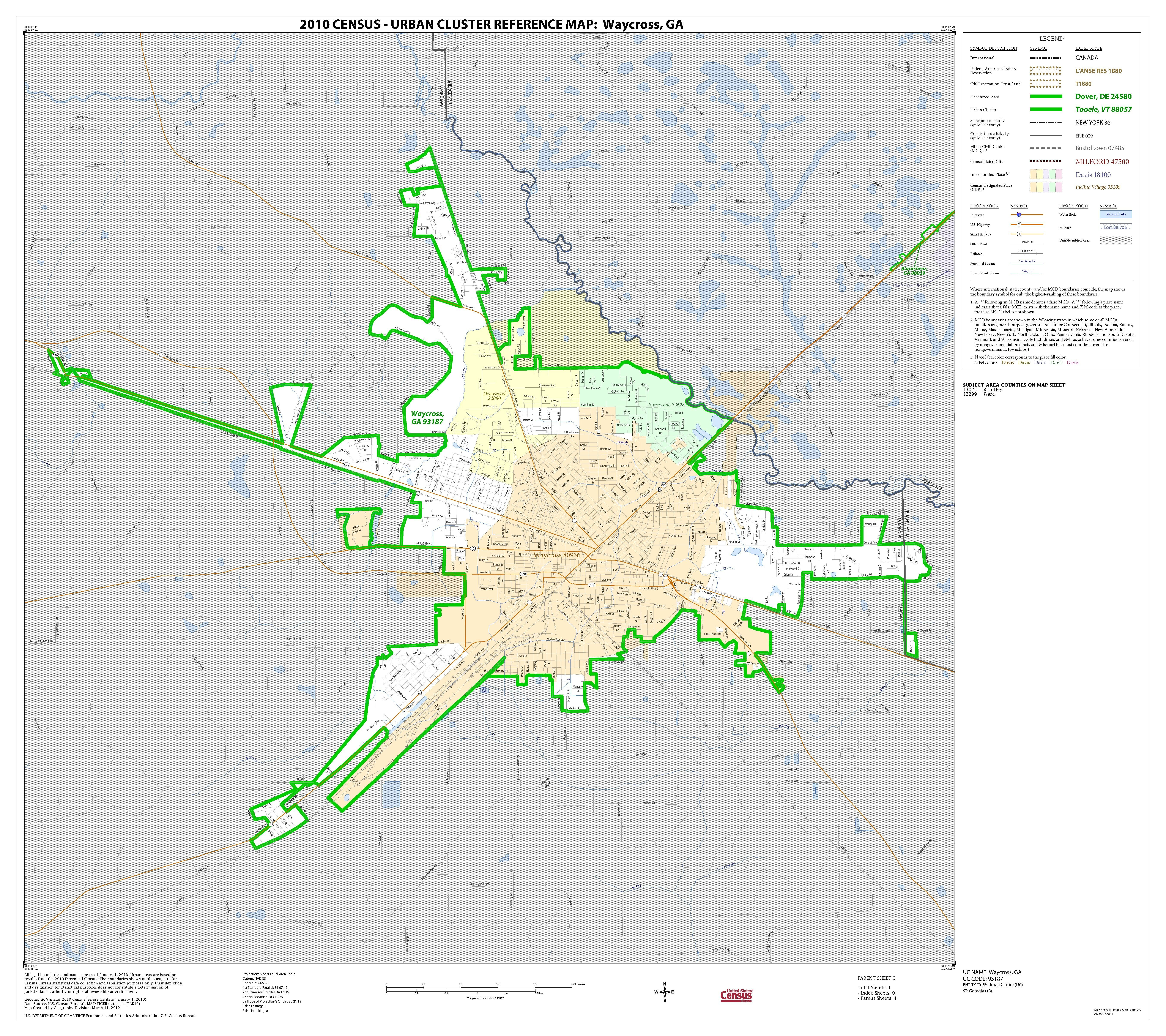
| 2010 Census Urban Cluster Reference Map for Waycross, Georgia
( |
||||||||||||||
|---|---|---|---|---|---|---|---|---|---|---|---|---|---|---|
| Creator | Department of Commerce. Bureau of the Census. Office of the Associate Director for Decennial Census. Geography Division. (1/1987 - 7/15/2011) | |||||||||||||
| Title |
2010 Census Urban Cluster Reference Map for Waycross, Georgia |
|||||||||||||
| Date | 2010-01-01/2010-12-31 | |||||||||||||
| Collection |
|
|||||||||||||
| Source/Photographer |
|
|||||||||||||
| Permission (Reusing this file) |
|
|||||||||||||
| Standardized rights statement |
|
|||||||||||||

File history
Click on a date/time to view the file as it appeared at that time.
| Date/Time | Thumbnail | Dimensions | User | Comment | |
|---|---|---|---|---|---|
| current | 20:42, 9 November 2022 |  | 5,404 × 4,800 (455 KB) | DPLA bot (talk | contribs) | Uploading DPLA ID a5a43b134808548cf526d5290c1493e9 |
You cannot overwrite this file.
File usage on Commons
The following page uses this file: