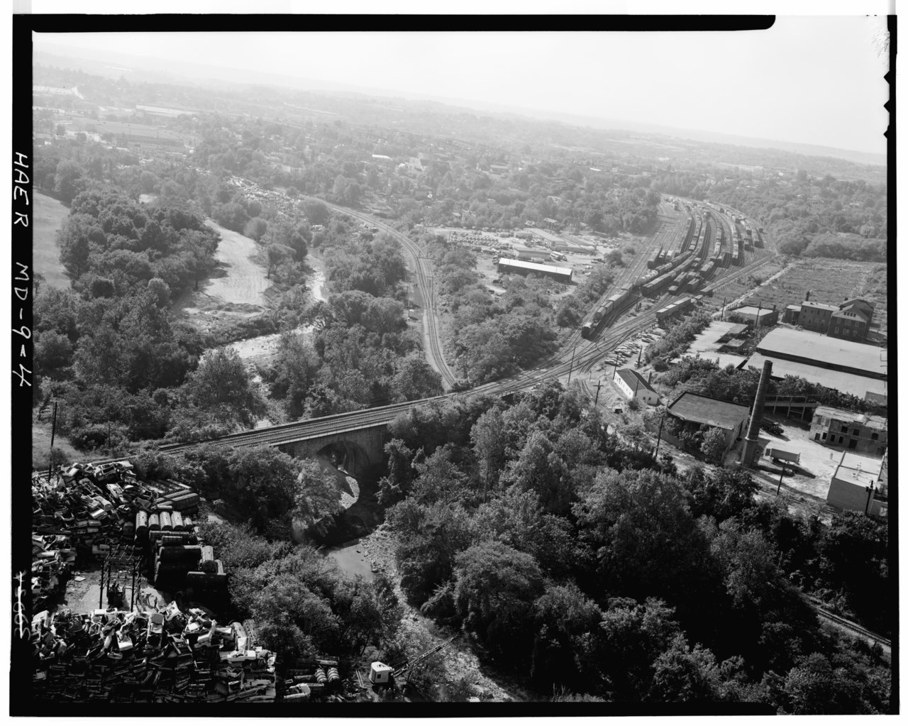
File:AERIAL VIEW OF VIADUCT LOOKING SOUTHEAST. - Baltimore and Ohio Railroad, Carrollton Viaduct, Spanning Gwynn's Falls near Carroll Park, Baltimore, Independent City, MD HAER MD,4-BALT,129-4.tif

Original file(4,933 × 3,944 pixels, file size: 18.56 MB, MIME type: image/tiff)

Captions

Captions

Add a one-line explanation of what this file represents

Summary edit

AERIAL VIEW OF VIADUCT LOOKING SOUTHEAST. - Baltimore and Ohio Railroad, Carrollton Viaduct, Spanning Gwynn's Falls near Carroll Park, Baltimore, Independent City, MD
Photographer
William E. Barrett
Title
AERIAL VIEW OF VIADUCT LOOKING SOUTHEAST. - Baltimore and Ohio Railroad, Carrollton Viaduct, Spanning Gwynn's Falls near Carroll Park, Baltimore, Independent City, MD
Depicted place Maryland; Independent City; Baltimore
Date between 1970 and 1971
date QS:P571,+1970-00-00T00:00:00Z/8,P1319,+1970-00-00T00:00:00Z/9,P1326,+1971-00-00T00:00:00Z/9
Dimensions 4 x 5 in.
Current location
Library of Congress Prints and Photographs Division Washington, D.C. 20540 USA
Accession number
HAER MD,4-BALT,129-4
Credit line
This file comes from the Historic American Buildings Survey (HABS), Historic American Engineering Record (HAER) or Historic American Landscapes Survey (HALS). These are programs of the National Park Service established for the purpose of documenting historic places. Records consist of measured drawings, archival photographs, and written reports.

This tag does not indicate the copyright status of the attached work. A normal copyright tag is still required. See Commons:Licensing.

Notes
  • Significance: Located over Gwynn's Falls near Baltimore, Maryland, the Carrollton Viaduct is the first American stone masonry bridge built for railroad use. It was named after Charles Carroll, the last living signer of the Declaration of Independence, who laid the cornerstone in May 1828. Builder Caspar Weaver and designer James Lloyd completed the structure for the Baltimore and Ohio Railroad in November 1829, at the cost of $58,106.73.
  • Survey number: HAER MD-9
  • The single-track rail line running under the viaduct, and exiting the photo at upper left, is the Tide Subdivision of the Western Maryland Railway. (Later renamed the Hanover Subdivision of CSX.)
  • The rail yard in the upper right is the B&O Mount Clare "A" Yard.
References

This is an image of a place or building that is listed on the National Register of Historic Places in the United States of America. Its reference number is 71001032.

Source
This image is available from the United States Library of Congress's Prints and Photographs division
under the digital ID hhh.md0908/photos.086092p.
This tag does not indicate the copyright status of the attached work. A normal copyright tag is still required. See Commons:Licensing.

العربية  беларуская (тарашкевіца)  বাংলা  čeština  Deutsch  English  español  فارسی  suomi  français  galego  עברית  magyar  Bahasa Indonesia  italiano  日本語  lietuvių  македонски  മലയാളം  Nederlands  polski  português  português do Brasil  română  русский  sicilianu  slovenčina  slovenščina  Türkçe  українська  简体中文  繁體中文  +/−

Permission
(Reusing this file)
Public domain This image or media file contains material based on a work of a National Park Service employee, created as part of that person's official duties. As a work of the U.S. federal government, such work is in the public domain in the United States. See the NPS website and NPS copyright policy for more information.

File history

Click on a date/time to view the file as it appeared at that time.

Date/TimeThumbnailDimensionsUserComment
current12:52, 22 July 2014Thumbnail for version as of 12:52, 22 July 20144,933 × 3,944 (18.56 MB) (talk | contribs)GWToolset: Creating mediafile for Fæ. HABS 21 July 2014 (1601:1800)

Metadata