File:Aerial view southwest, Adams Dam Road bottom left, State Route 100 center, back gates to Winterthur and Wilmington Country Club upper center, duck pond and reservoir bottom right HABS DEL,2-WIN,1-4.tif

Size of this JPG preview of this TIF file: 748 × 599 pixels. Other resolutions: 300 × 240 pixels | 599 × 480 pixels | 958 × 768 pixels | 1,278 × 1,024 pixels | 2,556 × 2,048 pixels | 5,000 × 4,007 pixels.
Original file (5,000 × 4,007 pixels, file size: 19.11 MB, MIME type: image/tiff)
Captions
Captions
Add a one-line explanation of what this file represents
Summary edit
| Photographer |
Related names:
|
|||
| Title |
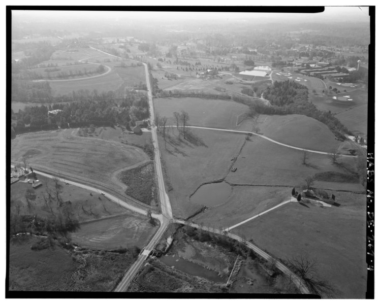
Aerial view southwest, Adams Dam Road bottom left, State Route 100 center, back gates to Winterthur and Wilmington Country Club upper center, duck pond and reservoir bottom right and center, and State Route 92 center bottom. - Winterthur Farms, Intersection State Routes 92 and 100, Intersection State Routes 92 and 100, Winterthur, New Castle County, DE |
|||
| Depicted place | Delaware; New Castle County; Winterthur | |||
| Date | Documentation compiled after 1933 | |||
| Dimensions | 4 x 5 in. | |||
| Current location |
Library of Congress Prints and Photographs Division Washington, D.C. 20540 USA http://hdl.loc.gov/loc.pnp/pp.print |
|||
| Accession number |
HABS DEL,2-WIN,1-4 |
|||
| Credit line |
|
|||
| Notes |
|
|||
| Source | https://www.loc.gov/pictures/item/de0364.photos.331244p | |||
| Permission (Reusing this file) |
|

| Object location | | View this and other nearby images on: OpenStreetMap |
|---|
File history
Click on a date/time to view the file as it appeared at that time.
| Date/Time | Thumbnail | Dimensions | User | Comment | |
|---|---|---|---|---|---|
| current | 22:20, 10 July 2014 |  | 5,000 × 4,007 (19.11 MB) | Fæ (talk | contribs) | GWToolset: Creating mediafile for Fæ. HABS 09 July 2014 (801:1000) |
You cannot overwrite this file.
File usage on Commons
The following page uses this file: