File:Altiplano map.png

Size of this preview: 800 × 397 pixels. Other resolutions: 320 × 159 pixels | 640 × 318 pixels | 1,024 × 508 pixels | 1,600 × 794 pixels.
Original file (1,600 × 794 pixels, file size: 173 KB, MIME type: image/png)
Captions
Captions
Add a one-line explanation of what this file represents
Summary
edit
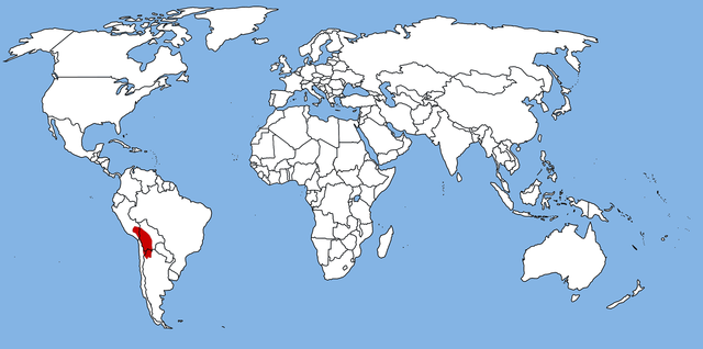
| Description | Altiplato (Andes) |
| Date | Today |
| Source | Own work |
| Author | TBjornstad 18:03, 25 November 2006 (UTC) |
| Permission (Reusing this file) |
PD |
Licensing
edit
| I, the copyright holder of this work, release this work into the public domain. This applies worldwide. In some countries this may not be legally possible; if so: I grant anyone the right to use this work for any purpose, without any conditions, unless such conditions are required by law. |
File history
Click on a date/time to view the file as it appeared at that time.
| Date/Time | Thumbnail | Dimensions | User | Comment | |
|---|---|---|---|---|---|
| current | 07:51, 29 March 2018 | | 1,600 × 794 (173 KB) | Maphobbyist (talk | contribs) | Montenegro and South Sudan borders |
| 18:03, 25 November 2006 |  | 1,600 × 794 (65 KB) | ToB (talk | contribs) | {{Information |Description=Altiplato (Andes) |Source=Own work |Date=Today |Author=~~~~ |Permission=PD |other_versions=None }} Category:Andes |
You cannot overwrite this file.
File usage on Commons
The following page uses this file:
File usage on other wikis
The following other wikis use this file:
- Usage on ar.wikipedia.org
- Usage on ca.wikipedia.org
- Usage on cs.wikipedia.org
- Usage on da.wikipedia.org
- Usage on el.wikipedia.org
- Usage on en.wikipedia.org
- Usage on eo.wikipedia.org
- Usage on es.wikipedia.org
- Usage on eu.wikipedia.org
- Usage on fa.wikipedia.org
- Usage on fr.wikipedia.org
- Usage on he.wikipedia.org
- Usage on hi.wikipedia.org
- Usage on hu.wikipedia.org
- Usage on it.wikipedia.org
- Usage on ka.wikipedia.org
- Usage on ko.wikipedia.org
- Usage on mk.wikipedia.org
- Usage on ml.wikipedia.org
- Usage on no.wikipedia.org
- Usage on pl.wikipedia.org
- Usage on pt.wikipedia.org
- Usage on qu.wikipedia.org
- Usage on ru.wikipedia.org
- Usage on sk.wikipedia.org
- Usage on sr.wikipedia.org
- Usage on uk.wikipedia.org
- Usage on vi.wikipedia.org
- Usage on www.wikidata.org
- Usage on zh.wikipedia.org