File:Arab World-Large ar.PNG
Size of this preview: 799 × 361 pixels. Other resolutions: 320 × 145 pixels | 640 × 289 pixels | 1,024 × 463 pixels | 1,735 × 784 pixels.
Original file (1,735 × 784 pixels, file size: 68 KB, MIME type: image/png)
Captions
Captions
Add a one-line explanation of what this file represents

|
File:Arabic Dialects-ar.svg is a vector version of this file. It should be used in place of this PNG file when not inferior.
File:Arab World-Large ar.PNG → File:Arabic Dialects-ar.svg
For more information, see Help:SVG. |
 |
Summary edit
| Description | |
| Date | |
| Source | ar::File:Arab World-Large.PNG، |
| Author | المستخدم: Arab League، ترجمها: Bassem19 |

|
This file has been superseded by Arabic Varieties Map.svg. It is recommended to use the other file. Please note that deleting superseded images requires consent. Reason to use the other file: "Up-to-date SVG version based on Ethnologue's 2022 report and other reliable sources."
|

|
Licensing edit
This file is licensed under the Creative Commons Attribution 3.0 Unported license.
- You are free:
- to share – to copy, distribute and transmit the work
- to remix – to adapt the work
- Under the following conditions:
- attribution – You must give appropriate credit, provide a link to the license, and indicate if changes were made. You may do so in any reasonable manner, but not in any way that suggests the licensor endorses you or your use.
Original upload log edit
The original description page was here. All following user names refer to ar.wikipedia.
Upload date | User | Bytes | Dimensions | Comment
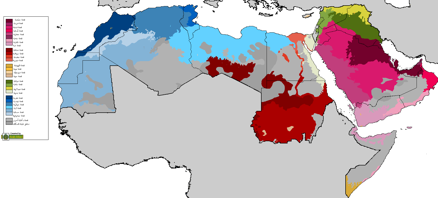
- 2010-03-31 15:01:36 | Bassem19 | 85368 | 1735×784 | {{معلومات | وصف = خارطة تظهر توزع [[لهجات عربية|اللهجات العربية]] في [[العالم العربي]]. | مصدر = [[:en:File:Arab World-Large.PNG]]، منقولة من [http://en.wikipedia.org/wiki/
File history
Click on a date/time to view the file as it appeared at that time.
| Date/Time | Thumbnail | Dimensions | User | Comment | |
|---|---|---|---|---|---|
| current | 11:17, 2 February 2018 | | 1,735 × 784 (68 KB) | Maphobbyist (talk | contribs) | Borders of South Sudan which became independent in 2011. |
| 11:54, 27 June 2010 |  | 1,735 × 784 (83 KB) | Ali1 (talk | contribs) | {{BotMoveToCommons|ar.wikipedia|year={{subst:CURRENTYEAR}}|month={{subst:CURRENTMONTHNAME}}|day={{subst:CURRENTDAY}}}} The upload bot is User:CommonsHelper2 Bot which is called by [http://toolserver.org/~commonshelper2/index.php CommonsHelper2]. The t |
You cannot overwrite this file.
File usage on Commons
The following page uses this file:
File usage on other wikis
The following other wikis use this file: