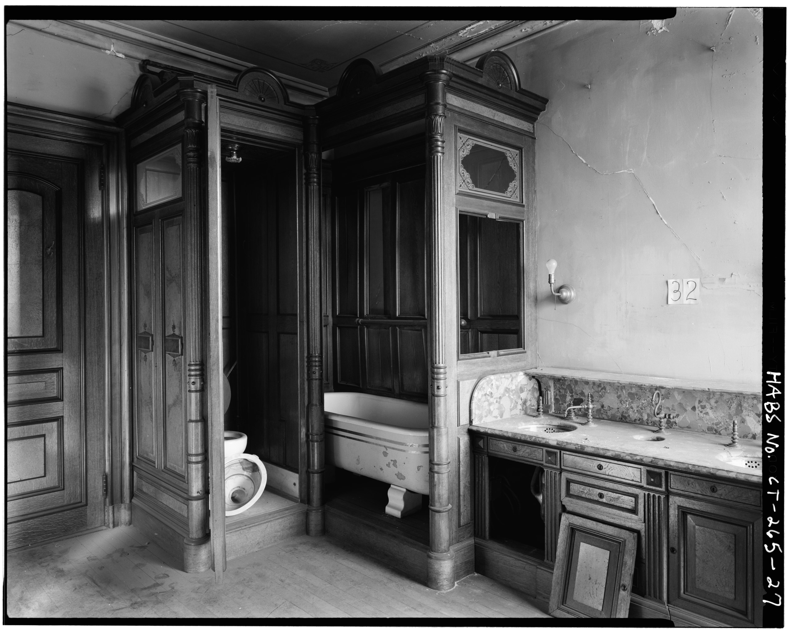
File:BATHROOM, EAST OF SOUTH CENTRAL SECOND FLOOR ROOM - Lockwood-Mathews House, Veterans' Memorial Park, Southeast, Norwalk, Fairfield County, CT HABS CONN,1-NOWA,2-27.tif

Size of this JPG preview of this TIF file: 750 × 600 pixels. Other resolutions: 300 × 240 pixels | 600 × 480 pixels | 960 × 768 pixels | 1,280 × 1,024 pixels | 2,560 × 2,048 pixels | 4,993 × 3,994 pixels.
Original file (4,993 × 3,994 pixels, file size: 19.02 MB, MIME type: image/tiff)
Captions
Captions
Add a one-line explanation of what this file represents
Summary edit
| BATHROOM, EAST OF SOUTH CENTRAL SECOND FLOOR ROOM - Lockwood-Mathews House, Veterans' Memorial Park, Southeast, Norwalk, Fairfield County, CT | ||||
|---|---|---|---|---|
| Photographer |
Related names:
|
|||
| Title |
BATHROOM, EAST OF SOUTH CENTRAL SECOND FLOOR ROOM - Lockwood-Mathews House, Veterans' Memorial Park, Southeast, Norwalk, Fairfield County, CT |
|||
| Depicted place | Connecticut; Fairfield County; Norwalk | |||
| Date | Documentation compiled after 1933 | |||
| Dimensions | 4 x 5 in. | |||
| Current location |
Library of Congress Prints and Photographs Division Washington, D.C. 20540 USA http://hdl.loc.gov/loc.pnp/pp.print |
|||
| Accession number |
HABS CONN,1-NOWA,2-27 |
|||
| Credit line |
|
|||
| Notes |
|
|||
| References |
|
|||
| Source | https://www.loc.gov/pictures/item/ct0097.photos.022471p | |||
| Permission (Reusing this file) |
|
|||

| Object location | | View this and other nearby images on: OpenStreetMap |
|---|
File history
Click on a date/time to view the file as it appeared at that time.
| Date/Time | Thumbnail | Dimensions | User | Comment | |
|---|---|---|---|---|---|
| current | 10:51, 7 July 2014 | 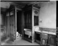 | 4,993 × 3,994 (19.02 MB) | Fæ (talk | contribs) | GWToolset: Creating mediafile for Fæ. HABS 06 July 2014 (611:700) |
You cannot overwrite this file.
File usage on Commons
The following page uses this file: