File:Borkum 6.72782E 53.59398N.jpg
Size of this preview: 800 × 599 pixels. Other resolutions: 320 × 240 pixels | 640 × 479 pixels | 1,024 × 766 pixels | 1,280 × 958 pixels.
Original file (1,280 × 958 pixels, file size: 87 KB, MIME type: image/jpeg)
Captions
Captions
Add a one-line explanation of what this file represents
| Description |
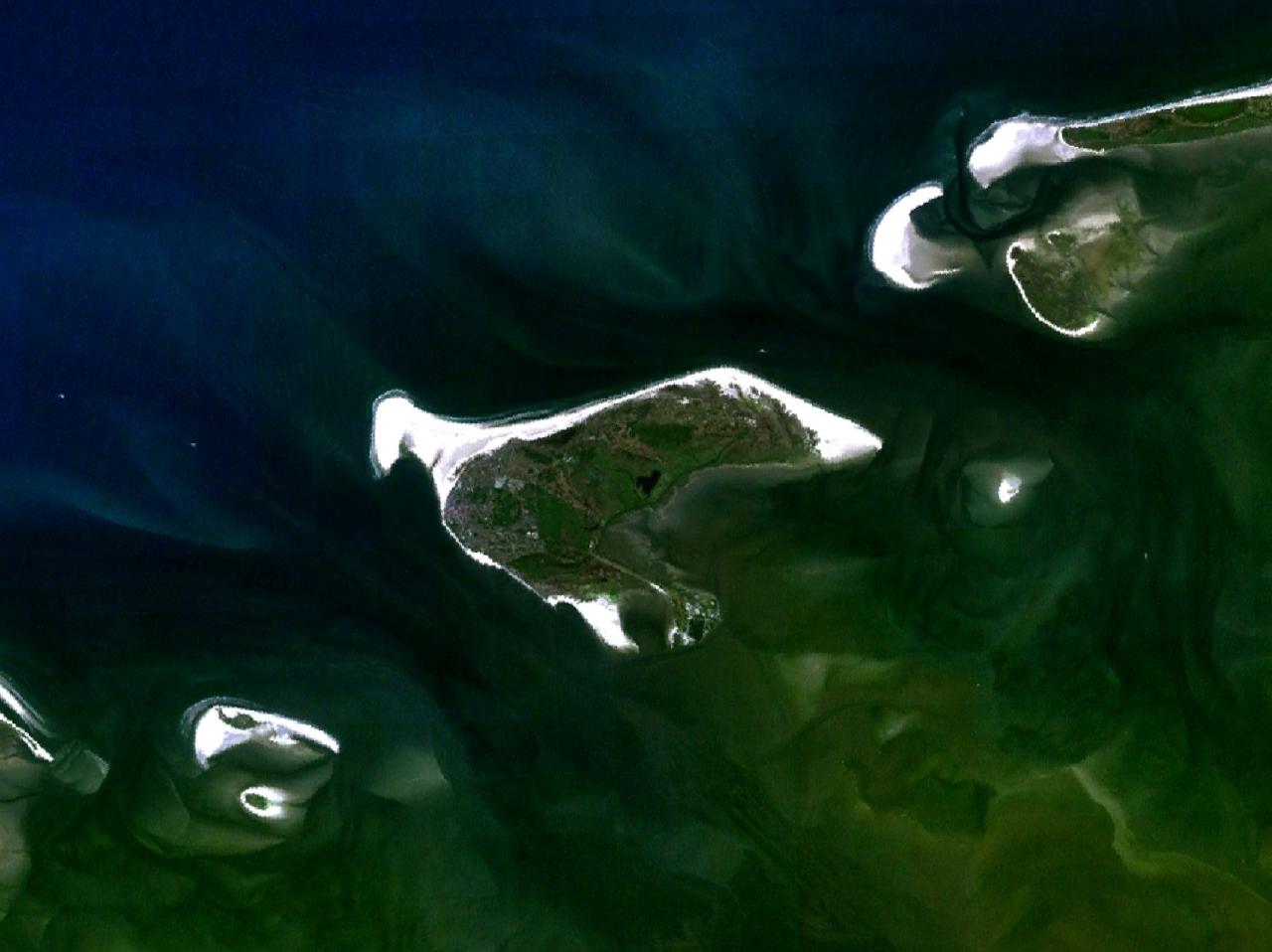
English: Some West Frisian Islands (Netherlands) and some East Frisian Islands (Germany), from left to right: Rottumerplaat, Rottumeroog (top) with Zuiderduintjes (below), Borkum, Kachelotplate, Juist (top) and Lütje Hörn (below), Memmert |
|||
| Date | before 2000 | |||
| Source |
English: NASA World Wind screenshot |
|||
| Author | – (NASA World Wind) | |||
| Permission (Reusing this file) |
|

| Annotations | This image is annotated: View the annotations at Commons |
File history
Click on a date/time to view the file as it appeared at that time.
| Date/Time | Thumbnail | Dimensions | User | Comment | |
|---|---|---|---|---|---|
| current | 13:55, 15 May 2005 | | 1,280 × 958 (87 KB) | Rex (talk | contribs) | NASA World Wind screenshot. {{PD-USGov-NASA}} Category:Maps of Germany |
You cannot overwrite this file.
File usage on Commons
There are no pages that use this file.
File usage on other wikis
The following other wikis use this file:
- Usage on de.wikipedia.org
- Usage on fy.wikipedia.org
- Usage on he.wikipedia.org
- Usage on nl.wikipedia.org
- Usage on stq.wikipedia.org