File:Cape Agulhas P1040396.JPG
(Redirected from File:Cape Agulhas P1040396 .JPG)
Size of this preview: 800 × 600 pixels. Other resolutions: 320 × 240 pixels | 640 × 480 pixels | 1,024 × 768 pixels | 1,280 × 960 pixels | 2,560 × 1,920 pixels | 3,264 × 2,448 pixels.
Original file (3,264 × 2,448 pixels, file size: 3.08 MB, MIME type: image/jpeg)
Captions
Captions
Add a one-line explanation of what this file represents
This image has been assessed using the Quality image guidelines and is considered a Quality image.
|
Summary edit
| Description |
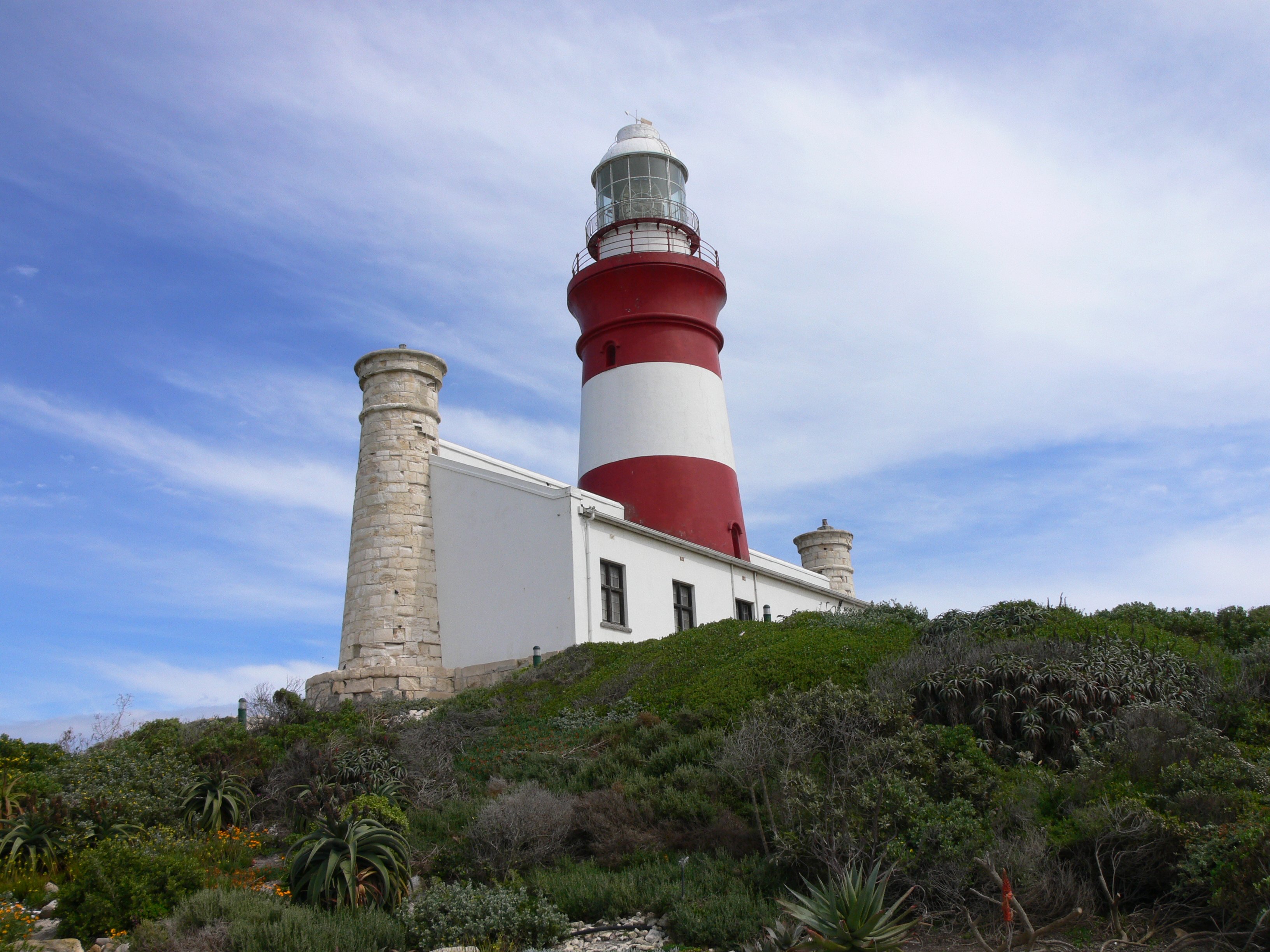
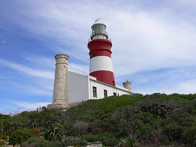
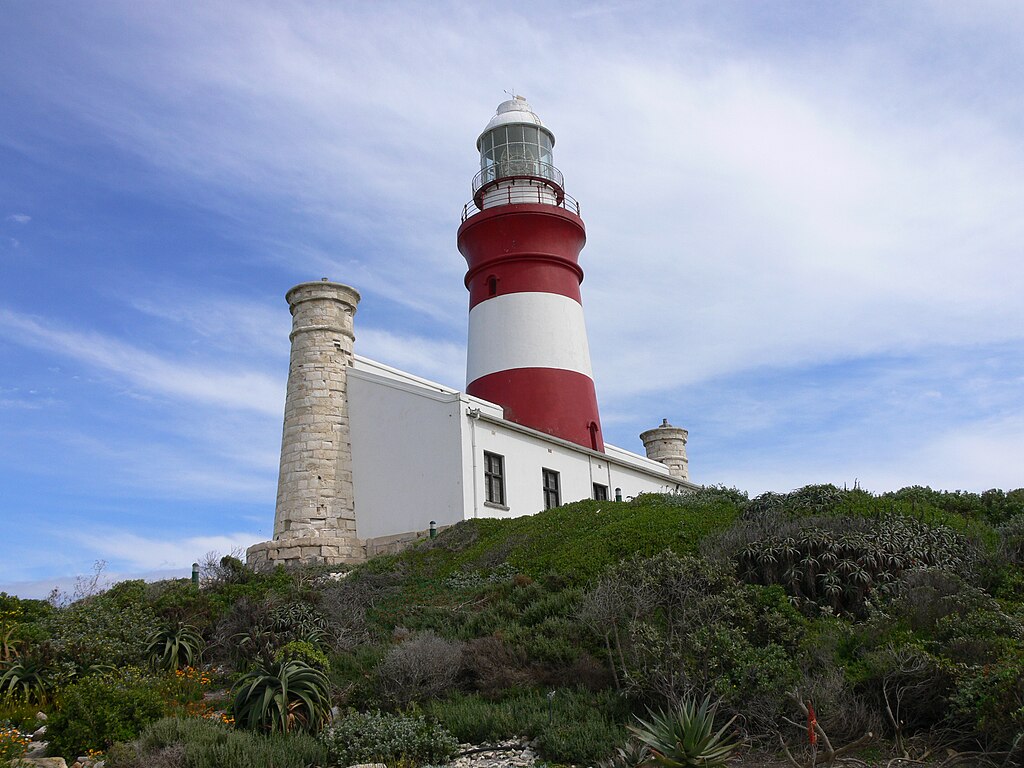
Afrikaans: Vuurtoring Kaap Agulhas, geografiese suidelike punt van Afrika Brezhoneg : Tour-tan Kab ar Pikernigoù Dansk: Fyr Kap Agulhas, Kap Agulhas er Afrikas sydligste punkt Deutsch: Leuchtturm am Kap Agulhas, südlichster Punkt Afrikas, im Distrikt Overberg, Provinz Westkap in Südafrika English: The lighthouse at Cape Agulhas, South Africa. Cape Agulhas is the geographic southern tip of the African continent, and is defined for hydrographic purposes to be the dividing line between the Atlantic and Indian oceans Español: Faro de Cabo de las Agujas, Sudáfrica, en el punto más meridional del continente africano y en el que convergen los oceanos Índico y Atlántico Esperanto: Lumturo sur la kabo, provinco Okcidenta Kabo, sud-afrika Français : Phare Cap des Aiguilles, Province du Cap-Occidental, en Afrique du Sud Hrvatski: Svjetionik na Agulhaškom rtu Italiano: Il faro di Capo Agulhas, Sud Africa. Capo Agulhas è il punto più meridionale del continente africano ed è il punto che divide l'oceano Indiano dall'oceano Atlantico Lëtzebuergesch: Liichttuerm um Kap Agulhas, dee südlechste geographesche Punkt vun Afrika Nederlands: Vuurtoren op Kaap Agulhas, het zuidelijkste punt van Afrika Norsk bokmål: Kapp Agulhas i Sør-Afrika er det sørligste punktet på det afrikanske kontinentet Polski: Przylądek Igielny, Przylądek Agulhas, stanowiący najbardziej wysunięty na południe kraniec Afryki, uznawany jednocześnie za umowną granicę Oceanów - Indyjskiego i Atlantyckiego Português: O farol do Cabo das Agulhas, Província do Cabo Ocidental da África do Sul Slovenčina: Maják na Strelkovom myse Svenska: Fyren vid Agulhas, Sydafrika Türkçe: İğne Burnu'ndaki deniz feneri Русский: Маяк Игольный мыс, южная оконечность Африки |
| Date | |
| Source | Own work |
| Author | Winfried Bruenken (Amrum) |
| Camera location | | View this and other nearby images on: OpenStreetMap |
|---|
Licensing edit
This file is licensed under the Creative Commons Attribution-Share Alike 2.5 Generic license.
- You are free:
- to share – to copy, distribute and transmit the work
- to remix – to adapt the work
- Under the following conditions:
- attribution – You must give appropriate credit, provide a link to the license, and indicate if changes were made. You may do so in any reasonable manner, but not in any way that suggests the licensor endorses you or your use.
- share alike – If you remix, transform, or build upon the material, you must distribute your contributions under the same or compatible license as the original.
File history
Click on a date/time to view the file as it appeared at that time.
| Date/Time | Thumbnail | Dimensions | User | Comment | |
|---|---|---|---|---|---|
| current | 21:13, 30 October 2007 | | 3,264 × 2,448 (3.08 MB) | Amrum (talk | contribs) | {{Information |Description=Leuchtturm am Kap Agulhas im Distrikt Overberg, Provinz Westkap in Südafrika. |Source=selbst erstellt/own work |Date=09.2006 |Author=Winfried Bruenken (Amrum) |Permission=Attribu |
You cannot overwrite this file.
File usage on Commons
The following 8 pages use this file:
File usage on other wikis
The following other wikis use this file:
- Usage on af.wikipedia.org
- Usage on az.wikipedia.org
- Usage on be.wikipedia.org
- Usage on br.wikipedia.org
- Usage on da.wikipedia.org
- Usage on et.wikipedia.org
- Usage on fr.wikipedia.org
- Usage on nl.wikipedia.org
- Usage on no.wikipedia.org
- Usage on pl.wikipedia.org
- Usage on ru.wikipedia.org
- Usage on sr.wikipedia.org