File:Central U.S. storm system 2019-05-20 1330Z.jpg

Size of this preview: 800 × 450 pixels. Other resolutions: 320 × 180 pixels | 640 × 360 pixels | 1,024 × 576 pixels | 1,280 × 720 pixels | 1,920 × 1,080 pixels.
Original file (1,920 × 1,080 pixels, file size: 747 KB, MIME type: image/jpeg)
Captions
Captions
Add a one-line explanation of what this file represents
Summary edit
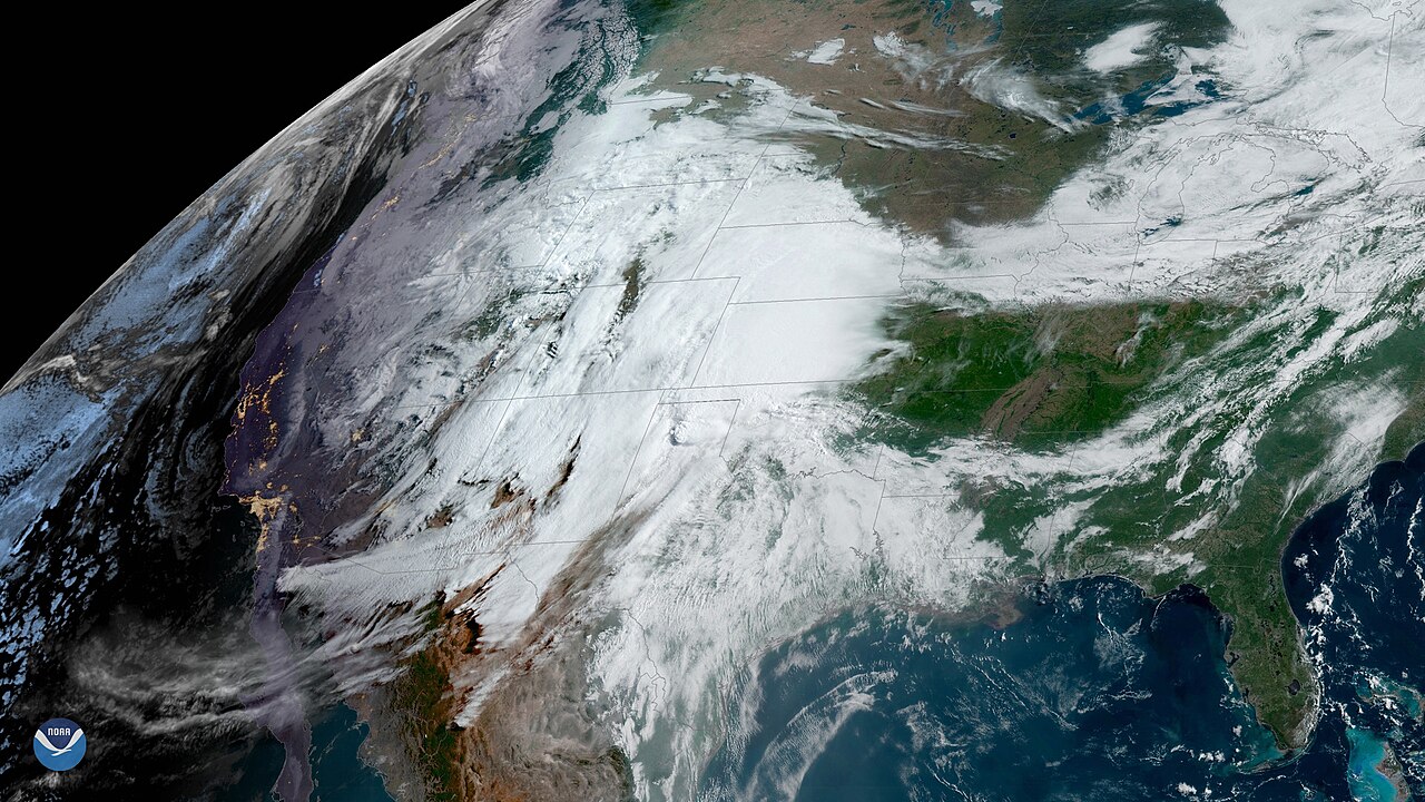
| Description | Storm system over the Central United States viewed from GOES 16 on the day of a Storm Prediction Center-issued High Risk in Oklahoma and Texas | |||
| Date | ||||
| Source | https://www.nesdis.noaa.gov/content/tornado-outbreak-possible-across-central-and-southern-plains | |||
| Author | NOAA Environmental Visualization Laboratory | |||
| Permission (Reusing this file) |
|
File history
Click on a date/time to view the file as it appeared at that time.
| Date/Time | Thumbnail | Dimensions | User | Comment | |
|---|---|---|---|---|---|
| current | 04:28, 24 May 2019 | | 1,920 × 1,080 (747 KB) | Master of Time (talk | contribs) | {{Information |Description=Storm system over the Central United States viewed from GOES 16 on the day of a Storm Prediction Center-issued High Risk in Oklahoma and Texas |Source=https://www.nesdis.noaa.gov/content/tornado-outbreak-possible-across-central-and-southern-plains |Date=2019-05-20 13:30 |Author=NOAA Environmental Visualization Laboratory |Permission={{PD-USGov-NOAA}} |other_versions= }} Category:GOES 16 pictures |
You cannot overwrite this file.
File usage on Commons
The following 2 pages use this file:
.jpg&redirect=no)
File usage on other wikis
The following other wikis use this file:
- Usage on en.wikipedia.org