File:Coswig(Anhalt),Roter Teich.jpg
Size of this preview: 800 × 600 pixels. Other resolutions: 320 × 240 pixels | 640 × 480 pixels | 1,024 × 768 pixels | 1,280 × 960 pixels | 2,667 × 2,000 pixels.
Original file (2,667 × 2,000 pixels, file size: 1.15 MB, MIME type: image/jpeg)
Captions
Captions
Add a one-line explanation of what this file represents
Summary edit
,Roter_Teich.jpg&action=edit§ion=1)
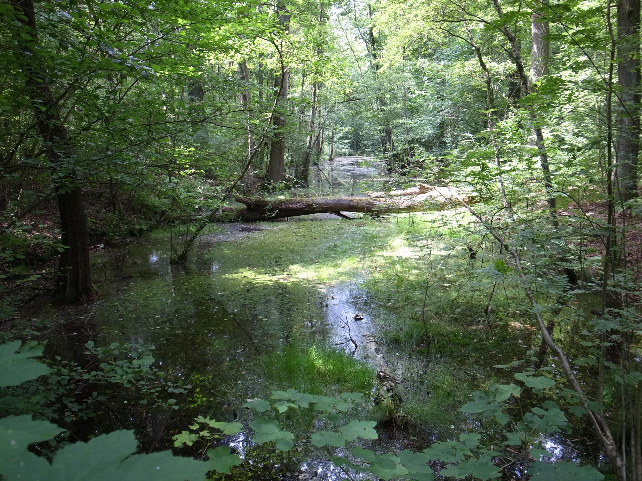
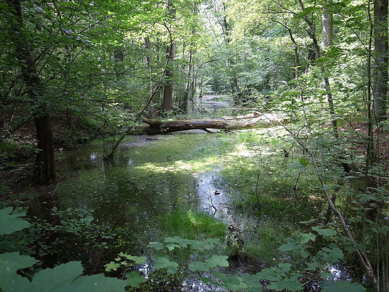
| Description | Coswig (Anhalt), Roter Teich am Wanderweg Bismarckstieg und Standort vom Bähr-Gedenkstein im FFH Gebiet Pfaffenheide-Wörpener Bach nördlich Coswig. |
| Date | |
| Source | Own work |
| Author | M_H.DE |
| Camera location | | View this and other nearby images on: OpenStreetMap |
|---|
,Roter_Teich.jpg¶ms=051.899056_N_0012.474056_E_globe:Earth_type:camera_heading:270.00&language=en)
Licensing edit
,Roter_Teich.jpg&action=edit§ion=2)
I, the copyright holder of this work, hereby publish it under the following license:
This file is licensed under the Creative Commons Attribution-Share Alike 4.0 International license.
- You are free:
- to share – to copy, distribute and transmit the work
- to remix – to adapt the work
- Under the following conditions:
- attribution – You must give appropriate credit, provide a link to the license, and indicate if changes were made. You may do so in any reasonable manner, but not in any way that suggests the licensor endorses you or your use.
- share alike – If you remix, transform, or build upon the material, you must distribute your contributions under the same or compatible license as the original.
File history
Click on a date/time to view the file as it appeared at that time.
| Date/Time | Thumbnail | Dimensions | User | Comment | |
|---|---|---|---|---|---|
| current | 20:26, 26 January 2017 | | 2,667 × 2,000 (1.15 MB) | M H.DE (talk | contribs) | {{Information |Description=Coswig (Anhalt), ''Roter Teich'' am Wanderweg ''Bismarckstieg'' und Standort vom ''Bähr-Gedenkstein'' im FFH Gebiet ''Pfaffenheide-Wörpener Bach nördlich Coswig''. |Source={{Own}} |Date=2014-07-06 |Author=M_H.DE |Permissio... |
You cannot overwrite this file.
File usage on Commons
The following page uses this file:
File usage on other wikis
The following other wikis use this file:
- Usage on de.wikipedia.org
- Usage on www.wikidata.org
,Roter_Teich.jpg&oldid=868961146)