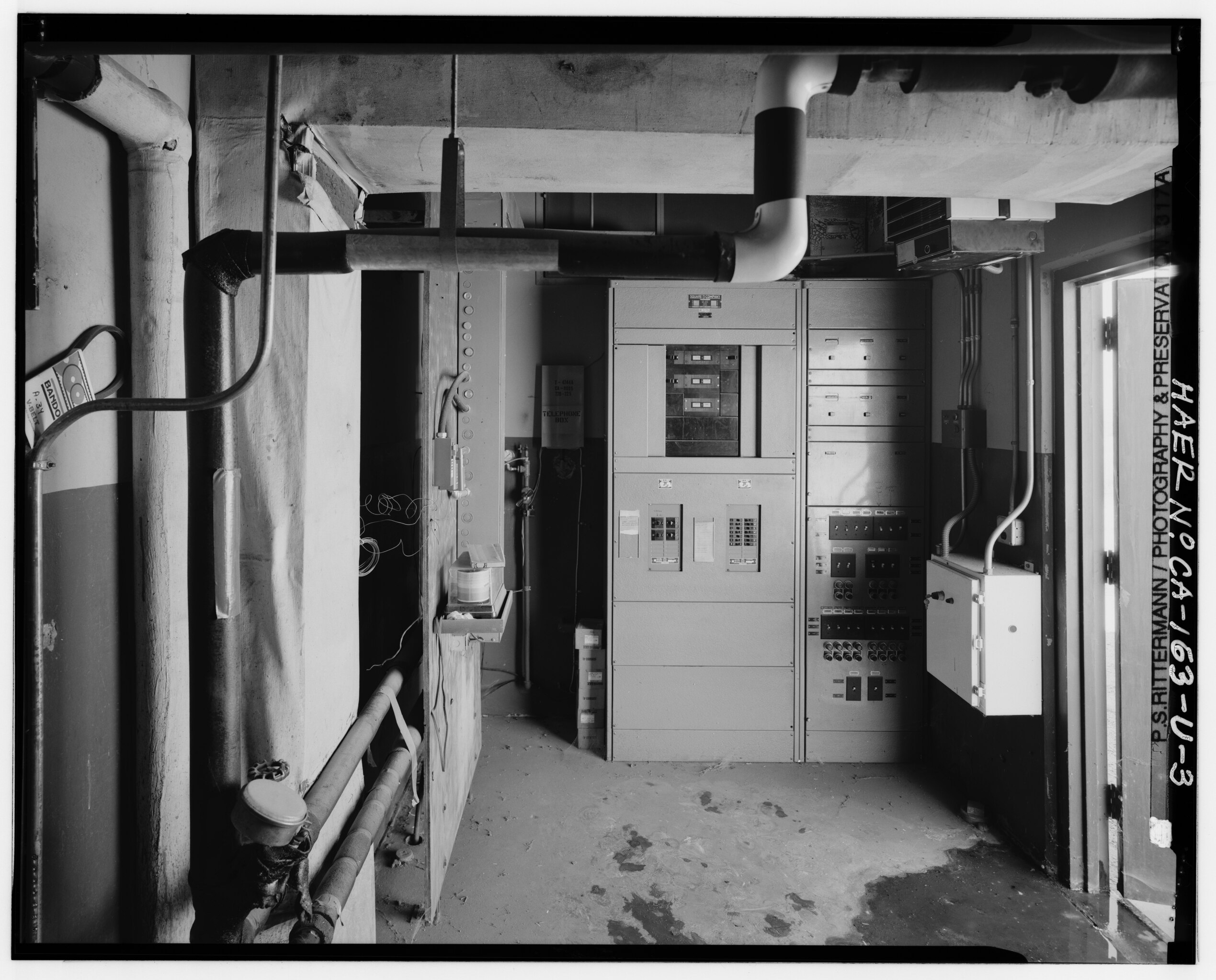
File:Credit PSR. Interior view shows the building equipment room as seen looking south southwest (206°) from the doorway. The control console contains switches for chiller HAER CAL,15-BORON.V,1U-3.tiff

Size of this JPG preview of this TIF file: 743 × 599 pixels. Other resolutions: 298 × 240 pixels | 595 × 480 pixels | 952 × 768 pixels | 1,270 × 1,024 pixels | 2,539 × 2,048 pixels | 5,560 × 4,485 pixels.
Original file (5,560 × 4,485 pixels, file size: 23.78 MB, MIME type: image/tiff)
Captions
Captions
Add a one-line explanation of what this file represents
Summary
edit| Photographer |
Related names:
|
|||
| Title |
Credit PSR. Interior view shows the building equipment room as seen looking south southwest (206°) from the doorway. The control console contains switches for chiller pumps, fans, heaters, temperature controls, and alarms - Jet Propulsion Laboratory Edwards Facility, Solid Propellant Conditioning Building, Edwards Air Force Base, Boron, Kern County, CA |
|||
| Depicted place | California; Kern County; Boron | |||
| Date | Documentation compiled after 1968 | |||
| Dimensions | 4 x 5 in. | |||
| Current location |
Library of Congress Prints and Photographs Division Washington, D.C. 20540 USA http://hdl.loc.gov/loc.pnp/pp.print |
|||
| Accession number |
HAER CAL,15-BORON.V,1U-3 |
|||
| Credit line |
|
|||
| Notes |
|
|||
| Source | https://www.loc.gov/pictures/item/ca3015.photos.382292p | |||
| Permission (Reusing this file) |
|

| Object location | | View this and other nearby images on: OpenStreetMap |
|---|
File history
Click on a date/time to view the file as it appeared at that time.
| Date/Time | Thumbnail | Dimensions | User | Comment | |
|---|---|---|---|---|---|
| current | 02:54, 6 July 2014 |  | 5,560 × 4,485 (23.78 MB) | Fæ (talk | contribs) | GWToolset: Creating mediafile for Fæ. HABS 05 July 2014 (501:600) |
You cannot overwrite this file.
File usage on Commons
The following 2 pages use this file:
- File:Credit PSR. Interior view shows the building equipment room as seen looking south southwest (206and-176;) from the doorway. The control console contains switches for chiller HAER CAL,15-BORON.V,1U-3.tif (file redirect)
- File:Credit PSR. Interior view shows the building equipment room as seen looking south southwest (206°) from the doorway. The control console contains switches for chiller HAER CAL,15-BORON.V,1U-3.tiff