File:DETAIL SHOWING WINDOWS, NORTH SIDE, FACING SOUTH. - Fort Baker, Storehouse, Near intersection of Breitung and Satterlee Roads, Sausalito, Marin County, CA HABS CAL,21-SAUS.V,2A-7.tif

Size of this JPG preview of this TIF file: 757 × 599 pixels. Other resolutions: 303 × 240 pixels | 606 × 480 pixels | 970 × 768 pixels | 1,280 × 1,014 pixels | 2,560 × 2,027 pixels | 5,000 × 3,959 pixels.
Original file (5,000 × 3,959 pixels, file size: 18.88 MB, MIME type: image/tiff)
Captions
Captions
Add a one-line explanation of what this file represents
Summary edit
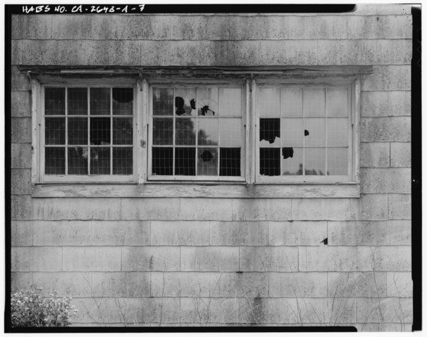
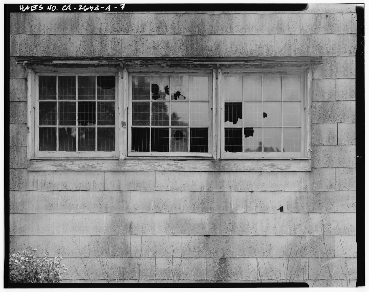
| DETAIL SHOWING WINDOWS, NORTH SIDE, FACING SOUTH. - Fort Baker, Storehouse, Near intersection of Breitung and Satterlee Roads, Sausalito, Marin County, CA | ||||
|---|---|---|---|---|
| Photographer |
Related names:
|
|||
| Title |
DETAIL SHOWING WINDOWS, NORTH SIDE, FACING SOUTH. - Fort Baker, Storehouse, Near intersection of Breitung and Satterlee Roads, Sausalito, Marin County, CA |
|||
| Depicted place | California; Marin County; Sausalito | |||
| Date | Documentation compiled after 1933 | |||
| Dimensions | 4 x 5 in. | |||
| Current location |
Library of Congress Prints and Photographs Division Washington, D.C. 20540 USA http://hdl.loc.gov/loc.pnp/pp.print |
|||
| Accession number |
HABS CAL,21-SAUS.V,2A-7 |
|||
| Credit line |
|
|||
| Notes |
|
|||
| References |
|
|||
| Source | https://www.loc.gov/pictures/item/ca2184.photos.182510p | |||
| Permission (Reusing this file) |
|
|||

| Object location | | View this and other nearby images on: OpenStreetMap |
|---|
File history
Click on a date/time to view the file as it appeared at that time.
| Date/Time | Thumbnail | Dimensions | User | Comment | |
|---|---|---|---|---|---|
| current | 22:16, 5 July 2014 |  | 5,000 × 3,959 (18.88 MB) | Fæ (talk | contribs) | GWToolset: Creating mediafile for Fæ. HABS 05 July 2014 (401:500) |
You cannot overwrite this file.
File usage on Commons
The following page uses this file: